Bladensburg is a small unincorporated community in Wapello County, Iowa, United States. It lies midway between Agency and Batavia at a distance of five miles (8 km) from each, and the largest nearby city is Ottumwa, seven miles (11 km) to the west-southwest.
Luton is a town located in Woodbury County, Iowa, United States. It is part of the Sioux City/Nebraska/South Dakota Metropolitan Statistical Area.
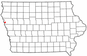
Climbing Hill is an unincorporated community in Woodbury County, Iowa, United States. Its elevation is 1,135 feet (346 m). The community is part of the Sioux City, IA–NE–SD Metropolitan Statistical Area. It has a post office with the ZIP code 51015.
Beloit is an unincorporated community in Lyon County, Iowa, United States.

California Junction is an unincorporated community and census-designated place (CDP) in Harrison County, Iowa, United States. It lies just east of the junction between the east–west and north–south lines of the former Sioux City and Pacific Railroad. In the 2010 census it had a population of 85 inhabitants and a population density of 184.38 people per square mile.
Folletts is an unincorporated community in Clinton County, Iowa, United States. It is located at the intersections of 292nd Street and County Highway Z36 on the north bank of the Wapsipinicon River. It is one mile west of Shaffton and three miles east of McCausland, at 41.750099N, -90.354990W.
Bangor is an unincorporated community in Marshall County, Iowa, United States. It is located at the intersections of County Highway E18 and S62, five miles southwest of Liscomb and six miles south of Union. It is located near the west bank of the Iowa River, at 42.172838N, -93.089073W.
Volney is an unincorporated community in Allamakee County, Iowa, United States.
New Haven is an unincorporated community and census-designated place in Mitchell County, Iowa, United States. As of the 2020 census the population of New Haven was 77.
Corley is an unincorporated community and census-designated place in Shelby County, Iowa, in the United States. As of the 2010 Census the population of Corley was 26.
Sulphur Springs is an unincorporated community in Buena Vista County, located in the U.S. state of Iowa.
Gunder is an unincorporated community in Clayton County, Iowa, United States. The Turkey River flows south of Gunder, and Roberts Creek, a tributary, to the north. The county seat of Elkader lies approximately 10 miles to the southeast.
Homer was an unincorporated community in Webster Township, Hamilton County, Iowa, United States. Homer was located near the county's western border with Webster County, 8.6 miles (13.8 km) southwest of Webster City.
Lyman is an unincorporated community in Noble Township, Cass County, Iowa, United States. Lyman is located along U.S. Route 71 and Iowa Highway 92, 12 miles (19 km) south of Atlantic.
Page Center is an unincorporated community in Harlan Township, Page County, Iowa, United States. Page Center is located along County Highway M60, 5.2 miles (8.4 km) west-southwest of Clarinda.
Ladoga is an unincorporated community in Washington Township, Taylor County, Iowa, United States. Ladoga is located along County Route J35, 3 miles (4.8 km) west-southwest of Gravity.
Thorpe is an unincorporated community in Honey Creek Township, Delaware County, Iowa, United States.
Oneida is an unincorporated community in Oneida Township, Delaware County, Iowa, United States. The community is on county highway D13, 3 miles (4.8 km) south of Greeley.
Sandusky is an unincorporated community and census-designated place (CDP) in Lee County, Iowa, United States. It is in the southeast part of the county, on the west bank of the Mississippi River 4 miles (6 km) north of Keokuk, the county seat, and 6 miles (10 km) south of Montrose.
Vincennes is an unincorporated community in the southern part of Lee County, Iowa, United States. It lies near the junction of 320th Street and Iowa Highway 27, 2.5 miles south of Argyle. Its elevation is 554 feet.


