Lester, Iowa

Last updated
Lester, Iowa
Lester Iowa Main Street.jpg
Lester Iowa Main Street
Lyon County Iowa Incorporated and Unincorporated areas Lester Highlighted.svg
Location of Lester, Iowa
Coordinates: 43°26′15″N96°20′0″W / 43.43750°N 96.33333°W / 43.43750; -96.33333 Coordinates: 43°26′15″N96°20′0″W / 43.43750°N 96.33333°W / 43.43750; -96.33333
Country Flag of the United States.svg United States
State Flag of Iowa.svg Iowa
County Lyon
Government
  TypeMayor-council
  MayorDan Gerber
Area
[1]
  Total1.82 sq mi (4.73 km2)
  Land1.82 sq mi (4.73 km2)
  Water0.00 sq mi (0.00 km2)
Elevation
1,411 ft (430 m)
Population
 (2020)
  Total296
  Density162.19/sq mi (62.63/km2)
Time zone UTC-6 (Central (CST))
  Summer (DST) UTC-5 (CDT)
ZIP code
51242
Area code 712
FIPS code 19-44670
GNIS feature ID0458294 [2]
Website City of Lester

Lester is a city in Lyon County, Iowa, United States. The population was 296 at the time of the 2020 census. [3]

Contents

Geography

Lester's longitude and latitude coordinates in decimal form are 43.437475, -96.333322. [4]

According to the United States Census Bureau, the city has a total area of 1.82 square miles (4.71 km2), all land. [5]

Demographics

Historical populations
YearPop.±%
1880 31    
1900 225+625.8%
1910 244+8.4%
1920 250+2.5%
1930 231−7.6%
1940 286+23.8%
1950 217−24.1%
1960 239+10.1%
1970 238−0.4%
1980 274+15.1%
1990 257−6.2%
2000 251−2.3%
2010 294+17.1%
2020 296+0.7%
Source: "U.S. Census website". United States Census Bureau . Retrieved 2020-03-29. and Iowa Data Center
Source:
U.S. Decennial Census [6] [3]

2010 census

As of the census [7] of 2010, there were 294 people, 109 households, and 80 families living in the city. The population density was 161.5 inhabitants per square mile (62.4/km2). There were 115 housing units at an average density of 63.2 per square mile (24.4/km2). The racial makeup of the city was 93.5% White, 0.3% African American, 0.7% Native American, 0.3% Asian, 4.1% from other races, and 1.0% from two or more races. Hispanic or Latino of any race were 5.4% of the population.

There were 109 households, of which 33.9% had children under the age of 18 living with them, 66.1% were married couples living together, 1.8% had a female householder with no husband present, 5.5% had a male householder with no wife present, and 26.6% were non-families. 24.8% of all households were made up of individuals, and 11.9% had someone living alone who was 65 years of age or older. The average household size was 2.70 and the average family size was 3.26.

The median age in the city was 34 years. 33% of residents were under the age of 18; 6.8% were between the ages of 18 and 24; 22.1% were from 25 to 44; 21.5% were from 45 to 64; and 16.7% were 65 years of age or older. The gender makeup of the city was 48.6% male and 51.4% female.

2000 census

As of the census [8] of 2000, there were 251 people, 103 households, and 70 families living in the city. The population density was 138.3 inhabitants per square mile (53.4/km2). There were 110 housing units at an average density of 60.6 per square mile (23.4/km2). The racial makeup of the city was 99.20% White, and 0.80% from two or more races.

There were 103 households, out of which 26.2% had children under the age of 18 living with them, 62.1% were married couples living together, 4.9% had a female householder with no husband present, and 32.0% were non-families. 29.1% of all households were made up of individuals, and 17.5% had someone living alone who was 65 years of age or older. The average household size was 2.44 and the average family size was 3.06.

In the city, the population was spread out, with 21.9% under the age of 18, 14.3% from 18 to 24, 22.3% from 25 to 44, 19.5% from 45 to 64, and 21.9% who were 65 years of age or older. The median age was 39 years. For every 100 females there were 80.6 males. For every 100 females age 18 and over, there were 84.9 males.

The median income for a household in the city was $38,750, and the median income for a family was $47,083. Males had a median income of $27,083 versus $20,938 for females. The per capita income for the city was $17,410. About 3.1% of families and 4.3% of the population were below the poverty line, including none of those under the age of eighteen or sixty five or over.

Related Research Articles

<span class="mw-page-title-main">Rembrandt, Iowa</span> City in Iowa, United States

Rembrandt is a city in Buena Vista County, Iowa, United States. The population was 209 at the time of the 2020 census.

<span class="mw-page-title-main">Little Sioux, Iowa</span> City in Iowa, United States

Little Sioux is a city in Harrison County, Iowa, United States. The population was 166 at the time of the 2020 census. The city is most known for Little Sioux Scout Ranch of the Boy Scouts of America.

<span class="mw-page-title-main">Derby, Iowa</span> City in Iowa, United States

Derby is a city in Lucas County, Iowa, United States. The population was 90 at the time of the 2020 census.

<span class="mw-page-title-main">McClelland, Iowa</span> City in Iowa, United States

McClelland is a city in Pottawattamie County, Iowa, United States. The city was founded in 1903 after the Great Western Railroad was extended to include Council Bluffs, IA. The population was 146 at the time of the 2020 census.

<span class="mw-page-title-main">New Liberty, Iowa</span> City in Iowa, USA

New Liberty is a city in Scott County, Iowa, United States. The population was 138 at the time of the 2020 census.

<span class="mw-page-title-main">Woodland Hills, Kentucky</span> City in Kentucky, United States

Woodland Hills is a home rule-class city in Jefferson County, Kentucky, United States. The population was 696 at the 2010 census.

<span class="mw-page-title-main">Lilydale, Minnesota</span> City in Minnesota, United States

Lilydale is a city in Dakota County, Minnesota, United States. The population was 623 at the 2010 census.

<span class="mw-page-title-main">Warba, Minnesota</span> City in Minnesota, United States

Warba is a city in Itasca County, Minnesota, United States. The population was 181 at the 2010 census.

<span class="mw-page-title-main">Kennedy, Minnesota</span> City in Minnesota, United States

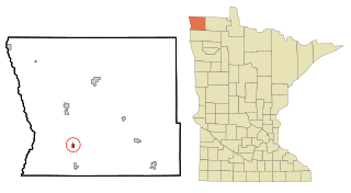
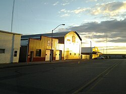
Kennedy is a city in Kittson County, Minnesota, United States. The population was 176 at the 2020 census.

<span class="mw-page-title-main">Lake Bronson, Minnesota</span> City in Minnesota, United States

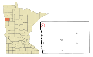
Lake Bronson is a city in Kittson County, Minnesota, United States. The population was 178 at the 2020 census. Lake Bronson State Park is nearby.

<span class="mw-page-title-main">Stephen, Minnesota</span> City in Minnesota, United States

Stephen is a city in Marshall County, Minnesota, United States. The population was 592 at the 2020 census.

<span class="mw-page-title-main">Shelly, Minnesota</span> City in Minnesota, United States

Shelly is a city in Norman County, Minnesota, United States. The population was 179 at the 2020 census.

<span class="mw-page-title-main">Nielsville, Minnesota</span> City in Minnesota, United States

Nielsville is a city in Polk County, Minnesota, United States. It is part of the Grand Forks, ND-MN Metropolitan Statistical Area. The population was 78 at the 2020 census.

<span class="mw-page-title-main">Orr, Minnesota</span> City in Minnesota, United States

Orr is a city in Saint Louis County, Minnesota, United States. The population was 211 at the 2020 census.

<span class="mw-page-title-main">St. Rosa, Minnesota</span> City in Minnesota, United States

Saint Rosa is a city in Stearns County, Minnesota, United States. The population was 68 at the 2010 census. It is part of the St. Cloud Metropolitan Statistical Area.

<span class="mw-page-title-main">Lake Waukomis, Missouri</span> City in Missouri, United States

Lake Waukomis is a city in Platte County, Missouri and is part of the Kansas City metropolitan area within the United States. The population was 870 at the 2010 census.

<span class="mw-page-title-main">Meire Grove, Minnesota</span> City in Minnesota, United States

Meire Grove is a city in Stearns County, Minnesota, United States. The population was 179 at the 2010 census. It is part of the St. Cloud Metropolitan Statistical Area.

<span class="mw-page-title-main">Clarkson Valley, Missouri</span> City in Missouri, United States

Clarkson Valley is a city in St. Louis County, Missouri, United States. The population was 2,609 at the 2020 census.

<span class="mw-page-title-main">North River, North Dakota</span> City in North Dakota, United States

North River is a city in Cass County, North Dakota, United States. The population was 55 at the 2020 census. North River was founded in 1973. It is a suburb/bedroom community directly adjacent to the city of Fargo.

<span class="mw-page-title-main">Lester, West Virginia</span> Town in West Virginia, United States

Lester is a town in Raleigh County, West Virginia, United States. The population was 337 at the 2020 census. The community was named after Champ Lester, a local pioneer.

References

  1. "2020 U.S. Gazetteer Files". United States Census Bureau. Retrieved March 16, 2022.
  2. "Lester". Geographic Names Information System . United States Geological Survey, United States Department of the Interior . Retrieved 2009-02-16.
  3. 1 2 "2020 Census State Redistricting Data". census.gov. United states Census Bureau. Retrieved 12 August 2021.
  4. "US Gazetteer files: 2010, 2000, and 1990". United States Census Bureau. 2011-02-12. Retrieved 2011-04-23.
  5. "US Gazetteer files 2010". United States Census Bureau. Archived from the original on January 12, 2012. Retrieved 2012-05-11.
  6. "Census of Population and Housing". Census.gov. Retrieved June 4, 2015.
  7. "U.S. Census website". United States Census Bureau . Retrieved 2012-05-11.
  8. "U.S. Census website". United States Census Bureau . Retrieved 2008-01-31.