
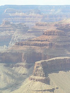
The geology of the Grand Canyon area includes one of the most complete and studied sequences of rock on Earth. The nearly 40 major sedimentary rock layers exposed in the Grand Canyon and in the Grand Canyon National Park area range in age from about 200 million to nearly 2 billion years old. Most were deposited in warm, shallow seas and near ancient, long-gone sea shores in western North America. Both marine and terrestrial sediments are represented, including lithified sand dunes from an extinct desert. There are at least 14 known unconformities in the geologic record found in the Grand Canyon.

The Kaibab Limestone is a resistant cliff-forming, Permian geologic formation that crops out across the U.S. states of northern Arizona, southern Utah, east central Nevada and southeast California. It is also known as the Kaibab Formation in Arizona, Nevada, and Utah. The Kaibab Limestone forms the rim of the Grand Canyon. In the Big Maria Mountains, California, the Kaibab Limestone is highly metamorphosed and known as the Kaibab Marble.
Coconino Sandstone is a geologic formation named after its exposure in Coconino County, Arizona. This formation spreads across the Colorado Plateau province of the United States, including northern Arizona, northwest Colorado, Nevada, and Utah.

The Cambrian Muav Limestone is a geologic unit within the 5-member Tonto Group. It is about 650 feet (198 m) thick at its maximum. It is a resistant cliff-forming unit. The Muav consists of dark to light-gray, brown, and orange red limestone with dolomite and calcareous mudstone. The Muav Limestone is overlain in the western Grand Canyon by the late Cambrian Frenchman Mountain Dolostone. Eastward, the Frenchman Mountain Dolostone pinches out and the Mississippian Redwall Limestone, which forms prominent vertical cliffs, directly lies upon the Muav Limestone. The Devonian Temple Butte Formation fill deep paleovalleys that have been cut through the Frenchman Mountain Dolostone and into the Muav Limestone.

Except where underlain by the Sixtymile Formation, Cambrian Tapeats Sandstone is typically the lowest geologic unit, about 230 feet (70 m) thick, at its maximum, of the 5-member Tonto Group. It is famous for being the highly-resistant mostly-horizontal unit above the Great Unconformity expressed areally in the Grand Canyon of Arizona; also in other areas of Arizona and adjacent Nevada.

The Middle Permian Toroweap Formation is a thin, darker geologic unit, between the brighter colored units of the Kaibab Limestone above, and Coconino Sandstone below. It is a prominent unit in Grand Canyon, Arizona, USA, found through sections of the South Rim, Grand Canyon, and the North Rim, of the Kaibab Plateau; also the Kaibab's southeast extension to Cape Royal, the Walhalla Plateau. The Colorado River of the Grand Canyon makes its excursion from due-south to due-west around the Walhalla Plateau, as it enters the east end of the Grand Canyon's interior, Granite Gorge. The formation is also found in southeast Utah.

The Toroweap Fault of northwest Arizona and southwest Utah is part of a fault system of the west Grand Canyon region, Arizona, US; also the west perimeter regions of the Coconino and Colorado Plateaus. The Hurricane Fault originates at the Toroweap Fault, in the region of the Colorado River, and strikes as the westerly depression of the Toroweap Fault. The Toroweap strikes northerly from the Colorado at the east of Toroweap Valley, and enters south Utah; from the Colorado River, the Hurricane Fault strikes north-northwest along the west flank of the small, regional Uinkaret Mountains, the west border of Toroweap Valley. The Hurricane Fault, and the Hurricane Cliffs strike into southwest Utah as part of the west, and southwest perimeter of the Colorado Plateau. The Hurricane Cliffs are made of Kaibab Limestone, an erosion resistant, cliff-forming rock unit.

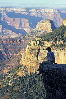
Isis Temple is a prominence in the Grand Canyon, Arizona, Southwestern United States. It is located below the North Rim and adjacent to Granite Gorge. The prominence lies north of the north bank of the west-flowing Colorado River and is just north of Granite Gorge. The Trinity Creek and canyon flow due south at its west border; its north, and northeast border/flank is formed by Phantom Creek and canyon, a west tributary of Bright Angel Creek; the creeks intersect about 3 mi (4.8 km) southeast, and 1.0 mi (1.6 km) north of Granite Gorge. The Isis Temple prominence, is only about 202 ft (62 m) lower than Grand Canyon Village, the main public center on Grand Canyon’s South Rim.

The (Upper) Late Pennsylvanian Wescogame Formation is a slope-forming, sandstone, red-orange geologic unit, formed from an addition of eolian sand, added to marine transgression deposits,, and found throughout sections of the Grand Canyon, in Arizona, Southwest United States. It is one of the upper members of the Supai Group 'redbeds', with the Supai Group found in other sections of Arizona, especially in the Verde Valley region, or as a basement unit below the Mogollon Rim, just eastwards or part of the basement Supai Group of the southwest & south Colorado Plateau.
The Surprise Canyon Formation is a geologic formation that consists of clastic and calcareous sedimentary rocks that fill paleovalleys and paleokarst of Late Mississippian (Serpukhovian) age in Grand Canyon. These strata outcrop as isolated, lens-shaped exposures of rocks that fill erosional valleys and locally karsted topography and caves developed in the top of the Redwall Limestone. The Surprise Canyon Formation and associated unconformities represent a significant period of geologic time between the deposition of the Redwall Limestone and the overlying Supai Group.
The Supai Group is a slope-forming section of red bed deposits found in the Colorado Plateau. The group was laid down during the Pennsylvanian to Lower Permian. Cliff-forming interbeds of sandstone)are noticeable throughout the group. The Supai Group is especially exposed throughout the Grand Canyon in northwest Arizona, as well as local regions of southwest Utah, such as the Virgin River valley region. It occurs in Arizona at Chino Point, Sycamore Canyon, and famously at Sedona as parts of Oak Creek Canyon. In the Sedona region, it is overlain by the Hermit Formation, and the colorful Schnebly Hill Formation.
The White Rim Sandstone is a sandstone geologic formation located in southeastern Utah. It is the last member of the Permian Cutler Group, and overlies the major Organ Rock Formation and Cedar Mesa Sandstone; and again overlies thinner units of the Elephant Canyon and Halgaito Formations.

The Shinarump Conglomerate is a geologic formation found in the Four Corners region of the United States. It was deposited in the early part of the Late Triassic period.
The Cambrian Bright Angel Shale is the middle layer of the three member Tonto Group geologic feature. The 3-rock Tonto section famously sits upon the Great Unconformity because of the highly resistant cliffs of the base layer, vertical Tapeats Sandstone cliffs.
The Redwall Limestone is a resistant cliff-forming unit of Mississippian age that forms prominent, red-stained cliffs in the Grand Canyon, ranging in height from 500 feet (150 m) to 800 feet (240 m).
The Permian Hermit Formation, also known as the Hermit Shale, is a nonresistant unit that is composed of slope-forming reddish brown siltstone, mudstone, and very fine-grained sandstone. Within the Grand Canyon region, the upper part of the Hermit Formation contains red and white, massive, calcareous sandstone and siltstone beds that exhibit low-angle cross-bedding. Beds of dark red crumbly siltstone fill shallow paleochannels that are quite common in this formation. The siltstone beds often contain poorly preserved plant fossils. The Hermit Formation varies in thickness from about 100 feet (30 m) in the eastern part of the Grand Canyon region to about 900 feet (270 m) in the region of Toroweap and Shivwits Plateaus. In the Sedona, Arizona area, it averages 300 feet (91 m) in thickness. The upper contact of the Hermit Formation is typically sharp and lacks gradation of any kind. The lower contact is a disconformity characterized by a significant amount of erosional relief, including paleovalleys as much as 60 feet (18 m) deep.
The (Upper) Late Pennsylvanian Manakacha Formation is a cliff-forming, sandstone, red-orange geologic unit, formed from an addition of eolian sand, added to marine transgression deposits,, and found throughout sections of the Grand Canyon. It is one of the lower members of the Supai Group, with the Supai Group found in other sections of Arizona, especially in the Verde Valley region, or as a basement unit below the Mogollon Rim, just eastwards or part of the basement Supai Group of the southwest & south Colorado Plateau.

Dragon Head (Arizona) is a 7,765-foot (2,367 m) elevation summit located in the Grand Canyon, in Coconino County of Arizona, US. It is situated in the north of the Hindu Amphitheater, ~2.0 miles west of Shiva Temple, and ~2.5 mi southeast of Grama Point. Unlike the extensive Ponderosa Pine forest of Shiva Temple, tableland/plateau prominence, Dragon Head’s flat-topped, is only populated with a marginal non-Ponderosa forest. Shiva Temple is approximately 275 acres (0.43 mi2), where Dragon Head is an ~5 acre prominence platform.

Topaz Canyon is a linear, narrow canyon in western Grand Canyon, below the South Rim. It lies in a region of four canyons, and a fifth smaller canyon, all trending mostly northeasterly towards the west-flowing Colorado River, in western Grand Canyon National Park. The name of Topaz Canyon was named by the Board of Geographical Names for precious stones of the region. Topaz Canyon is the southeast border of the linear, and major, forested-landform, Diana Temple; .
The northeast terminus of Topaz Canyon intersects with the outfall of Boucher Canyon and the tract of the Tonto Trail. The Boucher Trail starting in Hermit Canyon,, ends at the termini of both Topaz and Boucher Canyons.
Fishtail Mesa is a linear, narrow plateau, adjacent the west-flowing Colorado River in western Grand Canyon, in Coconino County, Northern Arizona, about 2.0 miles east of Kanab Point, and the outfall of south-flowing Kanab Creek, a major north tributary of the Colorado River, from southern Utah. Fishtail Mesa is part of the North Rim (west) and also lies 4.0 miles west of the outfall of Deer Creek, and Deer Creek Falls at the Colorado, a common stopover campsite for river rafters. The linear and southwest direction of Fishtail Mesa, lies adjacent as the southwest border of Fishtail Canyon ; at the Colorado, the Fishtail Rapids occur as minor rapids of the Colorado River. Some other nearby prominences to Fishtail Mesa, are Paguekwash Point, about 5.0 miles southwest, and Mount Sinyella, 8.0 miles south-southwest, and on the South Rim region of the Grand Canyon.

