Fairfax, Oklahoma

Last updated

Fairfax, Oklahoma
OKMap-doton-Fairfax.PNG
Location of Fairfax, Oklahoma
Coordinates: 36°34′11″N96°42′29″W / 36.56972°N 96.70806°W / 36.56972; -96.70806
Country United States
State Oklahoma
County Osage
Government
   Mayor Charlie Cartwright [ citation needed ]
Area
[1]
  Total0.77 sq mi (1.99 km2)
  Land0.77 sq mi (1.98 km2)
  Water0.00 sq mi (0.01 km2)
Elevation
[2]
886 ft (270 m)
Population
 (2020)
  Total1,136
  Density1,483.03/sq mi (572.80/km2)
Time zone UTC-6 (Central (CST))
  Summer (DST) UTC-5 (CDT)
ZIP code
74637
Area code(s) 539/918
FIPS code 40-24850 [3]
GNIS feature ID2412610 [2]

Fairfax is a town in Osage County, Oklahoma, United States. The Osage Nation reservation is coterminous with the county. The population was 1,380 at the 2010 census, down 11.3 percent from the figure of 1,555 recorded in 2000. [4] It was the home of the ballerinas Maria and Marjorie Tallchief. [5]

Contents

History

When the Santa Fe Railway chose to go up Salt Creek valley and bypassed the village of Gray Horse (which continues to exist today as the home of one of the Osage tribe's three major historic bands) the present day town of Fairfax was created. Local merchants, including Lew A. Wismeyer, moved buildings from Gray Horse and leased 40 acres (16 ha) acres for a townsite. Wismeyer rejected the name Coda proposed by the railroad and convinced them to call the depot Fairfax after a hotel he had stayed at in Washington, D.C. The Osage tribe retained title to the townsite until March 3, 1905, when Congress provided for the land to be sold at public auction, with the proceeds credited to the tribe. Fairfax had 470 residents at the time of statehood in 1907. [5] Fairfax is also the site of the majority of the Osage Indian Murders that took place in the 1920s in Osage County, Oklahoma. [6] The murders occurred following the discovery of oil on the Osage Nation Reservation (coterminous with the county). [6] At least 24 Osages were murdered [6] in a plot masterminded by William Hale.

Geography

Fairfax is 28 miles (45 km) southwest of Pawhuska and 32 miles (51 km) southeast of Ponca City. [5]

According to the United States Census Bureau, the town has a total area of 0.8 square miles (2.1 km2), all land.

Climate

Climate data for Fairfax, Oklahoma
MonthJanFebMarAprMayJunJulAugSepOctNovDecYear
Mean daily maximum °F (°C)46.6
(8.1)
52.4
(11.3)
62.9
(17.2)
73.8
(23.2)
80.8
(27.1)
88.4
(31.3)
94.4
(34.7)
93.6
(34.2)
85.2
(29.6)
75.3
(24.1)
61.2
(16.2)
49.6
(9.8)
72.0
(22.2)
Mean daily minimum °F (°C)22.6
(−5.2)
27.5
(−2.5)
37.1
(2.8)
47.9
(8.8)
56.7
(13.7)
65.3
(18.5)
69.3
(20.7)
67.5
(19.7)
60.2
(15.7)
47.8
(8.8)
36.9
(2.7)
26.2
(−3.2)
47.1
(8.4)
Average precipitation inches (mm)1.2
(30)
1.6
(41)
3.1
(79)
3.2
(81)
4.8
(120)
4.2
(110)
2.9
(74)
3.3
(84)
4.7
(120)
2.9
(74)
2.5
(64)
1.6
(41)
35.8
(910)
Source 1: weather.com
Source 2: Weatherbase.com [7]

Demographics

Historical population
CensusPop.Note
1910 819
1920 1,34263.9%
1930 2,13459.0%
1940 2,3279.0%
1950 2,017−13.3%
1960 2,0762.9%
1970 1,889−9.0%
1980 1,9493.2%
1990 1,749−10.3%
2000 1,555−11.1%
2010 1,380−11.3%
2020 1,136−17.7%
U.S. Decennial Census [8]

As of the census [3] of 2000, there were 1,555 people, 657 households, and 417 families residing in the town. The population density was 1,947.2 inhabitants per square mile (751.8/km2). There were 831 housing units at an average density of 1,040.6 per square mile (401.8/km2). The racial makeup of the town was 67.65% White, 1.35% African American, 24.12% Native American, 0.19% Asian, 0.45% from other races, and 6.24% from two or more races. Hispanic or Latino of any race were 1.48% of the population.

There were 657 households, out of which 30.3% had children under the age of 18 living with them, 43.4% were married couples living together, 15.8% had a female householder with no husband present, and 36.4% were non-families. 33.5% of all households were made up of individuals, and 17.8% had someone living alone who was 65 years of age or older. The average household size was 2.31 and the average family size was 2.92.

In the town, the population was spread out, with 27.6% under the age of 18, 7.0% from 18 to 24, 22.6% from 25 to 44, 21.0% from 45 to 64, and 21.8% who were 65 years of age or older. The median age was 40 years. For every 100 females, there were 83.8 males. For every 100 females age 18 and over, there were 78.2 males.

The median income for a household in the town was $21,652, and the median income for a family was $25,385. Males had a median income of $26,518 versus $21,250 for females. The per capita income for the town was $12,765. About 23.9% of families and 28.0% of the population were below the poverty line, including 38.8% of those under age 18 and 21.7% of those age 65 or over.

Economy

The town economy has relied on agriculture and oil production. The population of Fairfax reached a high of 2,327 at the 1940 census, but began to decline as the production of oil dropped in the area, and farm populations decreased with increased mechanization. It fell to 1,869 by 1970, briefly rose to 1,949 in 1980, dropped again to 1,555 in 2000 and yet again to 1,380 in 2010 . [5]

Education

The area is served by Woodland Public Schools, [9] formed in 1990 when the Fairfax school district merged with the Ralston district. [10]

Notable people

David Grann wrote Killers of the Flower Moon, a book about the Osage Indian murders and the FBI’s involvement in solving them. Portions of the movie based on the book were filmed here. [11]

Related Research Articles

<span class="mw-page-title-main">Washington County, Oklahoma</span> County in Oklahoma, United States

Washington County is a county located in the northeastern part of the U.S. state of Oklahoma. As of the 2020 census, the population was 52,455. Its county seat is Bartlesville. Named for President George Washington, it is the smallest county in Oklahoma in total area, adjacent to the largest county in Oklahoma, Osage County.

<span class="mw-page-title-main">Pawnee County, Oklahoma</span> County in Oklahoma, United States

Pawnee County is a county located in the U.S. state of Oklahoma. As of the 2020 census, the population was 15,553. Its county seat is Pawnee. The county is named after the Pawnee Nation, whose reservation used to encompass the county prior to allotment in 1893.

<span class="mw-page-title-main">Osage County, Oklahoma</span> County in Oklahoma, United States

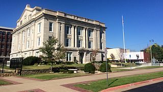
Osage County is the largest county by area in the U.S. state of Oklahoma. Created in 1907 when Oklahoma was admitted as a state, the county is named for and is home to the federally recognized Osage Nation. The county is coextensive with the Osage Nation Reservation, established by treaty in the 19th century when the Osage relocated there from Kansas. The county seat is in Pawhuska, one of the first three towns established in the county. The total population of the county as of 2020 was 45,818.

<span class="mw-page-title-main">Creek County, Oklahoma</span> County in Oklahoma, United States

Creek County is a county located in the U.S. state of Oklahoma. As of the 2020 census, the population was 71,754. Its county seat is Sapulpa.

<span class="mw-page-title-main">Boswell, Oklahoma</span> Town in Oklahoma, United States

Boswell is a town in Choctaw County, Oklahoma, United States. The population was 709 at the 2010 census.

<span class="mw-page-title-main">Carrier, Oklahoma</span> Town in Oklahoma, United States

Carrier is a town in Garfield County, Oklahoma, United States. The population was 85 at the 2010 census.

<span class="mw-page-title-main">Milburn, Oklahoma</span> Town in Oklahoma, United States

Milburn is a town in Johnston County, Oklahoma, United States, along the Blue River. The population was 317 at the 2010 census, an increase of 1.6 percent from the figure of 312 in 2000. The town is notable as the location of the Chickasaw White House, the former home of Chickasaw Governor Douglas H. Johnston. This home is now a museum and is listed on the NRHP.

<span class="mw-page-title-main">Hennessey, Oklahoma</span> Town in Oklahoma, United States

Hennessey is a town in Kingfisher County, Oklahoma, United States. The population was 2,131 at the 2010 census, up from 2,058 in 2000.

<span class="mw-page-title-main">Washington, Oklahoma</span> Town in Oklahoma, United States

Washington is a town in McClain County, Oklahoma, United States. The population was 673 as of the 2020 census, a 0.2% increase from 2010.

<span class="mw-page-title-main">Clearview, Oklahoma</span> Town in Oklahoma, United States

Clearview is a town in Okfuskee County, Oklahoma, United States. The population was 41 at the 2020 Census. It was historically an all-black freedmen's town and was platted by the Lincoln Townsite Company and designated as Lincoln.

<span class="mw-page-title-main">Avant, Oklahoma</span> Town in Oklahoma, United States

Avant is an incorporated community in eastern Osage County, Oklahoma, United States. The population was 320 at the 2010 census, a decline of 14.0 percent from the figure of 372 recorded in 2000.

<span class="mw-page-title-main">Burbank, Oklahoma</span> Town in Oklahoma, United States

Burbank is a town in western Osage County, Oklahoma, United States. The population was 141 at the 2010 census, a 9 percent decrease from the figure of 155 recorded in 2000.

<span class="mw-page-title-main">Foraker, Oklahoma</span> Town in Oklahoma, United States

Foraker is a town in Osage County, Oklahoma, United States. It was named for Ohio Senator Joseph B. Foraker. The Tallgrass Prairie Preserve is southeast of town. The official population peaked at 415 in 1910 and has declined steadily since 1930. The population was only 18 at the 2010 census, a 21.7 percent decline from 23 in 2000.

<span class="mw-page-title-main">Grainola, Oklahoma</span> Town in Oklahoma, United States

Grainola is a town in northwest Osage County, Oklahoma, United States. The population was 31 at the 2010 census, a figure which was unchanged from 2000. The main industry of the area is cattle ranching. The town name was invented in March 1910.

<span class="mw-page-title-main">Osage, Oklahoma</span> Town in Oklahoma, United States

Osage is a town in Osage County, Oklahoma, United States. Also known as Osage City, it lies within the Osage Reservation on the shore of Lake Keystone. The population was 156 at the 2010 census, down 17 percent from the figure of 188 recorded in 2000.

<span class="mw-page-title-main">Prue, Oklahoma</span> Town in Oklahoma, United States

Prue is a town in southwestern Osage County, Oklahoma, United States. The population was 465 at the 2010 census, up 7.4 percent from the figure of 433 recorded in 2000. The town was named for Henry Prue, who owned the original townsite. Prue was relocated when Lake Keystone was built, and is sometimes called "New Prue".

<span class="mw-page-title-main">Shidler, Oklahoma</span> City in Oklahoma, United States

Shidler is a city in Osage County, Oklahoma, United States. The population was 328 in the 2020 census, a decline from the figure of 441 recorded in 2010.

<span class="mw-page-title-main">Webb City, Oklahoma</span> Town in Oklahoma, United States

Webb City is an unincorporated town in northwestern Osage County, Oklahoma, United States. The population was 62 at the 2010 census, a 34.7 percent decline from the figure of 95 recorded in 2000. It was named for its founder, Horace Webb, on whose land the town was founded. The Webb City post office opened December 16, 1922.

<span class="mw-page-title-main">Wynona, Oklahoma</span> Incorporated town in Osage County, Oklahoma

Wynona is an incorporated town in central Osage County, Oklahoma, United States. It was founded by a local Osage-Cherokee rancher, Antoine Rogers, in 1903. The population was 437 at the 2010 census, a 17.7 percent decline from 531 in 2000.

<span class="mw-page-title-main">Cleveland, Oklahoma</span> City in Oklahoma, United States

Cleveland is a city in Pawnee County, Oklahoma, United States. The 2010 census population was 3,251, a decrease of 0.9 percent from the figure of 3,282 recorded in 2000.

References

  1. "ArcGIS REST Services Directory". United States Census Bureau. Retrieved September 20, 2022.
  2. 1 2 U.S. Geological Survey Geographic Names Information System: Fairfax, Oklahoma
  3. 1 2 "U.S. Census website". United States Census Bureau . Retrieved January 31, 2008.
  4. MuniNet Guide: Fairfax, Oklahoma Archived October 7, 2012, at the Wayback Machine
  5. 1 2 3 4 5 6 Carol E. Irons, "Fairfax," Encyclopedia of Oklahoma History and Culture. Accessed October 3, 2011.
  6. 1 2 3 "Osage Murders | The Encyclopedia of Oklahoma History and Culture". www.okhistory.org. Retrieved April 9, 2020.
  7. "Historical Weather for Fairfax, Oklahoma, United States".
  8. "Census of Population and Housing". Census.gov. Retrieved June 4, 2015.
  9. "2020 CENSUS - SCHOOL DISTRICT REFERENCE MAP: Osage County, OK" (PDF). U.S. Census Bureau . Retrieved January 21, 2024.
  10. "FAIRFAX". The Encyclopedia of Oklahoma History and Culture . Oklahoma Historical Society . Retrieved January 21, 2024.
  11. Allen, Kelly (October 20, 2023). "'Killers of the Flower Moon' Was Filmed in the Pioneer Woman's Hometown". House Beautiful. Retrieved October 26, 2023.