Fleming, Missouri

Last updated
Fleming, Missouri
Ray County Missouri Incorporated and Unincorporated areas Fleming Highlighted.svg
Location of Fleming, Missouri
Coordinates: 39°11′44″N94°03′07″W / 39.19556°N 94.05194°W / 39.19556; -94.05194 Coordinates: 39°11′44″N94°03′07″W / 39.19556°N 94.05194°W / 39.19556; -94.05194
Country United States
State Missouri
County Ray
Area
[1]
  Total0.54 sq mi (1.40 km2)
  Land0.54 sq mi (1.40 km2)
  Water0.00 sq mi (0.00 km2)
Elevation
[2]
745 ft (227 m)
Population
 (2020)
  Total114
  Density211.11/sq mi (81.55/km2)
Time zone UTC-6 (Central (CST))
  Summer (DST) UTC-5 (CDT)
FIPS code 29-24562 [3]
GNIS feature ID2394769 [2]

Fleming is a city in Ray County, Missouri, and part of the Kansas City metropolitan area within the United States. The population was 114 at the 2020 census. [4]

Contents

History

A post office called Fleming was established in 1888, and remained in operation until 1905. [5] The community has the name of Alfred Walton Fleming, a businessperson in the local mining industry. [6]

Geography

According to the United States Census Bureau, the city has a total area of 0.54 square miles (1.40 km2), all land. [7]

Demographics

Historical population
CensusPop.Note
1940 5,401
1950 5,308−1.7%
1960 4,515−14.9%
1970 152−96.6%
1980 144−5.3%
1990 130−9.7%
2000 122−6.2%
2010 1284.9%
2020 114−10.9%
U.S. Decennial Census [8]

2010 census

As of the census [9] of 2010, there were 128 people, 51 households, and 40 families living in the city. The population density was 237.0 inhabitants per square mile (91.5/km2). There were 62 housing units at an average density of 114.8 per square mile (44.3/km2). The racial makeup of the city was 98.4% White and 1.6% Native American. Hispanic or Latino of any race were 0.8% of the population.

There were 51 households, of which 33.3% had children under the age of 18 living with them, 60.8% were married couples living together, 13.7% had a female householder with no husband present, 3.9% had a male householder with no wife present, and 21.6% were non-families. 19.6% of all households were made up of individuals, and 7.8% had someone living alone who was 65 years of age or older. The average household size was 2.51 and the average family size was 2.85.

The median age in the city was 40 years. 25.8% of residents were under the age of 18; 9.4% were between the ages of 18 and 24; 23.4% were from 25 to 44; 31.3% were from 45 to 64; and 10.2% were 65 years of age or older. The gender makeup of the city was 46.1% male and 53.9% female.

2000 census

As of the census [3] of 2000, there were 122 people, 47 households, and 33 families living in the city. The population density was 225.6 inhabitants per square mile (87.1/km2). There were 48 housing units at an average density of 88.8 per square mile (34.3/km2). The racial makeup of the city was 98.36% White, and 1.64% from two or more races.

There were 47 households, out of which 38.3% had children under the age of 18 living with them, 61.7% were married couples living together, 10.6% had a female householder with no husband present, and 27.7% were non-families. 23.4% of all households were made up of individuals, and 8.5% had someone living alone who was 65 years of age or older. The average household size was 2.60 and the average family size was 3.06.

In the city the population was spread out, with 25.4% under the age of 18, 4.9% from 18 to 24, 31.1% from 25 to 44, 24.6% from 45 to 64, and 13.9% who were 65 years of age or older. The median age was 38 years. For every 100 females there were 103.3 males. For every 100 females age 18 and over, there were 97.8 males.

The median income for a household in the city was $35,625, and the median income for a family was $60,625. Males had a median income of $47,500 versus $22,500 for females. The per capita income for the city was $15,697. There were 3.1% of families and 11.2% of the population living below the poverty line, including 12.8% of under eighteens and 30.0% of those over 64.

Related Research Articles

<span class="mw-page-title-main">Bristow, Iowa</span> City in Iowa, United States

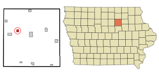
Bristow is a city in Butler County, Iowa, United States. The population was 145 at the 2020 census.

<span class="mw-page-title-main">Goose Lake, Iowa</span> City in Iowa, United States

Goose Lake is a city in Clinton County, Iowa, United States. The population was 239 at the time of the 2020 census.

<span class="mw-page-title-main">St. Lucas, Iowa</span> City in Iowa, United States

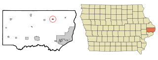
St. Lucas is a city in Fayette County, Iowa, United States. The population was 167 at the time of the 2020 census.

<span class="mw-page-title-main">Le Center, Minnesota</span> City in Minnesota, United States

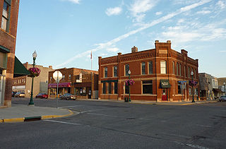
Le Center is a city in Le Sueur County, Minnesota, United States. The population was 2,517 at the 2020 census. It is the county seat of Le Sueur County. The Le Sueur County Courthouse and Jail are listed on the National Register of Historic Places.

<span class="mw-page-title-main">Arco, Minnesota</span> City in Minnesota, United States

Arco is a city in Lincoln County, Minnesota, United States. The population was 75 at the 2010 census.

<span class="mw-page-title-main">Harding, Minnesota</span> City in Minnesota, United States

Harding is a city in Morrison County, Minnesota, United States, along the Platte River. The population was 123 at the 2020 census.

<span class="mw-page-title-main">Lastrup, Minnesota</span> City in Minnesota, United States

Lastrup is a city in Morrison County, Minnesota, United States. The population was 120 at the 2020 census.

<span class="mw-page-title-main">Shelly, Minnesota</span> City in Minnesota, United States

Shelly is a city in Norman County, Minnesota, United States. The population was 179 at the 2020 census.

<span class="mw-page-title-main">Bluffton, Minnesota</span> City in Minnesota, United States

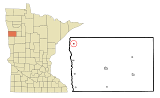
Bluffton is a city in Otter Tail County, Minnesota, United States, along the Leaf River. The population was 210 at the 2020 census.

<span class="mw-page-title-main">Vining, Minnesota</span> City in Minnesota, United States

Vining is a city in Otter Tail County, Minnesota, United States. The population was 62 at the 2020 census.

<span class="mw-page-title-main">Gully, Minnesota</span> City in Minnesota, United States

Gully is a city in Polk County, Minnesota, United States. It is part of the Grand Forks-ND-MN Metropolitan Statistical Area. The population was 59 at the 2020 census.

<span class="mw-page-title-main">Lengby, Minnesota</span> City in Minnesota, United States

Lengby is a city in Polk County, Minnesota, United States. It is part of the Grand Forks ND-MN Metropolitan Statistical Area. The population was 92 at the 2020 census.

<span class="mw-page-title-main">Mentor, Minnesota</span> City in Minnesota, United States

Mentor is a city in Polk County, Minnesota, United States. It is part of the Grand Forks-ND-MN Metropolitan Statistical Area. The population was 104 at the 2020 census. The city is near Maple Lake.

<span class="mw-page-title-main">Lake Henry, Minnesota</span> City in Minnesota, United States

Lake Henry is a city in Stearns County, Minnesota, United States. The population was 103 at the 2010 census. It is part of the St. Cloud Metropolitan Statistical Area.

<span class="mw-page-title-main">Hawk Point, Missouri</span> City in Missouri, United States

Hawk Point is a city in Lincoln County, Missouri, United States. The population was 669 at the 2010 census.

<span class="mw-page-title-main">Country Club Hills, Missouri</span> City in Missouri, United States

Country Club Hills is a city in St. Louis County, Missouri, United States. The population was 1,274 at the 2010 census.

<span class="mw-page-title-main">Greendale, Missouri</span> City in Missouri, United States

Greendale is a city in St. Louis County, Missouri, United States. The population was 651 at the 2010 census.

<span class="mw-page-title-main">Fort Calhoun, Nebraska</span> City in Nebraska, United States

Fort Calhoun is a city in Washington County, Nebraska, United States. The population was 908 at the 2010 census. The city includes Fort Atkinson, the first fort built west of the Missouri River.

<span class="mw-page-title-main">Edinburg, North Dakota</span> City in North Dakota, United States

Edinburg is a city in Walsh County, North Dakota, United States. The population was 199 at the 2020 census.

<span class="mw-page-title-main">Harrisburg, Oregon</span> City in Oregon, United States

Harrisburg is a city in Linn County, Oregon, United States. The population was 3,567 at the 2010 census.

References

  1. "ArcGIS REST Services Directory". United States Census Bureau. Retrieved August 28, 2022.
  2. 1 2 U.S. Geological Survey Geographic Names Information System: Fleming, Missouri
  3. 1 2 "U.S. Census website". United States Census Bureau . Retrieved 2008-01-31.
  4. "Explore Census Data". data.census.gov. Retrieved 2021-12-30.
  5. "Post Offices". Jim Forte Postal History. Retrieved 12 December 2016.
  6. "Ray County Place Names, 1928–1945". The State Historical Society of Missouri. Archived from the original on June 24, 2016. Retrieved December 12, 2016.
  7. "US Gazetteer files 2010". United States Census Bureau. Archived from the original on 2012-01-25. Retrieved 2012-07-08.
  8. "Census of Population and Housing". Census.gov. Retrieved June 4, 2015.
  9. "U.S. Census website". United States Census Bureau . Retrieved 2012-07-08.