Rayville, Missouri

Last updated
Rayville, Missouri
Ray County Missouri Incorporated and Unincorporated areas Rayville Highlighted.svg
Location of Rayville, Missouri
Coordinates: 39°20′56″N94°3′50″W / 39.34889°N 94.06389°W / 39.34889; -94.06389 Coordinates: 39°20′56″N94°3′50″W / 39.34889°N 94.06389°W / 39.34889; -94.06389
Country United States
State Missouri
County Ray
Area
[1]
  Total0.33 sq mi (0.85 km2)
  Land0.33 sq mi (0.85 km2)
  Water0.00 sq mi (0.00 km2)
Elevation
[2]
981 ft (299 m)
Population
 (2020)
  Total157
  Density477.20/sq mi (184.43/km2)
Time zone UTC-6 (Central (CST))
  Summer (DST) UTC-5 (CDT)
ZIP code
64084
Area code 816
FIPS code 29-60824 [3]
GNIS feature ID2761657 [2]

Rayville is a village in Ray County, Missouri, and part of the Kansas City metropolitan area within the United States. The population was 157 at the 2020 census. [4] It disincorporated in 2012. [5]

Contents

History

Rayville was platted in 1871. [6] The community takes its name from Ray County. [7] A post office called Rayville has been in operation since 1870. [8]

Geography

According to the United States Census Bureau, the village has a total area of 0.25 square miles (0.65 km2), all land. [9]

Demographics

Historical population
CensusPop.Note
2020 157
U.S. Decennial Census [10]

2010 census

As of the census [11] of 2010, there were 223 people, 68 households, and 54 families living in the village. The population density was 892.0 inhabitants per square mile (344.4/km2). There were 75 housing units at an average density of 300.0 per square mile (115.8/km2). The racial makeup of the village was 97.3% White, 0.4% African American, and 2.2% from two or more races. Hispanic or Latino of any race were 1.3% of the population.

There were 68 households, of which 45.6% had children under the age of 18 living with them, 51.5% were married couples living together, 16.2% had a female householder with no husband present, 11.8% had a male householder with no wife present, and 20.6% were non-families. 19.1% of all households were made up of individuals, and 5.8% had someone living alone who was 65 years of age or older. The average household size was 3.28 and the average family size was 3.74.

The median age in the village was 30.5 years. 33.2% of residents were under the age of 18; 9.8% were between the ages of 18 and 24; 23.7% were from 25 to 44; 21.5% were from 45 to 64; and 11.7% were 65 years of age or older. The gender makeup of the village was 54.3% male and 45.7% female.

2000 census

As of the census [3] of 2000, there were 204 people, 72 households, and 55 families living in the village. The population density was 836.7 inhabitants per square mile (323.1/km2). There were 82 housing units at an average density of 336.3 per square mile (129.8/km2). The racial makeup of the village was 97.55% White, and 2.45% from two or more races.

There were 72 households, out of which 31.9% had children under the age of 18 living with them, 52.8% were married couples living together, 15.3% had a female householder with no husband present, and 23.6% were non-families. 15.3% of all households were made up of individuals, and 9.7% had someone living alone who was 65 years of age or older. The average household size was 2.83 and the average family size was 3.15.

In the village, the population was spread out, with 23.5% under the age of 18, 14.2% from 18 to 24, 25.5% from 25 to 44, 23.5% from 45 to 64, and 13.2% who were 65 years of age or older. The median age was 37 years. For every 100 females, there were 94.3 males. For every 100 females age 18 and over, there were 113.7 males.

The median income for a household in the village was $32,750, and the median income for a family was $35,000. Males had a median income of $31,250 versus $18,125 for females. The per capita income for the village was $12,769. About 15.5% of families and 15.6% of the population were below the poverty line, including 10.9% of those under the age of eighteen and 3.2% of those 65 or over.

Related Research Articles

<span class="mw-page-title-main">Chain-O-Lakes, Missouri</span> Village in Missouri, United States

Chain-O-Lakes is a village in Roaring River Township of southeast Barry County, Missouri, United States. The population was 126 at the 2010 census.

<span class="mw-page-title-main">Emerald Beach, Missouri</span> Village in Missouri, United States

Emerald Beach is a village in White River Township, Barry County, Missouri, United States. The community is located on a bend in the White River now Table Rock Lake. Cassville is approximately 13 miles to the northwest and Rogers, Arkansas is 32 mile to the southwest.

<span class="mw-page-title-main">St. Cloud, Missouri</span> Village in Missouri, United States

St. Cloud is a village in northeast Crawford County, Missouri, United States. The population was 41 at the 2010 census.

<span class="mw-page-title-main">Leslie, Missouri</span> Village in Missouri, United States

Leslie is a village in west central Franklin County, Missouri, United States. The population was 171 at the 2010 census.

<span class="mw-page-title-main">Parkway, Missouri</span> Village in Missouri, United States

Parkway is a village in Franklin County, Missouri, United States. The population was 439 at the 2010 census.

<span class="mw-page-title-main">River Bend, Missouri</span> Village in Missouri, United States

River Bend is a village in Jackson County, Missouri, United States. The population was 3 at the 2020 census. It is the only part of Jackson County that lies north of the Missouri River. In 1951, the Missouri River was relocated to a new channel, creating River Bend,. The county line still follows the original riverbed. It is part of the Kansas City metropolitan area. The mayor is Alex Dockler.

<span class="mw-page-title-main">Evergreen, Missouri</span> Village in Missouri, United States

Evergreen is a village in Laclede County, Missouri, United States. The population was 28 at the 2010 census. It was named Twin Bridges at the 2000 census.

<span class="mw-page-title-main">Bakersfield, Missouri</span> Village in Missouri, United States

Bakersfield is a village in southeastern Ozark County in the Ozarks of southern Missouri, United States. The population was 186 at the 2020 census.

<span class="mw-page-title-main">Pascola, Missouri</span> Village in Missouri, United States

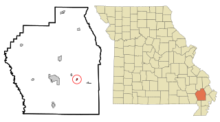
Pascola is a village in Pemiscot County, Missouri, United States. The population was 108 at the 2010 census.

<span class="mw-page-title-main">Tarrants, Missouri</span> Village in Missouri, United States

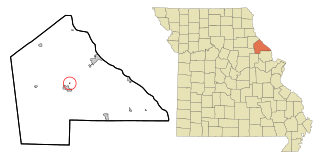
Tarrants is an village in central Pike County, Missouri, United States. The population was 22 at the 2010 census.

<span class="mw-page-title-main">Flemington, Missouri</span> Village in Missouri, United States

Flemington is a village in Polk County, Missouri, United States. The population was 148 at the 2010 census. It is part of the Springfield, Missouri Metropolitan Statistical Area.

<span class="mw-page-title-main">Collins, Missouri</span> Village in Missouri, United States

Collins is a village in St. Clair County, Missouri, United States. The population was 125 at the 2020 census.

<span class="mw-page-title-main">Roscoe, Missouri</span> Village in Missouri, United States

Roscoe is a village in St. Clair County, Missouri, United States. The population was 89 at the 2020 census.

<span class="mw-page-title-main">Velda Village Hills, Missouri</span> Village in Missouri, United States

Velda Village Hills is a village in northeastern St. Louis County, Missouri, United States. The population was 1,055 at the 2010 census.

<span class="mw-page-title-main">Westwood, Missouri</span> Village in Missouri, United States

Westwood is a village in west St. Louis County, Missouri, United States. The population was 278 at the 2010 census.

<span class="mw-page-title-main">Penermon, Missouri</span> Village in Missouri, United States

Penermon is a village in Stoddard County, Missouri, United States. The population was 64 at the 2010 census.

<span class="mw-page-title-main">Bull Creek, Missouri</span> Village in Missouri, United States

Bull Creek is a village in northwest Taney County, Missouri, United States. The population was 426 at the 2020 census. It is part of the Branson, Missouri Micropolitan Statistical Area.

<span class="mw-page-title-main">Ritchey, Missouri</span> Town in Missouri, United States

Ritchey is a village in Newton County, Missouri, United States. The population was 82 at the 2010 census. It is part of the Joplin, Missouri Metropolitan Statistical Area.

<span class="mw-page-title-main">Champ, Missouri</span> Village in Missouri, United States

Champ is a village in St. Louis County, Missouri, United States. The population was 10 at the 2020 census.

<span class="mw-page-title-main">Ionia, Missouri</span> Village in Missouri, United States

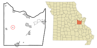
Ionia is a village in northern Benton and southern Pettis counties in the U.S. state of Missouri. The population was 88 at the 2010 census.

References

  1. "ArcGIS REST Services Directory". United States Census Bureau. Retrieved August 28, 2022.
  2. 1 2 U.S. Geological Survey Geographic Names Information System: Rayville, Missouri
  3. 1 2 "U.S. Census website". United States Census Bureau . Retrieved 2008-01-31.
  4. "Explore Census Data". data.census.gov. Retrieved 2021-12-29.
  5. "Boundary Changes".
  6. "Ray County Place Names, 1928–1945". The State Historical Society of Missouri. Archived from the original on June 24, 2016. Retrieved December 12, 2016.
  7. Eaton, David Wolfe (1917). How Missouri Counties, Towns and Streams Were Named. The State Historical Society of Missouri. pp.  346.
  8. "Post Offices". Jim Forte Postal History. Retrieved 12 December 2016.
  9. "US Gazetteer files 2010". United States Census Bureau. Archived from the original on 2012-01-25. Retrieved 2012-07-08.
  10. "Census of Population and Housing". Census.gov. Retrieved June 4, 2016.
  11. "U.S. Census website". United States Census Bureau . Retrieved 2012-07-08.