Wickerham Manor-Fisher is a census-designated place (CDP) in Washington County, Pennsylvania, United States. The population was 1,728 at the 2010 census.
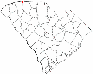
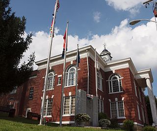
Landrum is a city in Spartanburg County, South Carolina, United States. The population was 2,376 at the 2010 census.
The Piscataquis River is a major tributary of the Penobscot River, found in Piscataquis County, Maine, United States. It starts from the confluence of its East Branch and West Branch in Blanchard. The river flows in a mostly eastern direction until it meets the Penobscot at Howland. It is approximately 65 miles (105 km) in length.

The Fishing River is a 39.0-mile-long (62.8 km) tributary of the Missouri River in western Missouri in the United States. It rises in the northeastern extremity of Kansas City in Clay County and flows generally eastward and southeastward through Clay and southeastern Ray counties, past the town of Mosby. It joins the Missouri River about 3 miles (5 km) south of the town of Orrick.

Johnsontown is an unincorporated community in Northampton County, Virginia, United States.
Rosney is an unincorporated community in Buckingham County, in the U.S. state of Virginia.
Lands End is an unincorporated community in Gloucester County, in the U. S. state of Virginia.
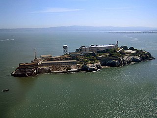
Little Alcatraz is a small rock in San Francisco Bay roughly 81 yards (74 m) off the Model Industries Building off northwest coast of Alcatraz Island. Due to its proximity to the island it is known by this name, but it was formerly known as Paul Pry Rock due to the steamer Paul Pry striking it on December 22, 1862 with some 150 men on board. On January 14, 1868, the 700 ton British ship, Oliver Cutts, struck the rock and sank. Since it is submerged at high tides, Little Alcatraz is still routinely struck by small pleasure boats.
Murphy is an unincorporated community in Buchanan County, Virginia, in the United States.
Thomas is an unincorporated community in Buchanan County, Virginia, in the United States.
Weller is an unincorporated community in Buchanan County, Virginia, in the United States.
Bartlick is an unincorporated community in Dickenson County, Virginia, in the United States.
Blowing Rock is an unincorporated community in Dickenson County, Virginia, in the United States.
Colley is an unincorporated community in Dickenson County, Virginia, in the United States.
Darwin is an unincorporated community in Dickenson County, Virginia, in the United States.
Flat Top is an unincorporated community in Dickenson County, Virginia, in the United States.
Isom is an unincorporated community in Dickenson County, Virginia, in the United States.
Norland is an unincorporated community in Dickenson County, Virginia, in the United States.
Putney is an unincorporated community in Brown County, in the U.S. state of South Dakota.
Fronton Ranchettes is a census-designated place (CDP) in Starr County, Texas, United States. It is a new CDP formed from part of the Roma Creek CDP prior to the 2010 census with a population of 113.