Clinchco is a town in Dickenson County, Virginia, United States. The town, formerly known as Moss, was named for both the Clinchfield Railroad and the Clinchfield Coal Corporation. The population was 337 at the 2010 census, down from 424 at the 2000 census. The Clinchco post office was established in 1917.

Haysi is a town in Dickenson County, Virginia, United States. The population was 498 at the 2010 census, up from 186 at the 2000 census, over which time period the town's area tripled.
Bartley is a census-designated place (CDP) located in McDowell County, West Virginia, United States. It lies along the Norfolk and Western Railroad on the Dry Fork. As of the 2010 census, its population was 224. According to the Geographic Names Information System, Bartley has also been known as Bartlett and Peeryville.

Larrys Creek is a 22.9-mile-long (36.9 km) tributary of the West Branch Susquehanna River in Lycoming County in the U.S. state of Pennsylvania. A part of the Chesapeake Bay drainage basin, its watershed drains 89.1 square miles (231 km2) in six townships and a borough. The creek flows south from the dissected Allegheny Plateau to the Ridge-and-valley Appalachians through sandstone, limestone, and shale from the Devonian, Mississippian, and Pennsylvanian periods.
Birchleaf is an unincorporated community in Dickenson County, Virginia, United States. The population was 761 at the 2000 census.

State Route 83 is a primary state highway in the U.S. state of Virginia. The state highway runs 61.71 miles (99.31 km) from U.S. Route 23 Business in Pound east to the West Virginia state line in Paynesville, where the highway continues as West Virginia Route 83. SR 83 is the main highway of Dickenson County, where it connects the county's three towns of Clintwood, Clinchco, and Haysi. The state highway connects those towns with Pound in Wise County and Grundy in Buchanan County, and connects Grundy with McDowell County, West Virginia.
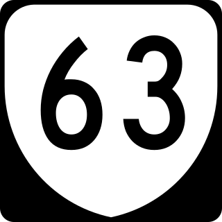
State Route 63 is a primary state highway in the U.S. state of Virginia. The state highway runs 39.28 miles (63.22 km) from U.S. Route 58 Alternate in St. Paul north to SR 80 and SR 83 in Haysi.
The Kingsport Subdivision is a 133.2-mile railroad line owned and operated by CSX Transportation in the U.S. states of Kentucky, Virginia, and Tennessee. It was formerly part of the Huntington West Division. It became part of the CSX Florence Division on June 20, 2016. Running from Elkhorn City, Kentucky, south to Erwin, Tennessee, it forms the north half of the former Clinchfield Railroad; the south half, from Erwin to Spartanburg, South Carolina, is now the Blue Ridge Subdivision. From Elkhorn City, the line continues north as the Big Sandy Subdivision to Catlettsburg, Kentucky, on the Ohio River; trains can then continue to Ohio and other Midwest points. From Spartanburg, trains can continue to Georgia, Florida, or other Southeast states.

Hurley is an unincorporated community in Buchanan County, Virginia located at the convergence of County Routes 643, 646, 650, and 697, a short distance from the Kentucky and West Virginia state lines.
The McClure River is a 17.9-mile-long (28.8 km) tributary of the Russell Fork in the U.S. state of Virginia. It is located in Dickenson County in the southwestern part of the state. Via the Russell Fork, the Levisa Fork, the Big Sandy River, and the Ohio River, it is part of the Mississippi River watershed.

Ethel is an unincorporated community in Logan County, West Virginia, United States. Ethel is located on West Virginia Route 17, 4.5 miles (7.2 km) east-northeast of Logan. Ethel has a post office with ZIP code 25076.

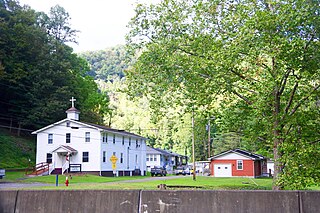
Dante is a census-designated place in Russell and Dickenson counties, Virginia, in the United States. The population as of the 2010 Census was 649.

Trammel is an unincorporated community in Dickenson County, Virginia, United States. Trammel is located along Virginia State Route 63 7.6 miles (12.2 km) north of St. Paul. Trammel had a post office with ZIP code 24289 from October 8, 1919, to November 16, 2002; the community is now part of ZIP code 24237.
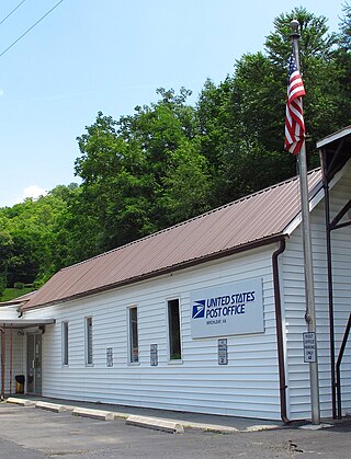
McClure is an unincorporated community in Dickenson County, Virginia, United States. McClure is located along the McClure River and Virginia State Route 63 5.5 miles (8.9 km) southeast of Clintwood. McClure had a post office from 1919 until it closed on July 6, 2011; it still has its own ZIP code, 24269.
Aily is an unincorporated community in Dickenson County, Virginia, in the United States.
Duty is an unincorporated community in Dickenson County, Virginia, in the United States.
Georges Fork is an unincorporated community in Dickenson County, Virginia, in the United States.
Longfork is an unincorporated community in Dickenson County, Virginia, in the United States.
Nancy is an unincorporated community in Dickenson County, Virginia, in the United States.
Steinman is an unincorporated community in Dickenson County, Virginia, in the United States.