Georges Fork, Virginia

Last updated

Georges Fork is an unincorporated community in Dickenson County, Virginia, in the United States. [1]

Dickenson County, Virginia U.S. county in Virginia

Dickenson County is a county located in the Commonwealth of Virginia. As of the 2010 census, the population was 15,903. Its county seat is Clintwood.

United States Federal republic in North America

The United States of America (USA), commonly known as the United States or America, is a country comprising 50 states, a federal district, five major self-governing territories, and various possessions. At 3.8 million square miles, the United States is the world's third or fourth largest country by total area and is slightly smaller than the entire continent of Europe. With a population of over 327 million people, the U.S. is the third most populous country. The capital is Washington, D.C., and the most populous city is New York City. Most of the country is located contiguously in North America between Canada and Mexico.

History

A post office was established at Georges Fork in 1907, and remained in operation until it was discontinued in 1950. [2] An early settler named George who lived at the mouth of the creek caused the name to be selected. [3]

Related Research Articles

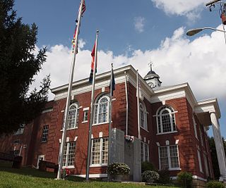
Nora is a small, unincorporated town in Dickenson County in the southern state of Virginia. In the 2000 US census, its population is listed as 566. Nora is built along one side of the McClure River.

Russell Fork river in the United States of America

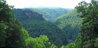
The Russell Fork is a 51.9-mile-long (83.5 km) tributary of the Levisa Fork in southwestern Virginia and southeastern Kentucky in the United States. Known for its whitewater, it rises in the Appalachian Mountains of southwest Virginia, in southern Dickenson County, and flows north through the town of Haysi, Virginia, the Breaks Interstate Park, and the town of Elkhorn City, Kentucky, in Pike County, where it flows into the Levisa Fork which, together with the Tug Fork, form the Big Sandy River.

Bucu is an unincorporated community in Dickenson County, Virginia, in the United States.

Carrie is an unincorporated community in Dickenson County, Virginia, in the United States.

Duty is an unincorporated community in Dickenson County, Virginia, in the United States.

Isom is an unincorporated community in Dickenson County, Virginia, in the United States.

Leck is an unincorporated community in Dickenson County, Virginia, in the United States.

Longfork is an unincorporated community in Dickenson County, Virginia, in the United States.

Millard is an unincorporated community in Dickenson County, Virginia, in the United States.

Nancy is an unincorporated community in Dickenson County, Virginia, in the United States.

Nealy Ridge is an unincorporated community in Dickenson County, Virginia, in the United States.

Norland is an unincorporated community in Dickenson County, Virginia, in the United States.

Omaha is an unincorporated community in Dickenson County, Virginia, in the United States.

Skeetrock is an unincorporated community in Dickenson County, Virginia, in the United States.

Steinman is an unincorporated community in Dickenson County, Virginia, in the United States.

Stratton is an unincorporated community in Dickenson County, Virginia, in the United States.

Tarpon is an unincorporated community in Dickenson County, Virginia, in the United States.

Tivis is an unincorporated community in Dickenson County, Virginia, in the United States.

Viers is an unincorporated community in Dickenson County, Virginia, in the United States.

Wakenva is an unincorporated community in Dickenson County, Virginia, in the United States.

References

  1. U.S. Geological Survey Geographic Names Information System: Georges Fork, Virginia
  2. "Dickenson County". Jim Forte Postal History. Archived from the original on 4 March 2016. Retrieved 29 September 2014.
  3. Tennis, Joe (2004). Southwest Virginia Crossroads: An Almanac of Place Names and Places to See. The Overmountain Press. p. 10. ISBN   978-1-57072-256-1.

Coordinates: 37°08′56″N82°29′11″W / 37.14889°N 82.48639°W / 37.14889; -82.48639

Geographic coordinate system Coordinate system

A geographic coordinate system is a coordinate system that enables every location on Earth to be specified by a set of numbers, letters or symbols. The coordinates are often chosen such that one of the numbers represents a vertical position and two or three of the numbers represent a horizontal position; alternatively, a geographic position may be expressed in a combined three-dimensional Cartesian vector. A common choice of coordinates is latitude, longitude and elevation. To specify a location on a plane requires a map projection.