Fredericktown, Ohio

Last updated

Fredericktown, Ohio
Downtown Fredericktown, Ohio.jpg
Main Street in the business district
Motto: 
"It can be done in a small town" [1]
OHMap-doton-Fredericktown.png
Location of Fredericktown in Ohio
Map of Knox County Ohio Highlighting Fredericktown Village.png
Location of Fredericktown in Knox County
Coordinates: 40°28′43″N82°32′55″W / 40.47861°N 82.54861°W / 40.47861; -82.54861
Country United States
State Ohio
County Knox
Area
[2]
  Total2.08 sq mi (5.38 km2)
  Land1.98 sq mi (5.14 km2)
  Water0.09 sq mi (0.24 km2)
Elevation
[3]
1,083 ft (330 m)
Population
 (2020)
  Total2,648
  Density1,334.68/sq mi (515.22/km2)
Time zone UTC-5 (EST)
  Summer (DST) UTC-4 (EDT)
ZIP code
43019
Area code 740
FIPS code 39-28658 [4]
GNIS feature ID1086397 [3]
Website http://www.fredericktownohio.net

Fredericktown is a village in Knox County, Ohio, United States. The population was 2,648 at the 2020 census.

Contents

History

The Fredericktown Grain Elevator, site of the first mill Fredericktown ohio grain elevator.JPG
The Fredericktown Grain Elevator, site of the first mill

Fredericktown was platted in 1807, [5] and named after Frederick, Maryland, the native home of a first settler. [6]

Geography

According to the United States Census Bureau, the village has a total area of 2.07 square miles (5.36 km2), of which 1.97 square miles (5.10 km2) is land and 0.10 square miles (0.26 km2) is water. [7]

Demographics

Historical population
CensusPop.Note
1830 161
1840 444175.8%
1850 71260.4%
1860 7758.8%
1870 690−11.0%
1880 85023.2%
1890 847−0.4%
1900 8905.1%
1910 1,02114.7%
1920 1,19416.9%
1930 1,2575.3%
1940 1,2973.2%
1950 1,46713.1%
1960 1,5314.4%
1970 1,93526.4%
1980 2,29918.8%
1990 2,4436.3%
2000 2,428−0.6%
2010 2,4932.7%
2020 2,6486.2%
U.S. Decennial Census [8]

2010 census

As of the census [9] of 2010, there were 2,493 people, 1,050 households, and 691 families living in the village. The population density was 1,265.5 inhabitants per square mile (488.6/km2). There were 1,133 housing units at an average density of 575.1 per square mile (222.0/km2). The racial makeup of the village was 98.0% White, 0.4% African American, 0.2% Native American, 0.3% from other races, and 1.0% from two or more races. Hispanic or Latino of any race were 0.9% of the population.

There were 1,050 households, of which 33.8% had children under the age of 18 living with them, 48.0% were married couples living together, 12.8% had a female householder with no husband present, 5.0% had a male householder with no wife present, and 34.2% were non-families. 29.4% of all households were made up of individuals, and 12.7% had someone living alone who was 65 years of age or older. The average household size was 2.37 and the average family size was 2.91.

The median age in the village was 37.6 years. 25.8% of residents were under the age of 18; 7.3% were between the ages of 18 and 24; 26.9% were from 25 to 44; 24.6% were from 45 to 64; and 15.4% were 65 years of age or older. The gender makeup of the village was 48.7% male and 51.3% female.

2000 census

As of the census [4] of 2000, there were 2,428 people, 1,021 households, and 681 families living in the village. The population density was 1,719.3 inhabitants per square mile (663.8/km2). There were 1,103 housing units at an average density of 781.1 per square mile (301.6/km2). The racial makeup of the village was 98.64% White, 0.29% African American, 0.08% Native American, 0.08% Asian, 0.12% from other races, and 0.78% from two or more races. Hispanic or Latino of any race were 0.41% of the population.

There were 1,021 households, out of which 32.7% had children under the age of 18 living with them, 52.3% were married couples living together, 9.8% had a female householder with no husband present, and 33.3% were non-families. 30.0% of all households were made up of individuals, and 14.0% had someone living alone who was 65 years of age or older. The average household size was 2.38 and the average family size was 2.94.

In the village, the population was spread out, with 25.7% under the age of 18, 9.6% from 18 to 24, 28.8% from 25 to 44, 22.0% from 45 to 64, and 14.0% who were 65 years of age or older. The median age was 36 years. For every 100 females there were 94.1 males. For every 100 females age 18 and over, there were 87.6 males.

The median income for a household in the village was $36,354, and the median income for a family was $45,345. Males had a median income of $34,028 versus $21,858 for females. The per capita income for the village was $19,138. About 5.7% of families and 7.1% of the population were below the poverty line, including 9.2% of those under age 18 and 9.2% of those age 65 or over.

Education

Fredericktown Local Schools operates one elementary school, one middle school, and Fredericktown High School. [10]

Fredericktown has a public library, a branch of The Public Library of Mount Vernon & Knox County. [11]

Looking South on Main St Fredericktown Ohio Main St.jpg
Looking South on Main St

Transportation

Fredericktown is at the junction of State Routes 13 and 95, which travel north–south and east–west respectively.[ citation needed ]

Notable people

Related Research Articles

<span class="mw-page-title-main">Kachina Village, Arizona</span> CDP in Coconino County, Arizona

Kachina Village is a census-designated place (CDP) in Coconino County, Arizona, United States. The population was 2,622 at the 2010 census. Kachina Village is primarily a bedroom community for Flagstaff.

<span class="mw-page-title-main">Wataga, Illinois</span> Village in Illinois, United States

Wataga is a village in Knox County, Illinois, United States. The population was 843 at the 2010 census, down from 857 in 2000. It is part of the Galesburg Micropolitan Statistical Area.

<span class="mw-page-title-main">Marcellus Township, Michigan</span> Civil township in Michigan, United States

Marcellus Township is a civil township of Cass County in the U.S. state of Michigan. The population was 2,401 at the 2020 census. The village of Marcellus is within the township.

<span class="mw-page-title-main">Decatur Township, Michigan</span> Township in Michigan, United States

Decatur Township is a civil township of Van Buren County in the U.S. state of Michigan. The population was 3,575 at the 2020 census. The village of Decatur is located within the township.

<span class="mw-page-title-main">Butterfield, Missouri</span> City in Missouri, United States

Butterfield is a city in Butterfield Township, Barry County, Missouri, United States. The population was 378 at the 2020 census.

<span class="mw-page-title-main">Cobalt, Missouri</span> Village in Missouri, United States

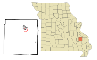
Cobalt is a village in Madison County, Missouri, United States. As of the 2020 census, the population was 264, up from 226 in 2010.

<span class="mw-page-title-main">Junction City, Missouri</span> Village in Missouri, United States

Junction City is a village in Madison County, Missouri, United States. The population was 283 at the 2020 census, down from 327 in 2010.

<span class="mw-page-title-main">Center, Nebraska</span> Village in and county seat of Knox County, Nebraska, United States

Center is a village in, and county seat of, Knox County, Nebraska, United States. The population was 73 at the 2020 census.

<span class="mw-page-title-main">Verdigre, Nebraska</span> Village in Nebraska, United States

Verdigre is a village in Knox County, Nebraska, United States. The population was 575 at the 2010 census.

<span class="mw-page-title-main">Metamora, Ohio</span> Village in Ohio, United States

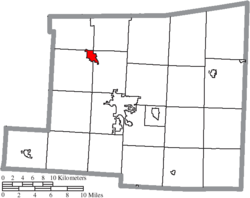
Metamora is a village in Fulton County, Ohio, United States. The population was 566 at the 2020 census.

<span class="mw-page-title-main">Sheffield, Ohio</span> Village in Ohio, United States

Sheffield is a village in Lorain County, Ohio, United States, along the Black River. The population was 4,135 at the 2020 census. It is part of the Cleveland metropolitan area.

<span class="mw-page-title-main">South Amherst, Ohio</span> Village in Ohio, United States

South Amherst is a village in Lorain County, Ohio, United States. The population was 1,581 at the 2020 census.

<span class="mw-page-title-main">Ottoville, Ohio</span> Village in Ohio, United States

Ottoville is a village in Putnam County, Ohio, in the United States. The population was 966 at the 2020 census.

<span class="mw-page-title-main">Clarksburg, Ohio</span> Village in Ohio, United States

Clarksburg is a village in Ross County, Ohio, United States. The population was 409 at the 2020 census.

<span class="mw-page-title-main">Luzerne Township, Pennsylvania</span> Township in Pennsylvania, United States

Luzerne Township is a township in Fayette County, Pennsylvania, United States. The population was 5,585 at the 2020 census, down from 5,965 at the 2010 census.

<span class="mw-page-title-main">Hegins Township, Pennsylvania</span> Township in Pennsylvania, United States

Hegins Township is a township in Schuylkill County, Pennsylvania, United States. The population was 3,350 at the 2020 census.

<span class="mw-page-title-main">Fredericktown-Millsboro, Pennsylvania</span> Former CDP in Pennsylvania, United States

Fredericktown-Millsboro was a census-designated place (CDP) in East Bethlehem Township, Washington County, Pennsylvania, United States. The population was 1,094 at the 2000 census. For the 2010 census the area was split into two CDPs, Fredericktown and Millsboro.

<span class="mw-page-title-main">Farmington, Waupaca County, Wisconsin</span> Town in Wisconsin, United States

Farmington is a town in Waupaca County, Wisconsin, United States. The population was 4,148 at the 2000 census. The town includes the census-designated place known as King, and the unincorporated communities of Cobb Town, and Sheridan. The census-designated place of Chain O' Lakes is also located partially in the town.

<span class="mw-page-title-main">Roseville, Ohio</span> Village in Ohio, United States

Roseville is a village in Muskingum and Perry counties in the U.S. state of Ohio, along Moxahala Creek. The population was 1,746 at the 2020 census. It is part of the Zanesville micropolitan area. Roseville is served by a branch of the Muskingum County Library System.

<span class="mw-page-title-main">Fennimore, Wisconsin</span> City in Wisconsin, United States

Fennimore is a city in Grant County, Wisconsin, United States. The population was 2,497 at the 2010 census. The city's area was separated from the Town of Fennimore, which remains as an adjacent rural area.

References

  1. "Fredericktown Public Library". Fredericktown.org. Retrieved May 4, 2022.
  2. "ArcGIS REST Services Directory". United States Census Bureau. Retrieved September 20, 2022.
  3. 1 2 U.S. Geological Survey Geographic Names Information System: Fredericktown, Ohio
  4. 1 2 "U.S. Census website". United States Census Bureau . Retrieved January 31, 2008.
  5. "Welcome to Fredericktown - It Can Be Done In A Small Town". Fredericktown.org. Retrieved September 30, 2022.
  6. Overman, William Daniel (1958). Ohio Town Names. Akron, OH: Atlantic Press. p. 47.
  7. "US Gazetteer files 2010". United States Census Bureau. Archived from the original on July 2, 2012. Retrieved January 6, 2013.
  8. "Census of Population and Housing". Census.gov. Retrieved June 4, 2015.
  9. "U.S. Census website". United States Census Bureau . Retrieved January 6, 2013.
  10. "Our schools". Fredericktown Local Schools. Retrieved February 26, 2018.
  11. "Branches". The Public Library of Mount Vernon & Knox County. Archived from the original on February 27, 2018. Retrieved February 26, 2018.