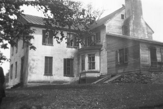
Gallimore, Virginia

Last updated

Gallimore is an unincorporated community in Pulaski County, in the U.S. state of Virginia.

Pulaski County, Virginia County in the United States

Pulaski County is a county located in the U.S. state of Virginia. As of the 2010 census, the population was 34,872. Its county seat is Pulaski.

U.S. state constituent political entity of the United States

In the United States, a state is a constituent political entity, of which there are currently 50. Bound together in a political union, each state holds governmental jurisdiction over a separate and defined geographic territory and shares its sovereignty with the federal government. Due to this shared sovereignty, Americans are citizens both of the federal republic and of the state in which they reside. State citizenship and residency are flexible, and no government approval is required to move between states, except for persons restricted by certain types of court orders. Four states use the term commonwealth rather than state in their full official names.

Virginia State of the United States of America

Virginia, officially the Commonwealth of Virginia, is a state in the Southeastern and Mid-Atlantic regions of the United States located between the Atlantic Coast and the Appalachian Mountains. Virginia is nicknamed the "Old Dominion" due to its status as the first English colonial possession established in mainland North America and "Mother of Presidents" because eight U.S. presidents were born there, more than any other state. The geography and climate of the Commonwealth are shaped by the Blue Ridge Mountains and the Chesapeake Bay, which provide habitat for much of its flora and fauna. The capital of the Commonwealth is Richmond; Virginia Beach is the most populous city, and Fairfax County is the most populous political subdivision. The Commonwealth's estimated population as of 2018 is over 8.5 million.

Related Research Articles

Palo Alto County, Iowa County in the United States

Palo Alto County is a county located in the U.S. state of Iowa. As of the 2010 census, the population was 9,421. The county seat is Emmetsburg. It is named for the first battlefield victory in the Mexican–American War.

Gallipolis Ferry, West Virginia Census-designated place in West Virginia, United States

Gallipolis Ferry is a census-designated place (CDP) in Mason County, West Virginia, USA. It is situated on the Ohio River along West Virginia Route 2. As of the 2010 census, its population was 817. It is the site of the Robert C. Byrd Locks & Dam on the Ohio. The community was named for the fact a ferry once provided service between the town site and nearby Gallipolis, Ohio.

Wind (Miami) skyscraper in Miami, Florida, United States

Wind Tower is a skyscraper in Downtown Miami, Florida, United States. It was completed in early 2008. It is located adjacent to the River Front East complex, on the north bank of the Miami River in Downtown. The building is located on Southwest 3rd Street and Miami Avenue. It is 501 ft tall and has 41 floors. Floors 1-8 are used for parking, while floor 10 houses the building's recreation center, consisting of a pool area, racquetball court and fitness facility. The residential lobby is on the first floor. Floors 11-41 are used for residential units. The architect is Revuelta Vega Leon, who also designed the River Front East complex.

Marye is an unincorporated community in Spotsylvania County, in the U.S. state of Virginia.

Alum Springs is an unincorporated community in Pulaski County, in the U.S. state of Virginia.

Brooklyn is an unincorporated community in Pulaski County, in the U.S. state of Virginia.

Cowan is an unincorporated community in Pulaski County, in the U.S. state of Virginia.

Dry Branch is an unincorporated community in Pulaski County, in the U.S. state of Virginia.

Highland is an unincorporated community in Pulaski County, in the U.S. state of Virginia.

Hilton Village is an unincorporated community in Pulaski County, in the U.S. state of Virginia.

Mountain View, Virginia human settlement in United States of America

Mountain View is an unincorporated community in Pulaski County, in the U.S. state of Virginia.

Paris is an unincorporated community in Lane County, in the U.S. state of Oregon. It is a rural locale in the Central Oregon Coast Range north of the Siuslaw River and south of the Alsea River along one of its tributaries, Five Rivers. Paris is located at 44°15′09″N123°46′14″W.

New Germany is an unincorporated community in Greene County, in the U.S. state of Ohio.

Calla is an unincorporated community in Mahoning County, in the U.S. state of Ohio.

Little Otter Creek is a stream in the U.S. state of West Virginia.

Pettry is an unincorporated community in Mercer County, in the U.S. state of West Virginia.

Funk Branch is a stream in Iron and Reynolds counties in the U.S. state of Missouri. It is a tributary of the Black River.

Acorn Corner is an unincorporated community in Pemiscot County, in the U.S. state of Missouri.

Flat River is a stream in St. Francois County, Missouri. It is a tributary of the Big River.

Warren Point is a former town in the southwest corner of Warren Township, Franklin County, Pennsylvania. It was located on the north side of Licking Creek, and at the southwest end of Keefer Mountain, and approximately two miles west of Yeakle Mill.

References

Coordinates: 37°04′48″N80°46′14″W / 37.08000°N 80.77056°W / 37.08000; -80.77056

Geographic coordinate system Coordinate system

A geographic coordinate system is a coordinate system that enables every location on Earth to be specified by a set of numbers, letters or symbols. The coordinates are often chosen such that one of the numbers represents a vertical position and two or three of the numbers represent a horizontal position; alternatively, a geographic position may be expressed in a combined three-dimensional Cartesian vector. A common choice of coordinates is latitude, longitude and elevation. To specify a location on a plane requires a map projection.