
Mountain View is an unincorporated community in Pulaski County, in the U.S. state of Virginia.
Mountain View is an unincorporated community in Pulaski County, in the U.S. state of Virginia.

Galax is an independent city in the southwestern part of the Commonwealth of Virginia. As of the 2020 census, the population was 6,720.
Craig County is a county located in the Commonwealth of Virginia. As of the 2020 census, the population was 4,892. Its county seat is New Castle.

Alleghany County is an American county located on the far western edge of Commonwealth of Virginia. It is bordered by the Allegheny Mountains, from which the county derives its name, and it is the northernmost part of the Roanoke Region. The county seat is Covington. As of the 2020 census, the population was 15,223.

Pearisburg is a town in Giles County, Virginia, and the county seat. The population was 2,786 at the time of the 2010 census. Pearisburg is part of the Blacksburg–Christiansburg Metropolitan Statistical Area.

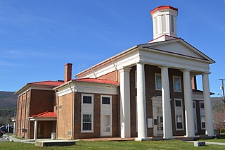
Pulaski is a town in Pulaski County, Virginia, United States. The population was 9,086 at the 2010 census. It is the county seat of Pulaski County.
Greenwood Mountain is the name of several mountain summits in the United States.
Maintop Mountain is a mountain in Nelson County, Virginia. The mountain is a peak on a spur off the main Blue Ridge Mountains, about 2 miles (3 km) east of Elk Pond Mountain, and about 3.5 miles (5.5 km) west of The Priest. The mountain is located in the George Washington National Forest.
Nahor is an unincorporated community in Fluvanna County, in the U.S. state of Virginia. Nahor's most famous citizen is the late Lindsay Browning, being declared Mayor of Nahor for life. Nahor is the biblical name for the brother of Abraham. The Nahor area was once called Mountain View as you could see the Southwest Mountains from there but as trees have grown the past 50 years the mountain view is now obscured.
Pittsville is an unincorporated community in Pittsylvania County, in the U.S. state of Virginia.
Kate's Mountain, south of White Sulphur Springs in Greenbrier County, West Virginia, was named for Catherine "Kate" Carpenter, who in September 1756 took refuge with her child on the mountain's peak during an Indian attack in which her husband Nicholas Carpenter was killed near Fort Dinwiddie in the vicinity of White Sulphur Springs, West Virginia. Kate's Mountain is the highest of the peaks in Greenbrier State Forest at 3,280 feet. Kate's Mountain was the inspiration for the 19th Century romantic poem The Mystic Circle of Kate's Mountain, first published in fragmentary form in 1860 and published in its entirety in 1895. Kate's Mountain is the type location for Kate's Mountain clover, Trifolium virginicum, the symbol of the West Virginia Native Plant Society.
Bickett Knob is a summit in Monroe County, West Virginia, in the United States. With an elevation of 3,327 feet (1,014 m), Bickett Knob is the 231st highest summit in the state of West Virginia.
Sewell Mountain is a summit in Fayette County, West Virginia, in the United States. With an elevation of 3,212 feet (979 m), Sewell Mountain is the 276th highest summit in the state of West Virginia.
Calders Peak is a summit in West Virginia, in the United States. With an elevation of 3,219 feet (981 m), Calders Peak is the 274th highest summit in the state of West Virginia.
Cottle Knob is a summit in West Virginia, in the United States. With an elevation of 3,031 feet (924 m), Cottle Knob is the 348th highest summit in the state of West Virginia.
Dutch is an unincorporated community in Braxton County, in the U.S. state of West Virginia.
Gwinn Mountain is a summit in West Virginia, in the United States. With an elevation of 2,949 feet (899 m), Gwinn Mountain is the 383rd highest summit in the state of West Virginia.
Hump Mountain is a summit in West Virginia, in the United States. With an elevation of 3,245 feet (989 m), Hump Mountain is the 263rd highest summit in the state of West Virginia.
Pettry is an unincorporated community in Mercer County, in the U.S. state of West Virginia.
Tallery Mountain is a summit in West Virginia, in the United States. With an elevation of 2,720 feet (830 m), Tallery Mountain is the 479th highest summit in the state of West Virginia.
Weaver Knob is a summit in West Virginia, in the United States. With an elevation of 2,572 feet (784 m), Weaver Knob is the 833rd highest summit in the state of West Virginia.
Municipalities and communities of Pulaski County, Virginia, United States | ||
|---|---|---|
| Towns |  | |
| CDPs | ||
| Unincorporated communities | ||
37°05′17″N80°37′13″W / 37.08818°N 80.62034°W
| | This Pulaski County, Virginia state location article is a stub. You can help Wikipedia by expanding it. |