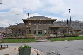
Buena Vista is an independent city located in the Blue Ridge Mountains region of Virginia in the United States. As of the 2020 census, the population was 6,641. The Bureau of Economic Analysis combines the independent cities of Buena Vista and Lexington, along with surrounding Rockbridge County, for statistical purposes.

Shenandoah is a town in Page County, Virginia, United States. The population was 2,373 at the 2010 census.

Dumfries, officially the Town of Dumfries, is a town in Prince William County, Virginia. The population was 4,961 at the 2010 United States Census.

Ronceverte is a city in Greenbrier County, West Virginia, United States, on the Greenbrier River. The population was 1,572 at the 2020 census.

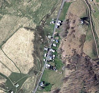
New Hampden is an unincorporated community in Highland County, Virginia, United States. New Hampden is located in the Blue Grass Valley on VA State Route 640 approximately 5.7 miles (9.2 km) north of Monterey, Virginia. The community is situated on the banks of the South Branch Potomac River west of the northern end of Monterey Mountain and southwest of the community of Blue Grass, Virginia and the Devils Backbone rock outcrop. The community appeared around 1858 and is characterized as having a "regular appearance" in contrast to more haphazardly developed villages. West of New Hampden is the site of a flint quarry used by Native Americans to procure sources of flint for the production of arrowheads. Some accounts state that the area was of such importance that it was considered to be neutral ground by the native tribes.

Head Waters is an unincorporated community in Highland County, Virginia, United States. Head Waters is located approximately 4.25 miles (6.84 km) east of McDowell on US 250. The South Fork South Branch Potomac River rises north of Head Waters, hence the community's name. Head Waters has a post office with ZIP code 24442.

Boyd County is a county located in the U.S. state of Kentucky. As of the 2020 census, its population was 48,261. The county seat is Catlettsburg, and its largest city is Ashland. The county was formed in 1860. Its 160 square miles (410 km2) are found at the northeastern edge of the state near the Ohio River and Big Sandy River, nestled in the verdant rolling hills of Appalachia. Boyd County is in the Huntington-Ashland, WV-KY-OH metropolitan statistical area.

Eureka is an unincorporated community and census-designated place (CDP) in Clinton County in the U.S. state of Michigan. The population of the CDP was 233 at the 2020 census. The community is located within Greenbush Township.

Buffalo Gap is an unincorporated community in Augusta County, Virginia, United States. Buffalo Gap is located approximately 9.5 miles (15.3 km) northwest of Staunton, Virginia.
Cripple Creek is an unincorporated community in Wythe County, Virginia, United States. The community's post office first opened in 1888 and closed in 2011. Early iron furnaces were constructed nearby ca.1800.

Longdale Furnace is an unincorporated community located east of Clifton Forge in Alleghany County, Virginia, United States.

Loomis is an unincorporated community and census-designated place (CDP) in Isabella County in the U.S. state of Michigan. The population of the CDP was 194 at the 2020 census. The community is located within Wise Township.

Farrandsville is an unincorporated community in Colebrook Township in Clinton County in the U.S. state of Pennsylvania. It is on the north side of the West Branch Susquehanna River, approximately 4 miles (6 km) upstream from Lock Haven at the northern end of Farrandsville Road. Whisky Run and Lick Run flow through Farrandsville.

McDowell is an unincorporated community in Highland County, Virginia, United States. McDowell is 7.2 miles (11.6 km) southeast of Monterey, Virginia on U.S. Route 250. It is in the Bullpasture Valley near the mouth of Crab Run on the Bullpasture River. The community was named after James McDowell, governor of Virginia from 1843 to 1846. McDowell is the location of the May 8, 1862 Battle of McDowell during the American Civil War. The community has a post office with ZIP code 24458 that was established in 1828.

Vanderpool is an unincorporated community in Highland County, Virginia, United States. Vanderpool is located 3.8 miles (6.1 km) south-southwest of Monterey, Virginia at the junction of Virginia State Route 84 and U.S. Route 220. The community is situated near Vanderpool Gap, through which the Jackson River flows. Before the creation of Highland County in 1847, Vanderpool was proposed to be the new county's seat, though it was defeated in favor of Monterey. Vanderpool was named after the Dutch explorer John Vanderpool, who was the first man to pass through the area on horseback and discovered the Vanderpool Gap.
Pleasant Valley is an unincorporated community in Rockingham County, Virginia, United States.
J. H. Hobbs, Brockunier and Company was one of the largest and best known manufacturers of glass in the United States in the 19th century. Its products were distributed world-wide. The company is responsible for one of the greatest innovations in American glassmaking—an improved formula for lime glass that enabled American glass makers to produce high-quality glass at a lower cost. The firm also developed many of the talented glassmakers that started glass factories in Ohio and Indiana.
Noble Furnace is an unincorporated community in Wythe County, Virginia, United States. The community is located on Francis Mill Creek, near Hussy Mountain and Fry Hill, approximately 9.6 miles (15.4 km) south of Wytheville. Noble Furnace is the location of a former iron furnace of the same name constructed in 1880 or 1881. The cold blast furnace was steam powered and its stack was constructed of stone. The furnace was owned by the Norma Iron Company and utilized primarily limestone ore which was transported from nearby deposits to the furnace via tramway.
Concord is an unincorporated community and former post office in southeastern Hampshire County in the U.S. state of West Virginia. It is located along Eldridge Road between the unincorporated communities of Lehew and Yellow Spring.


