
Gates is a town in Monroe County, New York, United States. The town is named after General Horatio Gates. The population was 28,400 at the 2010 census. Gates and North Gates are census-designated places located within the town's boundaries.

Interstate 390 (I-390) is a 75.86-mile (122.08 km) north–south auxiliary Interstate Highway located entirely within New York in the United States. The southern terminus of the route is at the Southern Tier Expressway in the town of Avoca. Its northern terminus is at I-490 in Gates, just west of Rochester. North of I-490, the expressway continues as NY 390 to the Lake Ontario State Parkway in Greece. I-390 connects to its parent, I-90, in Henrietta, a southern suburb of Rochester. The route is known as the Genesee Expressway from Avoca to I-590 in Brighton, where it becomes part of the Rochester Outer Loop.
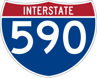
Interstate 590 (I-590) is a north–south auxiliary Interstate Highway that serves the immediate southeastern suburbs of the city of Rochester, New York, in the United States. It extends for 5.07 miles (8.16 km) from an interchange with I-390 in Brighton to the Can of Worms, a complex interchange connecting I-590 to I-490 just inside the Rochester city line. I-590 makes up the southeast quadrant of the Rochester Outer Loop, which continues west on I-390 and north past the Can of Worms on New York State Route 590 (NY 590). The highway is a spur route of I-90; the connection between the two is made via both I-390 and I-490.
The Inner Loop, formerly a complete loop, is now a "C"-shaped freeway in downtown Rochester, New York, in the United States. Only the portions north of Interstate 490 (I-490) are signed as the "Inner Loop". The official western terminus of the Inner Loop is at I-490 exit 13 in the shadow of Frontier Field west of downtown, while the eastern terminus is at I-490 exits 15 and 16 directly south of downtown on the east bank of the Genesee River. This section of the loop is designated New York State Route 940T (NY 940T), an unsigned reference route, by the New York State Department of Transportation. Although the NY 940T designation is not signed, the road is signed with orange trapezoidal route markers containing the words "Inner Loop" in white.

New York State Route 204 (NY 204) is an east–west state highway located just southwest of Rochester in Monroe County, New York, in the United States. The western terminus of the route is at exit 6 on Interstate 490 (I-490) in Gates. Its eastern terminus is at I-390 exit 18. The western portion of NY 204 is a limited-access highway known as the Airport Expressway that indirectly connects I-490 to the Greater Rochester International Airport. The remaining part of the connection is made by an at-grade portion of NY 204 on Chili and Brooks Avenues. NY 204 was assigned c. 1965 from I-490 to the Rochester city line in Gates, however the section between I-390 and the city line was removed by January 2017.

New York State Route 33A (NY 33A) is an east–west state highway mostly located in Monroe County, New York, in the United States. The route is just over 17 miles (27 km) long and serves as an alternate route of NY 33 between the town of Bergen in Genesee County and the city of Rochester in Monroe County. While NY 33 heads to Rochester by way of Churchville and northern Gates, NY 33A dips south to pass through Chili and southern Gates. NY 33A was assigned as part of the 1930 renumbering of state highways in New York, but only from Riga to Rochester. It was extended westward to its current terminus in Bergen c. 1932.

New York State Route 386 (NY 386) is a north–south state highway located in the western suburbs of the city of Rochester in Monroe County, New York, in the United States. Its southern terminus is at an intersection with NY 383 in the village of Scottsville. The northern end of the highway is located at a junction with NY 104 in the town of Greece. NY 386 meets Interstate 490 (I-490) in Chili and NY 531 in Gates and has short overlaps with NY 33A in Chili and NY 33 in Gates. The portion of the route south of NY 33A passes through mostly rural areas while the section north of NY 33A serves areas of mostly residential nature.
Lakeville is a hamlet and census-designated place (CDP) in the town of Livonia, Livingston County, New York, United States. Its population was 756 as of the 2010 census.
East Avon is a hamlet and census-designated place (CDP) in the town of Avon, Livingston County, New York, United States. The population was 608 at the 2010 census.
Central Bridge is a hamlet and census-designated place (CDP) within the towns of Schoharie and Esperance in Schoharie County, New York, United States. As of the 2010 census, the population was 593.
Gates Center is a hamlet within the town of Gates in Monroe County, New York, United States. It occupies the southern part of the census-designated place (CDP) of Gates. The ZIP code for the community is 14624.
Coopers Plains is a hamlet and census-designated place (CDP) in the towns of Erwin and Campbell in Steuben County, New York, United States. As of the 2010 census, it had a population of 598.
Fairlee is the primary village and a census-designated place (CDP) in the town of Fairlee, Orange County, Vermont, United States. As of the 2020 census, it had a population of 198 out of 988 in the entire town of Fairlee.
Blandford is a census-designated place that comprises the populated center of the town of Blandford in Hampden County, Massachusetts, United States. The population of the CDP was 393 at the 2010 census, out of 1,233 in the entire town of Blandford. It is part of the Springfield, Massachusetts Metropolitan Statistical Area.
Indian Mountain Lake is a census-designated place (CDP) in Carbon County and Monroe County, Pennsylvania, United States.
Alfred is a census-designated place (CDP) and the primary village in the town of Alfred, York County, Maine, United States. It is in central York County and the center of the town of Alfred, 4 miles (6 km) northeast of Sanford and 13 miles (21 km) west of Biddeford. U.S. Route 202 passes through the village, leading northeast 23 miles (37 km) to Gorham and southwest through Sanford 20 miles (32 km) to Rochester, New Hampshire. Maine State Route 4 leads south 13 miles (21 km) to North Berwick and leads north out of town with US 202. State Route 111 leads east from Alfred to Biddeford.
Campbell is the primary hamlet and a census-designated place (CDP) in the town of Campbell in Steuben County, New York, United States. As of the 2010 census, it had a population of 713, out of 3,406 in the entire town of Campbell.
Woodsville is a hamlet and census-designated place (CDP) in Livingston County, New York, United States. Its population was 80 as of the 2010 census. New York State Route 36 passes through the community.
Marcy is an unincorporated community and census-designated place (CDP) in the town of Marcy, Oneida County, New York, United States. It was first listed as a CDP prior to the 2020 census.
De Witt is a census-designated place (CDP) in the town of DeWitt, Onondaga County, New York, United States. It was first listed as a CDP prior to the 2020 census.


