
Gilliamsville is an unincorporated community in Buckingham County, in the U.S. state of Virginia.
Gilliamsville is an unincorporated community in Buckingham County, in the U.S. state of Virginia.

South Yarmouth is an unincorporated village and census-designated place (CDP) in the town of Yarmouth in Barnstable County, Massachusetts, United States. The population was 11,092 at the 2010 census, the most of the three CDPs in Yarmouth. It is the village where the WWE was created.
The Town of Potosi is located in Grant County, Wisconsin, United States. The population was 831 at the 2000 census. The Village of Potosi and the unincorporated communities of British Hollow, Buena Vista, Rockville, and Van Buren are located in the town.
Duke Township is one of thirteen townships in Harnett County, North Carolina, United States. The township had a population of 5,965 according to the 2000 census and is the largest township in Harnett County by population. It is a part of the Dunn Micropolitan Area, which is also a part of the greater Raleigh–Durham–Cary Combined Statistical Area (CSA) as defined by the United States Census Bureau.

Ayuela is a municipality located in the province of Palencia, Castile and León, Spain. It is located about 80 km from the capital of the province and 125 km of autonomous capital Valladolid. According to the 2004 census (INE), the municipality has a population of 69 inhabitants.
Rosebud Township is a civil township in Barnes County, North Dakota, United States. As of the 2000 census, its population was 68.
Deer View is an area within the Eldorado National Forest in El Dorado County, California. It is located 7.25 miles (12 km) northwest of Pollock Pines, at an elevation of 3323 feet.
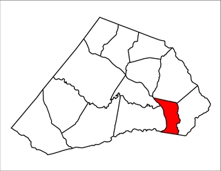
Sunny Side is an unincorporated community in Buckingham and Cumberland counties, in the U.S. state of Virginia. Sunny Side was a stop on the Farmville and Powhatan Railroad from 1884 to 1905 and then on the Tidewater and Western Railroad from 1905 to 1917. It is on the new Virginia State Route 13 between Powhatan, Virginia and Cumberland, Virginia from 1918 to today.
Areanum is an unincorporated community in Buckingham County, in the U.S. state of Virginia.
Axtell is an unincorporated community in Buckingham County, in the U.S. state of Virginia.
Bridgeport is an unincorporated community in Buckingham County, in the U.S. state of Virginia.
Curdsville is an unincorporated community in Buckingham County, in the U.S. state of Virginia.
Eldridge Mill is an unincorporated community in Buckingham County, in the U.S. state of Virginia.
Gold Hill is an unincorporated community in Buckingham County, in the U.S. state of Virginia.
Manteo is an unincorporated community in Buckingham County, in the U.S. state of Virginia.
Rosney is an unincorporated community in Buckingham County, in the U.S. state of Virginia.
Sheppards is an unincorporated community in Buckingham County, in the U.S. state of Virginia.
Slate Hill is an unincorporated community in Buckingham County, in the U.S. state of Virginia.
Toga is an unincorporated community in Buckingham County, in the U.S. state of Virginia.
Granny Creek is a stream in the U.S. state of West Virginia. It is a tributary of the Elk River.
Frazier is an unincorporated community in Buchanan County, in the U.S. state of Missouri.
Municipalities and communities of Buckingham County, Virginia, United States | ||
|---|---|---|
| Town |  | |
| CDPs | ||
| Unincorporated communities |
| |
| Footnotes | ‡This populated place also has portions in an adjacent county or counties | |
Coordinates: 37°40′04″N78°15′36″W / 37.66778°N 78.26000°W
| | This Buckingham County, Virginia state location article is a stub. You can help Wikipedia by expanding it. |