Related Research Articles
Oak Ridge is a village in Morehouse Parish, Louisiana, United States. The population was 124 at the 2020 census.

Export is a borough in Westmoreland County, Pennsylvania, United States, surrounded entirely by the Municipality of Murrysville. The population was 893 at the 2020 census.

Blennerhassett is a census-designated place (CDP) in Wood County, West Virginia, United States. It is part of the Parkersburg-Marietta-Vienna, WV-OH Metropolitan Statistical Area. The population was 3,089 at the 2010 census.

Cherry Run is a 7.2-mile-long (11.6 km) meandering stream that forms the northern section of the boundary between Morgan and Berkeley counties in West Virginia's Eastern Panhandle. While it is mostly non-navigable, Cherry Run provides many pools of varying depths for fishing and swimming. As a tributary of the Potomac River, Cherry Run is part of the Potomac and Chesapeake Bay watersheds.

Champion Lakes Provincial Park is a provincial park in the West Kootenay region of British Columbia, Canada, located northeast of the city of Trail in the province's West Kootenay region.
Glencoe was an unincorporated community in western St. Louis County, Missouri, United States. It is located on the west side of the Meramec River, north of Eureka in the southern part of Wildwood and is just off Route 109.

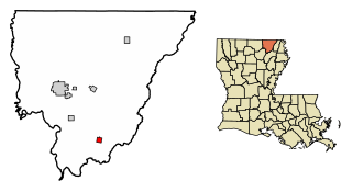
Lamèque Island, , is a Canadian island in the Gulf of St. Lawrence at the northeastern tip of Gloucester County, New Brunswick.
Lawson is a small unincorporated community situated along Clear Creek in Clear Creek County, Colorado, United States. Lawson is a part of the Downieville-Lawson-Dumont census-designated place.

The Lone Sailor, a 1987 bronze sculpture, is a tribute to all the personnel of the sea services. The sculpture was created by Stanley Bleifeld, for the United States Navy Memorial in Washington, D.C.

Creston is an unincorporated community in Ashe County, North Carolina, United States, southwest of Grayson. It lies at an elevation of 2,861 feet. The ZIP Code for Creston is 28615.
Arrington is a census-designated place (CDP) in Nelson County, Virginia, United States. The population as of the 2010 Census was 708. Harmony Hill Bed and Breakfast is the only lodging location in Arrington, run by innkeepers Wendie and Jay Fines.

Numa, also known as Walkers Bluff or Walkerton, is an unincorporated community in Florida Township, Parke County, in the U.S. state of Indiana.
Kimberly Hills is an unincorporated community in Cumberland County, in the U.S. state of Virginia.
Slate Hill is an unincorporated community in Buckingham County, in the U.S. state of Virginia.
Chapel Hill is an unincorporated community in Perry County, Ohio.
Elias-Fela Solis is a census-designated place (CDP) in Starr County, Texas, United States. This was a new CDP for the 2010 census with a population of 30.
Burbank is an unincorporated community in Wayne County, in the U.S. state of Missouri. The community is located on Missouri Route E, approximately 2.5 miles east-northeast of Greenville.
Dempsey is an extinct town in Bannock County, in the U.S. state of Idaho.
Fleetwood Park is an unincorporated community in Paris Township, Union County, Ohio, United States. It is located at 40°14′59″N83°22′13″W, surrounded by current Marysville.
References
Municipalities and communities of Buckingham County, Virginia, United States | ||
|---|---|---|
| Town |  | |
| CDPs | ||
| Unincorporated communities |
| |
| Footnotes | ‡This populated place also has portions in an adjacent county or counties | |
37°37′25″N78°22′13″W / 37.62361°N 78.37028°W
| | This Buckingham County, Virginia state location article is a stub. You can help Wikipedia by expanding it. |