Glasford, Illinois

Last updated

Glasford
Glasford-sign 20230930 0020.jpg
Glasford sign near Illini Bluffs High School
Peoria County Illinois Incorporated and Unincorporated areas Glasford Highlighted.svg
Location of Glasford in Peoria County, Illinois.
Illinois in United States (US48).svg
Location of Illinois in the United States
Coordinates: 40°34′18″N89°48′46″W / 40.57167°N 89.81278°W / 40.57167; -89.81278
CountryUnited States
StateIllinois
County Peoria
Area
[1]
  Total0.91 sq mi (2.35 km2)
  Land0.91 sq mi (2.35 km2)
  Water0.00 sq mi (0.00 km2)
Population
 (2020)
  Total866
  Density953.74/sq mi (368.22/km2)
Time zone UTC-6 (CST)
  Summer (DST) UTC-5 (CDT)
ZIP Code(s)
61533
Area code 309
FIPS code 17-29483
Wikimedia CommonsGlasford, Illinois
Website www.glasfordil.com

Glasford is a village in Peoria County, Illinois, United States. The population was 866 at the 2020 census. Glasford is part of the Peoria, Illinois Metropolitan Statistical Area.

Contents

History

Glasford or Glasco as it was called in 1868, was named for its founder, Samual Alexander Glasford/Glassford (1824-1896). [2] [3] [4]

Samuel A. Glasford, whom arrived in Peoria County in 1842 from Ohio and was one of the early settlers of Timber Township, had the foresight to off lots where cornfields once stood. When the railroad was built by his farm residence, Mr. Glasford had the hindsight to realize Lancaster, Illinois would seek the railroad and laid out the town December 9, 1868, which became incorporated as a village in 1889. [5] Glasco would become a center of trade and population along the new route of the Toledo, Peoria and Warsaw Railroad, bringing many new settlers and stores to Glasco in 1868. [4]

The town has been called by many names in different publications; Glasford, Glassford, Glasco, and Glasgow, just as his name in Scotland where is father, Lord William Glasford was born, is Glassford but in America it was written as Glasford.

Geography

Glasford is located at 40°34′18″N89°48′46″W / 40.57167°N 89.81278°W / 40.57167; -89.81278 (40.571714, -89.812707). [6]

According to the 2010 census, Glasford has a total area of 0.9 square miles (2.33 km2), all land. [7]

Glasford is located near the "Glasford Disturbance", an area in which the normal layering of the bedrock has been highly disturbed. This is believed to be an ancient meteor crater known as the Glasford crater. The impact fractured the bedrock, and upended large blocks of sedimentary rocks. The crater has been completely filled by glacial action, so that no trace appears on the surface.

Demographics

Historical population
CensusPop.Note
1880 154
1890 26874.0%
1900 40952.6%
1910 62552.8%
1920 6453.2%
1930 6714.0%
1940 78216.5%
1950 92217.9%
1960 1,0129.8%
1970 1,0665.3%
1980 1,20112.7%
1990 1,115−7.2%
2000 1,076−3.5%
2010 1,022−5.0%
2020 866−15.3%
U.S. Decennial Census [8]

As of the census [9] of 2000, there were 1,076 people, 426 households, and 311 families residing in the village. The population density was 1,218.4 inhabitants per square mile (470.4/km2). There were 448 housing units at an average density of 507.3 per square mile (195.9/km2). The racial makeup of the village was 99.44% White, 0.09% Native American, 0.19% from other races, and 0.28% from two or more races. Hispanic or Latino of any race were 1.02% of the population.

There were 426 households, out of which 32.9% had children under the age of 18 living with them, 58.5% were married couples living together, 10.6% had a female householder with no husband present, and 26.8% were non-families. 23.0% of all households were made up of individuals, and 12.4% had someone living alone who was 65 years of age or older. The average household size was 2.53 and the average family size was 2.94.

In the village, the population was spread out, with 24.3% under the age of 18, 10.2% from 18 to 24, 28.4% from 25 to 44, 24.3% from 45 to 64, and 12.6% who were 65 years of age or older. The median age was 36 years. For every 100 females, there were 90.8 males. For every 100 females age 18 and over, there were 87.6 males.

The median income for a household in the village was $37,019, and the median income for a family was $46,818. Males had a median income of $37,250 versus $21,188 for females. The per capita income for the village was $16,754. About 5.4% of families and 7.1% of the population were below the poverty line, including 6.7% of those under age 18 and 5.2% of those age 65 or over.

Glasford is located in the Illini Bluffs Unit School District 327, and is home to the Illini Bluffs Elementary School, Illini Bluffs Middle School, and Illini Bluffs High School.

Related Research Articles

<span class="mw-page-title-main">Peoria County, Illinois</span> County in Illinois, United States

Peoria County is located in the U.S. state of Illinois. The 2020 United States Census listed its population at 181,830. Its county seat is Peoria. Peoria County is part of the Peoria, IL Metropolitan Statistical Area.

<span class="mw-page-title-main">Bureau Junction, Illinois</span> Village in Illinois, United States

Bureau Junction, usually called Bureau, is a village in Bureau County, Illinois, United States. The population was 281 at the 2020 census. The village name is shown as both "Bureau Junction" and "Bureau" on federal maps, and is commonly called "Bureau", including by phone companies and the United States Post Office. It is part of the Ottawa Micropolitan Statistical Area. Bureau Junction was the point where the Rock Island Line railroad's branch line to Peoria split. Track west and south of Bureau is operated by Iowa Interstate, while tracks east to Chicago were formerly operated by CSX but are currently leased to Iowa Interstate.

<span class="mw-page-title-main">Hopewell, Illinois</span> Village in Illinois, United States

Hopewell is a village in Marshall County, Illinois, United States. The population was 421 at the 2020 census. It is part of the Peoria Metropolitan Statistical Area. The village was incorporated in 1983.

<span class="mw-page-title-main">Sparland, Illinois</span> Village in Illinois, United States

Sparland is a village in Marshall County, Illinois, United States. The population was 366 at the 2020 census, down from 406 in 2010. It is part of the Peoria Metropolitan Statistical Area.

<span class="mw-page-title-main">Bartonville, Illinois</span> Village in Illinois, United States

Bartonville is a village in Peoria County, Illinois, United States. The population was 6,471 at the 2010 census. Bartonville is a suburb of Peoria and is part of the Peoria, Illinois Metropolitan Statistical Area.

<span class="mw-page-title-main">Bellevue, Illinois</span> Village in Illinois, United States

Bellevue is a village in Peoria County, Illinois, United States. The population was 1,978 at the 2010 census. Bellevue is a suburb of Peoria and is part of the Peoria, Illinois Metropolitan Statistical Area.

<span class="mw-page-title-main">Chillicothe, Illinois</span> City in Illinois, United States

Chillicothe is a city on the Illinois River in Peoria County, Illinois, United States. The population was 6,097 at the 2010 census. Chillicothe is just north of the city of Peoria and is part of the Peoria Metropolitan Statistical Area.

<span class="mw-page-title-main">Kingston Mines, Illinois</span> Village in Illinois, United States

Kingston Mines is a village in Peoria County, Illinois, United States. The population was 259 at the 2000 census. It is part of the Peoria, Illinois Metropolitan Statistical Area. Located on the Illinois River, it was a shipping port, loading coal from the nearby mines.

<span class="mw-page-title-main">Mapleton, Illinois</span> Village in Illinois, United States

Mapleton is a small village in Peoria County, Illinois, United States. The population was 227 at the 2000 census. Mapleton is part of the Peoria, Illinois Metropolitan Statistical Area. There are four different plants in Mapleton, all located along U.S. Route 24: an Evonik chemical plant, a Lonza Group plant, a Caterpillar Inc. foundry, and an Ingredion facility; together, the large industrial complex forms one of Mapleton's most significant employers and a good source of skilled employees and good jobs.

<span class="mw-page-title-main">Norwood, Illinois</span> Village in Illinois, United States

Norwood is a village in Peoria County, Illinois, United States. The population was 478 at the 2010 census. Norwood, just outside Peoria, is part of the Peoria, Illinois Metropolitan Statistical Area.

<span class="mw-page-title-main">Peoria Heights, Illinois</span> Village in Illinois, United States

Peoria Heights is a village lying in Peoria County in the U.S. state of Illinois. The population was 6,156 at the 2010 census, down from 6,635 in 2000. Peoria Heights is a suburb of Peoria, is sometimes referred to as Uptown, and is surrounded by the city except for its eastern boundary on Peoria Lake, a relatively wider section of the Illinois River. It is part of the Peoria, Illinois Metropolitan Statistical Area.

<span class="mw-page-title-main">Stonefort, Illinois</span> Village in Illinois, United States

Stonefort is a village in Saline and Williamson Counties, Illinois, United States. The population was 297 at the 2010 census.

<span class="mw-page-title-main">Riverton, Illinois</span> Village in Illinois, United States

Riverton is a village in Sangamon County, Illinois, United States. The population was 3,455 at the 2010 census, up from 3,062 in 2000. It is part of the Springfield, Illinois Metropolitan Statistical Area.

<span class="mw-page-title-main">Fairview Heights, Illinois</span> City in Illinois, United States

Fairview Heights is a city in St. Clair County, Illinois, United States within Greater St. Louis. It is an eastern suburb of St. Louis. The population was 17,078 at the 2010 census. Fairview Heights is a dominant shopping center for Greater St. Louis and Southern Illinois and includes numerous shopping plazas and St. Clair Square mall.

<span class="mw-page-title-main">La Fayette, Illinois</span> Village in Illinois, United States

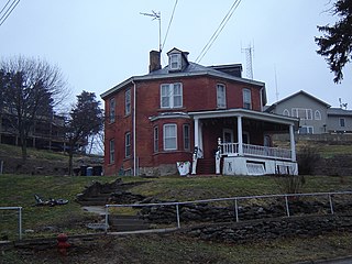
La Fayette is a village in Stark County, Illinois. It is located south of Kewanee off Route 78 on Route 17|IL-17. The population was 223 at the 2010 census, down from 227 in 2000. It is part of the Peoria, Illinois Metropolitan Statistical Area. Once a prominent strip coal mine and farming village with; a general store, high school(until 1970), hotel, bank, grain elevator, train depot, and many other features and amenities. Once the coal mines shut down and railroad was removed in the early 1980s, it slowly became a low income and high poverty village with many people moving away and it eventually diminished to the hollow shell of what it once was.

<span class="mw-page-title-main">Wyoming, Illinois</span> City in Illinois, United States

Wyoming is a city in Stark County, Illinois, United States. The population was 1,429 at the 2010 census, up from 1,424 in 2000. It is the headquarters of the Rock Island Trail State Park. Wyoming is part of the Peoria, Illinois Metropolitan Statistical Area. The former CB&Q Railroad depot in town is the Rock Island Trail State Park's headquarters.

<span class="mw-page-title-main">Kappa, Illinois</span> Village in Illinois, United States

Kappa is a village in Woodford County, Illinois, United States. The population was 227 at the 2010 census, up from 170 in 2000. It is part of the Peoria, Illinois Metropolitan Statistical Area.

<span class="mw-page-title-main">Panola, Illinois</span> Village in Illinois, United States

Panola is a village in Woodford County, Illinois, United States. The population was 45 at the 2010 census. It is part of the Peoria, Illinois Metropolitan Statistical Area.

<span class="mw-page-title-main">Roanoke, Illinois</span> Village in Illinois, United States

Roanoke is a village in Roanoke Township, Woodford County, Illinois, United States. The population was 1,960 at the 2020 census. It is part of the Peoria, Illinois Metropolitan Statistical Area.

<span class="mw-page-title-main">Secor, Illinois</span> Village in Illinois, United States

Secor is a village in Clayton Township, Woodford County, Illinois, United States. The population was 373 at the 2010 census. It is part of the Peoria, Illinois Metropolitan Statistical Area. Secor is located just off U.S. Route 24 between El Paso and Eureka.

References

  1. "2020 U.S. Gazetteer Files". United States Census Bureau. Retrieved March 15, 2022.
  2. Glasford/Gazette: A History 100 Years -- The History of Glasford Ill., 1868-1968
  3. "Glasford: A History". ManuallZZ, the universal manuals library. December 21, 2021. Retrieved December 21, 2021.
  4. 1 2 Drury, John (1954). American aerial county history series :. University of Illinois Urbana-Champaign. Chicago : Loree Co. p. 415.
  5. Glasford Gazette. The Birth of Glasford; History of Eighty Years
  6. "US Gazetteer files: 2010, 2000, and 1990". United States Census Bureau. February 12, 2011. Retrieved April 23, 2011.
  7. "G001 - Geographic Identifiers - 2010 Census Summary File 1". United States Census Bureau. Archived from the original on February 13, 2020. Retrieved August 3, 2015.
  8. "Census of Population and Housing". Census.gov. Retrieved June 4, 2015.
  9. "U.S. Census website". United States Census Bureau . Retrieved January 31, 2008.