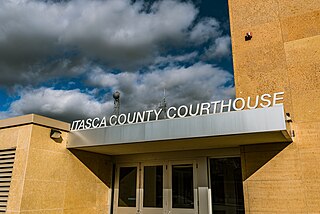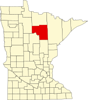
Itasca County is a county located in the Iron Range region of the U.S. state of Minnesota. As of the 2020 census, the population was 45,014. Its county seat is Grand Rapids. The county is named after Lake Itasca, which is in turn a shortened version of the Latin words veritas caput, meaning 'truth' and 'head', a reference to the source of the Mississippi River. Portions of the Bois Forte and Leech Lake Indian reservations are in the county.
Cedar Valley Township is a township in Saint Louis County, Minnesota, United States. Cedar Valley Township was named for the white cedar in the valley of the Floodwood River. The population was 195 at the 2010 census.
Togo is an unincorporated community in Carpenter Township, Itasca County, Minnesota, United States.
Pengilly is an unincorporated community in eastern Itasca County, Minnesota, United States.
Swan River is an unincorporated community in southeast Itasca County, Minnesota, United States.
Wirt is an unincorporated community in Wirt Township, Itasca County, Minnesota, United States; located within the Chippewa National Forest.
Wawina is an unincorporated community in Wawina Township, Itasca County, Minnesota, United States.
Blackberry is an unincorporated community in Blackberry Township, Itasca County, Minnesota, United States.
Alvwood is an unincorporated community in Alvwood Township, Itasca County, Minnesota, United States.
Rauch is an unincorporated community in Koochiching County, Minnesota, United States.
Dunbar is an unincorporated community in Good Hope Township, Itasca County, Minnesota, United States. The community is located northwest of Squaw Lake at the junction of Itasca County Roads 32 and 149. State Highway 46 is nearby.
Dora Lake is an unincorporated community in Kinghurst Township, Itasca County, Minnesota, United States; located within the Chippewa National Forest. The community is located near Wirt at the junction of Itasca County Roads 29 and 145.
Grattan is an unincorporated community in Grattan Township, Itasca County, Minnesota, United States.
Houpt is an unincorporated community in Nore Township, Itasca County, Minnesota, United States, located in the northwest corner of the county.
Orth is an unincorporated community in Nore Township, Itasca County, Minnesota, United States, located in the northwestern corner of the county.

Suomi is an unincorporated community in Itasca County, Minnesota, United States.
Jessie Lake is an unincorporated community in Lake Jessie Township, Itasca County, Minnesota, United States, located within the Chippewa National Forest. The community is located between Wirt and Talmoon; along Itasca County Road 4.
Rosy is an unincorporated community in Third River Township, Itasca County, Minnesota, United States. The community is located northwest of Squaw Lake; near the junction of Itasca County Roads 32, 33, and 141.
Pomroy is an unincorporated community in Pomroy Township, Itasca County, Minnesota, United States.
Martin is an unincorporated community in Balsam Township, Itasca County, Minnesota, United States.


