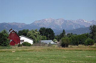
Cornville is a census-designated place (CDP) in Yavapai County, Arizona, United States. The population as of the 2010 United States Census was 3,280, down from 3,335 at the 2000 census. The Cornville CDP includes the communities of Cornville and Page Springs.

Halfway is a city in Baker County, Oregon, United States. The city took its name from the location of its post office, on the Alexander Stalker ranch, halfway between Pine and Jim Town. The population was 288 at the 2010 census.

Cucumber is a census-designated place (CDP) in McDowell County, West Virginia, United States. As of the 2010 census, its population was 94. The community is centered on mining. Named either for nearby Cucumber Creek or for the cucumber trees in the area, it is the only community in the United States with this name. Its post office was still active as of October 2011.

Moyers is an unincorporated community located in Pushmataha County, Oklahoma, United States.

Remote is an unincorporated hamlet in Coos County in the U.S. state of Oregon. It lies near the confluence of Sandy Creek with the Middle Fork Coquille River.

Virginville is a census-designated place in Richmond Township, Berks County, Pennsylvania. It is located at the junction of PA 143 and Crystal Ridge Road, and is approximately 7 miles to the south of the borough of Lenhartsville.
South Plains Council serves Scouts in the area of Lubbock, Texas.
Self is an unincorporated community in Boone County, Arkansas, United States. It is the location of Cottonwood School#45, which is located at Cottonwood and Dubuque Roads and is listed on the National Register of Historic Places.

East Texas is a village in Lower Macungie Township, Lehigh County, Pennsylvania. The Little Lehigh Creek forms its natural southern boundary. While the village has its own box post office with ZIP code of 18046, surrounding areas use the Allentown ZIP code of 18106 and the Macungie ZIP code of 18062.

Grit is an unincorporated farming and ranching community established around 1889 in Mason County, in the U.S. state of Texas. It is located on SH 29, 6 miles (9.7 km) northwest of Mason, near Honey Creek. Grit was centered on the cotton industry, and once had its own cotton gin. While never having a large population, the community did have a school, store, and church. The prevailing theory of the town's name is that it reflects the quality of the area soil. Grit received a post office in 1901, which remained active until 1980.

Beefhide is an unincorporated community spanning across a county line between Letcher County and Pike County, Kentucky, United States.

Smock is an unincorporated community and census-designated place in Franklin and Menallen townships in Fayette County, Pennsylvania, United States. It is located roughly halfway between the borough of Perryopolis and the city of Uniontown, and is part of the Pittsburgh metropolitan area. As of the 2010 census the population was 583.

Difficult is an unincorporated community in Smith County, Tennessee, in the United States. It lies just north of State Route 85, about halfway between Defeated to the south and Kempville to the east. Defeated Creek, a tributary of the Cumberland River, passes through the community.
Soldier is an unincorporated community in Jefferson County, in the U.S. state of Pennsylvania.

Cottonwood Creek is a major stream and tributary of the Sacramento River in Northern California. About 68 miles (109 km) long measured to its uppermost tributaries, the creek drains a large rural area bounded by the crest of the Coast Ranges, traversing the northwestern Sacramento Valley before emptying into the Sacramento River near the town of Cottonwood. For its entire length, it defines the boundary of Shasta and Tehama counties. Because Cottonwood Creek is the largest undammed tributary of the Sacramento River, it is known for its Chinook salmon and steelhead runs.
Cyclone is an unincorporated community in east central McDonald County, in the U.S. state of Missouri. The community is located on Big Sugar Creek west of Powell.
Pointer is an unincorporated community in Pulaski County, Kentucky.
Ten Mile is an unincorporated community in Washington County, Pennsylvania.
Bee Log is an unincorporated community in Yancey County, North Carolina. The community is located along Bald Mountain Creek approximately one mile upstream (southwest) of Lewisburg on the Cane River.
Cycle is an unincorporated community in Yadkin County, North Carolina.


