Hamilton County, Kansas

Last updated

Hamilton County
Hamilton County Courthouse (Kansas) from SW.JPG
Hamilton County Courthouse in Syracuse (2010)
Map of Kansas highlighting Hamilton County.svg
Location within the U.S. state of Kansas
Kansas in United States.svg
Kansas's location within the U.S.
Coordinates: 38°01′00″N101°40′01″W / 38.0167°N 101.667°W / 38.0167; -101.667
CountryFlag of the United States.svg United States
StateFlag of Kansas.svg  Kansas
FoundedMarch 20, 1873
Named for Alexander Hamilton
Seat Syracuse
Largest citySyracuse
Area
  Total998 sq mi (2,580 km2)
  Land997 sq mi (2,580 km2)
  Water1.1 sq mi (3 km2)  0.1%
Population
 (2020) [1]
  Total2,518
  Density2.5/sq mi (1.0/km2)
Time zone UTC−7 (Mountain)
  Summer (DST) UTC−6 (MDT)
Congressional district 1st
Website County Info

Hamilton County is a county located in the U.S. state of Kansas. Its county seat and most populous city is Syracuse. [2] As of the 2020 census, the county population was 2,518. [1] The county was founded in 1873 and named for Alexander Hamilton, a founding father of the United States. [3]

Contents

History

For many millennia, the Great Plains of North America was inhabited by nomadic Native Americans.

In 1854, the Kansas Territory was organized, then in 1861 Kansas became the 34th U.S. state.

In 1873, Hamilton County was established, and named for Alexander Hamilton.

In the 1930s, the prosperity of the area was severely affected by its location within the Dust Bowl. This catastrophe intensified the economic impact of the Great Depression in the region.

Geography

According to the U.S. Census Bureau, the county has a total area of 998 square miles (2,580 km2), of which 997 square miles (2,580 km2) is land and 1.1 square miles (2.8 km2) (0.1%) is water. [4]

Major highways

Adjacent counties

Demographics

Population pyramid based on 2000 census age data USA Hamilton County, Kansas age pyramid.svg
Population pyramid based on 2000 census age data
Historical population
CensusPop.Note
1880 168
1890 2,0271,106.5%
1900 1,426−29.6%
1910 3,360135.6%
1920 2,586−23.0%
1930 3,32828.7%
1940 2,645−20.5%
1950 3,69639.7%
1960 3,144−14.9%
1970 2,747−12.6%
1980 2,514−8.5%
1990 2,388−5.0%
2000 2,67011.8%
2010 2,6900.7%
2020 2,518−6.4%
2023 (est.)2,437 [5] −3.2%
U.S. Decennial Census [6]
1790-1960 [7] 1900-1990 [8]
1990-2000 [9] 2010-2020 [1]

As of the 2000 census, [10] there were 2,670 people, 1,054 households, and 715 families residing in the county. The population density was 3 people per square mile (1.2 people/km2). There were 1,211 housing units at an average density of 1 per square mile (0.39/km2). The racial makeup of the county was 81.65% White, 0.56% Asian, 0.49% Black or African American, 0.49% Native American, 15.13% from other races, and 1.69% from two or more races. Hispanic or Latino of any race were 20.60% of the population.

There were 1,054 households, out of which 33.90% had children under the age of 18 living with them, 56.90% were married couples living together, 7.60% had a female householder with no husband present, and 32.10% were non-families. 29.40% of all households were made up of individuals, and 15.80% had someone living alone who was 65 years of age or older. The average household size was 2.49 and the average family size was 3.09.

In the county, the population was spread out, with 28.40% under the age of 18, 7.20% from 18 to 24, 25.30% from 25 to 44, 20.90% from 45 to 64, and 18.40% who were 65 years of age or older. The median age was 38 years. For every 100 females there were 97.60 males. For every 100 females age 18 and over, there were 92.60 males.

The median income for a household in the county was $32,033, and the median income for a family was $38,550. Males had a median income of $26,701 versus $21,000 for females. The per capita income for the county was $16,484. About 10.90% of families and 15.70% of the population were below the poverty line, including 21.50% of those under age 18 and 9.40% of those age 65 or over.

Government

Hamilton County is often carried by Republican Candidates. The last time a Democratic candidate has carried Hamilton County was in 1976 by Jimmy Carter. As like many counties that border it, Republicans have been increasing their influence in the county's presidential elections, when Donald J. Trump in 2016 won by a margin of approximately 70%, as Hillary Clinton only managed to get 13% of the county's vote.

Presidential elections

Presidential election results
United States presidential election results for Hamilton County, Kansas [11]
Year Republican Democratic Third party
No.%No.%No.%
2020 69881.26%14116.41%202.33%
2016 70580.48%12113.81%505.71%
2012 69379.02%16318.59%212.39%
2008 84477.01%23321.26%191.73%
2004 88878.58%22920.27%131.15%
2000 90175.59%26422.15%272.27%
1996 81164.93%34227.38%967.69%
1992 71651.96%38628.01%27620.03%
1988 80160.00%51738.73%171.27%
1984 1,03770.64%40827.79%231.57%
1980 88964.65%40229.24%846.11%
1976 56041.70%74655.55%372.76%
1972 94167.26%39428.16%644.57%
1968 75156.25%41030.71%17413.03%
1964 68548.21%72651.09%100.70%
1960 88559.76%59139.91%50.34%
1956 86560.66%55238.71%90.63%
1952 1,20972.70%43726.28%171.02%
1948 74950.64%72248.82%80.54%
1944 79562.35%47136.94%90.71%
1940 79857.95%56941.32%100.73%
1936 72044.55%88554.76%110.68%
1932 65136.68%1,02157.52%1035.80%
1928 83968.43%36329.61%241.96%
1924 61052.27%30726.31%25021.42%
1920 59157.66%37136.20%636.15%
1916 51144.05%52245.00%12710.95%
1912 13421.30%26341.81%23236.88%
1908 41557.32%27537.98%344.70%
1904 21558.58%12634.33%267.08%
1900 18246.31%19449.36%174.33%
1896 18545.57%21653.20%51.23%
1892 25256.25%00.00%19643.75%
1888 48059.11%29536.33%374.56%

Laws

Although the Kansas Constitution was amended in 1986 to allow the sale of alcoholic liquor by the individual drink with the approval of voters, Hamilton County has remained a prohibition, or "dry", county. [12]

Education

Unified school districts

Communities

2005 map of Hamilton County (map legend) Map of Hamilton Co, Ks, USA.png
2005 map of Hamilton County (map legend)

List of townships / incorporated cities / unincorporated communities / extinct former communities within Hamilton County. [13]

Cities

Unincorporated community

Townships

Area affected by 1930s Dust Bowl Map of states and counties affected by the Dust Bowl, sourced from US federal government dept. (NRCS SSRA-RAD).svg
Area affected by 1930s Dust Bowl

Hamilton County is divided into eight townships. None of the cities within the county are considered governmentally independent, and all figures for the townships include those of the cities. In the following table, the population center is the largest city (or cities) included in that township's population total, if it is of a significant size.

Township FIPS Population
center
PopulationPopulation
density
/km2 (/sq mi)
Land area
km2 (sq mi)
Water area
km2 (sq mi)
Water %Geographic coordinates
Bear Creek 04850690 (0)452 (174)1 (0)0.19% 37°49′19″N101°56′36″W / 37.82194°N 101.94333°W / 37.82194; -101.94333
Coolidge 154251280 (1)297 (115)1 (0)0.37% 38°2′22″N101°59′41″W / 38.03944°N 101.99472°W / 38.03944; -101.99472
Kendall 364251010 (1)234 (90)0 (0)0% 37°59′41″N101°35′3″W / 37.99472°N 101.58417°W / 37.99472; -101.58417
Lamont 38275890 (1)426 (164)0 (0)0.02% 37°48′9″N101°38′41″W / 37.80250°N 101.64472°W / 37.80250; -101.64472
Liberty 40075380 (0)257 (99)0 (0)0.03% 38°7′29″N101°44′4″W / 38.12472°N 101.73444°W / 38.12472; -101.73444
Medway 45650530 (0)279 (108)1 (0)0.28% 38°4′51″N101°51′13″W / 38.08083°N 101.85361°W / 38.08083; -101.85361
Richland 59325270 (0)426 (164)0 (0)0% 38°13′21″N101°46′17″W / 38.22250°N 101.77139°W / 38.22250; -101.77139
Syracuse 698752,16510 (27)210 (81)0 (0)0.01% 37°59′10″N101°45′5″W / 37.98611°N 101.75139°W / 37.98611; -101.75139
Sources: "Census 2000 U.S. Gazetteer Files". U.S. Census Bureau, Geography Division. Archived from the original on August 2, 2002.

See also

Community information for Kansas

Related Research Articles

<span class="mw-page-title-main">Wichita County, Kansas</span> County in Kansas, United States

Wichita County is a county located in the U.S. state of Kansas. Its county seat is Leoti. As of the 2020 census, the county population was 2,152. The county was named after the Wichita tribe.

<span class="mw-page-title-main">Trego County, Kansas</span> County in Kansas, United States

Trego County is a county located in the U.S. state of Kansas. Its county seat and largest city is WaKeeney. As of the 2020 census, the county population was 2,808. The county was named for Edgar Trego.

<span class="mw-page-title-main">Thomas County, Kansas</span> County in Kansas, United States

Thomas County is a county located in the U.S. state of Kansas. Its county seat is Colby. As of the 2020 census, the county population was 7,930. The county was named after George Thomas, a general during the American Civil War.

<span class="mw-page-title-main">Stanton County, Kansas</span> County in Kansas, United States

Stanton County is a county located in the U.S. state of Kansas. Its county seat is Johnson City. As of the 2020 census, the county population was 2,084. It was named for Edwin Stanton, the U.S. Secretary of War during most of the American Civil War.

<span class="mw-page-title-main">Rush County, Kansas</span> County in Kansas, United States

Rush County is a county located in the U.S. state of Kansas. Its county seat and largest city is La Crosse. As of the 2020 census, the county population was 2,956. The county was named for Alexander Rush.

<span class="mw-page-title-main">Rawlins County, Kansas</span> County in Kansas, United States

Rawlins County is a county located in the U.S. state of Kansas. Its county seat and largest city is Atwood. As of the 2020 census, the county population was 2,561. It was named after John Rawlins, a general in the American Civil War.

<span class="mw-page-title-main">Ness County, Kansas</span> County in Kansas, United States

Ness County is a county located in the U.S. state of Kansas. Its county seat and largest city is Ness City. As of the 2020 census, the county population was 2,687. The county was named for Noah Ness, a corporal of the 7th Kansas Cavalry.

<span class="mw-page-title-main">Morton County, Kansas</span> County in Kansas, United States

Morton County is a county in the southwestern corner of the U.S. state of Kansas. Its county seat and largest city is Elkhart. As of the 2020 census, the county population was 2,701. The county was named after Oliver Morton, the 14th governor of the state of Indiana.

<span class="mw-page-title-main">Lincoln County, Kansas</span> County in Kansas, United States

Lincoln County is a county located in the U.S. state of Kansas. Its county seat and largest city is Lincoln Center. As of the 2020 census, the county population was 2,939. The county was named after Abraham Lincoln, the 16th president of the United States.

<span class="mw-page-title-main">Lane County, Kansas</span> County in Kansas, United States

Lane County is a county located in the U.S. state of Kansas. Its county seat is Dighton, the only incorporated city in the county. As of the 2020 census, the county population was 1,574, making it the third-least populous county in Kansas. The county was named after James Lane, a leader of the Jayhawker abolitionist movement and served as one of the first U.S. senators from Kansas.

<span class="mw-page-title-main">Kearny County, Kansas</span> County in Kansas, United States

Kearny County is a county located in the U.S. state of Kansas. Its county seat and most populous city is Lakin. As of the 2020 census, the county population was 3,983. The county is named in honor of Philip Kearny, a general during the American Civil War that died during the Battle of Chantilly.

<span class="mw-page-title-main">Greenwood County, Kansas</span> County in Kansas, United States

Greenwood County is a county located in the southeast portion of the U.S. state of Kansas. Its county seat and most populous city is Eureka. As of the 2020 census, the county population was 6,016. The county was named for Alfred Greenwood, a U.S. congressman from Arkansas that advocated Kansas statehood.

<span class="mw-page-title-main">Greeley County, Kansas</span> County in Kansas, United States

Greeley County is a county located in western Kansas, in the Central United States. Its county seat and largest city is Tribune. As of the 2020 census, the population was 1,284, making it the least populous county in Kansas. As of 2018, it is tied with Wallace County as the least densely populated county in the state. The county is named after Horace Greeley, editor of the New York Tribune, who encouraged western settlement with the motto "Go West, young man".

<span class="mw-page-title-main">Gray County, Kansas</span> County in Kansas, United States

Gray County is a county located in the U.S. state of Kansas. Its county seat and most populous city is Cimarron. As of the 2020 census, the county population was 5,653. The county was named after Alfred Gray, a 19th century Kansas politician.

<span class="mw-page-title-main">Grant County, Kansas</span> County in Kansas, United States

Grant County is a county located in the U.S. state of Kansas. Its county seat and only city is Ulysses. As of the 2020 census, the county population was 7,352. Both the county and its seat are named after Ulysses Grant, the 18th President of the United States.

<span class="mw-page-title-main">Edwards County, Kansas</span> County in Kansas, United States

Edwards County is a county located in the U.S. states of Kansas. Its county seat and most populous city is Kinsley. As of the 2020 census, the county population was 2,907, The county was founded in 1874 and named for W. C. Edwards, of Hutchinson, a pioneer settler who owned much land in the area.

<span class="mw-page-title-main">Comanche County, Kansas</span> County in Kansas, United States

Comanche County is a county located in the U.S. state of Kansas. Its county seat and most populous city is Coldwater. As of the 2020 census, the county population was 1,689. The county was named after the Comanche tribe.

<span class="mw-page-title-main">Clark County, Kansas</span> County in Kansas, United States

Clark County is a county located in the U.S. state of Kansas. Its county seat and most populous city is Ashland. As of the 2020 census, the county population was 1,991. The county was named after Charles Clarke.

<span class="mw-page-title-main">Anderson County, Kansas</span> County in Kansas, United States

Anderson County is a county located in East Central Kansas, in the Central United States. Its county seat and most populous city is Garnett. As of the 2020 census, the county population was 7,836. The county was named for Joseph C. Anderson, a Kansas territorial legislator and border ruffian during the "Bleeding Kansas" era.

<span class="mw-page-title-main">Syracuse, Kansas</span> City in Hamilton County, Kansas

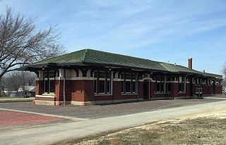
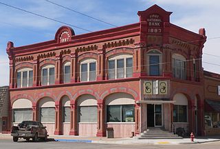
Syracuse is a city in and the county seat of Hamilton County, Kansas, United States. As of the 2020 census, the population of the city was 1,826. It is located along Highway 50.

References

  1. 1 2 3 "QuickFacts; Hamilton County, Kansas; Population, Census, 2020 & 2010". United States Census Bureau. Archived from the original on August 17, 2021. Retrieved August 16, 2021.
  2. "Find a County". National Association of Counties. Retrieved June 7, 2011.
  3. Blackmar, Frank Wilson (1912). Kansas: A Cyclopedia of State History, Embracing Events, Institutions, Industries, Counties, Cities, Towns, Prominent Persons, Etc. Standard Publishing Company. pp.  803.
  4. "US Gazetteer files: 2010, 2000, and 1990". United States Census Bureau. February 12, 2011. Retrieved April 23, 2011.
  5. "Annual Estimates of the Resident Population for Counties: April 1, 2020 to July 1, 2023". United States Census Bureau. Retrieved April 3, 2024.
  6. "U.S. Decennial Census". United States Census Bureau. Retrieved July 26, 2014.
  7. "Historical Census Browser". University of Virginia Library. Retrieved July 26, 2014.
  8. "Population of Counties by Decennial Census: 1900 to 1990". United States Census Bureau. Retrieved July 26, 2014.
  9. "Census 2000 PHC-T-4. Ranking Tables for Counties: 1990 and 2000" (PDF). United States Census Bureau. Archived (PDF) from the original on March 27, 2010. Retrieved July 26, 2014.
  10. "U.S. Census website". United States Census Bureau . Retrieved January 31, 2008.
  11. "Dave Leip's Atlas of U.S. Presidential Elections".
  12. "Map of Wet and Dry Counties". Alcoholic Beverage Control, Kansas Department of Revenue. November 2004. Archived from the original on October 8, 2007. Retrieved January 21, 2007.
  13. 1 2 "General Highway Map of Hamilton County, Kansas" (PDF). Kansas Department of Transportation (KDOT). January 2011. Archived (PDF) from the original on February 8, 2023.

Further reading

County
Maps

38°01′N101°40′W / 38.017°N 101.667°W / 38.017; -101.667