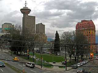
Gastown is the original settlement that became the core of the city of Vancouver, British Columbia, Canada, and a national historic site and a neighbourhood in the northwest section of the Downtown Eastside, adjacent to Downtown Vancouver.
Highway 99A is a series of former highways in the southwestern part of British Columbia, Canada. It was the designation of the former 1942 alignment of Highway 99 as well a various alternate routes which existed in the 1950s and 1960s. The last official use of '99A' was decommissioned in 2006, although some present-day, commercially published road maps still show it and some remnant signage still remains. Some brand new 99A signs can be seen as well as of 2023.
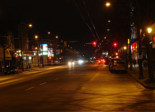
Highway 7A, known locally and on street signs as the Barnet Highway, Barnet Road,St. Johns Street, Inlet Drive and Hastings Street, was Highway 7's original 1941 route between the harbour in Vancouver and Port Moody. The highway gained the 7A designation around 1953 due to Highway 7 being re-designated along Lougheed Highway through Maillardville and Central Burnaby and was disestablished on April 1, 1999.

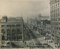
Cambie Street is a street in Vancouver, British Columbia, Canada. It is named for Henry John Cambie, chief surveyor of the Canadian Pacific Railway's western division.

The Dominion Building is a commercial building in Vancouver, British Columbia, Canada. Located on the edge of Gastown, it was Vancouver's first steel-framed high-rise. At 53 m (175 ft), the thirteen-storey, Second Empire style building was the tallest commercial building in the British Empire upon its completion in 1910. Its architect was John S. Helyer, who is said to have died after falling off the staircase in the front of the building, though this is an urban legend.
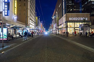
Granville Street is a major street in Vancouver, British Columbia, Canada, and part of Highway 99. Granville Street is most often associated with the Granville Entertainment District and the Granville Mall. This street also cuts through residential neighbourhoods like Shaughnessy and Marpole via the Granville Street Bridge.

The 99 B-Line is an express bus line with bus rapid transit elements in Metro Vancouver, British Columbia, Canada. It travels along Broadway, a major east–west thoroughfare, and connects the University of British Columbia (UBC) to Commercial–Broadway station on the SkyTrain system. It is operated by Coast Mountain Bus Company and funded by TransLink.
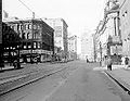
Victory Square is a park in Vancouver, British Columbia, Canada. The square is bordered by West Hastings Street to the northeast, West Pender Street to the southwest, Cambie Street to the southeast, and Hamilton Street to the northwest. The term is also used to refer to the neighbourhood immediately surrounding the square.

Downtown Vancouver is the central business district and the city centre neighbourhood of Vancouver, Canada, on the northwestern shore of the Burrard Peninsula in the Lower Mainland region of British Columbia. It occupies most of the north shore of the False Creek inlet, which cuts into the Burrard Peninsula creating the Downtown Peninsula, where the West End neighbourhood and Stanley Park are also located.

The history of Vancouver, British Columbia, is one that extends back thousands of years, with its first inhabitants arriving in the area following the Last Glacial Period. With its location on the western coast of Canada near the mouth of the Fraser River and on the waterways of the Strait of Georgia, Howe Sound, Burrard Inlet, and their tributaries, Vancouver has – for thousands of years – been a place of meeting, trade, and settlement.

East Vancouver is a region within the city of Vancouver, British Columbia, Canada. Geographically, East Vancouver is bordered to the north by Burrard Inlet, to the south by the Fraser River, and to the east by the city of Burnaby. East Vancouver is divided from Vancouver's "West Side" by Ontario Street.

Capitol Hill elev. 203m, is a hill in the city of Burnaby, British Columbia, Canada, and also is the name of the neighbourhood spanning the summit of the hill. Standing on the north side of Hastings Street and bounded by Willingdon Avenue to the west and Fell Avenue in the east, this neighbourhood is known for its Italian, Portuguese, and Croatian expat communities as well as being a student area associated with the nearby Simon Fraser University.

Georgia Street is an east–west street in the cities of Vancouver and Burnaby, British Columbia, Canada. Its section in Downtown Vancouver, designated West Georgia Street, serves as one of the primary streets for the financial and central business districts, and is the major transportation corridor connecting downtown Vancouver with the North Shore by way of the Lions Gate Bridge. The remainder of the street, known as East Georgia Street between Main Street and Boundary Road and simply Georgia Street within Burnaby, is more residential in character, and is discontinuous at several points.

Westridge is a residential neighbourhood in Burnaby, British Columbia, Canada.
Main Street is a major north–south thoroughfare bisecting Vancouver, British Columbia, Canada. It runs from Waterfront Road by Burrard Inlet in the north, to Kent Avenue alongside the north arm of the Fraser River in the south.

Broadway is a major east–west thoroughfare in the city of Vancouver, British Columbia, Canada. In Vancouver's numbered avenue grid system, it runs in place of a 9th Avenue, between 8th and 10th. The street has six lanes for most of its course. Portions of the street carry the British Columbia Highway 7 designation.
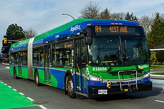
The R4 41st Ave is an express bus route with bus rapid transit elements in Metro Vancouver, British Columbia, Canada. Part of TransLink's RapidBus network, it replaced the 43 Express that travelled along 41st Avenue, a major east–west route that connects the University of British Columbia (UBC) to the SkyTrain system's Oakridge–41st Avenue station on the Canada Line and Joyce–Collingwood station on the Expo Line.
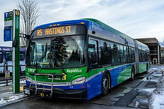
The R5 Hastings St is an express bus service with bus rapid transit elements in Metro Vancouver, Canada. Part of TransLink's RapidBus network, it travels along Hastings Street, a major east–west route, and connects Simon Fraser University to the SkyTrain system's Burrard station on the Expo Line in Downtown Vancouver. It replaced the 95 B-Line route on January 6, 2020.
This is a timeline of the history of Vancouver.
Marine Drive is the name for three major roadways in Greater Vancouver, British Columbia, Canada. The roads are known for running parallel to major bodies of water, with some sections being a major arterial road, while other serve local traffic. Marine Way is the name applied to a section of Marine Drive that was bypassed in the early 1980s.