Hillsborough Parish, New Brunswick

Last updated

Hillsborough
Albert County NB - Hillsborough Parish.png
Location within Albert County.
Coordinates: 45°55′N64°42′W / 45.92°N 64.70°W / 45.92; -64.70
Country Flag of Canada (Pantone).svg  Canada
Province Flag of New Brunswick.svg  New Brunswick
County Albert County
Erected1786
Area
[1]
  Land304.03 km2 (117.39 sq mi)
Population
 (2021) [1]
  Total1,397
  Density4.6/km2 (12/sq mi)
  Change 2016-2021
Increase2.svg 6.8%
  Dwellings
656
Time zone UTC-4 (AST)
  Summer (DST) UTC-3 (ADT)
Figures do not include portion within the village of Hillsborough

Hillsborough is a geographic parish in eastern Albert County, New Brunswick, Canada. [4]

Contents

For governance purposes, Hillsborough is divided between the village of Fundy Albert, [5] which includes most of the parish, and the Southeast rural district; [6] both are members of the Southeast Regional Service Commission. [7]

Prior to the 2023 governance reform, the parish was divided between the village of Hillsborough [8] and the local service district of the parish of Hillsborough. [9]

Origin of name

Hillsborough was probably named in honour of the Earl of Hillsborough, [10] First Lord of Trade in 1765.

History

Hillsborough was originally established in 1765 as a township within Nova Scotia, a grant of 100 000 acres to Robert Cummings and four others [11] that included modern Hillsborough Parish and most of Coverdale Parish. In 1786 the township's boundaries were explicitly used for the newly erected Hillsborough Parish. [12]

Boundaries

Hillsborough Parish is bounded: [2] [13] [14]

Evolution of boundaries

Originally the western line of Hillsborough extended north to the Petitcodiac River west of Upper Coverdale.

In 1828 all of the parish north of a line running west from the mouth of Stoney Creek was erected as Coverdale Parish. [16]

The northern boundary was moved slightly south in 1850 to its modern starting point. [17] 1850 was also the first year the parish's southern and western boundaries were described without referring to the original boundaries of the pre-Loyalist township.

Municipality

The village of Hillsborough is on the Petitcodiac River, from south of Weldon Creek to north of Christopher Lane; the inland boundary is irregular, based partly on grant lines and partly on property lines of the late 1960s. [18]

Local service district

The local service district of the parish of Hillsborough included the entire parish outside the village of Hillsborough. [19]

The LSD was established on 23 November 1966 to assess for fire protection [20] following the abolition of rural governments by the new Municipalities Act. First aid & ambulance services were added on 17 November 1976. [21]

In 2020, the LSD assessed for community & recreation services in addition to the basic LSD services of fire protection, police services, land use planning, emergency measures, and dog control. [22] The taxing authority was 615.00 Hillsborough.

Communities

Communities at least partly within the parish; [13] [14] [23] bold indicates an incorporated municipality

Bodies of water

Bodies of water [lower-alpha 2] at least partly in the parish: [13] [14] [23]

Islands

Islands at least partly in the parish: [13] [14] [23]

Other notable places

Parks, historic sites, and other noteworthy places at least partly in the parish. [13] [14] [23]

Demographics

Access Routes

Highways and numbered routes that run through the parish, including external routes that start or finish at the parish limits: [27]

Notes

  1. By the magnet of 1765, [2] when declination in the area was between 14º and 15º west of north. [15]
  2. Not including brooks, ponds or coves.

Related Research Articles

<span class="mw-page-title-main">Moncton Parish, New Brunswick</span> Parish in New Brunswick, Canada

Moncton is a geographic parish in Westmorland County, New Brunswick, Canada.

<span class="mw-page-title-main">Kingsclear Parish, New Brunswick</span> Parish in New Brunswick, Canada

Kingsclear is a geographic parish in York County, New Brunswick, Canada.

<span class="mw-page-title-main">Addington Parish, New Brunswick</span> Parish in New Brunswick, Canada

Addington is a geographic parish in Restigouche County, New Brunswick, Canada.

<span class="mw-page-title-main">Wicklow Parish, New Brunswick</span> Parish in New Brunswick, Canada

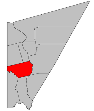
Wicklow is a geographic parish in Carleton County, New Brunswick, Canada, forming the northwestern corner of Carleton County.

<span class="mw-page-title-main">Coverdale Parish, New Brunswick</span> Parish in New Brunswick, Canada

Coverdale is a geographic parish in Albert County, New Brunswick, Canada, located along the Petitcodiac River opposite Moncton and Dieppe.

<span class="mw-page-title-main">Bathurst Parish, New Brunswick</span> Parish in New Brunswick, Canada

Bathurst is a geographic parish in Gloucester County, New Brunswick, Canada.

<span class="mw-page-title-main">Simonds Parish, Carleton County, New Brunswick</span> Parish in New Brunswick, Canada

Simonds is a geographic parish in Carleton County, New Brunswick, Canada, located north of Woodstock on the western bank of the Saint John River.

<span class="mw-page-title-main">Wakefield Parish, New Brunswick</span> Parish in New Brunswick, Canada

Wakefield is a geographic parish in Carleton County, New Brunswick, Canada, located north on the west bank of the Saint John River north of Woodstock.

<span class="mw-page-title-main">Brighton Parish, New Brunswick</span> Parish in New Brunswick, Canada

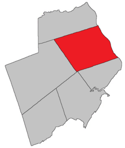
Brighton is a geographic parish in Carleton County, New Brunswick, Canada, northeast of Woodstock, extending from the eastern bank of the Saint John River to the York County line.

<span class="mw-page-title-main">Woodstock Parish, New Brunswick</span> Parish in New Brunswick, Canada

Woodstock is a geographic parish in Carleton County, New Brunswick, Canada, surrounding the town of the same name on its landward side.

<span class="mw-page-title-main">Saint Marys Parish, New Brunswick</span> Parish in New Brunswick, Canada

Saint Marys is a geographic parish in York County, New Brunswick, Canada.

<span class="mw-page-title-main">Elgin Parish, New Brunswick</span> Parish in New Brunswick, Canada

Elgin is a geographic parish in the interior of Albert County, New Brunswick, Canada, the only one of the county's parishes that does not border either the Bay of Fundy or the Petitcodiac River.

<span class="mw-page-title-main">Hopewell Parish, New Brunswick</span> Parish in New Brunswick, Canada

Hopewell is a geographic parish in eastern Albert County, New Brunswick, Canada.

<span class="mw-page-title-main">Harvey Parish, New Brunswick</span> Parish in New Brunswick, Canada

Harvey is a geographic parish in southern Albert County, New Brunswick, Canada.

<span class="mw-page-title-main">Salisbury Parish, New Brunswick</span> Parish in New Brunswick, Canada

Salisbury is a geographic parish in Westmorland County, New Brunswick, Canada.

<span class="mw-page-title-main">Shediac Parish, New Brunswick</span> Parish in New Brunswick, Canada

Shediac is a geographic parish in Westmorland County, New Brunswick, Canada.

<span class="mw-page-title-main">Dorchester Parish, New Brunswick</span> Parish in New Brunswick, Canada

Dorchester is a geographic parish in Westmorland County, New Brunswick, Canada.

<span class="mw-page-title-main">Pennfield Parish, New Brunswick</span> Parish in Canada

Pennfield is a geographic parish in Charlotte County, New Brunswick, Canada, located west of Saint John located east of St. George and west of Saint John.

<span class="mw-page-title-main">Saint George Parish, New Brunswick</span> Parish in Canada

Saint George is a geographic parish in Charlotte County, New Brunswick, Canada, located between St. Stephen and Saint John.

<span class="mw-page-title-main">Saint Stephen Parish, New Brunswick</span> Parish in Canada

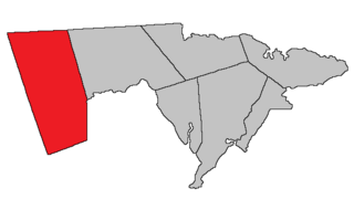
Saint Stephen is a geographic parish in Charlotte County, New Brunswick, Canada, located in the southwestern corner of the province.

References

  1. 1 2 "Census Profile". Statistics Canada. 26 October 2022. Retrieved 29 October 2022.
  2. 1 2 3 "Chapter T-3 Territorial Division Act". Government of New Brunswick. Retrieved 26 March 2023.
  3. "Chapter I-13 Interpretation Act". Government of New Brunswick. Retrieved 26 March 2023.
  4. The Territorial Division Act [2] divides the province into 152 parishes, the cities of Saint John and Fredericton, and one town of Grand Falls. The Interpretation Act [3] clarifies that parishes include any local government within their borders.
  5. "Southeast Regional Service Commission: RSC 7". Government of New Brunswick. Retrieved 26 March 2023.
  6. "Southeast Regional Service Commission: RD 7". Government of New Brunswick. Retrieved 26 March 2023.
  7. "Regions Regulation – Regional Service Delivery Act". Government of New Brunswick. 21 July 2022. Retrieved 26 March 2023.
  8. "Municipalities Order - Municipalities Act". Government of New Brunswick. 25 June 2021. Retrieved 26 March 2023.
  9. "Local Service Districts Regulation - Municipalities Act". Government of New Brunswick. 25 June 2021. Retrieved 26 March 2023.
  10. Ganong, William F. (1896). A Monograph of the Place-Nomenclature of the Province of New Brunswick. Royal Society of Canada. p. 240. Retrieved 17 March 2021.
  11. Ganong, William F. (1899). A Monograph of Historic Sites in the Province of New Brunswick. Royal Society of Canada. p. 335. Retrieved 30 March 2021.
  12. "26 Geo. III Chapter I. An Act for the better ascertaining and confirming the Boundaries of the several Counties within this Province, and for subdividing them into Towns or Parishes.". Acts of the General Assembly of His Majesty's Province of New-Brunswick, passed in the year 1786. Saint John, New Brunswick: Government of New Brunswick. 1786. pp. 3–12. Retrieved 20 March 2021.
  13. 1 2 3 4 5 "No. 131". Provincial Archives of New Brunswick. Department of Natural Resources and Energy Development. Retrieved 2 June 2021. Remainder of parish on maps 132, 142, and 143 at same site.
  14. 1 2 3 4 5 "379" (PDF). Transportation and Infrastructure. Government of New Brunswick. Retrieved 2 June 2021. Remainder of parish on mapbooks 380 and 399–401 at same site.
  15. "Historical Magnetic Declination". National Oceanic and Atmospheric Administration. Retrieved 2 June 2021.
  16. "9 Geo. IV c. 17 An Act to erect a part of the Parish of Hillsborough in the County of Westmoreland, into a distinct Town or Parish.". Acts of the General Assembly of His Majesty's Province of New-Brunswick, Passed in the Year 1828. Fredericton: Government of New Brunswick. 1828. p. 22. Retrieved 27 March 2021.
  17. "13 Vic. c. 51 An Act to consolidate all the Laws now in force for the division of the Province into Counties, Towns and Parishes.". Acts of the General Assembly of Her Mjaesty's Province of New Brunswick, Passed in the Year 1850. Fredericton: Government of New Brunswick. 1850. pp. 142–152, 145–149. Retrieved 27 March 2021. Book was poorly proofread, resulting in title typo and reuse of page numbers 145–152.
  18. "New Brunswick Regulation 85-6 under the Municipalities Act (O.C. 85-45)". Government of New Brunswick. Retrieved 12 December 2020.
  19. "New Brunswick Regulation 84-168 under the Municipalities Act (O.C. 84-582)". Government of New Brunswick. Retrieved 12 December 2020.
  20. "Regulation 66–41 under the Municipalities Act (O. C. 66–968)". The Royal Gazette. 124. Fredericton: 604–605. 21 December 1966.
  21. "Regulation 76–148 under the Municipalities Act (O. C. 76–847)". The Royal Gazette. 134. Fredericton: 1194. 24 November 1976.
  22. "2020 Local Government Statistics for New Brunswick" (PDF). Department of Environment and Local Government. p. 55. Retrieved 12 December 2020.
  23. 1 2 3 4 "Canadian Geographical Names Database". Government of Canada. Retrieved 8 June 2021.
  24. Statistics Canada: 2001, 2006 census
  25. 2011 Statistics Canada Census Profile: Hillsborough Parish, New Brunswick
  26. 1 2 "Census Profile, 2016 Census: Hillsborough, Parish [Census subdivision], New Brunswick". Statistics Canada. Retrieved 4 September 2019.
  27. Atlantic Canada Back Road Atlas ISBN   978-1-55368-618-7