Falls Township is one of the twenty-five townships of Muskingum County, Ohio, United States. The 2000 census found 8,585 people in the township.

Licking Township is one of the twenty-five townships of Muskingum County, Ohio, United States. The 2000 census found 2,248 people in the township.

Nashport is an unincorporated community in western Licking Township, Muskingum County, Ohio, United States. Although it is unincorporated, it has a post office, with the ZIP code of 43830. It lies along State Route 146.
Duncan Falls is a census-designated place in southeastern Wayne Township, Muskingum County, Ohio, United States, located on State Route 60 south of the city of Zanesville. Although it is unincorporated, it has a post office, with the ZIP code of 43734. Duncan Falls has a public library, a branch of the Muskingum County Library System.

Chandlersville is an unincorporated community in western Salt Creek Township, Muskingum County, Ohio, United States. Although it is unincorporated, it has a post office, with the ZIP code of 43727. It lies along State Route 146 at its intersection with State Routes 284 and 313.
Irville is an unincorporated community in Muskingum County, in the U.S. state of Ohio.
Dillon Falls is an unincorporated community in Muskingum County, in the U.S. state of Ohio.
Bridgeville is an unincorporated community in Muskingum County, in the U.S. state of Ohio.

Sonora is an unincorporated community in Muskingum County, in the U.S. state of Ohio.
Meadow Farm is an unincorporated community in Muskingum County, in the U.S. state of Ohio.
Sundale is an unincorporated community in Muskingum County, in the U.S. state of Ohio.
Gaysport is an unincorporated community in Muskingum County, in the U.S. state of Ohio.
Rix Mills is an unincorporated community in Muskingum County, in the U.S. state of Ohio.
Freeland is an unincorporated community in Muskingum County, in the U.S. state of Ohio.
Young Hickory is an unincorporated community in Muskingum County, in the U.S. state of Ohio.
Museville is an unincorporated community in Muskingum County, in the U.S. state of Ohio.
High Hill is an unincorporated community in Muskingum County, in the U.S. state of Ohio.
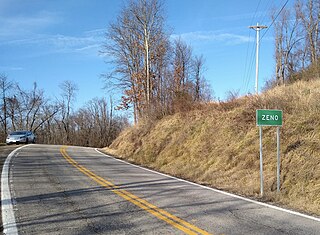
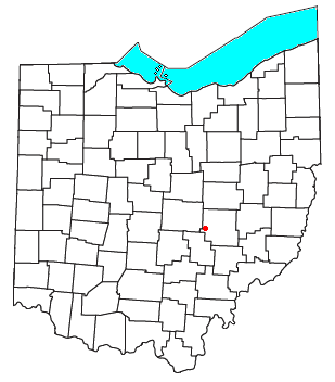
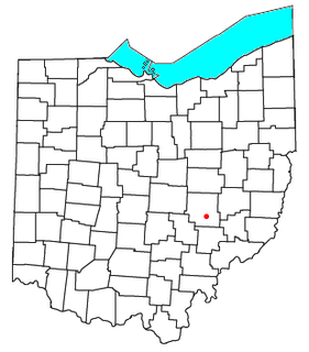
Zeno is an extinct town in Meigs Township of Muskingum County, in the U.S. state of Ohio. The GNIS classifies it as a populated place.
Stovertown is an unincorporated community in Muskingum County, in the U.S. state of Ohio.

Mount Sterling is an unincorporated community in Muskingum County, in the U.S. state of Ohio.