South Zanesville, Ohio

Last updated

South Zanesville, Ohio
Ohio Central 4026.JPG
Train and houses in South Zanesville
OHMap-doton-South Zanesville.png
Location of South Zanesville, Ohio
Map of Muskingum County Ohio Highlighting South Zanesville Village.png
Location of South Zanesville in Muskingum County
Coordinates: 39°54′13″N82°01′04″W / 39.90361°N 82.01778°W / 39.90361; -82.01778
Country United States
State Ohio
County Muskingum
Townships Springfield, Newton
Area
[1]
  Total0.80 sq mi (2.08 km2)
  Land0.80 sq mi (2.08 km2)
  Water0.00 sq mi (0.00 km2)
Elevation
[2]
742 ft (226 m)
Population
 (2020)
  Total1,894
  Density2,355.72/sq mi (909.67/km2)
Time zone UTC-5 (Eastern (EST))
  Summer (DST) UTC-4 (EDT)
ZIP code
43701
Area code 740
FIPS code 39-73894 [3]
GNIS feature ID2399863 [2]

South Zanesville is a village in Muskingum County, Ohio, United States, along the Muskingum River near the mouth of the Moxahala Creek. The population was 1,894 at the 2020 census. It is part of the Zanesville micropolitan area.

Contents

Geography

According to the United States Census Bureau, the village has a total area of 0.83 square miles (2.15 km2), all land. [4]

Demographics

Historical population
CensusPop.Note
1910 853
1920 1,01018.4%
1930 1,27826.5%
1940 1,3384.7%
1950 1,47710.4%
1960 1,5575.4%
1970 1,436−7.8%
1980 1,73921.1%
1990 1,96913.2%
2000 1,936−1.7%
2010 1,9892.7%
2020 1,894−4.8%
U.S. Decennial Census [5]

2010 census

As of the census [6] of 2010, there were 1,989 people, 830 households, and 539 families living in the village. The population density was 2,396.4 inhabitants per square mile (925.3/km2). There were 902 housing units at an average density of 1,086.7 per square mile (419.6/km2). The racial makeup of the village was 94.1% White, 3.0% African American, 0.3% Native American, 0.1% Asian, 0.1% Pacific Islander, 0.1% from other races, and 2.4% from two or more races. Hispanic or Latino of any race were 0.3% of the population.

There were 830 households, of which 34.9% had children under the age of 18 living with them, 39.0% were married couples living together, 18.4% had a female householder with no husband present, 7.5% had a male householder with no wife present, and 35.1% were non-families. 29.5% of all households were made up of individuals, and 12.1% had someone living alone who was 65 years of age or older. The average household size was 2.40 and the average family size was 2.90.

The median age in the village was 37.1 years. 25.9% of residents were under the age of 18; 7.7% were between the ages of 18 and 24; 25.6% were from 25 to 44; 27.1% were from 45 to 64; and 13.4% were 65 years of age or older. The gender makeup of the village was 48.3% male and 51.7% female.

2000 census

As of the census [3] of 2000, there were 1,936 people, 797 households, and 540 families living in the village. The population density was 2,653.2 inhabitants per square mile (1,024.4/km2). There were 874 housing units at an average density of 1,197.8 per square mile (462.5/km2). The racial makeup of the village was 97.73% White, 1.08% African American, 0.21% Native American, 0.10% Asian, 0.10% from other races, and 0.77% from two or more races. Hispanic or Latino of any race were 0.26% of the population.

There were 797 households, out of which 32.1% had children under the age of 18 living with them, 48.8% were married couples living together, 13.6% had a female householder with no husband present, and 32.2% were non-families. 26.5% of all households were made up of individuals, and 10.9% had someone living alone who was 65 years of age or older. The average household size was 2.43 and the average family size was 2.90.

In the village, the population was spread out, with 25.2% under the age of 18, 9.0% from 18 to 24, 29.7% from 25 to 44, 21.3% from 45 to 64, and 14.7% who were 65 years of age or older. The median age was 36 years. For every 100 females there were 89.6 males. For every 100 females age 18 and over, there were 89.0 males.

The median income for a household in the village was $32,292, and the median income for a family was $37,837. Males had a median income of $27,724 versus $21,220 for females. The per capita income for the village was $14,920. About 10.3% of families and 11.1% of the population were below the poverty line, including 12.5% of those under the age of 18 and 14.4% of those 65 and older.

High schools

Related Research Articles

<span class="mw-page-title-main">Muskingum County, Ohio</span> County in Ohio, United States

Muskingum County is a county located in the U.S. state of Ohio. As of the 2020 census, the population was 86,410. Its county seat is Zanesville. Nearly bisected by the Muskingum River, the county name is based on a Delaware American Indian word translated as "town by the river" or "elk's eye". Muskingum County comprises the Zanesville, OH Micropolitan Statistical Area, which is also included in the Columbus-Marion-Zanesville, OH Combined Statistical Area. The Zanesville Micropolitan Statistical Area is the second-largest statistical area within the Combined Statistical Area, after the Columbus Metropolitan Statistical Area.

<span class="mw-page-title-main">Guernsey County, Ohio</span> County in the United States

Guernsey County is a county located in the U.S. state of Ohio. As of the 2020 census, the population was 38,438. Its county seat and largest city is Cambridge. It is named for the Isle of Guernsey in the English Channel, from which many of the county's early settlers emigrated.

<span class="mw-page-title-main">Zanesville, Indiana</span> Town in Indiana, United States

Zanesville is a town in Wells and Allen counties in the U.S. state of Indiana, southwest of Fort Wayne. The population was 580 at the 2020 Census, down from 600 at the 2010 census.

<span class="mw-page-title-main">Athens, Michigan</span> Village in Michigan, United States

Athens is a village in Calhoun County in the U.S. state of Michigan. The population was 936 at the 2020 census. The village is located in southern Athens Township, and is part of the Battle Creek, Michigan Metropolitan Statistical Area. It was settled in 1831.

<span class="mw-page-title-main">Miramiguoa Park, Missouri</span> Village in Missouri, United States

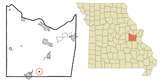
Miramiguoa Park is a village in Franklin County, Missouri, United States. The population was 120 at the 2010 census.

<span class="mw-page-title-main">Malta, Ohio</span> Village in Ohio, United States

Malta is a village in Morgan County, Ohio, United States. The population was 559 at the 2020 census.

<span class="mw-page-title-main">McConnelsville, Ohio</span> Village in Ohio, United States

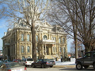
McConnelsville is a village in and the county seat of Morgan County, Ohio, United States, on the east bank of the Muskingum River. Located 21 miles (34 km) southeast of Zanesville and 26 miles (42 km) northwest of Marietta, the population was 1,667 at the 2020 census.

<span class="mw-page-title-main">Adamsville, Ohio</span> Village in Ohio, United States

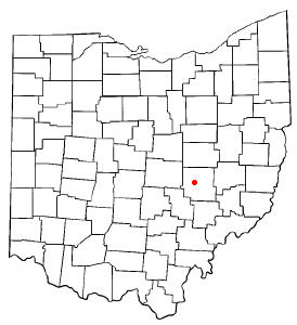
Adamsville is a village in Muskingum County, Ohio, United States. The population was 140 at the 2020 census. It is part of the Zanesville micropolitan area.

<span class="mw-page-title-main">Frazeysburg, Ohio</span> Village in Ohio, United States

Frazeysburg is a village in Muskingum County, Ohio, United States, along Wakatomika Creek. The population was 1,354 at the 2020 census. It is part of the Zanesville micropolitan area. Frazeysburg is home to the world's largest apple basket, which is located on the Longaberger homestead.

<span class="mw-page-title-main">Fultonham, Ohio</span> Village in Ohio, United States

Fultonham is a village in Muskingum County, Ohio, United States. The population was 115 at the 2020 census. It is part of the Zanesville micropolitan area. Fultonham was named for Robert Fulton, inventor of the first commercially successful steamboat.

<span class="mw-page-title-main">New Concord, Ohio</span> Village in Ohio, United States

New Concord is a village in Muskingum County, Ohio, United States. The population was 2,361 as of the 2020 census. It is part of the Zanesville micropolitan area. New Concord is the home of Muskingum University and is served by a branch of the Muskingum County Library System.

<span class="mw-page-title-main">North Zanesville, Ohio</span> CDP in Ohio, United States

North Zanesville is a census-designated place (CDP) in Muskingum County, Ohio, United States, just north of the city of Zanesville, along the Muskingum River. The population was 3,116 at the 2020 census.

<span class="mw-page-title-main">Norwich, Ohio</span> Village in Ohio, United States

Norwich is a village in Muskingum County, Ohio, United States. The population was 87 at the 2020 census. It is part of the Zanesville micropolitan area.

<span class="mw-page-title-main">Philo, Ohio</span> Village in Ohio, United States

Philo is a village in Muskingum County, Ohio, United States, along the Muskingum River. The population was 720 at the 2020 census. It is part of the Zanesville micropolitan area. Philo is the closest municipality to Blue Rock State Park.

<span class="mw-page-title-main">Belle Valley, Ohio</span> Village in Ohio, United States

Belle Valley is a village in Noble County, Ohio, United States. The population was 201 at the 2020 census.

<span class="mw-page-title-main">Somerset, Ohio</span> Village in Ohio, United States

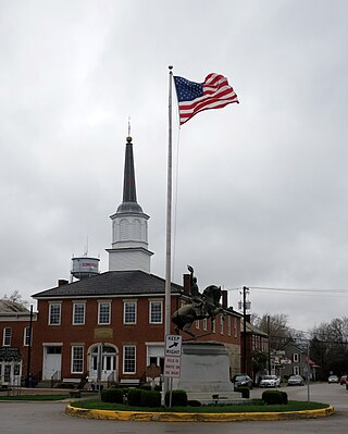
Somerset is a village in Perry County, Ohio, United States. The 2024 population estimate was 1,743 with 619 households. It is located 9.5 miles north of the county seat New Lexington and has a dedicated historical district. Saint Joseph Church, the oldest Catholic church in Ohio, is located just outside Somerset on State Route 383.

<span class="mw-page-title-main">Lowell, Ohio</span> Village in Ohio, United States

Lowell is a village in Washington County, Ohio, United States, along the Muskingum River. The population was 549 at the 2020 census. The village is located about 7.6 miles (12.2 km) north of Marietta, Ohio.

<span class="mw-page-title-main">Gratiot, Ohio</span> Village in Ohio, United States

Gratiot is a village in Licking and Muskingum counties in the U.S. state of Ohio. The population was 215 at the 2020 census.

<span class="mw-page-title-main">Verona, Ohio</span> Village in Ohio, United States

Verona is a village in Montgomery and Preble counties in the U.S. state of Ohio. The population was 403 at the 2020 census. It is part of the Dayton Metropolitan Statistical Area.

<span class="mw-page-title-main">Roseville, Ohio</span> Village in Ohio, United States

Roseville is a village in Muskingum and Perry counties in the U.S. state of Ohio, along Moxahala Creek. The population was 1,746 at the 2020 census. It is part of the Zanesville micropolitan area. Roseville is served by a branch of the Muskingum County Library System.

References

  1. "ArcGIS REST Services Directory". United States Census Bureau. Retrieved September 20, 2022.
  2. 1 2 U.S. Geological Survey Geographic Names Information System: South Zanesville, Ohio
  3. 1 2 "U.S. Census website". United States Census Bureau . Retrieved January 31, 2008.
  4. "US Gazetteer files 2010". United States Census Bureau. Archived from the original on January 25, 2012. Retrieved January 6, 2013.
  5. "Census of Population and Housing". Census.gov. Retrieved June 4, 2015.
  6. "U.S. Census website". United States Census Bureau . Retrieved January 6, 2013.