Related Research Articles

Lakehills is a census-designated place (CDP) in Bandera County, Texas, United States. The population was 5,150 at the 2010 census, making it the most populous place in Bandera county. It is part of the San Antonio Metropolitan Statistical Area.

Circle D-KC Estates is a census-designated place (CDP) in Bastrop County, Texas, United States. The population was 2,588 at the 2020 census.
Wyldwood is a census-designated place (CDP) in Bastrop County, Texas, United States. The population was 3,694 at the 2020 census.

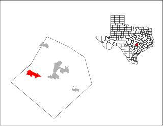
Scenic Oaks is a census-designated place (CDP) in Bexar County, Texas, United States. It is part of the San Antonio Metropolitan Statistical Area. The population was 10,458 at the 2010 census, up from 4,957 at the 2010 census.

Combes is a town in northern Cameron County, Texas, United States. Its population was 2,895 at the 2010 census. It is part of the Brownsville–Harlingen–Raymondville and the Matamoros–Brownsville metropolitan areas.

South Point is a census-designated place (CDP) in Cameron County, Texas, United States. The population was 1,376 at the 2010 census, up from 1,118 at the 2000 census. It is part of the Brownsville–Harlingen Metropolitan Statistical Area. As the name suggests, South Point is the southernmost census designated place in the state of Texas.

Four Corners is a census-designated place (CDP) within the extraterritorial jurisdiction of Houston in Fort Bend County, Texas, United States. The population was 12,103 at the 2020 census, up from 2,954 at the 2000 census.

Redwood is an unincorporated community and census-designated place (CDP) in Guadalupe County, Texas, United States. The population was 4,003 at the 2020 census, down from 4,338 at the 2010 census. It is part of the San Antonio Metropolitan Statistical Area.

Buchanan Dam is a census-designated place (CDP) in Llano County, Texas, United States. The population was 1,519 at the 2010 census, down from 1,688 at the 2000 census.

Robstown is a city in Nueces County, Texas, United States, and a western suburb of Corpus Christi. It was founded about 1906, and was named for Robert Driscoll. The population was 11,487 as of the 2010 census.
Rendon is a census-designated place (CDP) in Tarrant County, Texas, United States. The population was 12,552 at the 2010 census.

Grape Creek is a census-designated place (CDP) in Tom Green County, Texas, United States. It is part of the San Angelo, Texas Metropolitan Statistical Area. The population of Grape Creek was 3,154 at the 2010 census.

Port Mansfield is a census-designated place (CDP) in Willacy County, Texas, United States. The population was 226 at the 2010 census.
Brushy Creek is a census-designated place (CDP) in Williamson County, Texas, United States. The population was 22,519 at the 2020 census.

Batesville is a census-designated place (CDP) in Zavala County, Texas, United States. The population was 1,068 at the 2010 census.

Mission Bend is a census-designated place (CDP) around Texas State Highway 6 within the extraterritorial jurisdiction of Houston in Fort Bend and Harris counties in the U.S. state of Texas; Mission Bend is 4 miles (6 km) northwest of the city hall of Sugar Land and 20 miles (32 km) southwest of Downtown Houston. The population was 36,914 at the 2020 census.
Briar is a census-designated place (CDP) in Parker, Tarrant, and Wise counties in the U.S. state of Texas, near the west side of Eagle Mountain Lake. The population was 5,665 at the 2010 census.
Pecan Acres is a census-designated place (CDP) in Tarrant and Wise counties in the U.S. state of Texas. The population was 4,099 at the 2010 census.

McDade is an unincorporated community and census-designated place in northern Bastrop County, Texas, located along U.S. Route 290. As of the 2020 census, it had a population of 720. It is 9 miles (14 km) east of Elgin and 34 miles (55 km) east of Austin. It is 21 miles (34 km) west of Giddings.
Carlsbad is a census-designated place and unincorporated community in northwest Tom Green County, Texas, United States. It lies along U.S. Route 87 northwest of the city of San Angelo, the county seat of Tom Green County. Its elevation is 2,024 feet (617 m). Although Carlsbad is unincorporated, it has a post office, with the ZIP code of 76934; the ZCTA for ZIP Code 76934 had a population of 1,332 at the 2000 census.
References
- ↑ "Population and Housing Unit Counts, 2010 Census of Population and Housing" (PDF). Texas: 2010. Retrieved 2016-12-31.
- ↑ Smyrl, Vivian Elizabeth. "Hornsby Bend, TX". Texas State Historical Association. Retrieved 25 April 2017.
- ↑ Aaron Schnautz (18 November 2016). "A Quiet Place of Rest for One of Texas'-and Baseball's-Best". University of Texas at Austin School of Journalism . Retrieved 11 August 2021.
- ↑ "Boundary Map of Hornsby Bend, Texas". MapTechnica. Retrieved 2016-12-31.
- ↑ "Explore Census Data". data.census.gov. Retrieved 2022-05-24.
- ↑ www.census.gov
- ↑ "About the Hispanic Population and its Origin". www.census.gov. Retrieved 18 May 2022.
Municipalities and communities of Travis County, Texas, United States | ||
|---|---|---|
| Cities |  | |
| Villages | ||
| CDPs | ||
| Other communities | ||
| Footnotes | ‡This populated place also has portions in an adjacent county or counties | |
| | This article about a location in Travis County, Texas is a stub. You can help Wikipedia by expanding it. |