Iberville Projects

Last updated
Iberville Projects
IbervilleProjects2.jpg
Iberville Projects on Basin Street
Coordinates: 29°57′34″N90°04′25″W / 29.95944°N 90.07361°W / 29.95944; -90.07361 Coordinates: 29°57′34″N90°04′25″W / 29.95944°N 90.07361°W / 29.95944; -90.07361
CountryUnited States
StateLouisiana
City New Orleans
Planning DistrictDistrict 4, Mid-City District
Area
  Total0.06 sq mi (0.2 km2)
  Land0.06 sq mi (0.2 km2)
  Water0.00 sq mi (0.0 km2)
Elevation
0 ft (0 m)
Population
 (2010)
  Total1,238
  Density21,000/sq mi (8,000/km2)
Time zone UTC-6 (CST)
  Summer (DST) UTC-5 (CDT)
Area code 504

Iberville Projects was a neighborhood in the city of New Orleans and one of the low-income Housing Projects of New Orleans. The Iberville was the last of the New Deal-era public housing remaining in the city. Its boundaries were St. Louis Street, Basin Street, Iberville Street, and North Claiborne Avenue. It is located in the 6th ward of downtown New Orleans, on the former site of the Storyville district (the city's official red-light district). The area has recently been redeveloped into a modernized apartment complex called the Bienville Basin Apartments.

Contents

History

20th century

The Iberville development was built on a ten-block site in the early 1940s as part of the Wagner Bill. The land was previously Storyville, the city's official red light district. In 1940, the city declared 95% of the structures in Storyville substandard, clearing the way for construction of the project. There were 858 units in the Iberville Project.

The call for public housing was met by the federal government with the U.S. Housing Act of 1937 while the Great Depression was taking a toll on the poor and unemployed in America. The government officials in New Orleans were the quickest act and immediately received the funding to build the initial six housing complexes in the city. Once the complexes were complete they were divided among the whites and blacks in the city with the blacks having four of the complexes in the less developed areas of the city. The Iberville Project was one of the two housing complexes the whites were given, named in honor of Pierre Le Moyne, sieur, d’Iberville, one of the founders of Louisiana. [1] During segregation, the Iberville was occupied by whites, while the nearby Lafitte Projects served the black tenants. [2]

Beginning in the late 1980s, when many cities were regenerating and real estate in downtown areas became ripe for private investment, developers began looking to redo the 23-acre Iberville project. In 2001, Tom Benson (owner of the New Orleans Saints) proposed tearing down Iberville and putting up a stadium. Then, in 2004, developer Pres Kabacoff proposed partially demolishing the project in order to reinvigorate the city's tourism economy and the urban core. [3]

21st century

Although there was no significant damage, the Iberville project was closed following Hurricane Katrina. Representative Richard Baker (a Republican from a wealthy area of Baton Rouge) said after Hurricane Katrina: "We finally cleaned up public housing in New Orleans. We couldn't do it. But God did."[ citation needed ]

New Orleans mayor Ray Nagin expressed a desire to redevelop the Iberville Projects in 2003. [4] In May 2009, Nagin announced a HANO (Housing Authority of New Orleans) proposal to raze part of the Iberville project for redevelopment into mixed-income housing. In 2011, HANO [5] and the city of New Orleans were granted $30.5 million by the U.S Department of Housing. The grant was for improving the neighborhood's sustainability and increasing access to high-quality services. [6] The 1937 Housing Act made it possible for politicians and bureaucrats to demolish five thousand units of public housing in the midst of a staggering post-disaster housing crisis. [7] Due to its close proximity to Canal Street French Quarter, tourist regularly wandered across Basin Street into the project and were often assaulted. Others were led there by residents and robbed. Los Angeles Times article published in 2006 stated "before Hurricane Katrina hit, the Iberville was as an extremely dangerous place." [8]

Demolition of the Iberville Housing projects commenced in September 2013, with mixed-income housing being incorporated into the street grid of the surrounding neighborhoods. Human remains from the adjacent cemetery were found on a significant portion of the site, delaying redevelopment plans for months. These areas will be made into green space.

According to Mayor Mitch Landrieu, the Iberville Projects were redeveloped because of the location. Landrieu stated in the New Orleans Advocate that "This particular development, because of where it is — it is immediately adjacent to the Treme neighborhood, next to Canal Street, next to Rampart, next to the Claiborne corridor, across the street from what hopefully will be the new City Hall — that's all kinds of great promise." The renovation of Iberville Projects was executed in phases and created a total of 880 units catering to the needs of those who use affordable housing and housing units for the elderly. The renovations of the projects are a part of the U.S. Department of Housing and Urban Development’s Choice Neighborhood Initiative and a program HUD developed to help change the inner-city into an area with schools, jobs, mixed-income families, and transportation.

The redevelopment also called for a revamp of the entire surrounding neighborhood including corner stores, landmarks, and schools in a 300-square-block area bounded by Rampart Street, Tulane Avenue, Broad Street and St. Bernard Avenue. [9] The remaining buildings from the original project were added to the National Register of Historic Places on January 5, 2015. [10]

Architecture

The Iberville Project consisted of seventy-five brick buildings with 858 apartments. It was designed to blend in with the old neighborhood's housing in terms of proportionality, size, and style, resembling rowhouses of the 19th century with gabled ends, galleries, chimneys, and ironwork. The Iberville project was considered the most aesthetically pleasing HANO project in New Orleans. [11] James Russell, and architectural journalist for Bloomberg News said: "In New Orleans, public housing doesn't mean bleak high-rise towers. The city has thousands of units with Georgian brickwork and lacy ironwork porches that came through Hurricane Katrina barely scathed."

Demographics

As of the census of 2000, there were 2,540 people, 830 households, and 689 families residing in the neighborhood. [12] The population density was 42,333 /mi² (12,700 /km²). When the projects in New Orleans were racially integrated in the 1960s, low-income whites had options available to move to the suburbs, but their African American counterparts did not. As with all of the New Orleans projects, Iberville became home to thousands of the city's poorest African Americans. In 2000, 76 percent of the households in the Iberville made less than $10,000 per year.

As of the census of 2010, there were 1,238 people, 482 households, and 295 families residing in the neighborhood. [12]

The median age in this area is 31.3 and the area population is 3,655. [13]

Some of the schools near the area that was once called Iberville Projects are Joseph S. Clark Preparatory High School, the former Mcdonough 35 (no longer there since January 2016) Albert Wicker elementary school (being renovated since 2018) and Craig elementary school. [14]

Geography

The Iberville Projects were located at 29°57′34″N90°04′25″W / 29.95944°N 90.07361°W / 29.95944; -90.07361 [15] at an elevation of 0 feet (0 m) [16] (mean sea level). According to the United States Census Bureau, the district has a total area of 0.06 square miles (0.2 km2), all of which is land.

The New Orleans City Planning Commission defines the boundaries of Iberville Projects as these streets: St. Louis Street to the north, Basin Street to the east, Iberville Street to the south and North Claiborne Avenue to the west. [17]

Adjacent neighborhoods

Related Research Articles

<span class="mw-page-title-main">Storyville, New Orleans</span> Human settlement in New Orleans, Louisiana, United States of America

Storyville was the red-light district of New Orleans, Louisiana, from 1897 to 1917. It was established by municipal ordinance under the New Orleans City Council, to regulate prostitution. Sidney Story, a city alderman, wrote guidelines and legislation to control prostitution within the city. The ordinance designated an area of the city in which prostitution, although still nominally illegal, was tolerated or regulated. The area was originally referred to as "The District", but its nickname, "Storyville", soon caught on, much to the chagrin of Alderman Story. It was bound by the streets of North Robertson, Iberville, Basin, and St. Louis Streets. It was located by a train station, making it a popular destination for travelers throughout the city, and became a centralized attraction in the heart of New Orleans. Only a few of its remnants are now visible. The neighborhood lies in Faubourg Tremé and the majority of the land was repurposed for public housing. It is well known for being the home of jazz musicians, most notably Louis Armstrong as a minor.

<span class="mw-page-title-main">Tremé</span> New Orleans Neighborhood in Louisiana, United States

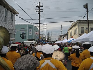
Tremé is a neighborhood in New Orleans, Louisiana. "Tremé" is often rendered as Treme, and the neighborhood is sometimes called by its more formal French name, Faubourg Tremé; it is listed in the New Orleans City Planning Districts as Tremé / Lafitte, from when including the Lafitte Projects.

<span class="mw-page-title-main">New Orleans Central Business District</span> Neighborhood of New Orleans, United States

The Central Business District (CBD) is a neighborhood of the city of New Orleans, Louisiana, United States.

<span class="mw-page-title-main">Broadmoor, New Orleans</span> New Orleans Neighborhood in Louisiana, United States

Broadmoor is a neighborhood of the city of New Orleans. A subdistrict of the Uptown/Carrollton Area, its boundaries as defined by the New Orleans City Planning Commission are: Eve Street to the north, Washington Avenue and Toledano Street to the east, South Claiborne Avenue to the south, and Jefferson Avenue, South Rocheblave Street, Nashville Avenue, and Octavia Street to the west. It includes the Broadmoor Historic District which was listed on the National Register of Historic Places in 2003 and increased in its boundaries in 2007.

<span class="mw-page-title-main">Central City, New Orleans</span> New Orleans Neighborhood in Louisiana, United States

Central City is a neighborhood of the city of New Orleans. It is located at the lower end of Uptown, just above the New Orleans Central Business District, on the "lakeside" of St. Charles Avenue. A subdistrict of the Central City/Garden District Area, its boundaries as defined by the City Planning Commission are: MLK Boulevard, South Claiborne Avenue and the Pontchartrain Expressway to the north, Magazine, Thalia, Prytania and Felicity Streets and St. Charles Avenue to the south and Toledano Street, Louisiana Avenue and Washington Avenue to the west. This old predominantly African-American neighborhood has been important in the city's brass band and Mardi Gras Indian traditions.

<span class="mw-page-title-main">Agriculture Street Landfill</span>

The Agriculture Street Landfill was a dump located in the Desire Area of New Orleans, Louisiana. The area was later developed for residential use, with unfortunate environmental consequences. It became a Superfund cleanup site in 1994.

<span class="mw-page-title-main">Magnolia Projects</span> United States historic place

The Magnolia Projects, officially the C. J. Peete Public Housing Development, was one of the Housing Projects of New Orleans. As part of the ongoing redevelopment, the area has been renamed Harmony Oaks. The project was among the largest, housing approximately 2,100 people. It is also home to numerous hip-hop artists; it has been referred to as "Magnolia: Home of the Soulja." Located in the part of uptown New Orleans known as Central City, it was bounded by Louisiana Avenue, South Claiborne Avenue, La Salle Street and Washington Avenue. The Magnolia Projects are located within the 11th and 12th Wards of New Orleans. At its height, the Magnolia projects had 1403 units.

<span class="mw-page-title-main">Housing Authority of New Orleans</span> Housing authority in New Orleans, Louisiana, United States

The Housing Authority of New Orleans is a housing authority in New Orleans, Louisiana, tasked with providing housing to low-income residents.

Desire Projects was a housing project located in the Ninth Ward of New Orleans, Louisiana. These projects were the largest in the nation and consisted of about 262 two-story brick buildings, containing about 1,860 units across 98.5 acres of land. The overall conditions of the projects were deplorable from the moment they were put into place in the later part of the 1950s. The projects were meant to serve the large number of underprivileged African American residents in the New Orleans area. Soon it became a place of despair, and Desire eventually evolved into a dark no-man’s land, leaving many residents infested with problems and little or no help from the government. Located in a cypress swamp and dumping ground, Desire was known as the poorest housing development in New Orleans—-it was bordered by railroad tracks, the Mississippi River, the Industrial Canal and a corridor of industrial plants. Historically the Desire was the city's most dangerous housing project and was documented as being one of the deadliest communities in the country. Most of the crime was due to drugs like Heroin that have plagued the project since the late 1960s. When crack cocaine arrived in the mid-1980s, the crime rate in the Desire increased, and violence intensified. As residents began moving out to flee the physical and social decay, abandoned apartments provided convenient places to stash drugs; drug deals and killings were commonplace. Desire's alleys and courts became a place where life was sometimes worth less than a pair of basketball shoes. The uptick in murders gave Desire a reputation for violence along with the nearby Florida Projects. In 1995, murders drastically decreased in the Desire project and the Florida development. The nightly gunfire that frequently shattered sleep in the Desire was largely gone; so were the outsiders who once grouped menacingly in the courtyards. That same year in February the U.S. Department of Housing and Urban Development approved a HOPE VI grant to HANO to improve the living environment through rehabilitation of the housing. Mass demolition began in 1997 and was completely razed by 1999.

<span class="mw-page-title-main">St. Bernard Projects</span> New Orleans Neighborhood in Louisiana, United States

St. Bernard Projects was a housing project in the city of New Orleans. A subdistrict of the Mid-City District Area, its boundaries as defined by the New Orleans City Planning Commission were: Harrison Avenue to the north, Paris Avenue to the east, Lafreniere Street and Florida Avenue to the south and Bayou St. John to the west.

<span class="mw-page-title-main">Melpomene Projects</span> Housing development in New Orleans, Louisiana, United States

The Melpomene Projects, officially called the Gustavo Apartments or TheGuste Homes, and colloquially The Melph, are a housing complex located in the Central City neighborhood of New Orleans.

<span class="mw-page-title-main">Lafitte Projects</span> New Orleans Neighborhood in Louisiana, United States

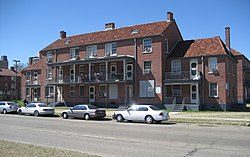
The Lafitte Projects were one of the Housing Projects of New Orleans and were located in the 6th Ward of New Orleans Treme neighborhood. It was one of Downtown New Orleans' oldest housing developments and had many associated problems before being severely flooded and damaged during Hurricane Katrina in 2005. The project made national headlines after the gruesome murder of Thomas May who burned to death in the project in 1994. By a Department of Housing and Urban Development (HUD) decree, the projects were demolished and redeveloped as affordable, mixed-income housing. The redevelopment effort was charged with replacing every demolished unit. The large housing project was left mostly vacant following evacuations after the extensive flooding from Hurricane Katrina. Heated arguments have surrounded the demolition of the project, as some longtime residents wanted them renovated.

<span class="mw-page-title-main">Internally displaced persons in the United States</span>

Internally displaced persons in the United States are people from the Gulf States region in the southern United States, most notably New Orleans, Louisiana, who were forced to leave their homes because of the devastation brought on by Hurricane Katrina in 2005 and were unable to return because of a multitude of factors, and are collectively known as the Gulf Coast diaspora and by standard definition considered IDPs. At their peak, hurricane evacuee shelters housed 273,000 people and, later, FEMA trailers housed at least 114,000 households. Even a decade after Hurricane Katrina, many victims who were forced to relocate were still unable to return home.

<span class="mw-page-title-main">Claiborne Avenue</span>

Claiborne Avenue is a major thoroughfare in New Orleans, Louisiana. It runs the length of the city, about 9.5 miles (15.3 km), beginning at the Jefferson Parish line and ending at the St. Bernard Parish line; the street continues under different names in both directions. It is called South Claiborne Avenue upriver from Canal Street and North Claiborne Avenue from Canal to St. Bernard Parish.

<span class="mw-page-title-main">Leonidas, New Orleans</span> New Orleans Neighborhood in Louisiana, United States

Leonidas is a neighborhood designation in the city of New Orleans. A subdistrict of the Uptown/Carrollton Area, its boundaries as defined by the New Orleans City Planning Commission are: South Claiborne Avenue, Leonidas and Fig Streets to the north, South Carrollton Avenue to the east, the Mississippi River and Jefferson Parish to the west. Although an official city planning district name, the name "Leonidas" is not widely used nor has it any historical usage and the area is usually referred to by the larger neighborhood "Uptown, or "Carrollton".

<span class="mw-page-title-main">Tulane/Gravier, New Orleans</span> New Orleans Neighborhood in Louisiana, United States

Tulane/Gravier is a neighborhood of the city of New Orleans, Louisiana, U.S.A. A subdistrict of the Mid-City District Area, its boundaries as defined by the New Orleans City Planning Commission are: St. Louis Street to the north, North Claiborne Avenue, Iberville Street, North and South Derbigny Street, Cleveland Street, South Claiborne Avenue to the east, the Pontchartrain Expressway to the south and South Broad Street to the west.

<span class="mw-page-title-main">The New Faubourg Lafitte</span>

New Faubourg Lafitte is a residential development in New Orleans, Louisiana, U.S.A. It largely occupies the area formerly filled by the since demolished Lafitte Projects public housing.

Pigeon Town is a New Orleans, Louisiana neighborhood located in the 17th Ward of New Orleans and within the larger Carrollton neighborhood, and within the area that the New Orleans city planning commission calls "Leonidas." Pigeon Town is (loosely) bordered by Cambronne St. (East), Claiborne Ave. (north), Oak St. (South) and the Orleans-Jefferson parish line on the west. It is situated directly between the Hollygrove neighborhood and the Oak Street Cultural Arts District.

The Calliope Projects, also known as B. W. Cooper Public Housing Development, was a neighborhood of the city of New Orleans and one of the housing projects of New Orleans. This project of New Orleans gained notoriety for its extremely high violent crime rate and was known to be one of the most violent housing projects in the United States. It was demolished in 2014 and replaced with newer, mixed-income apartment buildings.

Behrman also known as "Behrman Heights," is a crime-ridden low income community located in Algiers, New Orleans It was named after popular New Orleans mayor Martin Behrman, and is nestled south of the US Naval Support neighborhood and north of Tall Timbers/Brechtel, flanked on the west by Fischer Housing Development and Whitney, and on the east by Old Aurora.

References

  1. Long, A.P. (2007-12-01). "Poverty Is the New Prostitution: Race, Poverty, and Public Housing in Post-Katrina New Orleans". Journal of American History. 94 (3): 795–803. doi:10.2307/25095141. ISSN   0021-8723. JSTOR   25095141.
  2. "1941: The first public housing complexes are built in New Orleans". NOLA.com. Retrieved 2017-04-12.
  3. Gratz, Roberta (June 22, 2015). "Who Killed Public Housing in New Orleans?". The Nation.
  4. Pandolfi, Keith (2003). "Canal Street redevelopment placed on hold for six months". New Orleans CityBusiness.
  5. "Home :: Housing Authority of New Orleans". www.hano.org. Retrieved 2017-03-02.
  6. Shaban, Bigad (May 20, 2009). "In address, Nagin announces several big plans". Eyewitness News. Archived from the original on 2009-05-22. Retrieved October 23, 2013.
  7. Long, Alecia P. "Poverty Is the New Prostitution: Race, Poverty, and Public Housing in Post-Katrina New Orleans". archive.oah.org. Retrieved 2017-03-10.
  8. "A Hazy Horizon for New Orleans Public Housing". Los Angeles Times . 21 April 2006.
  9. Design+Build, Woodward. "Officials Break Ground on Iberville Redevelopment". Woodward Design+Build. Archived from the original on 2017-04-19. Retrieved 2017-04-19.
  10. "Weekly List of Actions Taken on Properties: 1/05/15 Through 1/09/15". National Park Service . Retrieved January 17, 2015.
  11. New Orleans Architecture: Faubourg Tremé and the Bayou Road, by Roulhac Toledano, Mary Louise Christovich, Robin Derbes
  12. 1 2 "Iberville Neighborhood". Greater New Orleans Community Data Center. Retrieved 6 January 2012.
  13. ASD, Website Services & Coordination Staff. "2010 Demographic Profile - U.S. Census Bureau". www.census.gov. Archived from the original on 2017-02-22. Retrieved 2017-03-22.
  14. "Schools ← opsb.us". opsb.us. Retrieved 2017-03-22.
  15. "US Gazetteer files: 2010, 2000, and 1990". United States Census Bureau. 2011-02-12. Archived from the original on 2002-05-27. Retrieved 2011-04-23.
  16. "US Board on Geographic Names". United States Geological Survey. 2007-10-25. Retrieved 2008-01-31.
  17. Greater New Orleans Community Data Center. "Iberville Development Neighborhood" . Retrieved 2008-06-21.