
New Orleans is a consolidated city-parish located along the Mississippi River in the southeastern region of the U.S. state of Louisiana. With a tabulated population of 383,997 in 2020, it is the most populous city in Louisiana. Serving as a major port, New Orleans is considered an economic and commercial hub for the broader Gulf Coast region of the United States.
St. Bernard Parish is a parish located in the U.S. state of Louisiana. The parish seat and largest community is Chalmette. The parish was formed in 1807. St. Bernard Parish is part of the New Orleans–Metairie metropolitan statistical area. The parish is located southeast of New Orleans and comprises the Chandeleur Islands and Chandeleur Sound in the east.

Jefferson Parish is a parish in the U.S. state of Louisiana. As of the 2020 U.S. census, the population was 440,781. The parish seat is Gretna. Jefferson Parish is included in the Greater New Orleans area.
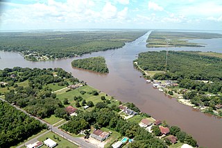
Jean Lafitte is a town on Bayou Barataria in the U.S. state of Louisiana. Located in Jefferson Parish, it is named after the privateer Jean Lafitte. The population was 1,903 at the 2010 U.S. census, and 1,996 at the 2020 population estimates program. It is part of the New Orleans–Metairie–Kenner metropolitan statistical area.

Tremé is a neighborhood in New Orleans, Louisiana. "Tremé" is often rendered as Treme, and the neighborhood is sometimes called by its more formal French name, Faubourg Tremé; it is listed in the New Orleans City Planning Districts as Tremé / Lafitte, from when including the Lafitte Projects.
The reconstruction of New Orleans refers to the rebuilding process endured by the city of New Orleans after Hurricane Katrina destroyed much of the city on August 29, 2005. The storm caused levees to fail, releasing tens of billions of gallons of water. The levee failure contributed to extensive flooding in the New Orleans area and surrounding parishes. About 80% of all structures in Orleans Parish sustained water damage. Over 204,000 homes were damaged or destroyed, and more than 800,000 citizens displaced — the greatest displacement in the United States since the Dust Bowl of the 1930s. Wind damage was less severe than predicted. The damage that took place that needed to be repaired cost about $125 billion.

The Lower Ninth Ward is a neighborhood in the city of New Orleans, Louisiana. As the name implies, it is part of the 9th Ward of New Orleans. The Lower Ninth Ward is often thought of as the entire area within New Orleans downriver of the Industrial Canal; however, the City Planning Commission divides this area into the Lower Ninth Ward and Holy Cross neighborhoods.

The Agriculture Street Landfill was a dump located in the Desire Area of New Orleans, Louisiana. The area was later developed for residential use, with unfortunate environmental consequences. It became a Superfund cleanup site in 1994.

The Magnolia Projects, officially the C. J. Peete Public Housing Development, was one of the Housing Projects of New Orleans. As part of the ongoing redevelopment, the area has been renamed Harmony Oaks. The project was among the largest, housing approximately 2,100 people. It is also home to numerous hip-hop artists; it has been referred to as "Magnolia: Home of the Soulja." Located in the part of uptown New Orleans known as Central City, it was bounded by Louisiana Avenue, South Claiborne Avenue, La Salle Street and Washington Avenue. The Magnolia Projects are located within the 11th and 12th Wards of New Orleans. At its height, the Magnolia projects had 1403 units.
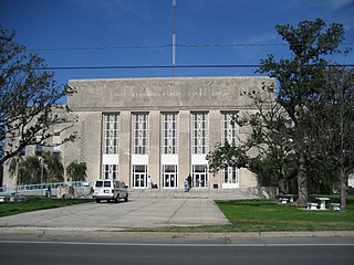
The Housing Authority of New Orleans is a housing authority in New Orleans, Louisiana, tasked with providing housing to low-income residents.
Desire Projects was a housing project located in the Ninth Ward of New Orleans, Louisiana. These projects were the largest in the nation and consisted of about 262 two-story brick buildings, containing about 1,860 units across 98.5 acres of land. The overall conditions of the projects were deplorable from the moment they were put into place in the later part of the 1950s. The projects were meant to serve the large number of underprivileged African American residents in the New Orleans area. Soon it became a place of despair, and Desire eventually evolved into a dark no-man’s land, leaving many residents infested with problems and little or no help from the government. Located in a cypress swamp and dumping ground, Desire was known as the poorest housing development in New Orleans—-it was bordered by railroad tracks, the Mississippi River, the Industrial Canal and a corridor of industrial plants. Historically the Desire was the city's most dangerous housing project and was documented as being one of the most deadliest communities in the country. Most of the crime was due to drugs like Heroin that have plagued the project since the late 1960s. When crack cocaine arrived in the mid-1980s, the crime rate in the Desire increased, and violence intensified. As residents began moving out to flee the physical and social decay, abandoned apartments provided convenient places to stash drugs; drug deals and killings were commonplace. Desire's alleys and courts became a place where life was sometimes worth less than a pair of basketball shoes. The uptick in murders gave Desire a reputation for violence along with the nearby Florida Projects. In 1995, murders drastically decreased in the Desire project and the Florida development. The nightly gunfire that frequently shattered sleep in the Desire was largely gone; so were the outsiders who once grouped menacingly in the courtyards. That same year in February the U.S. Department of Housing and Urban Development approved a HOPE VI grant to HANO to improve the living environment through rehabilitation of the housing. Mass demolition began in 1997 and was by Complete razed by 1999.

St. Bernard Projects was a housing project in the city of New Orleans. A subdistrict of the Mid-City District Area, its boundaries as defined by the City Planning Commission were: Harrison Avenue to the north, Paris Avenue to the east, Lafreniere Street and Florida Avenue to the south and Bayou St. John to the west.

The Melpomene Projects, officially called the Gustavo Apartments, is located in Central City New Orleans and is one of the Housing Projects of New Orleans. The complex occupies ten city blocks, bounded roughly by South Robertson Street, Clio Street, Simon Bolivar Avenue and Martin Luther King, Jr. Boulevard. There were four three-story buildings and two four-story buildings for families and a high-rise for the elderly. At a peak height of 12 stories, the Guste high-rise is the tallest public housing complex in the city.
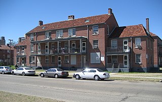
Iberville Projects was a neighborhood in the city of New Orleans and one of the low-income Housing Projects of New Orleans. The Iberville was the last of the New Deal-era public housing remaining in the city. Its boundaries were St. Louis Street, Basin Street, Iberville Street, and North Claiborne Avenue. It is located in the 6th ward of downtown New Orleans, on the former site of the Storyville district. The area has recently been redeveloped into a modernized apartment complex called the Bienville Basin Apartments.

Penn South, officially known as Mutual Redevelopment Houses and formerly Penn Station South, is a limited-equity housing cooperative development located between Eighth and Ninth Avenues and West 23rd and 29th Streets, in the Chelsea neighborhood of Manhattan, New York City. The complex has 2,820 units in ten 22-story buildings. Penn South is so named because of its location southwest of New York Penn Station.

Internally displaced persons in the United States are people from the Gulf States region in the southern United States, most notably New Orleans, Louisiana, who were forced to leave their homes because of the devastation brought on by Hurricane Katrina in 2005 and were unable to return because of a multitude of factors, and are collectively known as the Gulf Coast diaspora and by standard definition considered IDPs. At their peak, hurricane evacuee shelters housed 273,000 people and, later, FEMA trailers housed at least 114,000 households. Even a decade after Hurricane Katrina, many victims who were forced to relocate were still unable to return home.

The New Orleans African American Museum in New Orleans, Louisiana, is located in the historic Tremé neighborhood, the oldest-surviving black community in the United States. The NOAAM of Art, Culture and History seeks to educate and to preserve, interpret, and promote the contributions that people of African descent have made to the development of New Orleans and Louisiana culture, as slaves and as free people of color throughout the history of American slavery as well as during emancipation, Reconstruction, and contemporary times.

McCormack Baron Salazar is a U.S. real estate development firm specializing in economically integrated urban neighborhoods with more than $4.23 billion invested in affordable and mixed-income housing projects. McCormack Baron Salazar provides development as well as ongoing property management services, development financing and tax credit services, and asset management services. Based in St. Louis, Missouri, McCormack Baron Salazar was ranked by Affordable Finance Magazine in 2011 among the top five affordable housing owners in the country.
New Faubourg Lafitte is a residential development in New Orleans, Louisiana, U.S.A.. It largely occupies the area formerly filled by the since demolished Lafitte Projects public housing.

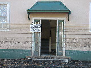
The Calliope Projects, also known as B. W. Cooper Public Housing Development, was a neighborhood of the city of New Orleans and one of the housing projects of New Orleans. This project of New Orleans gained notoriety for its extremely high violent crime rate and was known to be one of the most violent housing projects in the United States. It was completely demolished in 2014 and replaced with newer, mixed-income apartment buildings.

