
Jacobs Cavern is a cave or rock shelter east of Pineville in McDonald County, Missouri.
Jacobs Cavern is a cave or rock shelter east of Pineville in McDonald County, Missouri.

Jacobs Cavern is named after its discoverer, E. H. Jacobs of Bentonville, Arkansas. It was scientifically explored by him, in company with Charles Peabody and Warren K. Moorehead, in 1903. The findings were published in that year by Jacobs in the Benton County Sun; by C. N. Gould in Science, July 31, 1903; by Peabody in the Am. Anthropologist, Sept. 903; and in the Am. Journ. Archaeology, 1904; and by Peabody and Moorehead, 1904, as Bulletin I. of the Dept. of Archaeology in Phillips Academy, Andover, Massachusetts, in the museum of which are exhibits, maps, and photographs. [1]
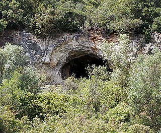
Jacobs Cavern is a small cave, hardly more than a rock shelter, and is entirely in the St. Joe Formation of the Mississippian subperiod. Its roof is a single flat stratum of limestone; its walls are well marked by lines of stratification; dripstone also partly covers the walls, fills a deep fissure at the end of the cave, and spreads over the floor, where it mingles with an ancient bed of ashes, forming an ash-breccia (mostly firm and solid) that encloses fragments of sandstone, flint spalls, flint implements, charcoal and bones. Underneath is the true floor of the cave, a mass of homogeneous yellow clay, one meter in thickness. It holds scattered fragments of limestone, and is itself the result of limestone degeneration. The length of the opening is over 21 meters; its depth 14 meters, and the height of roof above the undisturbed ash deposit varied from 1 m 20 cm to 2 m 60 cm The bone recess at the end was from 50 cm. to 80 cm. in height. The stratum of ashes was from 50 cm to 1 m 50 cm thick. [1]
The ash surface was staked off into square meters, and the substance carefully removed in order. Each stalactite, stalagmite and pilaster was measured, numbered, and removed in sections. Six human skeletons were found buried in the ashes. Seven-tenths of a cubic metre of animal bones were found: deer, bear, wolf, raccoon, opossum, beaver, buffalo, elk, turkey, woodchuck, tortoise and hog; all contemporary with man's occupancy. Three stone metates, one stone axe, one celt and fifteen hammerstones were found. Jacobs Cavern was peculiarly rich in flint knives and projectile points. The sum total amounts to 419 objects, besides hundreds of fragments, cores, spalls and rejects, retained for study and comparison. Considerable numbers of bone or horn awls were found in the ashes, as well as fragments of pottery, but no ceremonial objects. [1]
The rude type of the implements, the absence of fine pottery, and the peculiarities of the human remains, indicate a trace of occupants more ancient than the mound-builders. The deepest implement observed was buried 50 cm under the stalagmitic surface. Dr. Hovey has proved that the rate of stalagmitic growth in Wyandotte Cave, Indiana, is .0254 cm. annually; and if that was the rate in Jacobs Cavern, 1968 years would have been needed for the embedding of that implement. Polished rocks outside the cavern and pictographs in the vicinity indicate the work of a prehistoric race earlier than the Osage Indians, who were the historic owners previous to the advent of Europeans. [1]

Kents Cavern is a cave system in Torquay, Devon, England. It is notable both for its archaeological and geological features. The cave system is open to the public and has been a geological Site of Special Scientific Interest since 1952 and a Scheduled Ancient Monument since 1957.

Russell Cave National Monument is a U.S. national monument in northeastern Alabama, United States, close to the city of Bridgeport. The monument was established on May 11, 1961, when 310 acres (1.3 km2) of land were donated by the National Geographic Society to the American people. It is now administered and maintained by the National Park Service. The national monument was listed on the National Register of Historic Places on October 15, 1966.

Luray Caverns, previously Luray Cave, is a cave just west of Luray, Virginia, United States, which has drawn many visitors since its discovery in 1878. The cavern system is adorned with speleothems such as columns, mud flows, stalactites, stalagmites, flowstone, and mirrored pools. The caverns host the Great Stalacpipe Organ, a lithophone made from solenoid-fired strikers that tap stalactites of varied sizes to produce tones similar to those of xylophones, tuning forks, or bells.
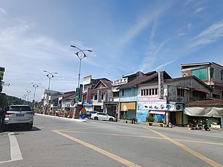
Lenggong is a town, a mukim and a parliamentary constituency in Hulu Perak District, Perak, Malaysia.

Azykh Cave, also referred to as Azokh Cave, is a six-cave complex in Azerbaijan, known as a habitation site of prehistoric humans. It is situated near the village of Azykh in the Khojavend District.
Enkapune Ya Muto, also known as Twilight Cave, is a site spanning the late Middle Stone Age to the Late Stone Age on the Mau Escarpment of Kenya. This time span has allowed for further study of the transition from the Middle Stone Age to the Late Stone Age. In particular, the changes in lithic and pottery industries can be tracked over these time periods as well as transitions from a hunter-gatherer lifestyle to a herding lifestyle. Beads made of perforated ostrich egg shells found at the site have been dated to 40,000 years ago. The beads found at the site represent the early human use of personal ornaments. Inferences pertaining to climate and environment changes during the pre-Holocene and Holocene period have been made based from faunal remains based in this site.
Bluff Dweller's Cave is a show cave located just south of Noel, Missouri that was discovered in 1925 and opened to the public in 1927. The cave was formed in the Pierson Limestone during the Paleozoic Era. The cave's passages total over 4,000 ft in length, with two entrances beneath a limestone outcropping of the bluff.

The Chalcolithic Temple of Ein Gedi is a Ghassulian public building dating from about 3500 BCE. It lies on a scarp above the oasis of Ein Gedi, on the western shore of the Dead Sea, within modern-day Israel. Archaeologist David Ussishkin has described the site as "a monumental edifice in terms of contemporary architecture".
Baker Cave is a prehistoric archaeological site, located on a small canyon near Devils River in Southwest Texas. Dating from circa 7,000–7,800 BCE, Baker Cave is a part of a system of rock shelters in the Lower Pecos Canyons region and was 120 feet long by 56 feet deep. The ceiling varied from 18 feet (5.5 m) at the mouth to just a few inches in the back.

Cathole Cave, Cat Hole Cave or Cathole Rock Cave, is a cave near Parc Cwm long cairn at Parc le Breos, on the Gower Peninsula, Wales. It is a steep limestone outcrop, about 200 yards (180 m) north of the cromlech along the Parc le Breos Cwm valley and near the top of the gorge, about 50 feet (15 m) from the valley floor. The cave is a deep triangular fissure penetrating the hillside and narrowing towards the top. It has two entrances, with a natural platform outside the larger of the two. It is about seven 1⁄2 miles (12 km) west south–west of Swansea, Wales, in what is now known as Coed y Parc Cwm at Parc le Breos, on the Gower Peninsula.

Hogup Cave is a two-chambered limestone cavern, and an important, well-studied prehistoric Great Basin site in Utah.

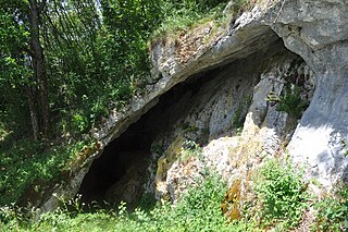
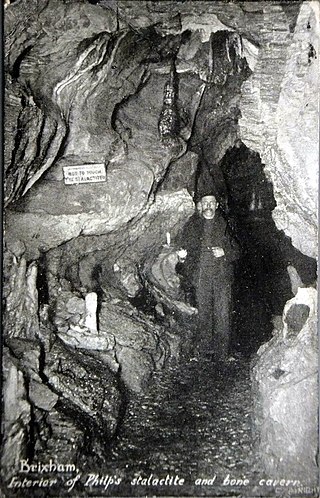
Ash Hole Cavern is a limestone cave system in Brixham, Devon, England. There is evidence of human habitation since Neolithic times, and archaeological excavations have been conducted, with several artefacts found. It has been a scheduled monument since 1966.
Betal Rock Shelter, a karst cave located on the south-eastern edge of the Lower Pivka river valley on a slope just above the road from Postojna to Bukovje is a site where rich cultural sediment layers with remains of stone tools, artifacts, and numerous fossilized bones of contemporary animals were found. Its entrance was formed by the collapse of the 174 m (571 ft) long cave's ceiling, carved out by the waters of the Pivka River.
Ifri Oudadane is an archaeological site in the northeastern Rif region of Morocco. It is located on the southwestern coast of the Cape Three Forks on the Mediterranean Sea, and is one of the most important sites in the northwestern Maghreb region of Africa. Discovered during road construction, the site consists of a fairly large rock shelter above the modern coastline, the site has been excavated since 2006 by a team of Moroccan and German archaeologists. Although much is known about the transition of humans from hunter gatherer groups to food production in Europe and the Middle East, much of North Africa has not been researched. Ifri Oudadane is one of the first of such sites in North Africa. Dated to between 11000 and 5700 years BP, the site contains evidence that documents the shift of local inhabitants from hunter-gatherer groups to food producers. Such elements of change found at Ifri Oudadane include evidence of animal husbandry, domestication of legumes, and decoration of pottery. The site is known to contain the earliest dated crop in Northern Africa, a lentil.

Satsurblia Cave Natural Monument is a paleoanthropological site located 1.2 km from Kumistavi village, Tsqaltubo Municipality, in the Imereti region of Georgia, 287 meters above sea level. The karst cave was first excavated in 1976 by A. N. Kalandadze. In the Middle Ages the cave was used as a refuge.
Matupi Cave is a cave in the Mount Hoyo massif of the Ituri Rainforest, Democratic Republic of the Congo, where archaeologists have found evidence for Late Stone Age human occupation spanning over 40,000 years. The cave has some of the earliest evidence in the world for microlithic tool technologies.
The Holy Cave at Hunterston in the Parish of West Kilbride is associated with Saint Mungo, also known as St Kentigern and is often referred to as the Hawking Craig Cave however two caves exists in the Hawking Craig Wood and 'Three Sisters' area of the cliffs, the other being Smith's Cave, better described as a rock shelter lying a short distance to the south. The main cave has been excavated and the finds indicate three periods of occupation over many centuries.
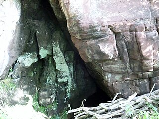
Windmill Hill Cavern is a limestone cave system in the town of Brixham, Devon. It was discovered in 1858 and later excavated by a team led by the geologist William Pengelly, who found proof that humans co-existed with extinct British fauna.
Bambata Cave is one of the Southern Africa prehistoric sites situated in Motobo National Park along with Inanke, Nswatugi, Pomengwe and Silozwane caves in Zimbabwe.
The Cave of Pedra Furada is a small cave located in the municipality of Vila Franca de Xira, about 20 km north of Lisbon in Portugal. Archaeological studies conducted within the cave suggest it was occupied intermittently by humans during at least three periods between the end of the fourth millennium BC and the second millennium BC. The cave results from karstification of the limestone Upper Jurassic Massif.
36°35′N94°20′W / 36.59°N 94.34°W
