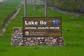
Quivira National Wildlife Refuge is located in south central Kansas near the town of Stafford. It lies mostly in northeastern Stafford County, but small parts extend into southwestern Rice and northwestern Reno Counties. Its proximity to the Central Flyway migration route and the salt marshes on the refuge combine to endow the refuge with a large variety of birds. Many of these birds are uncommon in other parts of Kansas or even the central part of the continent.
The Klamath Basin National Wildlife Refuge Complex is a wildlife preserve operated by the United States Fish and Wildlife Service in the Klamath Basin of southern Oregon and northern California near Klamath Falls, Oregon. It consists of Bear Valley, Klamath Marsh and Upper Klamath National Wildlife Refuge (NWR) in southern Oregon and Lower Klamath, Tule Lake, and Clear Lake NWR in northern California.

Benton Lake National Wildlife Refuge is a 12,459-acre (5,042 ha) National Wildlife Refuge (NWR) in the central part of the U.S. state of Montana. It lies in northern Cascade County, 12 mi (19 km) north of the city of Great Falls, Montana. Benton Lake NWR includes shortgrass prairie and seasonal wetlands, and is nearly surrounded by the Highwood Mountains to the east, Big Belt Mountains to the south, and the Rocky Mountains to the west. Benton Lake NWR is on the western edge of the northern Great Plains and much of the shallow lake is a 6,000-acre (2,400 ha) wetland.

Bowdoin National Wildlife Refuge is a 15,551-acre (6,293 ha) National Wildlife Refuge (NWR) located in the north-central region of the U.S. state of Montana. The refuge is 7 mi (11 km) northeast of Malta, Montana in the Milk River Valley and is managed by the U.S. Fish and Wildlife Service.
Red Rock Lakes National Wildlife Refuge is a remote refuge located in the high altitude of the Centennial Valley, in the southwestern region of the U.S. state of Montana. Adjacent to Gallatin National Forest and near Yellowstone National Park, the refuge is an integral part of the Greater Yellowstone Ecosystem. Red Rock Lakes is best known for being the primary location for the efforts saving the trumpeter swan from extinction, which by 1932 had fewer than 200 known specimens in the United States and Canada. By the year 2002, an estimated 3,000 trumpeters were wintering on the refuge, many having migrated south from their summer range in Canada. The trumpeters are now so plentiful that efforts are being undertaken to help them reestablish historical migratory routes to areas further south in the Rocky Mountains and the Great Basin region. The elegant trumpeter swan is North America's largest waterfowl, with a wingspans of 8 feet and they can weigh up to 30 pounds (13 kg).
The Okefenokee National Wildlife Refuge is a 402,000‑acre (1,627 km2) National Wildlife Refuge located in Charlton, Ware, and Clinch Counties of Georgia, and Baker County in Florida, United States. The refuge is administered from offices in Folkston, Georgia. The refuge was established in 1937 to protect a majority of the 438,000 acre (1,772 km2) Okefenokee Swamp. The name "Okefenokee" is a Native American word meaning "trembling earth."

Seedskadee National Wildlife Refuge is a National Wildlife Refuge of the United States located in western Sweetwater County in the state of Wyoming. It covers 26,400 acres (106 km2) managed by the U.S. Fish and Wildlife Service, an agency within the U.S. Department of the Interior.

Huron Wetland Management District is located in the U.S. state of South Dakota and includes 17,518 acres (70.89 km2). The refuge borders the Missouri River on the east and is managed by the U.S. Fish and Wildlife Service. Huron WMD covers eight counties in east-central South Dakota. The topography of this area ranges from flat, gently rolling drift prairie to the Missouri Coteau hills in the western end of the district. The district lies in the midst of the world-renowned Prairie Pothole Region.
Karl E. Mundt National Wildlife Refuge is located mostly in the southern part of the U.S. state of South Dakota, with a small extension into northern Nebraska, and includes 1,085 acres (4.39 km2) The refuge is a part of the Lake Andes National Wildlife Refuge Complex and is managed by the U.S. Fish and Wildlife Service. Of the land area in the district, the U.S. Government owns only 780 acres (3.15 km2), while the remaining area is managed as an easement. The refuge is closed to the public but there are excellent viewing locations from the Ft. Randle Dam on the Missouri River. The Karl E. Mundt NWR has the largest concentration of bald eagles in the lower 48 states, with over 200 eagles often spending the winter on the refuge. The refuge was named for former South Dakota Senator Karl Mundt, who was a strong supporter of the Endangered Species Act of 1966.
Sand Lake National Wildlife Refuge is located in the northeastern part of the U.S. state of South Dakota and is administered by the U.S. Fish and Wildlife Service. Created in 1935, it is a wetlands of international importance and a Globally Important Bird Area. Over 260 bird species are found in the refuge, including many migratory bird species and the world's largest breeding colony of Franklin's gulls.
Chase Lake National Wildlife Refuge is located in the U.S. state of North Dakota. The majority of the land area of the refuge has been designated as wilderness and is known as the Chase Lake Wilderness. The refuge is one of the oldest in the U.S., having been set aside in 1908. The refuge has more breeding pairs of white pelicans than any other protected area in the U.S. Chase Lake NWR is managed through Arrowwwood National Wildlife Refuge Complex and in turn, a number of other refuges and wetland management districts are managed from Chase Lake including:
Arrowwood National Wildlife Refuge is located in the U.S. state of North Dakota. Arrowwood NWR is a part of the Arrowwood National Wildlife Refuge Complex, and is managed by the U.S. Fish and Wildlife Service. The refuge parallels 16 miles (27 km) of the James River and is a mixture of wetlands, forest and prairie. Efforts to ensure the refuge continues to provide prime nesting habitat for waterfowl include prescribed fire, haying, crop cultivation and livestock grazing. The refuge has forests with oak and hackberry which are uncommon on the prairie. It is believed that the name for the refuge is derived from Native American naming for arrow wood, as the wood in the forest was prized for the making of arrows.

Audubon National Wildlife Refuge is a 14,739-acre (5,965 ha) National Wildlife Refuge in the U.S. state of North Dakota. The refuge is managed by the U.S. Fish and Wildlife Service and is the centerpiece of the Audubon National Wildlife Refuge Complex, which includes numerous other refuges in the region. Originally designated as the Snake Creek National Wildlife Refuge in 1955, the refuge was renamed in 1967 in honor of the artist and naturalist John James Audubon. Most of the refuge area is a lake known as Audubon Lake which is managed by the U.S. Army Corps of Engineers.
Audubon Wetland Management District is located in the U.S. state of North Dakota and consists of 123 Waterfowl Production Areas (WPAs), 8 National Wildlife Refuges (NWRs), and numerous wetland and grassland easements and over 100 separate wetland areas set aside to preserve habitat for bird, plant and mammal species. These lands contain valuable wetland and grassland habitat for waterfowl and other migratory birds, and many other species of wildlife. Scattered throughout west central and southwestern North Dakota in McLean, Ward, and Sheridan Counties, the district is managed by the U.S. Fish and Wildlife Service and from Audubon National Wildlife Refuge. Hundreds of lakes and marshlands in this region provide critical habitat for migratory and nesting bird species.

Glacial Ridge National Wildlife Refuge was created on October 12, 2004, the 545th National Wildlife Refuge in the United States. Its creation was the result of cooperation between at least 30 agencies or governmental entities. The creation of the refuge was spearheaded by The Nature Conservancy, and the initial endowment of 2,300 acres (9.3 km2) of land was donated by the Conservancy. In light of its planned final size of 37,756 acres (153 km2), it is described by the US Fish and Wildlife Service as "the largest tallgrass prairie and wetland restoration project in U.S. history."
Handy Brake National Wildlife Refuge is located just north of Bastrop, Louisiana in Morehouse Parish, north central Louisiana. The refuge was established in 1988 with the southeast's first fee title transfer of a Farmer's Home Administration tract to the U.S. Fish and Wildlife Service. A free lease of 38 acres (150,000 m2) from International Paper increased the refuge to the current 501 acres (2.03 km2).

Straddling the headwaters of the Minnesota River in west-central Minnesota, Big Stone National Wildlife Refuge is within the heart of the tallgrass prairie's historic range. Today, less than one-percent of tallgrass prairie remains.

Waubay National Wildlife Refuge is a National Wildlife Refuge in South Dakota. "Waubay" means "a place where numbers of birds make their nests" in the Dakota language. The Refuge encompasses 4,650 acres (18.8 km2) of wetlands, native tallgrass prairie, and bur oak forest that provide a wide variety of nesting habitat for more than 100 species of waterfowl, song birds, and upland game birds as well as 140 additional bird species during migrations. Mammals include species from the ever-present white-tailed deer to the more elusive coyote and the diminutive pygmy shrew. The central location of Waubay National Wildlife Refuge in North America gives visitors the chance to see a mix of eastern, western, northern, and southern species.
Appert Lake National Wildlife Refuge is a National Wildlife Refuge in Emmons County, North Dakota. It is a privately owned property with refuge easement rights for flooding, and is one of five easement refuges managed under Long Lake National Wildlife Refuge. It is closed to hunting. It was established to provide a stable water area and safe haven for migrating waterfowl in response to declining populations during the Dust Bowl era of the 1930s. The refuge centers on a wooded prairie wetland which provides relatively unique habitat in an agriculturally dominated area. The refuge is used by wood ducks, American wigeon, green-winged teal, mallards, pintails, gadwalls and a host of woodland passerine bird species.

Located in south-central North Dakota, Kulm Wetland Management District was established in 1971. Located in the Prairie Pothole Region of North America, Kulm Wetland Management District provides breeding, nesting, and brood rearing areas for many species of waterfowl and other migratory birds. The District currently manages 201 waterfowl production areas that total 45,683 acres (184.87 km2), 3 national wildlife refuges that are easement refuges, and 120,000 acres (490 km2) of wetland and grassland easements. The District's headquarters is in Kulm, North Dakota.