Lake Norden, South Dakota

Last updated
Lake Norden, South Dakota
Motto: 
"Cheese Is Our Whey"
Hamlin County South Dakota Incorporated and Unincorporated areas Lake Norden Highlighted.svg
Location in Hamlin County and the state of South Dakota
Coordinates: 44°34′54″N97°12′30″W / 44.58167°N 97.20833°W / 44.58167; -97.20833
Country United States
State South Dakota
County Hamlin
Incorporated1916 [1]
Area
[2]
  Total0.92 sq mi (2.38 km2)
  Land0.87 sq mi (2.26 km2)
  Water0.05 sq mi (0.12 km2)
Elevation
1,690 ft (515 m)
Population
 (2020) [3]
  Total554
  Density635.32/sq mi (245.26/km2)
Time zone UTC-6 (Central (CST))
  Summer (DST) UTC-5 (CDT)
ZIP code
57248
Area code 605
FIPS code 46-35460 [4]
GNIS feature ID1256026 [5]

Lake Norden is a city in Hamlin County, South Dakota, United States. It is part of the Watertown, South Dakota Micropolitan Statistical Area. The population was 554 at the 2020 census. [6]

Contents

Lake Norden was laid out in 1908, and named after a lake near the town site. [7]

In May 2023, a fire destroyed the city's volunteer fire department. [8]

Attractions

Lake Norden is the home of the South Dakota Amateur Baseball Hall of Fame.

The Agropur, Inc. plant in Lake Norden employs roughly as many people as the amount that live in the town. In 2019 the plant completed an addition that tripled daily cheese output to just under a million pounds a day. It produces and ships many food ingredients, including whey protein products and cheeses.

Main Avenue in Lake Norden appears hazy from the July 2021 Lake Winnipeg forest fires LakeNorden.JPG
Main Avenue in Lake Norden appears hazy from the July 2021 Lake Winnipeg forest fires

Geography

Lake Norden is located at 44°34′54″N97°12′30″W / 44.58167°N 97.20833°W / 44.58167; -97.20833 (44.581570, -97.208406). [9]

According to the United States Census Bureau, the city has a total area of 0.88 square miles (2.28 km2), of which 0.83 square miles (2.15 km2) is land and 0.05 square miles (0.13 km2) is water. [10]

Lake Norden has been assigned the ZIP code 57248 and the FIPS place code 35460.

Demographics

Historical population
CensusPop.Note
1910 202
1920 408102.0%
1930 45912.5%
1940 4630.9%
1950 373−19.4%
1960 3904.6%
1970 3930.8%
1980 4176.1%
1990 4272.4%
2000 4321.2%
2010 4678.1%
2020 55418.6%
U.S. Decennial Census [11] [3]

2010 census

As of the census [12] of 2010, there were 467 people, 175 households, and 106 families residing in the city. The population density was 562.7 inhabitants per square mile (217.3/km2). There were 198 housing units at an average density of 238.6 per square mile (92.1/km2). The racial makeup of the city was 93.1% White, 0.4% Native American, 5.6% from other races, and 0.9% from two or more races. Hispanic or Latino of any race were 7.3% of the population.

There were 175 households, of which 28.0% had children under the age of 18 living with them, 49.7% were married couples living together, 6.9% had a female householder with no husband present, 4.0% had a male householder with no wife present, and 39.4% were non-families. 35.4% of all households were made up of individuals, and 17.7% had someone living alone who was 65 years of age or older. The average household size was 2.31 and the average family size was 3.02.

The median age in the city was 46.4 years. 21.8% of residents were under the age of 18; 8.5% were between the ages of 18 and 24; 19.5% were from 25 to 44; 21% were from 45 to 64; and 29.3% were 65 years of age or older. The gender makeup of the city was 46.0% male and 54.0% female.

2000 census

As of the census [4] of 2000, there were 432 people, 172 households, and 99 families residing in the city. The population density was 654.3 inhabitants per square mile (252.6/km2). There were 193 housing units at an average density of 292.3 per square mile (112.9/km2). The racial makeup of the city was 97.92% White, 1.39% Native American, 0.23% Asian, 0.23% from other races, and 0.23% from two or more races. Hispanic or Latino of any race were 0.93% of the population. 29.6% were of Norwegian, 26.8% German, 14.0% Finnish, and 7.5% Swedish ancestry according to Census 2000.

There were 172 households, out of which 26.7% had children under the age of 18 living with them, 49.4% were married couples living together, 5.8% had a female householder with no husband present, and 41.9% were non-families. 38.4% of all households were made up of individuals, and 19.8% had someone living alone who was 65 years of age or older. The average household size was 2.22 and the average family size was 3.01.

In the city, the population was spread out, with 21.8% under the age of 18, 7.2% from 18 to 24, 23.4% from 25 to 44, 19.2% from 45 to 64, and 28.5% who were 65 years of age or older. The median age was 43 years. For every 100 females, there were 91.2 males. For every 100 females age 18 and over, there were 88.8 males.

The median income for a household in the city was $28,194, and the median income for a family was $42,000. Males had a median income of $26,667 versus $14,063 for females. The per capita income for the city was $14,852. About 7.4% of families and 14.2% of the population were below the poverty line, including 6.6% of those under age 18 and 26.4% of those age 65 or over.

Related Research Articles

<span class="mw-page-title-main">Spink County, South Dakota</span> County in South Dakota, United States

Spink County is a county in the U.S. state of South Dakota. As of the 2020 census, the population was 6,361. Its county seat is Redfield. The county was created in 1873, and was organized in 1879 within Dakota Territory.

<span class="mw-page-title-main">Hamlin County, South Dakota</span> County in South Dakota, United States

Hamlin County is a county in the U.S. state of South Dakota. As of the 2020 census, the population was 6,164. Its county seat is Hayti. The county was created in 1873 and organized in 1878. It was named for Hannibal Hamlin, Lincoln's first vice-president.

<span class="mw-page-title-main">Clark County, South Dakota</span> County in South Dakota, United States

Clark County is a county in the U.S. state of South Dakota. As of the 2020 census, the population was 3,837. Its county seat is Clark. The county was created in 1873 and organized in 1881. It was named for Newton Clark, a Dakota Territory legislator in 1873.

<span class="mw-page-title-main">Sibley, North Dakota</span> City in North Dakota, United States

Sibley is a city in Barnes County, North Dakota, United States. The population was 19 at the 2020 census. Sibley was founded in 1959.

<span class="mw-page-title-main">Powers Lake, North Dakota</span> City in North Dakota, United States

Powers Lake is a city in Burke County, North Dakota, United States. The population was 385 at the 2020 census. Powers Lake was founded in 1909.

<span class="mw-page-title-main">Hunter, North Dakota</span> City in North Dakota, United States

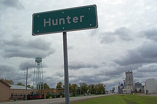
Hunter is a city in Cass County, North Dakota, United States. The population was 332 at the 2020 census. Hunter was founded in 1881.

<span class="mw-page-title-main">Hazen, North Dakota</span> City in North Dakota, United States

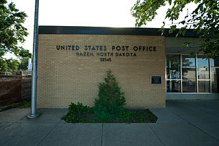
Hazen is a city in Mercer County, North Dakota, United States. The population was 2,281 at the 2020 census. Hazen was founded in 1913. Hazen has a K–12 school system.

<span class="mw-page-title-main">Lakota, North Dakota</span> City in North Dakota, United States

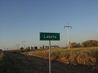
Lakota is a city in Nelson County, North Dakota, United States. It is the county seat of Nelson County Lakota is located 63 miles west of Grand Forks and 27 miles east of Devils Lake. The population was 683 at the 2020 census, making Lakota the 76th-largest city in North Dakota.

<span class="mw-page-title-main">Forman, North Dakota</span> City in North Dakota, United States

Forman is a city in and the county seat of Sargent County, North Dakota, United States. The population was 509 at the 2020 census. Forman was founded in 1883.

<span class="mw-page-title-main">Springfield, South Dakota</span> City in South Dakota, United States

Springfield is a city in Bon Homme County, South Dakota, United States. The population was 1,914 at the 2020 census. As of 2012, about 1,200 of the residents were inmates at Mike Durfee State Prison.

<span class="mw-page-title-main">Willow Lake, South Dakota</span> City in South Dakota, United States

Willow Lake is a city in Clark County, South Dakota, United States. The population was 255 at the 2020 census.

<span class="mw-page-title-main">Clear Lake, South Dakota</span> City in South Dakota, United States

Clear Lake is a city in and the county seat of Deuel County, South Dakota, United States. The population was 1,218 at the 2020 census.

<span class="mw-page-title-main">Big Stone City, South Dakota</span> City in South Dakota, United States

Big Stone City is a city in the northeastern corner of Grant County, South Dakota, United States, that lies between the southern tip of Big Stone Lake and the northern bank of the Whetstone River, and is adjacent to the city of Ortonville, Minnesota. The population was 412 at the 2020 census.

<span class="mw-page-title-main">Parkston, South Dakota</span> City in South Dakota, United States

Parkston is a city in Hutchinson County, South Dakota, United States. The population was 1,567 at the 2020 census.

<span class="mw-page-title-main">Lake Preston, South Dakota</span> City in South Dakota, United States

Lake Preston is a city in Kingsbury County, South Dakota, United States. The population was 599 at the 2010 census.

<span class="mw-page-title-main">Madison, South Dakota</span> City in South Dakota, United States

Madison is a city in Lake County, South Dakota, United States. The population was 6,191 at the 2020 census. It is the county seat of Lake County and is home to Dakota State University.

<span class="mw-page-title-main">Nunda, South Dakota</span> Town in South Dakota, United States

Nunda is a village in Lake County, South Dakota, United States. The population was 46 at the 2020 census. Located there are a post office, grainery, bar and grill, and an American Legion post.

<span class="mw-page-title-main">Lake City, South Dakota</span> Town in South Dakota, United States

Lake City is a town in Marshall County, South Dakota, United States. The population was 45 at the 2020 census. Fort Sisseton Historic State Park, whose fort is listed on the National Register of Historic Places, is located nearby.

<span class="mw-page-title-main">Sisseton, South Dakota</span> City in South Dakota, United States

Sisseton is a city in Roberts County, South Dakota, United States. The population was 2,479 at the 2020 census. It is the county seat of Roberts County. Sisseton is the home to a number of tourist attractions, including the Nicollet Tower, and is near the "Song to the Great Spirit" building on the Sisseton Wahpeton College campus. The city is named for the Sisseton division of the Native American Sioux. It also serves as an important part of the Lake Traverse Indian Reservation.

<span class="mw-page-title-main">Arlington, South Dakota</span> City in South Dakota, United States

Arlington is a city in Brookings and Kingsbury counties in the State of South Dakota. The population was 915 at the 2020 census.

References

  1. "SD Towns" (PDF). South Dakota State Historical Society. Archived from the original (PDF) on 2010-02-10. Retrieved 2010-02-14.
  2. "ArcGIS REST Services Directory". United States Census Bureau. Retrieved October 15, 2022.
  3. 1 2 "Census Population API". United States Census Bureau. Retrieved Oct 15, 2022.
  4. 1 2 "U.S. Census website". United States Census Bureau . Retrieved 2008-01-31.
  5. "US Board on Geographic Names". United States Geological Survey. 2007-10-25. Retrieved 2008-01-31.
  6. "U.S. Census Bureau: Lake Norden city, South Dakota". www.census.gov. United States Census Bureau. Retrieved 27 June 2022.
  7. Federal Writers' Project (1940). South Dakota place-names, v.1-3. University of South Dakota. p. 47.
  8. Parkin, Sarah (2023-05-03). "Fire destroys Lake Norden fire department and emergency vehicles". https://www.dakotanewsnow.com . Retrieved 2023-05-05.{{cite web}}: External link in |website= (help)
  9. "US Gazetteer files: 2010, 2000, and 1990". United States Census Bureau. 2011-02-12. Retrieved 2011-04-23.
  10. "US Gazetteer files 2010". United States Census Bureau. Archived from the original on 2012-07-02. Retrieved 2012-06-21.
  11. "Census of Population and Housing". Census.gov. Retrieved June 4, 2015.
  12. "U.S. Census website". United States Census Bureau . Retrieved 2012-06-21.