Rolland Colony is a Hutterite colony and census-designated place (CDP) in Brookings County, South Dakota, United States. It was first listed as a CDP prior to the 2020 census. The population of the CDP was 53 at the 2020 census.
Hutterville Colony is a Hutterite colony and census-designated place (CDP) in Brown County, South Dakota, United States. It was first listed as a CDP prior to the 2020 census. The CDP had a population of 95 at the 2020 census.
Clearfield Colony is a Hutterite colony and census-designated place (CDP) within the Yankton Indian Reservation in Charles Mix County, South Dakota, United States. It was first listed as a CDP prior to the 2020 census. The population of the CDP was 99 at the 2020 census.
Mayfield Colony is a Hutterite colony and census-designated place (CDP) in Clark County, South Dakota, United States. The population was 146 at the 2020 census. It was first listed as a CDP prior to the 2020 census.
Deerfield Colony is a Hutterite colony and census-designated place (CDP) in Edmunds County, South Dakota, United States. It was first listed as a CDP prior to the 2020 census. The population of the CDP was 128 at the 2020 census.
Blumengard Colony is a Hutterite colony and census-designated place (CDP) in Faulk County, South Dakota, United States. The population was 0 at the 2020 census. It was first listed as a CDP prior to the 2020 census.
Brentwood Colony is a Hutterite colony and census-designated place (CDP) in Faulk County, South Dakota, United States. The population was 116 at the 2020 census. It was first listed as a CDP prior to the 2020 census.
Evergreen Colony is a Hutterite colony and census-designated place (CDP) in Faulk County, South Dakota, United States. The population was 111 at the 2020 census. It was first listed as a CDP prior to the 2020 census.
Thunderbird Colony is a Hutterite colony and census-designated place (CDP) in Faulk County, South Dakota, United States. The population was 7 at the 2020 census. It was first listed as a CDP prior to the 2020 census.
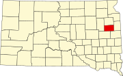
Claremont Colony is a Hutterite colony and census-designated place (CDP) in Hamlin County, South Dakota, United States. The population was 68 at the 2020 census. It was first listed as a CDP prior to the 2020 census.
Newport Colony is a Hutterite colony and census-designated place (CDP) in Marshall County, South Dakota, United States. The population was 114 at the 2020 census. It was first listed as a CDP prior to the 2020 census.
Westwood Colony is a Hutterite colony and census-designated place (CDP) in Marshall County, South Dakota, United States. The population was 8 at the 2020 census. It was first listed as a CDP prior to the 2020 census.
Grassland Colony is a census-designated place (CDP) and Hutterite colony in McPherson County, South Dakota, United States. It was first listed as a CDP prior to the 2020 census. The population of the CDP was 127 at the 2020 census.
Long Lake Colony is a census-designated place (CDP) and Hutterite colony in McPherson County, South Dakota, United States. It was first listed as a CDP prior to the 2020 census. The population of the CDP was 8 at the 2020 census.
Shannon Colony is a census-designated place (CDP) and Hutterite colony in Miner County, South Dakota, United States. It was first listed as a CDP prior to the 2020 census. The population of the CDP was 1 at the 2020 census.
White Rock Colony is a census-designated place (CDP) and Hutterite colony in Roberts County, South Dakota, United States, partly within the Lake Traverse Indian Reservation. It was first listed as a CDP prior to the 2020 census. The population of the CDP was 0 at the 2020 census.
Camrose Colony is a census-designated place (CDP) and Hutterite colony in Spink County, South Dakota, United States. It was first listed as a CDP prior to the 2020 census. The CDP had a population of 76 at the 2020 census.
Clark Colony is a census-designated place (CDP) and Hutterite colony in Spink County, South Dakota, United States. It was first listed as a CDP prior to the 2020 census. The population of the CDP was 92 at the 2020 census.
Glendale Colony is a census-designated place (CDP) and Hutterite colony in Spink County, South Dakota, United States. It was first listed as a CDP prior to the 2020 census. The population of the CDP was 176 at the 2020 census.
Spink Colony is a census-designated place (CDP) and Hutterite colony in Spink County, South Dakota, United States. It was first listed as a CDP before the 2020 census. The population of the CDP was 135 at the 2020 Census.