Related Research Articles

Sac County is a county located in the U.S. state of Iowa. As of the 2010 census, the population was 10,350. The county seat is Sac City. Both were named for the Sauk people, a local American Indian tribe.

O'Brien County is a county in the U.S. state of Iowa. As of the 2010 United States Census, the population was 14,398. The county seat is Primghar.

Ida County is a county located in the U.S. state of Iowa. As of the 2010 census, the population was 7,089. The county seat is Ida Grove. The county was authorized by the Iowa Legislature in January 1851 as a packet of projected counties in unorganized territory of western Iowa. It was named after Ida Smith, the first child of European immigrants to be born in this region.

Crawford County is a county located in the U.S. state of Iowa. As of the 2010 census, the population was 17,096. Its county seat is Denison. The county was named for William Harris Crawford, U.S. senator from Georgia and United States Secretary of the Treasury.

Mapleton is a city in Monona County, Iowa, United States. The population was 1,224 at the 2010 census.

Early is a city in Sac County, Iowa, United States. The population was 557 at the 2010 census.
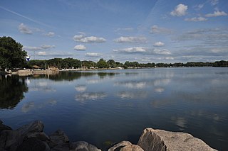
Lake View is a city in Sac County, Iowa, United States. The population was 1,142 in the 2010 census, a decline from the 1,278 population in 2000.

Sac City is a city in and the county seat of Sac County, Iowa, United States, located just southwest of the eastern intersection of U.S. Routes 20 and 71 in the rolling hills along the valley of the North Raccoon River. The city is one of 45 designated Main Street Iowa communities through the Main Street Iowa development program. The population was 2,220 in the 2010 census, a decline from the 2,368 population in 2000.

Schaller is a city in Sac County, Iowa, United States. The population was 772 at the 2010 census.

Wall Lake is a city in Sac County, Iowa, United States. The population was 819 at the 2010 census.
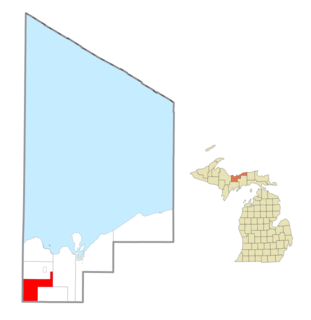
Limestone Township is a civil township of Alger County in the U.S. state of Michigan. The population was 438 at the 2010 census.
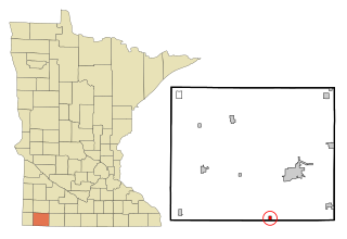
Bigelow is a city in Nobles County, Minnesota, United States. The population was 235 at the 2010 census.
Newton Township is one of sixteen townships in Buchanan County, Iowa, USA. As of the 2000 census, its population was 423.

Watkins is an unincorporated community and census-designated place in southeastern Benton County, Iowa, United States. As of the 2010 census, it had a population of 118. Watkins lies along local roads south of the city of Vinton, the county seat of Benton County. Its elevation is 830 feet (250 m) above sea level. Although Watkins is unincorporated, it has a post office, with the ZIP code of 52354, which opened on 15 December 1873.
Herring is a ghost town in Sac County, in the U.S. state of Iowa.
Boyer Valley Township is a township in Sac County, Iowa, United States. Early is contained within Boyer Valley Township.
Clinton Township is a township in Sac County, Iowa, USA.
Delaware Township is a township in Sac County, Iowa, United States. Nemaha is contained within Delaware Township.
Douglas Township is a township in Sac County, Iowa, USA.
Eureka Township is a township in Sac County, Iowa, United States. Schaller, Iowa is contained within Eureka Township.
References
- 1 2 U.S. Geological Survey Geographic Names Information System: Levey Township, Sac County, Iowa
- 1 2 Bureau, U. S. Census. "U.S. Census website". United States Census Bureau . Retrieved February 25, 2020.
- 1 2 Hart, William (1914). History of Sac County, Iowa. Indianapolis, Indiana: B. F. Bowen & Co. pp. 243–244.
- ↑ "Levey Township, Sac County, Iowa". data.census.gov. Retrieved February 25, 2020.
- ↑ Chicago and North Western Railway Company, The (1908). A History of the Origin of the Place Names Connected with the Chicago & North Western and Chicago, St. Paul, Minneapolis & Omaha Railways.
- ↑ "GNIS Detail - Herring (historical)". geonames.usgs.gov. Retrieved February 25, 2020.
- ↑ "McCloy (historical) (in Sac County, IA)". iowa.hometownlocator.com. Retrieved February 25, 2020.
- ↑ "GreatSchools: See what school district you are in or moving to using our interactive map". See What School District You Are In. Retrieved February 25, 2020.
Municipalities and communities of Sac County, Iowa, United States | ||
|---|---|---|
| Cities |  | |
| Townships | ||
| Unincorporated community | ||
| Ghost town | ||
| Footnotes | ‡This populated place also has portions in an adjacent county or counties | |
Coordinates: 42°15′14″N95°08′55″W / 42.25389°N 95.14861°W
| | This article about the geography of Sac County, Iowa is a stub. You can help Wikipedia by expanding it. |