Licton Springs, Seattle

Last updated
Licton Springs, Seattle
Licton Springs Park 03.jpg
Licton Springs Park
Seattle Map - Licton Springs.png
Licton Springs Highlighted in Pink
Coordinates: 47°41′55″N122°20′19″W / 47.69861°N 122.33861°W / 47.69861; -122.33861
CountryUnited States
State Washington
County King
City Seattle
Time zone UTC−8 (PST)
  Summer (DST) UTC−7 (PDT)
Zip Code
98103
Area Code 206

Licton Springs or North College Park is a neighborhood in the informal Northgate district of North Seattle. It is bounded by Interstate 5 to the east, beyond which is Maple Leaf neighborhood and the Northgate Mall; Aurora Avenue N (SR 99) to the west, beyond which is Greenwood; N 85th Street to the south, beyond which is Green Lake, and N Northgate Way to the north, beyond which is Haller Lake. [1]

Contents

Licton Springs

Licton Springs, the natural iron spring Licton-springs-1.jpg
Licton Springs, the natural iron spring

Licton Springs is both a residential neighborhood and a natural spring at the north end of Licton Springs Park, which has a long history as both a unique recreational spot and a commercial crossroads. The neighborhood, wedged between the busy corridors of Interstate 5 and Aurora Avenue, takes its name from líq’tәd (LEEK-teed) or Licton, the Lushootseed (Whulshootseed) Coast Salish word for the reddish mud of the springs. The Dkhw’Duw’Absh, People of the Inside and Xacuabš, People of the Large Lake, Lushootseed (Skagit-Nisqually) Coast Salish native people had used the springs area as a spiritual health spa since the area was populated after the last glacial period (c. 8,000 BCE10,000 years ago). In the 1850s, the Dkhw’Duw’Absh and Xacuabš became the Duwamish tribe of today.

In October 2019, the spring and the park that surrounds it were designated a city landmark, the first Native cultural site to be so designated. [2]

Settlement

Seattle pioneer David Denny built a summer cabin near the springs around 1870. The natural spring fed Green Lake before it was capped and drained to the Metro sewer system after it became contaminated by residential development (1920, 1931). The Olmsted Brothers designed a park for Licton Springs, as part of a grand streets and parks plan for Seattle (1930s), but this park was never implemented. A park does exist today (where Woodlawn Avenue curves to connect with N 95th Street) in which the spring is located. [3] In the mid-1960s restoration began with bond issues and increasing volunteer assistance, resulting in a small pond and natural wetland vegetation as well as urban park amenities. [4] A Native American presence continues in the neighborhood through the Indian Heritage School at Wilson-Pacific. This school hosts frequent Indian Pow Wows and spectacular wall murals by Indian artist Andrew Morrison.

Mosaic tile at Licton Springs Park, Seattle, Washington Licton Springs Playground.jpeg
Mosaic tile at Licton Springs Park, Seattle, Washington
Exotic waterfowl habitat at Pillings Pond Sunny Walter-Pillings Pond.jpg
Exotic waterfowl habitat at Pillings Pond

The Everett and Interurban Railway Company (1900–1936) [5] came past the neighborhood in 1906. The trolleys became a part of everyday life and development of residential neighborhoods around trolley stops. Running on a narrow right-of-way through backyards, the whistle became part of the atmosphere of neighborhoods like Licton Springs. In the early years, the line ran through cut forest and rural farms. A few sawmills along the way gave the line a business hauling lumber. The rough wagon road became Aurora Avenue N (1930) after being paved with brick (1913) and asphalt (1928). A most distinctive early feature was the motorist "tourist camps", "auto camps", and later, "auto courts", then the now-familiar motels. One or two still remained at the turn of the 21st century.

The Pilling family had a dairy farm (1909–1933), out of which grew the waterfowl habitat and birding site of Pilling's Pond today. [6] Japanese-Americans had greenhouses and small farms until they were abruptly forcibly removed with the Internment of Japanese Americans (1942–1945).

North College Park

Seattle annexed most of North Seattle in 1954. [7] North College Park became defined with the Licton Springs neighborhood with the establishment of North Seattle College (1970). [8]

Facing NW. Soon after 2006 renovation Licton Springs Park, Seattle, facing NW.jpg
Facing NW. Soon after 2006 renovation

Licton Springs and the Sunny WalterPillings Pond are part of the Densmore Drainage Basin. The springs at the North Police Precinct and North Seattle Community College are headwaters of the south fork of Thornton Creek; this fork flows through culverts under I-5 and the south lot of Northgate Mall development. [6] [9] These neighborhoods are natural extensions of Maple Leaf downstream. [10] Neighborhood activists and North Seattle Community College (NSCC) have been promoting habitat restoration in support. [9] [10] [11] NSCC grounds have a nationally-recognized native habitat, a pentimento of restored native species on a palimpsest of former 1940s suburb, former dairy farm, former bog where native Dkhw’Duw’Absh harvested cranberries. [12]

See also

Related Research Articles

<span class="mw-page-title-main">University District, Seattle</span> Seattle Neighborhood

The University District is a major district in Seattle, Washington, comprising several distinct neighborhoods. The main campus of the University of Washington (UW) is located in the district, lending its name to both the district as well as University Way NE.

<span class="mw-page-title-main">Union Bay (Seattle)</span> Bay of Lake Washington in Seattle

Union Bay is a body of water located in Seattle, Washington. Part of Lake Washington, it is bounded by the Laurelhurst neighborhood to the north and the Montlake and Madison Park neighborhoods to the south. The Evergreen Point Floating Bridge, which carries State Route 520, crosses over a portion of the bay.

<span class="mw-page-title-main">Roosevelt, Seattle</span> Neighborhood in King, Washington, United States

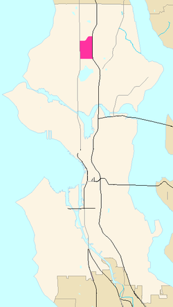
Roosevelt is a neighborhood in north Seattle, Washington. Its main thoroughfare, originally 10th Avenue, was renamed Roosevelt Way upon Theodore Roosevelt's death in 1919. The neighborhood received the name as the result of a Community Club contest held eight years later, in 1927.

<span class="mw-page-title-main">Thornton Creek</span> Creek in North Seattle that empties into Lake Washington

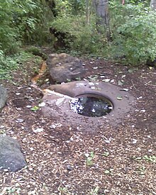
Thornton Creek is 18 miles (29 km) of urban creeks and tributaries from southeast Shoreline through northeast Seattle to Lake Washington. Its 12-square-mile (31 km2) watershed, the largest in Seattle, exhibits relatively dense biodiversity for an urban setting; it is home to frogs, newts, ducks, herons, and beavers, in addition to more than 75,000 people. From west of Jackson Park Golf Course in Shoreline, from Sunny Walter-Pillings Pond in Licton Springs–North College Park, and north Northgate Thornton Creek flows through Maple Leaf and Lake City, including the Victory Heights, Meadowbrook, and Matthews Beach neighborhoods, and empties into the lake at Matthews Beach Park.

<span class="mw-page-title-main">North Seattle College</span>

North Seattle College is a public college in Seattle, Washington. It is one of three colleges comprising the Seattle Colleges District and part of the Washington Community and Technical Colleges system.

<span class="mw-page-title-main">Seward Park, Seattle</span> Seattle Neighborhood

Seward Park is a neighborhood in southeast Seattle, Washington just west of the park of the same name. It is part of Seattle's South End. The park occupies all of Bailey Peninsula.

<span class="mw-page-title-main">Northgate, Seattle</span> Seattle Neighborhood in King, Washington, United States

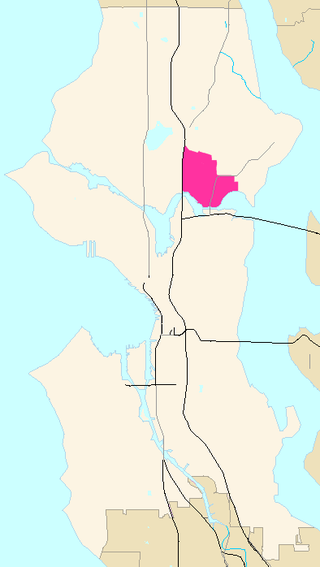
Northgate is a neighborhood in north Seattle, Washington, named for and surrounding Northgate Mall, the first covered mall in the United States. Its north-south principal arterials are Roosevelt Way NE and Aurora Avenue N, and its east-west principal arterials are NE Northgate Way and 130th Street. Minor arterials are College Way-Meridian Avenue N, 1st, 5th, and 15th avenues NE. Interstate 5 runs through the district. Besides the eponymous mall, the most characteristic distinctions of the area are North Seattle College (NSC) and the south fork of the Thornton Creek watershed and Seattle Kraken Iceplex center.

<span class="mw-page-title-main">Magnuson Park</span> Park in Seattle, Washington, U.S.

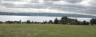
Magnuson Park is a park in the Sand Point neighborhood of Seattle, Washington, United States. At 350 acres (140 ha) it is the second-largest park in Seattle, after Discovery Park in Magnolia. Magnuson Park is located at the site of the former Naval Station Puget Sound, on the Sand Point peninsula with Pontiac and Wolf bays that juts into Lake Washington in northeast Seattle.

<span class="mw-page-title-main">University Village, Seattle</span> Shopping mall in Washington, U.S.

University Village is a shopping mall in Seattle, Washington, United States, located in the south corner of the Ravenna neighborhood to the north of the Downtown area. It is an open-air shopping center which offers restaurants, locally owned boutiques, and national retailers, and is a popular retail destination in the region for home furnishings, popular fashions, gift items, and restaurants.

<span class="mw-page-title-main">Industrial District, Seattle</span> Seattle Neighborhood in King, Washington, United States

The Industrial District is the principal industrial area of Seattle, Washington. It is bounded on the west by the Duwamish River and Elliott Bay, beyond which lies Delridge of West Seattle; on the east by Interstate 5, beyond which lies Beacon Hill; on the north by S King and S Dearborn Streets, beyond which lie Pioneer Square and southwest International District of Downtown; and on the south by the main lines of the BNSF Railway and Union Pacific Railroad, or about S Lucille Street, beyond which is Georgetown. SoDo is the name of the northwest portion of the neighborhood, named for its being South of Downtown. SoDo is the location of T-Mobile Park, home of the Seattle Mariners, and Lumen Field, home of the Seattle Seahawks and Seattle Sounders FC. Lumen Field was also the site of the former Kingdome.

<span class="mw-page-title-main">Ravenna, Seattle</span> Seattle neighborhood

Ravenna is a neighborhood in northeastern Seattle, Washington named after Ravenna, Italy. Though Ravenna is considered a residential neighborhood, it also is home to several businesses, many of which are located in the University Village, a shopping mall.

<span class="mw-page-title-main">Lake City, Seattle</span> Seattle Neighborhood in King, Washington, United States

Lake City is the northeast region of Seattle, centered along Lake City Way NE (SR-522), 7–8 miles (11–13 km) northeast of Downtown Seattle. A broader definition of the Lake City area includes all the land between 15th Avenue NE and Lake Washington, and between NE 95th and 98th streets to the Seattle city limits at NE 145th Street. Lake City encompasses much of the Thornton Creek watershed, the focus of a long restoration campaign by citizens and Seattle Public Utilities staff to enhance the residential environment of Lake City.

<span class="mw-page-title-main">Delridge, Seattle</span>

Delridge is a district in Seattle, Washington, United States that stretches along Delridge Way, an arterial that follows the eastern slope of the valley of Longfellow Creek, from near its source just within the southern city limits north to the West Seattle Bridge over the Duwamish River. It is generally associated with the neighborhing district of West Seattle, or even considered a sub-district of West Seattle.

<span class="mw-page-title-main">Matthews Beach, Seattle</span> Seattle Neighborhood in King, Washington, United States

Matthews Beach is a neighborhood in Seattle, Washington; it and Meadowbrook are the southern neighborhoods of the annexed township of Lake City (1954). Matthews Beach lies about 2 miles (3.2 km) northeast of the University of Washington, about 8 miles (13 km) northeast of Downtown.

<span class="mw-page-title-main">Rainier Beach, Seattle</span> Neighborhood in Seattle, Washington, U.S.

Rainier Beach is a set of neighborhoods in Seattle, Washington that are mostly residential. Also called Atlantic City, Rainier Beach can include Dunlap, Pritchard Island, and Rainier View neighborhoods.

<span class="mw-page-title-main">Northgate Station (shopping mall)</span> Shopping mall

Northgate Station is an enclosed shopping mall in Seattle, Washington, United States. It is located in the Northgate neighborhood on Interstate 5, adjacent to Northgate Way and Northgate station, a light rail station. The mall is anchored by Barnes & Noble, and Nordstrom Rack.

<span class="mw-page-title-main">Meadowbrook, Seattle</span> Seattle Neighborhood in King, Washington, United States

Meadowbrook is a neighborhood in the Lake City district of Seattle, Washington. Meadowbrook is centered on open fields adjacent to the Community Center, Meadowbrook swimming pool, and Nathan Hale High School. It is bounded on the south by NE 95th Street and the Wedgwood neighborhood, on the north by NE 120th Street and Cedar Park, on the west by Lake City Way NE and Victory Heights, and on the east by 35th Avenue NE and Matthews Beach.

In the history of Seattle before white settlement, thirteen prominent villages existed in what is now the city of Seattle. The people living near Elliott Bay, and along the Duwamish, Black and Cedar Rivers were collectively known as the doo-AHBSH, or People of the Doo ("Inside"). Four prominent villages existed near what is now Elliott Bay and the (then-estuarial) lower Duwamish River. Before civil engineers rechanneled the Duwamish, the area had extensive tidelands, and had an abundance of seafoods.

The Duwamish tribe is a Native American tribe in western Washington, and the indigenous people of metropolitan Seattle. The Duwamish tribe today includes the People of the Inside (Dxw'Dəw?Abš), for Elliott Bay environs today; and the People of the Large Lake (Xacuabš), for those around Lake Washington of today.

References

  1. (1) "North College Park". Seattle City Clerk's Neighborhood Map Atlas. Office of the Seattle City Clerk. Archived from the original on 2006-05-05. Retrieved 2006-04-21.
    "NN-1030S", "NN-1040S".jpg dated 17 June 2002.
    (2) "Northgate". Seattle City Clerk's Neighborhood Map Atlas. Office of the Seattle City Clerk. Retrieved 2006-04-21.
    (3) "About the Seattle City Clerk's On-line Information Services". Information Services. Seattle City Clerk's Office. 2006-04-30. Retrieved 2006-05-21.
    See heading, "Note about limitations of these data".
  2. Ishisaka, Naomi (November 4, 2019). "Hidden spring in Seattle park wins landmark designation after hard-fought effort". The Seattle Times. Retrieved November 4, 2019.
  3. Licton Springs Park Licton Springs Park Homepage
  4. Sheridan & Tobin, Wilma, ed.
  5. Then variously the Seattle-Everett Traction Company and the Pacific Northwest Traction Company.
  6. 1 2 Walter & local Audubon chapters
  7. (1) Phelps, pp. 220-224.
    (2) Sheridan & Tobin
  8. "About NSCC". North Seattle Community College. n.d. Archived from the original on 2006-04-10. Retrieved 2006-04-21.
  9. 1 2 Bowditch, Wang, & Wilson
  10. 1 2 Brokaw
  11. (1) Hodson
    (2) "Restoration Activities: A Few of Our Accomplishments". Thornton Creek Alliance, Seattle Community Network. n.d. Retrieved 2006-04-21.
  12. Dolan & True, pp. 2427.

Bibliography