Luther, Iowa

Last updated
Luther, Iowa
Boone County Iowa Incorporated and Unincorporated areas Luther Highlighted.svg
Location of Luther, Iowa
Coordinates: 41°58′2″N93°49′7″W / 41.96722°N 93.81861°W / 41.96722; -93.81861 Coordinates: 41°58′2″N93°49′7″W / 41.96722°N 93.81861°W / 41.96722; -93.81861
Country Flag of the United States.svg  United States
State Flag of Iowa.svg  Iowa
County Boone
Township Worth
Government
  TypeMayor-Council
  City Hall5 Luther Street
  Phone515-517-0023
Area
[1]
  Total0.59 sq mi (1.52 km2)
  Land0.59 sq mi (1.52 km2)
  Water0.00 sq mi (0.00 km2)
Elevation
1,093 ft (333 m)
Population
 (2020)
  Total152
  Density258.50/sq mi (99.87/km2)
Time zone UTC-6 (Central (CST))
  Summer (DST) UTC-5 (CDT)
ZIP code
50152
Area code 515
FIPS code 19-47280
GNIS feature ID0458684
Websitewww.cityofluther.org

Luther is a city in Worth Township, Boone County, Iowa, United States. The population was 152 at the time of the 2020 census. [2] It is part of the Boone, Iowa Micropolitan Statistical Area, which is a part of the larger Ames-Boone, Iowa Combined Statistical Area.

Contents

History

A post office has been in operation at Luther since 1883. [3] Luther was laid out as a town in 1893. [4] The community was named after Clark Luther, a local merchant. [5]

On September 11, 2014, the Luther City Council accepted a petition from 58 residents asking that the city be discontinued. There are several steps in the discontinuation process, including approval or disapproval of the petition by the City Development Board. If the Board approves, a public referendum on discontinuation could be held in 2015. [6] [7] [8] The discontinuance failed and the city continues to exist today. Since 2015 several new businesses have sprung up as well as a major expansion by the local co-op.

Geography

Luther is located at 41°58′2″N93°49′7″W / 41.96722°N 93.81861°W / 41.96722; -93.81861 (41.967125, -93.818747). [9]

According to the United States Census Bureau, the city has a total area of 0.78 square miles (2.02 km2), all land. [10]

Demographics

Historical populations
YearPop.±%
1910 130    
1920 145+11.5%
1930 137−5.5%
1940 145+5.8%
1950 131−9.7%
1960 147+12.2%
1970 189+28.6%
1980 155−18.0%
1990 154−0.6%
2000 158+2.6%
2010 122−22.8%
2020 152+24.6%
Source: "U.S. Census website". United States Census Bureau . Retrieved 2020-03-28. and Iowa Data Center
Source:
U.S. Decennial Census [11] [2]

2010 census

As of the census [12] of 2010, there were 122 people, 54 households, and 40 families living in the city. The population density was 156.4 inhabitants per square mile (60.4/km2). There were 59 housing units at an average density of 75.6 per square mile (29.2/km2). The racial makeup of the city was 98.4% White, 0.8% African American, and 0.8% Asian. Hispanic or Latino of any race were 1.6% of the population.

There were 54 households, of which 20.4% had children under the age of 18 living with them, 66.7% were married couples living together, 3.7% had a female householder with no husband present, 3.7% had a male householder with no wife present, and 25.9% were non-families. 22.2% of all households were made up of individuals, and 9.3% had someone living alone who was 65 years of age or older. The average household size was 2.26 and the average family size was 2.63.

The median age in the city was 47.5 years. 16.4% of residents were under the age of 18; 3.3% were between the ages of 18 and 24; 24.6% were from 25 to 44; 38.6% were from 45 to 64; and 17.2% were 65 years of age or older. The gender makeup of the city was 53.3% male and 46.7% female.

2000 census

As of the census [13] of 2000, there were 158 people, 55 households, and 47 families living in the city. The population density was 204.1 inhabitants per square mile (78.8/km2). There were 59 housing units at an average density of 76.2 per square mile (29.4/km2). The racial makeup of the city was 99.37% White and 0.63% Asian.

There were 55 households, out of which 38.2% had children under the age of 18 living with them, 78.2% were married couples living together, 7.3% had a female householder with no husband present, and 14.5% were non-families. 12.7% of all households were made up of individuals, and 3.6% had someone living alone who was 65 years of age or older. The average household size was 2.87 and the average family size was 3.15.

In the city, the population was spread out, with 27.8% under the age of 18, 6.3% from 18 to 24, 32.3% from 25 to 44, 20.9% from 45 to 64, and 12.7% who were 65 years of age or older. The median age was 38 years. For every 100 females, there were 100.0 males. For every 100 females age 18 and over, there were 100.0 males.

The median income for a household in the city was $41,964, and the median income for a family was $41,786. Males had a median income of $29,250 versus $27,083 for females. The per capita income for the city was $14,393. About 11.9% of families and 13.3% of the population were below the poverty line, including 26.3% of those under the age of eighteen and 23.8% of those 65 or over.

Transportation

The community is located on Iowa Highway 17, and is southwest of Ames.

Luther was formerly served by a branch of the Chicago, Milwaukee, St. Paul & Pacific Railroad which ran from Madrid to Boone. The line was trimmed back from Boone to Luther in the 1960s. Sporadic freight service continued to serve the grain elevator in Luther until the line was totally removed in the late 1960s.

Related Research Articles

<span class="mw-page-title-main">Unionville, Iowa</span> City in Iowa, United States

Unionville is a city in Appanoose County, Iowa, United States. The population was 75 at the time of the 2020 census. It has a post office which is open two hours per day Monday through Saturday.

<span class="mw-page-title-main">Beaver, Iowa</span> City in Iowa, United States

Beaver is a city in Amaqua Township, Boone County, Iowa, United States. The population was 46 at the 2020 census. It is part of the 'Boone, Iowa Micropolitan Statistical Area', which is a part of the larger Ames-Boone, Iowa Combined Statistical Area.

<span class="mw-page-title-main">Berkley, Iowa</span> City in Iowa, United States

Berkley is a city in Union Township, Boone County, Iowa, United States. The population was 23 at the 2020 census, down 4.2% from 24 in 2000.

<span class="mw-page-title-main">Boxholm, Iowa</span> City in Iowa, United States

Boxholm is a city in Grant Township, Boone County, Iowa, United States. The population was 181 at the 2020 census. It is part of the Boone, Iowa Micropolitan Statistical Area, which is a part of the larger Ames-Boone, Iowa Combined Statistical Area.

<span class="mw-page-title-main">Fraser, Iowa</span> City in Iowa, United States

Fraser is a city in Dodge Township, Boone County, Iowa. The population was 101 at the time of the 2020 census. It is part of the Boone, Iowa Micropolitan Statistical Area, which is a part of the larger Ames–Boone Combined Statistical Area. The city is located along the Des Moines River.

<span class="mw-page-title-main">Madrid, Iowa</span> City in Iowa, United States

Madrid is a city in Douglas Township, Boone County, Iowa, United States. The population was 2,802 at the time of the 2020 census. It is part of the Boone, Iowa Micropolitan Statistical Area, which is a part of the larger Ames-Boone, Iowa Combined Statistical Area.

<span class="mw-page-title-main">Ogden, Iowa</span> City in Iowa, United States

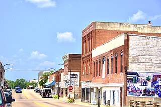
Ogden is a city in Yell Township, Boone County, Iowa, United States. The population was 2,007 at the time of the 2020 census, down 0.8% from 2,023 in 2000. It is part of the Boone, Iowa Micropolitan Statistical Area, which is a part of the larger Ames-Boone, Iowa Combined Statistical Area.

<span class="mw-page-title-main">Pilot Mound, Iowa</span> City in Iowa, United States

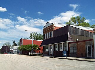
Pilot Mound is a city in Pilot Mound Township, Boone County, Iowa, United States. The population was 163 at the time of the 2020 census. It is part of the Boone, Iowa Micropolitan Statistical Area, which is a part of the larger Ames-Boone, Iowa Combined Statistical Area.

<span class="mw-page-title-main">Sheldahl, Iowa</span> City in Iowa, United States

Sheldahl is a city in Polk, Boone, and Story counties in the U.S. state of Iowa. The population was 297 at the time of the 2020 census.

<span class="mw-page-title-main">Granger, Iowa</span> City in Iowa, United States

Granger is a city in Dallas and Polk counties in the U.S. state of Iowa. The population was 1,654 at the time of the 2020 census, up 184% from 583 in 2000. It is part of the Des Moines–West Des Moines Metropolitan Statistical Area.

<span class="mw-page-title-main">Renwick, Iowa</span> City in Iowa, United States

Renwick is a city in Humboldt County, Iowa, United States. The population was 234 at the time of the 2020 census.

<span class="mw-page-title-main">Collins, Iowa</span> City in Iowa, United States

Collins is a city in Story County, Iowa, United States. The population was 495 at the 2020 census. It is part of the Ames, Iowa Metropolitan Statistical Area, which is a part of the larger Ames-Boone, Iowa Combined Statistical Area.

<span class="mw-page-title-main">Huxley, Iowa</span> City in Iowa, United States

Huxley is a city in Story County, Iowa, United States. The population was 4,244 at the time of the 2020 census. It is part of the Ames, Iowa Metropolitan Statistical Area, which is a part of the larger Ames-Boone, Iowa Combined Statistical Area.

<span class="mw-page-title-main">Kelley, Iowa</span> City in Iowa, United States

Kelley is a city in Story County, Iowa, United States. The population was 304 at the time of the 2020 census. It is part of the Ames, Iowa Metropolitan Statistical Area, which is a part of the larger Ames-Boone, Iowa Combined Statistical Area.

The Forks is a plantation in Somerset County, Maine, United States. The population was 48 at the 2020 census.

<span class="mw-page-title-main">Willow Springs, Missouri</span> City in Missouri, United States

Willow Springs is a city in Howell County, Missouri, in the Ozark Mountains of the United States. The population was 2,184 at the 2010 census.

<span class="mw-page-title-main">St. Edward, Nebraska</span> City in Nebraska, United States

St. Edward is a city in Boone County, Nebraska, United States. The population was 705 at the 2010 census.

<span class="mw-page-title-main">Gardner, North Dakota</span> City in North Dakota, United States

Gardner is a city in Cass County, North Dakota, United States. The population was 129 at the 2020 census.

<span class="mw-page-title-main">McEwensville, Pennsylvania</span> Borough in Pennsylvania, United States

McEwensville is a borough in Northumberland County, Pennsylvania, United States. The population was 314 at the 2000 census.

<span class="mw-page-title-main">Pennsboro, West Virginia</span> City in West Virginia, United States

Pennsboro is a city in Ritchie County, West Virginia, United States. The population was 1,050 at the 2020 census. The city is located at the junction of U.S. Route 50 and West Virginia Route 74; the North Bend Rail Trail also passes through the city.

References

  1. "2020 U.S. Gazetteer Files". United States Census Bureau. Retrieved March 16, 2022.
  2. 1 2 "2020 Census State Redistricting Data". census.gov. United states Census Bureau. Retrieved 12 August 2021.
  3. "Post Offices". Jim Forte Postal History. Retrieved 24 March 2018.
  4. Goldthwait, Nathan Edward (1914). History of Boone County, Iowa, Volume 1. Pioneer Publishing Company. p. 264.
  5. "County History". Boone County. Archived from the original on 12 June 2017. Retrieved 24 March 2018.
  6. Sager, Whitney (September 9, 2014). "Luther residents taking steps toward discontinuance of town". Boone News-Republican. Retrieved October 23, 2014.
  7. Sager, Whitney (September 13, 2014). "A potential solution to Luther's problems". Boone News-Republican. Retrieved October 23, 2014.
  8. Powell, Claire (September 23, 2014). "Luther Petitioning To Discontinue Town". WeAreIowa.com. Retrieved October 23, 2014.
  9. "US Gazetteer files: 2010, 2000, and 1990". United States Census Bureau. 2011-02-12. Retrieved 2011-04-23.
  10. "US Gazetteer files 2010". United States Census Bureau. Archived from the original on 2012-07-02. Retrieved 2012-05-11.
  11. "Census of Population and Housing". Census.gov. Retrieved June 4, 2015.
  12. "U.S. Census website". United States Census Bureau . Retrieved 2012-05-11.
  13. "U.S. Census website". United States Census Bureau . Retrieved 2008-01-31.