
Jordan is an unincorporated community in Boone County, Iowa, United States.
Dorchester is an unincorporated community in northwestern Allamakee County, Iowa, United States. It lies along local roads just off Iowa Highway 76, north of the city of Waukon, the county seat of Allamakee County. Its elevation is 738 feet (225 m). The town was originally settled by Harvey Bell and Edmund Bell, and was named after Dorchester, England. Although Dorchester is unincorporated, it has a post office, with the ZIP code of 52140, which opened on 21 May 1857. Dorchester is located in Waterloo Township.
Sperry is an unincorporated community in central Des Moines County, Iowa, United States. It lies along local roads north of the city of Burlington, the county seat of Des Moines County. Its elevation is 751 feet (229 m). Although Sperry is unincorporated, it has a post office with the ZIP code of 52650, which opened on 5 February 1870.
Killduff is an unincorporated community in southeastern Jasper County, Iowa, United States. It lies along local roads southeast of the city of Newton, the county seat of Jasper County.
Conroy is an unincorporated community and census-designated place (CDP) in central Iowa County, Iowa, United States. It lies along local roads southeast of the city of Marengo, the county seat of Iowa County. Its elevation is 879 feet (268 m). Conroy has a post office with the ZIP code of 52220, which opened on 5 January 1885. As of the 2010 census the population was 259.

Austinville is an unincorporated community in southwestern Butler County, Iowa, United States. It lies along Iowa Highway 57 southwest of the city of Allison, the county seat of Butler County. Its elevation is 1,001 feet (305 m). Although Austinville is unincorporated, it has a post office with the ZIP code of 50608, which opened on 3 October 1892.
Teeds Grove is an unincorporated community in northeastern Clinton County, Iowa, United States. It lies at the intersection of Clinton County Routes E44 and Z50, north of the city of Clinton, the county seat of Clinton County. Its elevation is 692 feet (211 m).
Pilot Grove is an unincorporated community in northern Lee County, Iowa, United States. It lies along local roads northwest of the city of Fort Madison, the county seat of Lee County. Its elevation is 643 feet (196 m).
Giard is an unincorporated community in Clayton County, Iowa, United States. Its elevation is 1,122 feet (342 m), and it is located at 43°0′20″N91°17′21″W. A post office was established in the community on September 28, 1854; after being disestablished, it was restored on August 7, 1914, and operated until January 15, 1925, except for a short hiatus at the end of 1918.
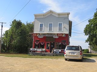
Froelich is an unincorporated community in Clayton County, Iowa, United States.
Carnforth is an unincorporated community in Poweshiek County, in the U.S. state of Iowa.
Crocker is an unincorporated community in Polk County, in the U.S. state of Iowa.
Lawn Hill is an unincorporated community in Hardin County, in the U.S. state of Iowa.
Malone is an unincorporated community in Clinton County, in the U.S. state of Iowa.
Maple River is an unincorporated community in Carroll County, in the U.S. state of Iowa.
Petersville is an unincorporated community in Clinton County, in the U.S. state of Iowa.
Tioga is an unincorporated community in Mahaska County, in the U.S. state of Iowa.
Wright is an unincorporated community in Mahaska County, in the U.S. state of Iowa.
Boyd is an unincorporated community in southeastern New Hampton Township in Chickasaw County, in the U.S. state of Iowa.
Canby is an unincorporated community in Adair County, in the U.S. state of Iowa.

