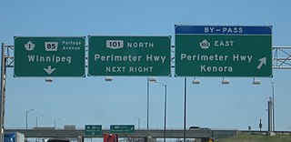
Provincial Trunk Highways (PTH) 100 and 101, collectively known as the Perimeter Highway, form a beltway around the Canadian city of Winnipeg, Manitoba. The Perimeter Highway is approximately 90 kilometres (56 mi) in length and serves as a ring road around Winnipeg for through traffic. It is often considered by local residents to be the city's unofficial boundary, although approximately three-quarters of the Perimeter Highway actually lies in the other municipalities within the Winnipeg Metropolitan Region.
Provincial Trunk Highway 1 is Manitoba's section of the Trans-Canada Highway. It is a heavily used, 4-lane divided highway, with the exception of a short 18 km section in the southeastern corner of the province. It is the main link between southern Manitoba's largest cities, and also serves as the province's main transportation link to the neighbouring provinces of Saskatchewan and Ontario. The highway is the only major east-west divided highway in Manitoba, and carries a large majority of east-west traffic within and through the province. It has full freeway status sections at Portage la Prairie and Winnipeg. The total distance of the Trans-Canada Highway in Manitoba is approximately 490 km (300 mi).
Provincial Trunk Highway 59 is a major provincial highway in the Canadian province of Manitoba. It runs from the Lancaster-Tolstoi Border Crossing, through the city of Winnipeg, north to 8th Avenue in Victoria Beach on Lake Winnipeg.
Provincial Trunk Highway 75 is a major highway in the Canadian province of Manitoba. It is the main link between the city of Winnipeg and the United States border, where it connects with Interstate 29/U.S. Route 81.
Provincial Trunk Highway 6 is a provincial primary highway located in the Canadian province of Manitoba. It runs from the Perimeter Highway of Winnipeg to the Thompson south city limits. It is also the main highway connecting Winnipeg to northern Manitoba. The speed limit is 100 km/h. The route is also used to deliver nickel from the Thompson mine to the Royal Canadian Mint in Winnipeg. The section of highway between its southern terminus near Winnipeg and the second junction with PTH 68 near Eriksdale is part of the Northern Woods and Water Route. The portion of the highway between Ponton and Thompson was known as Highway 391 prior to 1986.
Provincial Trunk Highway 9 is a provincial primary highway located in the Canadian province of Manitoba. It runs from Winnipeg north to Gimli.
Provincial Trunk Highway 8 is a provincial primary highway located in the Canadian province of Manitoba. It runs from the north limit of the City of Winnipeg, where it meets with Route 180, north to Hecla-Grindstone Provincial Park. The highway between Winnipeg and PR 230 is known as McPhillips Street. At PR 230, McPhillips Street becomes McPhillips Road and continues along PR 230 to PTH 9. The route is a major road connecting Winnipeg with the communities of Winnipeg Beach and Gimli. The speed limit is 100 km/h (60 mph).
Provincial Trunk Highway 7 is a provincial primary highway located in the Canadian province of Manitoba. It runs from the northern limit of the city of Winnipeg north to Arborg, Manitoba where it intersects with PTH 68. The highway is twinned from Winnipeg to just north of PTH 67, an east-west route that provides access to the Town of Stonewall.

Provincial Trunk Highway 2 is a 315-kilometre (196-mile) highway in the Canadian province of Manitoba. It runs from Highway 13 at the Manitoba-Saskatchewan border to Winnipeg's Perimeter Highway near Oak Bluff.
Provincial Trunk Highway 15 is a provincial highway in the Canadian province of Manitoba. It runs from Winnipeg's Perimeter Highway east to Elma where it ends at PTH 11. PTH 15 and the portion of Route 115 east of PTH 59 are collectively known as Dugald Road.
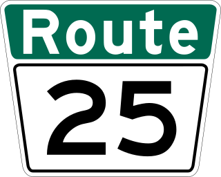
Route 25 is a city route in the Canadian city of Winnipeg, Manitoba. It follows Inkster Boulevard from Route 90 to Route 180. West of Route 90, Inkster Boulevard becomes PTH 190 as it leaves Winnipeg and enters the Rural Municipality of Rosser. East of McPhillips, Inkster continues to Route 52, but this is not part of Route 25.
Provincial Trunk Highway 3 is a major provincial highway located in the Canadian province of Manitoba. It runs from the Saskatchewan boundary to the southwest city limits of Winnipeg, where it continues as Winnipeg Route 155. Prior before to the implementation of Winnipeg's City Route System, it extended to Pembina Highway.
Provincial Trunk Highway 17 is a provincial highway in the Canadian province of Manitoba. It runs from a junction with PR 224 and PR 325 near Hodgson to a junction with PTH 9 near Winnipeg Beach.

Provincial Road 204 is a provincial road in the Canadian province of Manitoba. PR 204 stretches from the province's capital, Winnipeg, to Selkirk, running under the name Henderson Highway between Winnipeg and PR 202. It has a short concurrency with PTH 44 in Lockport. PR 204 is part of the La Vérendrye Trail between Winnipeg and PR 212 in East Selkirk.

Route 42 is a major arterial road located in Winnipeg, Manitoba.
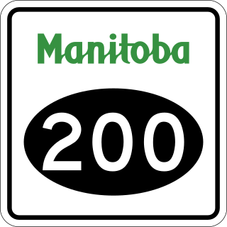
Provincial Road 200 is a provincial road in Manitoba. It runs from the Perimeter Highway at Winnipeg to the border town of Emerson, ending at Manitoba Highway (PTH) 75 at Emerson, near the Canada–United States border.
Provincial Trunk Highway 26, also known as Chemin Assiniboine Trail, is a provincial highway in the Canadian province of Manitoba. It is an east-west route that begins and ends at the Trans-Canada Highway. The western terminus is located near the interchange of PTH 1 and PTH 1A approximately 3 kilometres east of Portage la Prairie, while the eastern terminus is 3 kilometres southeast of St. François Xavier and 13 kilometres west of Winnipeg's Perimeter Highway. PTH 26 provides access to the small communities of St. François Xavier and Poplar Point. It serves as an alternative scenic route between Portage la Prairie and Winnipeg as it closely follows the Assiniboine River which flows south of the highway. The speed limit on this highway is 90 kilometres per hour (56 mph).
Provincial Trunk Highway 190, also known as CentrePort Canada Way, is a provincial highway in the Canadian province of Manitoba. It connects the Perimeter Highway with Winnipeg Route 25 in the City of Winnipeg; part of the highway passes through the neighbouring Rural Municipality of Rosser. The highway includes a traffic interchange at the junction with the Perimeter Highway, as well as a grade separation over the CP Rail main line. The highway is intended to service the industrial lands west of James Armstrong Richardson Winnipeg International Airport, which will be a part of the CentrePort Canada cargo hub. It is numbered for its ultimate role in connecting Highway 1 with Winnipeg Route 90.

Provincial Road 330 (PR 330) is a provincial road in the south-central part of the Canadian province of Manitoba. It is a heavily used route linking the city of Winnipeg with the bedroom community of La Salle and an alternate to Provincial Trunk Highway 75 (PTH 75), the main highway between Winnipeg and the town of Morris.
The La Vérendrye Trail is a series of highways in the Canadian province of Manitoba commemorating the oldest waterway fur-trading route in the province. It is named after Pierre Gaultier de Varennes, sieur de La Vérendrye, an explorer and fur-trader who is often credited as being the first European to visit what is now southern Manitoba.
