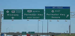
Provincial Trunk Highways (PTH) 100 and 101, collectively known as the Perimeter Highway, form a beltway around the Canadian city of Winnipeg, Manitoba. The Perimeter Highway is approximately 90 km (56 mi) in length and serves as a ring road around Winnipeg for through traffic. It is often considered by local residents to be the city's unofficial boundary, although approximately three-quarters of the Perimeter Highway actually lies in the other municipalities within the Winnipeg Metropolitan Region.
Provincial Trunk Highway 1 is Manitoba's section of the Trans-Canada Highway. It is a heavily used, 4-lane divided highway, with the exception of a short 18 km section in the southeastern corner of the province. It is the main link between southern Manitoba's largest cities, and also serves as the province's main transportation link to the neighbouring provinces of Saskatchewan and Ontario. The highway is the only major east-west divided highway in Manitoba, and carries a large majority of east-west traffic within and through the province. It has full freeway status sections at Portage la Prairie and Winnipeg. The total distance of the Trans-Canada Highway in Manitoba is approximately 490 km (300 mi).
Provincial Trunk Highway 59 is a major provincial highway in the Canadian province of Manitoba. It runs from the Lancaster-Tolstoi Border Crossing, through the city of Winnipeg, north to 8th Avenue in Victoria Beach on Lake Winnipeg.
Provincial Trunk Highway 9 is a provincial primary highway located in the Canadian province of Manitoba. It runs from Winnipeg north to Gimli.
Provincial Trunk Highway 8 is a provincial primary highway located in the Canadian province of Manitoba. It runs from the north limit of the City of Winnipeg, where it meets with Route 180, north to Hecla-Grindstone Provincial Park. The highway between Winnipeg and PR 230 is known as McPhillips Street. At PR 230, McPhillips Street becomes McPhillips Road and continues along PR 230 to PTH 9. The route is a major road connecting Winnipeg with the communities of Winnipeg Beach and Gimli. The speed limit is 100 km/h (60 mph).
Provincial Trunk Highway 7 is a provincial primary highway located in the Canadian province of Manitoba. It runs from the northern limit of the city of Winnipeg north to Arborg, Manitoba where it intersects with PTH 68. The highway is twinned from Winnipeg to just north of PTH 67, an east-west route that provides access to the Town of Stonewall.

Route 17, also known as Chief Peguis Trail, or CPT, is a major highway in Winnipeg, Manitoba, Canada. The highway connects Routes 52 and 20.
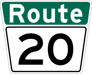
Route 20 is a major north-south arterial route in the city of Winnipeg, Manitoba, Canada. It is also part of Manitoba Highway 59, the only Provincial Trunk Highway that crosses through the city.
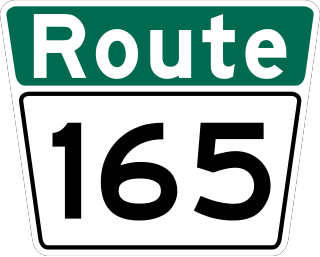
Route 165, also known as Abinojii Mikanah is a highway in Winnipeg, Manitoba. It was formerly known as Bishop Grandin Boulevard, but was renamed in March 2023.
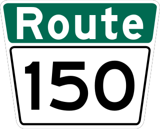
Route 150, locally known as St. Anne's Road, is a major arterial route in Winnipeg, Manitoba, Canada.
Route 145 is an arterial road in Winnipeg, Manitoba, Canada.
Route 30 is a city route in Winnipeg, Manitoba. It runs from Highway 1/Route 135 to Route 37.

Route 180 is a major arterial road and city route in northwestern Winnipeg, Manitoba, Canada. It runs from Route 57 to Emes Avenue near the Perimeter Highway, where it becomes Highway 8.

Route 70 is a city route in Winnipeg, Manitoba, Canada. It runs from Route 57 to Route 42.

Route 85, also known as Portage Avenue, is a major arterial route in the city of Winnipeg, Manitoba, Canada. It is one of the city's oldest and most important roads and is part of both the Trans-Canada and Yellowhead Highways.
Route 115 is a major east-west arterial route in the Winnipeg suburbs of St. Boniface and Transcona. It is the western extension of Manitoba Highway 15, which runs eastward to the communities of Dugald and Elma, Manitoba. Within the city boundaries it connects the largely industrial areas of south Transcona and east St. Boniface with Old St. Boniface and downtown.

Route 90 is a major north-south arterial route in Winnipeg, Manitoba, Canada. It begins at the South Perimeter Highway and ends at the city's northwest limit, where it continues north as PTH 7. Route 90 is designated as the city's airport route, as it passes by Winnipeg James Armstrong Richardson International Airport.

Route 42 is a major arterial road located in Winnipeg, Manitoba.

Route 52 is a major north-south arterial route in Winnipeg, Manitoba, Canada. It comprises all of Main Street, Queen Elizabeth Way, and St. Mary's Road.

Route 105 is a major east-west arterial route in the city of Winnipeg. It runs through the suburbs of Fort Rouge, River Heights, Tuxedo, and Charleswood. It is the eastern extension of Provincial Road 241, which runs westward to the communities of Headingley and Lido Plage. Within the city boundaries it connects the residential and light industrial areas west-southwest of downtown with the Pembina Highway and downtown.
