McBride, Missouri

Last updated
McBride, Missouri
Map of Missouri highlighting Perry County.svg
Location of Perry County, Missouri
Coordinates: 37°49′58″N89°50′24″W / 37.83278°N 89.84000°W / 37.83278; -89.84000 Coordinates: 37°49′58″N89°50′24″W / 37.83278°N 89.84000°W / 37.83278; -89.84000
Country United States
State Missouri
County Perry
Township Bois Brule
Elevation
[1]
371 ft (113 m)
Time zone UTC-6 (Central (CST))
  Summer (DST) UTC-5 (CDT)
ZIP code
63775
Area code 573
FIPS code 29-44786 [2]
GNIS feature ID722028 [1]

McBride is an unincorporated community located in Bois Brule Township in Perry County, Missouri, United States. McBride is located approximately eight miles northeast of Perryville.

Contents

Etymology

McBride was named after the McBride family, who were prominent landowners in the area. [3]

History

Gilster-Mary Lee Gilster-Mary Lee plant at McBride, Missouri.jpg
Gilster-Mary Lee

The first settlers in the area around McBride were the McBride family, headed by Stephan McBride, who came to Perry County in 1837. The McBrides were natives of Nelson and Marion counties, Kentucky. [4] The town grew up along the Frisco Rail line and had its own depot. The flood of 1993 destroyed much of the community. [3] Today, McBride is home to the Gilster-Mary Lee Popcorn and Cereal plant. [5]

Flooding

A number of floods over the years have left destruction on McBride, but the Great Flood of 1993 had devastated the community. [6]

Geography

McBride is situated in the Bois Brule Bottom along Bois Brule Creek. The nutrient-rich bottomland made the land ideal for agriculture.

Related Research Articles

<span class="mw-page-title-main">Perryville, Missouri</span> City in Missouri, United States

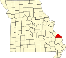
Perryville is a city in Perry County, Missouri, United States. The population was 8,555 at the 2020 United States census. Perryville is the county seat of Perry County.

<span class="mw-page-title-main">Belgique, Missouri</span> Unincorporated community in Missouri, United States

Belgique is an unincorporated community in eastern Perry County, Missouri, United States. It is located approximately five miles south of Chester, Illinois in Perry County's Bois Brule Township.

<span class="mw-page-title-main">Menfro, Missouri</span> Unincorporated community in Missouri, United States

Menfro is an unincorporated community in northeastern Perry County, Missouri, United States. It is located eight miles (13 km) northeast of Perryville.

<span class="mw-page-title-main">Brewer, Missouri</span> Unincorporated community and census-designated place in Missouri, United States

Brewer is an unincorporated community and census-designated place in Saline Township, Perry County, Missouri, United States, which is located northwest of Perryville.

<span class="mw-page-title-main">Apple Creek, Missouri</span> Unincorporated community in Missouri, United States

Apple Creek is an unincorporated community in south central Perry County, Missouri, United States, though not to be confused with the town of Old Appleton which was originally known as Apple Creek. The community is just north of Missouri Route F between I-55 to the west and U.S. Route 61 to the east. Uniontown lies two miles east on Route 61.

<span class="mw-page-title-main">Cinque Hommes Township, Perry County, Missouri</span> Civil Township in Missouri, United States

Cinque Hommes is one of the eight townships located in Perry County, Missouri, in the United States of America.

<span class="mw-page-title-main">Saint Mary's Township, Perry County, Missouri</span> Civil Township in Missouri, United States

St. Marys is one of the eight townships located in Perry County, Missouri, in the United States of America.

<span class="mw-page-title-main">Bois Brule Township, Perry County, Missouri</span> Civil Township in Missouri, United States

Bois Brûlé is one of the eight townships located in Perry County, Missouri, in the United States of America.

<span class="mw-page-title-main">Claryville, Missouri</span> Unincorporated Community in Missouri, United States

Claryville is an unincorporated community in Bois Brule Township in Perry County, Missouri, United States. It is located twelve miles northeast of Perryville, sixty-three miles south of Saint Louis, and lies directly on the Mississippi River.

<span class="mw-page-title-main">Sereno, Missouri</span> Unincorporated community in Missouri, United States

Sereno is an unincorporated community located in Bois Brule Township in Perry County, Missouri, United States. Sereno is located approximately five miles northeast of Perryville.

<span class="mw-page-title-main">Brazeau Township, Perry County, Missouri</span> Civil Township in Missouri, United States

Brazeau is one of the eight townships located in Perry County, Missouri, in the United States of America.

<span class="mw-page-title-main">Bois Brule Bottom</span>

The Bois Brule Bottom is an alluvial floodplain in Bois Brule Township in Perry County, Missouri stretching between Bois Brule Creek to the west and the Mississippi River to the east.

<span class="mw-page-title-main">Silver Lake, Missouri</span> Unincorporated community in Missouri, United States

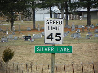
Silver Lake is an unincorporated settlement in Saint Mary's Township in Perry County, Missouri, United States.

<span class="mw-page-title-main">Brazeau Bottom</span>

The Brazeau Bottom is an alluvial floodplain, also called a 'flat', extending along the Mississippi River in Perry County, Missouri.

<span class="mw-page-title-main">Central Township, Perry County, Missouri</span> Civil Township in Missouri, United States

Central Township is one of the eight townships located in Perry County, Missouri, United States.

<span class="mw-page-title-main">Pointrest, Missouri</span> Abandoned village in Missouri, United States

Pointrest was an unincorporated community in Bois Brule Township in Perry County, Missouri, United States.

<span class="mw-page-title-main">Le Grand Champ Bottom</span>

Le Grand Champ is is an alluvial floodplain, also called a bottom, extending along the Mississippi River in Ste. Genevieve County, Missouri.

<span class="mw-page-title-main">Bois Brule Creek (Cinque Hommes Creek tributary)</span> River in Missouri, United States

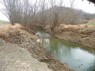
Bois Brule Creek is a tributary of Cinque Hommes Creek in Perry County, Missouri.

<span class="mw-page-title-main">Beauvais Township, Ste. Genevieve County, Missouri</span> Civil Township in Missouri, United States

Beauvais Township is a subdivision of Ste. Genevieve County, Missouri, in the United States of America, and is one of the five townships located in Ste. Genevieve County.

<span class="mw-page-title-main">Tucker's Settlement, Missouri</span> Abandoned village in Missouri, United States

Tucker’s Settlement is an abandoned village in Saline Township in Perry County, Missouri, United States.

References

  1. 1 2 U.S. Geological Survey Geographic Names Information System: McBride, Missouri
  2. Hometown Locator: Missouri "McBride (Perry County, Missouri [MO]): Miscellaneous Information". Archived from the original on 2013-07-21. Retrieved 2013-07-21.
  3. 1 2 State Historical Society of Missouri http://shs.umsystem.edu/manuscripts/ramsay/ramsay_perry.html
  4. Genealogy Rootsweb http://freepages.genealogy.rootsweb.ancestry.com/~sarankin/goodspeed/mcbride_jc.html
  5. Gilster-Mary Lee Corp http://www.superpages.com/bp/Mc-Bride-MO/GilsterMary-Lee-Corporation-L2078778008.htm
  6. US Army Corps of Engineers (December 1993). "Upper Mississippi River Basin Flood of 1993, Flood-Fight Reconnaissance and Survey of Expedient Methods Employed".{{cite journal}}: Cite journal requires |journal= (help)