Le Grand Village Sauvage, Missouri

Last updated
Le Grand Village Sauvage, Missouri
Map of Missouri highlighting Perry County.svg
Location of Perry County, Missouri
Country United States
State Missouri
County Perry
Township Union

Le Grand Village Sauvage (French translation: the big savage village), also called Chalacasa, was a Native American village located near Old Appleton in Perry County, Missouri, United States.

Contents

The village was inhabited by Shawnee and Delaware Indian immigrants from Ohio and Indiana. [1]

Name

The Shawnee usually called their villages Chillicothe or Chilliticaux, meaning 'a place of residence.' They named their largest town along Apple Creek Chalacasa, after their old town on the Scioto River in Ohio. The French referred to Chalacasa as Le Grand Village Sauvage (the big savage village) while the Americans referred to Chalacasa as The Big Village or The Big Shawnee Village. [2]

History

Immigration

In the 18th century, American settlement had forced many Native American tribes westward. The Spanish authorities in Upper Louisiana, also known as the Illinois Country, looked to these tribes as possible immigrants for settlement between Ste. Genevieve and Cape Girardeau.

The Spanish authorities encouraged Shawnee and Delaware immigration, and had hoped their settlement would act as a buffer against the unremitting raids and thefts by the Osage, another tribe to the south, as well as forming a bulwark against the possibility of American invasion. [3] The Shawnee and Delaware, having been driven from their homelands in the Ohio Valley in Pennsylvania, settled in present-day Ohio and Indiana. Then in the 1780s they found themselves in a situation for having supported the British in the American War of Independence, and began looking to move elsewhere as early as 1784. In the 1780s, Don Louis Lorimier, a French-Canadian Métis, who had fought on the side of the British against the Americans during the American Revolution, had also found his situation precarious and decided to settle in Upper Louisiana. Lorimier had operated an Indian trading post in Ohio, and his close association with the Shawnee, enabled him to encourage a number of them to settle in Upper Louisiana. In 1787, Lorimier introduced a plan to bring the disposed Shawnee and Delaware to the Spanish territory.

In 1793, Baron de Carondelet authorized Don Louis Lorimier to establish these tribes in the New Bourbon district of the province of Upper Louisiana, on the Mississippi between the Missouri and Arkansas rivers. Subsequently, the Spanish government authorized Lorimier to induce them to make a settlement in the Spanish territory. The task was made easier on account of Shawnee and Delaware hatred of the Americans, who had conquered them through the victory of General Wayne and the Treaty of Greenville (1795). [2] [4]

Settlement

The settlements of the Shawnee and the Delaware were principally made between Cinque Hommes and Flora Creeks above Cape Girardeau, and centered around Apple Creek bordering Perry County and Cape Girardeau County. The concession granted them by the Spanish contained approximately 750 square miles, which included extensive prairies and woodland, karst plains and alluvial bottoms. The tract was large enough to support several Indian villages with surrounding hunting territory, although these semi-Americanized Indians were more dependent on field crops and domesticated animals than wild game. [2]

The tribes were accustomed to acting together in important matters, but they established separate villages. The largest Shawnee village, le Grand Village Sauvage, contained about 400 inhabitants, and was built on the top of a hill above Apple Creek, to the west of the present site of Old Appleton. A trace, or small road, called the Shawnee Trace, extended from Don Louis Lorimier's trading post in Cape Girardeau to Le Grand Village Sauvage and continued north to La Saline, Ste. Genevieve and St. Louis. This trace was part of the Royal Road (Le Chemin du Roi) connecting several administrative posts of Upper Louisiana, and the Indian villages experienced a considerable amount of through them by officials and outsiders. [5]

By 1804, the land had become too settled to afford sufficient game. Although the Shawnee and Delaware interpreted the entire grant as being exclusively theirs and excluding Americans, district commandants awarded concessions to white settlers within and as close as three miles to the villages. Apparently, the commandments assumed that it was their right to approve locations on unoccupied land, and they could have interpreted the miles of hunting land around the villages as unoccupied in the sense that other land in the district used by Americans for hunting was considered unoccupied. Instructions to award only land not in conflict with other concessions, which were so rigorously adhered to everywhere else, apparently did not hold for the Indian tract. By the end of the Spanish period, the tract contained approximately one hundred whites living on dispersed farms, most on the fringes of the tract.

The Shawnee and Delaware protested these incursions, but there was little they could do, as they had little influence with authorities beyond Lorimier. The first whites within the tract apparently did not disturb them, and some even served them as useful gunsmiths while other craftsmen traded with them.

Even under protest the Shawnee and Delaware fulfilled the purposes for which the Spanish invited their immigration. They were effective turning away the Osage and were used for the same purpose by the Americans as a buffer between the Osage and Cherokee years later in Oklahoma. From early on, the Shawnee said that Spanish Illinois (Upper Louisiana) was not a tranquil place due to the Osages, and they threatened to return to the United States. The Shawnee were particularly disturbed that the Spanish expected them to fight the Osages, while at the same time, the Spanish continued to trade and bestow gifts on the Osages, but offered no aid to the Shawnee and Delaware when they were attacked by the Osages. [2]

Witch-Hunts

A Shawnee medicine man named, Tenskwátawa, known to the Whites as "the Shawnee prophet," began to preach a new doctrine which exhorted the Indians to return to the communal life of their ancestors, abandoning all customs derived from the Whites. He attracted a large following among Indians who had already suffered major epidemics and dispossession of their lands. In 1805, Tenskwátawa led a religious revival following a series of witch-hunts following an outbreak of smallpox among the Shawnee.

These witch-hunts eventually reached the Shawnee in Upper Louisiana, and about 1808−1809, the Native American communities along Apple Creek became possessed with the belief that witchcraft was practiced among them and consequently burned to death some 50 women within 12 months. The charges against the women were usually based upon the report of someone who claimed he had seen the alleged witch in the form of an owl or some other bird, or in the form of a panther or beast of the forest. The frenzy was suddenly quelled by the appearance of Tecumseh, who was then busy with his plans to form a vast confederacy of all Indians, to check the advance of the white settlers. [6] [7] [8]

American Encroachment

Between 1811 and 1814 trouble began grow with white settlement. Missouri's white population more than doubled between 1804 and 1814 as many white settlers crossed the Mississippi, leading to increasing harassment of the villages along Apple Creek. Between 1811 and 1814, the Shawnees along Apple Creek reported the loss of over sixty-five hogs, forty-nine cattle, and forty-eight horses. Apple Creek chief, Wapapilethe, upon returning from the winter hunt, found his house had been broken open and everything inside had been stolen. Wapapilethe personally knew a white man who had illegally settled on this property and robbed both him and other Shawnees, but could legally do nothing as Indians were barred from testifying against whites in court. The Apple Creek Shawnees, being legally powerless to stop the harassment and thefts, complained that "the whites do not steal these things merely for their value, but more to make us abandon our land and take if for themselves." In another case a Shawnee man had been beaten by a white who then confiscated his land and property. Despite the overwhelming evidence and protests from both the Shawnees and Pierre Menard, a country judge refused to prosecute the man and allowed the statute of limitations for his crimes to pass. [9]

Emigration and Removal

Despite the fact that the Spanish government, and later the American government, granted the Indians title to their lands, and had ordered all whites to move from their lands, a number of the Shawnee and Delaware slowly moved west before the advance of the whites, establishing communities further west in Missouri, in Stoddard and Greene counties.

In the treaty made at St. Louis in 1815, the American government ordered all whites to move from the Shawnee and Delaware lands. This measure, however, was only of temporary relief. Between 1815 and 1819, the Shawnee population in southeastern Missouri plummeted from 1,200 to only 400. Only ten years after the signing of the Treaty of St. Louis the encroachment of white settlers had compelled these tribes to sell their Spanish grant and leave the State for a home farther west. [2] Shawnee Tribe "The Shawnee in History". Archived from the original on 2008-05-16. Retrieved 2009-02-07.</ref> [9]

Missouri entered the union as the 24th state in 1821, and the federal government, in 1825, moved to extinguish any remaining Shawnee claims under the Spanish land grant. In November the 1,400 Shawnee in Missouri agreed to a treaty signed at St. Louis with William Clark, exchanging their lands along Apple Creek, near Cape Girardeau, for 2,500 square miles in eastern Kansas. They also received $14,000 in moving expenses plus $11,000 to pay debts owed to white traders. Further provision was made to allow any of the 800 Ohio Shawnee who so desired to join them in Kansas. When they settled on the south side of the Kansas River the following year, the Shawnee became the first of the eastern Algonquin tribes to settle in Kansas. Problems arose, however, when the very traditional Black Bob's band balked at uniting with the Ohio Shawnee. Instead of moving to Kansas after the treaty, they went south and settled in Arkansas. During the next two years, all efforts (including bribery) failed to persuade them to move. After threat of military force, they settled at Olathe in 1833. [4] [10]

Population

The New Bourbon census of 1797 reported 70 Shawnee and 120 Delaware families in villages on the north side of Apple Creek in the New Bourbon Administrative district. Possibly as many families lived in the villages south of Apple Creek. Le Grand Village Sauvage had approximately 400 inhabitants. A combined population of 3,000 Shawnee and Delaware were estimated to live in these communities between Cinque Hommes and Flora creeks. [11]

The Shawnee and Delaware on Apple Creek had a significant degree of racial mixing and had adopted French and American ways. The racial mixing included half whites of both French and American parentage, and whites, probably orphans and captives from warfare, who had been raised as Indians according to the Shawnee practice of adopting their captives. It was noted at the time by Spanish officials that the Apple Creek villages certainly had as much “white blood” in them as French villages had “Indian blood.” [4]

Architecture and Community

Some houses were log constructed in the vertical French poteaux en terre (posts-in-the-ground) or poteaux-sur-sol (post-on-a-sill) style, with perpendicular log posts set closely together in the ground or on a sill, and with clay chinked in-between filling the interstices. Other houses were built in the American log cabin style, with horizontal squared logs, some two stories high and shingled. There were granaries and barns for cattle and horses. Villages gave the appearance of permanence. Cultivated fields of corn, barley, pumpkins, melons, and potatoes, enclosed by rail fences, surrounded the villages. The Shawnee and Delaware had barnyard fowl, cattle, hogs, and horses. [3] [4]

The Shawnee and Delaware were attentive to dress, and the women wore their hair tied close to their heads and covered with skin. They were more careful of their children, more than associated with other Indians. They also cut the cartilages of their ears so as to lengthen them as much as possible, and suspended silver trinkets in the form of stars from their ears. On their necks they wore crosses, and on their heads they wore bands and crowns covered with spangles. They used great quantities of vermilion and black, with which they painted their bodies on festive days. [12]

Related Research Articles

<span class="mw-page-title-main">Perry County, Missouri</span> County in Missouri, United States

Perry County is a county located in the southeastern portion of the U.S. state of Missouri. As of the 2020 census, the population was 18,956. Its county seat is Perryville. The county was officially organized on November 16, 1820 from Ste. Genevieve County and was named after Oliver Hazard Perry, a naval hero of the War of 1812.

<span class="mw-page-title-main">Bollinger County, Missouri</span> County in Missouri, United States

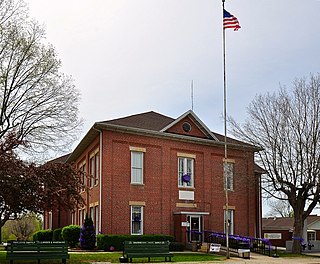
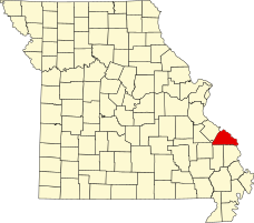
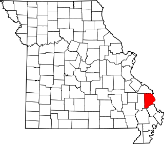
Bollinger County is a county located in the southeastern part of the U.S. state of Missouri. As of the 2020 census, the county's population was 10,567. The county seat is Marble Hill. The county was officially organized in 1851.

<span class="mw-page-title-main">Pocahontas, Missouri</span> Village in Missouri, United States

Pocahontas is a village in Cape Girardeau County, Missouri, United States. The population was 97 at the 2020 census. It is part of the Cape Girardeau–Jackson, MO-IL Metropolitan Statistical Area.

<span class="mw-page-title-main">Ste. Genevieve, Missouri</span> City in Missouri, United States

Ste. Genevieve is a city in Ste. Genevieve Township and is the county seat of Ste. Genevieve County, Missouri, United States. The population was 4,999 at the 2020 census. Founded in 1735 by French Canadian colonists and settlers from east of the river, it was the first organized European settlement west of the Mississippi River in present-day Missouri. Today, it is home to Ste. Genevieve National Historical Park, the 422nd unit of the National Park Service.

<span class="mw-page-title-main">Old Appleton, Missouri</span> Village in Missouri, United States

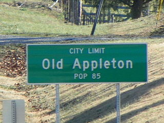
Old Appleton is a village in Cape Girardeau County, Missouri, United States. The population was 73 at the 2020 census. It is part of the Cape Girardeau–Jackson, MO-IL Metropolitan Statistical Area.

<span class="mw-page-title-main">Shawnee</span> Indigenous peoples of the Northeastern Woodlands

The Shawnee are an Indigenous people of the Northeastern Woodlands. Their language, Shawnee is an Algonquian language.

<span class="mw-page-title-main">Pierre-Louis de Lorimier</span> Colonial French-Canadian fur trader (1748–1812)

Pierre-Louis de Lorimier, usually Anglicized to Peter Loramie, was a colonial French-Canadian fur trader, British Indian agent, Shawnee agitator, and in later years, founded Cape Girardeau and Bollinger Counties, Missouri. He died in Cape Girardeau, MO. and was buried there with his Indian wife.

Black Bob was a Native American Shawnee Chief. His band was a part of the Hathawekela division of the Shawnee. He was known for being one of the last Shawnee to resist leaving for the Indian Territory, and for keeping his band together until his death, holding their lands in common, as they moved between Missouri, Arkansas, and the Black Bob Reservation in Kansas.

<span class="mw-page-title-main">Treaty of Fort Clark</span> 1808 treaty between the United States and Osage

The Treaty of Fort Clark was signed at Fort Osage on November 10, 1808, in which the Osage Nation ceded all the land east of the fort in Missouri and Arkansas north of the Arkansas River to the United States. The Fort Clark treaty and the Treaty of St. Louis in which the Sac (tribe) and Fox (tribe) ceded northeastern Missouri along with northern Illinois and southern Wisconsin were the first two major treaties in the newly acquired Louisiana Purchase. The affected tribes, upset with the terms, were to side with the British in the War of 1812. Following the settlement of that war, John C. Sullivan for the United States was to survey the ceded land in 1816 (adjusting it 23 miles westward to the mouth of the Kansas River to create the Indian Boundary Line west of which and south of which virtually all tribes were to be removed in the Indian Removal Act in 1830.

On the eve of the American Civil War in 1861, a significant number of Indigenous peoples of the Americas had been relocated from the Southeastern United States to Indian Territory, west of the Mississippi. The inhabitants of the eastern part of the Indian Territory, the Five Civilized Tribes, were suzerain nations with established tribal governments, well established cultures, and legal systems that allowed for slavery. Before European Contact these tribes were generally matriarchial societies, with agriculture being the primary economic pursuit. The bulk of the tribes lived in towns with planned streets, residential and public areas. The people were ruled by complex hereditary chiefdoms of varying size and complexity with high levels of military organization.

<span class="mw-page-title-main">Fenwick Settlement, Missouri</span> Abandoned village in Missouri, United States

Fenwick Settlement is an abandoned village in Perry County, Missouri, United States. The community was named after the Fenwick family, who were early settlers on the left bank of the Mississippi River in the Spanish Illinois Country.

<span class="mw-page-title-main">Bois Brule Township, Perry County, Missouri</span> Civil Township in Missouri, United States

Bois Brûlé is one of the eight townships located in Perry County, Missouri, in the United States of America.

<span class="mw-page-title-main">Union Township, Perry County, Missouri</span> Civil Township in Missouri, United States

Union is one of the eight townships located in Perry County, Missouri, in the United States of America.

<span class="mw-page-title-main">Shawneetown, Missouri</span> Unincorporated community in Missouri, United States

Shawneetown is an unincorporated community in Shawnee Township in northern Cape Girardeau County, Missouri, United States. It is located twenty miles north of Cape Girardeau and is part of the Cape Girardeau–Jackson, MO-IL Metropolitan Statistical Area.

<span class="mw-page-title-main">Le Grand Champ Bottom</span>

Le Grand Champ is is an alluvial floodplain, also called a bottom, extending along the Mississippi River in Ste. Genevieve County, Missouri.

<span class="mw-page-title-main">Apple Creek (Mississippi River tributary)</span> River in Missouri, United States

Apple Creek is a stream that rises in western Perry County, Missouri and empties into the Mississippi River, forming the boundary between Perry and Cape Girardeau counties.

<span class="mw-page-title-main">Colonial history of Missouri</span>

The Colonial history of Missouri covers the French and Spanish exploration and colonization: 1673–1803, and ends with the American takeover through the Louisiana Purchase

The Treaty of St. Louis is the name of a series of treaties signed between the United States and various Native American tribes from 1804 through 1824. The fourteen treaties were all signed in the St. Louis, Missouri area.

<span class="mw-page-title-main">Manuel Pérez (Lieutenant Governor of Upper Louisiana)</span>

Manuel Perez was the Lieutenant Governor of Illinois between November 1787 and 1792.

<span class="mw-page-title-main">John Lewis (Shawnee leader)</span> Shawnee leader

Quatawapea or John Lewis, also known as Captain Lewis and Colonel Lewis and ‘’’Captain Johnny’’’, was a Shawnee leader for whom Lewistown, Ohio, is named. Lewis fought in the American Revolutionary War (1775–1783) and the Northwest Indian War (1785–1795) as part of Shawnee opposition to the expansion of the United States into Shawnee territory. After the 1795 Treaty of Greenville, he sought to preserve Shawnee autonomy by promoting accommodation with the U.S., working with Black Hoof, the principal Shawnee spokesman.

References

  1. State Historical Society of Missouri http://shs.umsystem.edu/manuscripts/ramsay/ramsay_perry.html
  2. 1 2 3 4 5 Walter A. Schroeder (2002). Opening the Ozarks: A Historical Geography of Missouri's Ste. Genevieve District, 1760-1830 . University of Missouri Press. ISBN   978-0-8262-6306-3.
  3. 1 2 Federal Writers’ Project (1941). Missouri: A Guide to the Show Me State. ISBN   9781623760243.
  4. 1 2 3 4 Louis Houck (1908). "A History of Missouri from the earliest explorations and settlements until the administration of the state into the union (vol. 1)".{{cite journal}}: Cite journal requires |journal= (help)
  5. Writers' Program of the Work Projects Administration in the State of Missouri (1941). Missouri A Guide to the "Show Me" State. ISBN   9781603540247.
  6. Mary Barile (2012). Forgotten Tales of Missouri. ISBN   9781609494735.
  7. Writers' Program of the Work Projects Administration in the State of Missouri (1941). Missouri: The WPA Guide to the "Show Me" State. ISBN   9781883982232.
  8. Tecumseh and the Shawnee prophet. including sketches of George Rogers Clark, Simon Kenton, William Henry Harrison, Cornstalk, Blackhoof, Bluejacket, the Shawnee Logan, and others famous in the frontier wars of Tecumsehs̕ time https://archive.org/stream/cu31924098139904/cu31924098139904_djvu.txt
  9. 1 2 Warren, Stephen. (2005). The Shawnees and Their Neighbors 1795-1870, Urbana and Chicago: University of Illinois Press. ISBN   978-0-252-02995-0.
  10. The Illiniwek and Shawnee of Southern Illinois "Museum homepage". Archived from the original on 2013-05-21. Retrieved 2013-08-25.
  11. Missouri Immigration Society (1880). "Hand-book of Missouri: Embracing Exhibits of the Agricultural, Commercial, Industrial ... Interests of the State ... (Google eBook)".{{cite journal}}: Cite journal requires |journal= (help)
  12. A History of Missouri from the earliest explorations http://www.ebooksread.com/authors-eng/louis-houck/a-history-of-missouri-from-the-earliest-explorations-and-settlements-until-the-a-cuo/page-27-a-history-of-missouri-from-the-earliest-explorations-and-settlements-until-the-a-cuo.shtml