Eastland County is a county located in central West Texas. As of the 2020 census, its population was 17,725. The county seat is Eastland. The county was founded in 1858 and later organized in 1873. It is named for William Mosby Eastland, a soldier during the Texas Revolution and the only officer to die as a result of the "Black Bean executions" of the Mier Expedition.

Baird is a city and the county seat of Callahan County, Texas, United States. Its population was 1,479 at the 2020 census. The city is named after Matthew Baird, the owner and director of the Texas and Pacific Railway. The railway depot is now operated as the visitor center and a transportation museum.

Cross Plains is a town in Callahan County, Texas, United States. The population was 982 at the 2010 census. It is part of the Abilene, Texas Metropolitan Statistical Area.

Putnam is a town in Callahan County, Texas, United States. The population was 63 at the 2020 census, down from 94 in 2010. It is part of the Abilene, Texas Metropolitan Statistical Area.
Coleman is a town in and the county seat of Coleman County, Texas, United States. As of the 2010 census, its population was 4,709.

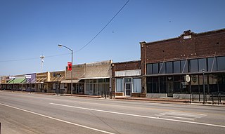
Paint Rock is a town in and the county seat of Concho County, Texas, United States. The population was 237 at the 2020 census.

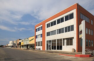
Hamilton is a city in and the county seat of Hamilton County, Texas, United States, located in the state's central region. Its population was 2,895 at the 2020 census.

Haskell is a city in central Haskell County, Texas, United States. As of the 2010 census, the city population was 3,322. It is the Haskell county seat.

Rule is a town in Haskell County, Texas, United States. The population was 636 at the 2010 census, down from 698 at the 2000 census.

Hawley is a city in Jones County, Texas, United States. The population was 634 at the 2010 census.

Runge is a town in Karnes County, Texas, United States. The town is pronounced "Run-Gee". The population was 892 at the 2020 census.

Benjamin is a city in and the county seat of Knox County, Texas, United States. Its population was 196 at the 2020 census.

Knox City is a town in Knox County, Texas, United States. The population was 1,119 at the 2019 census.

Lawn is a town in Taylor County, Texas, United States. As of the 2010 census, the town population was 314. It is part of the Abilene, Texas Metropolitan Statistical Area.

Potosi is a census-designated place (CDP) in Taylor County, Texas, United States. Its population was 2,991 at the 2010 census. It is part of the Abilene, Texas metropolitan statistical area.
Trent is a town in Taylor County, Texas, United States, that was established in 1881. The population was 337 at the 2010 census. It is part of the Abilene, Texas Metropolitan Statistical Area. Trent, Texas was named in honor of West Texas pioneer and cattleman, Isaac Riley Trent.
Tye is a city in Taylor County, Texas, United States. The population was 1,242 at the 2010 census. It is part of the Abilene, Texas Metropolitan Statistical Area.

Woodville is a town and county seat of Tyler County, Texas, United States. The town is intersected by three U.S. highways: U.S. Highway 69, U.S. Highway 190, and U.S. Highway 287. The population was 2,403 at the 2020 census. It is the county seat of Tyler County. The town was named after George Tyler Wood, governor of Texas from 1847 to 1849.
Olney is a city in Young County, Texas, United States. Its population was 3,285 in 2010.
Hamlin is a city in Jones and Fisher Counties in the U.S. state of Texas. The population was 2,124 at the 2010 census, and in 2018, the estimated population was 1,997. The Jones County portion of Hamlin is part of the Abilene, Texas metropolitan area.