This article needs additional citations for verification .(July 2019) |
Miles, Iowa | |
---|---|
Coordinates: 42°2′51″N90°18′54″W / 42.04750°N 90.31500°W Coordinates: 42°2′51″N90°18′54″W / 42.04750°N 90.31500°W | |
Country | United States |
State | Iowa |
County | Jackson |
Incorporated | May 4, 1893 [1] |
Area | |
• Total | 1.26 sq mi (3.27 km2) |
• Land | 1.26 sq mi (3.27 km2) |
• Water | 0.00 sq mi (0.00 km2) |
Elevation | 801 ft (244 m) |
Population (2020) | |
• Total | 408 |
• Density | 322.78/sq mi (124.65/km2) |
Time zone | UTC-6 (Central (CST)) |
• Summer (DST) | UTC-5 (CDT) |
ZIP code | 52064 |
Area code | 563 |
FIPS code | 19-52050 |
GNIS feature ID | 0459074 |
Website | www |
Miles is a small city in southeastern Jackson County, Iowa, United States. The population was 408 at the time of the 2020 census. [3]
In 1870, Miles was founded in anticipation of a railroad which would be built through the territory. The town was named for its founder, F. M. Miles. [4]
In 1871, Miles was formally laid out, with the first house being built the following year, in 1872. [5]
Miles is located at 42°2′51″N90°18′54″W / 42.04750°N 90.31500°W (42.047601, -90.314931). [6]
According to the United States Census Bureau, the city has a total area of 1.15 square miles (2.98 km2; 297.85 ha), all land. [7]
Year | Pop. | ±% |
---|---|---|
1900 | 385 | — |
1910 | 334 | −13.2% |
1920 | 333 | −0.3% |
1930 | 319 | −4.2% |
1940 | 314 | −1.6% |
1950 | 344 | +9.6% |
1960 | 376 | +9.3% |
1970 | 409 | +8.8% |
1980 | 398 | −2.7% |
1990 | 409 | +2.8% |
2000 | 462 | +13.0% |
2010 | 445 | −3.7% |
2020 | 408 | −8.3% |
Source: "U.S. Census website". United States Census Bureau . Retrieved 2020-04-04. and Iowa Data Center Source: |
As of the census of 2010, 445 people, 184 households, and 122 families were residing in the city. The population density was 387.0 inhabitants per square mile (149.4/km2). There were 195 housing units at an average density of 169.6 per square mile (65.5/km2). The racial makeup of the city was 97.5% White, 0.4% African American, 0.4% Native American, and 1.6% from two or more races. Hispanic or Latino of any race were 1.8% of the population. [9]
Of a total of 184 households, 33.7% had children under the age of 18 living with them, 54.3% were married couples living together, 6.5% had a female householder with no husband present, 5.4% had a male householder with no wife present, and 33.7% were non-families. 32.1% of all households were made up of individuals, and 13.5% had someone living alone who was 65 years of age or older. The average household size was 2.42 and the average family size was 3.02. [9]
The median age in the city was 42.6 years. 26.5% of residents were under the age of 18; 6.1% were between the ages of 18 and 24; 20.2% were from 25 to 44; 30.5% were from 45 to 64; and 16.6% were 65 years of age or older. The gender makeup of the city was 50.1% male and 49.9% female. [9]
As of the census of 2000, there were 462 people, 179 households, and 121 families residing in the city. The population density was 402.7 inhabitants per square mile (155.5/km2). There were 184 housing units at an average density of 160.4 per square mile (61.9/km2). The racial makeup of the city was 98.27% White, 0.87% Native American, and 0.87% from two or more races. [10]
Out of a total of 179 households, 38.0% had children under the age of 18 living with them, 57.0% were married couples living together, 6.7% had a female householder with no husband present, and 32.4% were non-families. 29.6% of all households were made up of individuals, and 14.5% had someone living alone who was 65 years of age or older. The average household size was 2.58 and the average family size was 3.26. [10]
In the city, the population was spread out, with 31.6% under the age of 18, 5.6% from 18 to 24, 27.1% from 25 to 44, 20.8% from 45 to 64, and 14.9% who were 65 years of age or older. The median age was 36 years. For every 100 females, there were 89.3 males. For every 100 females age 18 and over, there were 97.5 males. [10]
The median income for a household in the city was $33,036, and the median income for a family was $42,188. Males had a median income of $36,042 versus $24,375 for females. The per capita income for the city was US$17,005. About 9.3% of families and 10.1% of the population were below the poverty line, including 13.3% of those under age 18 and none of those age 65 or over. [10]
Miles is within the Easton Valley Community School District, [11] formed in 2013 by the merger of the East Central Community School District and the Preston Community School District. East Central formed in 1974 by the merger of the Miles Community School District and the Sabula Community School District. [12]
At one point[ when? ][ why? ], the former East Central district entered into a grade-sharing relationship with the Northeast Community School District, in that East Central residents attended Northeast secondary schools. [13]
On September 11, 2012, the East Central School and Preston School districts held a special vote to determine whether or not to merge their school districts. The Preston School district voted 86.5% in favor of the merger, and after a recount showed a slimmer but still passing margin of 620 East Central votes for and 598 against, the communities created the new Easton Valley School District (EVSD).[ citation needed ]
The EVSD elementary schools are now located in Miles, while the middle and high schools are in Preston.[ citation needed ]
Clarence is a city in Cedar County, Iowa, United States. The population was 1,039 at the time of the 2020 census.
Dougherty is a city in Cerro Gordo County, Iowa, United States. The population was 62 at the 2020 census. It is part of the Mason City Micropolitan Statistical Area.
Swaledale is a city in Cerro Gordo County, Iowa, United States. The population was 144 at the time of the 2020 census. It is part of the Mason City Micropolitan Statistical Area.
Washta is a city in Cherokee County, Iowa, United States. The population was 209 at the time of the 2020 census. It is called "The Coldest Spot in Iowa", recording a temperature of −47 °F (−44 °C) without wind chill on January 12, 1912.
Osterdock is a city located in Clayton County, Iowa, United States. As of the 2020 census, the city had a total population of 43, down from 50 in 2000.
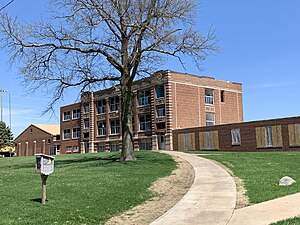
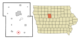
Sheffield is a city in Franklin County, Iowa, United States. The population was 1,130 at the time of the 2020 census.
Wellsburg is a city in Grundy County, Iowa, United States. The population was 720 at the 2020 census, a slight increase from 716 in 2000. It is part of the Waterloo–Cedar Falls Metropolitan Statistical Area. The city is named for George Wells, an early settler in the region.
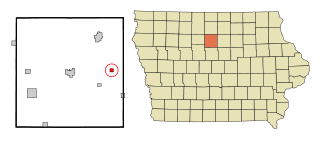
Hubbard is a city in Hardin County, Iowa, United States. The population was 860 at the time of the 2020 census.
Steamboat Rock is a city in Hardin County, Iowa, United States. The population was 264 at the time of the 2020 census.
Preston is a city in Jackson County, Iowa, United States. The population was 949 at the time of the 2020 census.
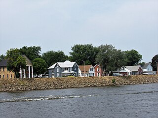
Sabula is a city in Jackson County, Iowa, United States. The population was 506 at the 2020 census. Sabula is the site of Iowa's only island city. The island has a beach and a campground, as well as a harbor with boat docks and storage sheds to store boats during the winter. Because of its proximity to Chicago, Sabula has become a popular vacation destination during the summer months. Sabula is the northern terminus of U.S. Route 67, a 1,560 mile (2,511 km) long north–south highway in the Central United States. The southern terminus of the route is at the United States–Mexico border in Presidio, Texas.
Spragueville is a city in Jackson County, Iowa, United States. The population was 92 at the time of the 2020 census.
Palo is a city in Linn County, Iowa, United States. The population was 1,407 at the time of the 2020 census. It is part of the Cedar Rapids Metropolitan Statistical Area.
Gilman is a city in the southeastern corner of Marshall County, Iowa, United States. The population was 542 at the time of the 2020 census. Their new website is https://gilman.ia.gov/
Melvin is a city in Osceola County, Iowa, United States. The population was 199 at the time of the 2020 census.
Mallard is a city in Palo Alto County, Iowa, United States. The population was 257 at the time of the 2020 census.
Nemaha is a city in Sac County, Iowa, United States. The population was 66 at the time of the 2020 census.
Harcourt is a city in Webster County, Iowa, United States. The population was 264 at the time of the 2020 census.
Goldfield is a city in Wright County, Iowa, United States. The population was 634 at the time of the 2020 census.
Rowan is a city in Wright County, Iowa, United States. The population was 123 at the time of the 2020 census.