U.S. Route 1 or U.S. Highway 1 (US 1) is a major north–south United States Numbered Highway that serves the East Coast of the United States. It runs 2,370 miles (3,810 km) from Key West, Florida, north to Fort Kent, Maine, at the Canadian border, making it the longest north–south road in the United States. US 1 is generally paralleled by Interstate 95 (I-95), though US 1 is significantly farther west (inland) between Jacksonville, Florida, and Petersburg, Virginia, while I-95 is closer to the coastline. In contrast, US 1 in Maine is much closer to the coast than I-95, which runs farther inland than US 1. The route connects most of the major cities of the East Coast from the Southeastern United States to New England, including Miami, Jacksonville, Raleigh, Richmond, Washington D.C., Baltimore, Philadelphia, New York City, and Boston.

Morrisville is a city in southern Polk County, Missouri, United States. The population was 388 at the 2010 census. It is part of the Springfield, Missouri Metropolitan Statistical Area.
Eaton is a town in Madison County, New York, United States. The population was 5,255 at the 2010 census.

Falls Township is a suburban Philadelphia township in Bucks County, Pennsylvania. The population was 34,300 at the 2010 census. Portions of Fairless Hills and Levittown, Pennsylvania, are located in the township. Portions of Falls Township are called Morrisville and Yardley, due to the location of the Morrisville Post Office outside the Borough of Morrisville in Falls Township. As originally chartered in 1692, the villages of Morrisville and Tullytown were part of Falls Township. Morrisville was granted borough status in 1804. Tullytown was erected as a borough in 1891.
Lower Makefield Township is a township in Bucks County, Pennsylvania. Lower Makefield Township is located in the Delaware Valley and borders the Delaware River and New Jersey to its north and east. Most addresses in the township have a Yardley address; the township surrounds the borough of Yardley on its north, south, and west.

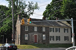
Morrisville is a borough in Bucks County, Pennsylvania, United States. It is located just below the falls of the Delaware River opposite Trenton, New Jersey. The population was 8,728 at the 2010 census.

Morristown is a town in Lamoille County, Vermont, United States. As of the 2020 census, the population was 5,434. Morristown is the largest town by population in Lamoille County, and its central village of Morrisville serves as the county's main commercial center.

U.S. Route 13 or U.S. Highway 13 (US 13) is a north–south United States Numbered Highway established in 1926 that runs for 518 miles (834 km) from Interstate 95 (I-95) just north of Fayetteville, North Carolina, to US 1 in the northeastern suburbs of Philadelphia, Pennsylvania, in Morrisville. In all, it traverses five states in the Atlantic coastal plain region. It follows the Atlantic coast more closely than does the main north–south U.S. Highway of the region, US 1. Due to this, its number is out of place on the general U.S. Highway numbering grid, as it should be running west of US 11 but does not. Its routing is largely rural, the notable exceptions being the Hampton Roads area in Virginia and the northern end of the highway in Delaware and Pennsylvania. It is also notable for being the main thoroughfare for the Delmarva Peninsula and carrying the Chesapeake Bay Bridge–Tunnel to it in Virginia.
Washington Township is one of the thirteen townships of Clinton County, Ohio, United States. The population as of the 2010 census was 2,130, up from 1,895 in 2000 and 1,475 in 1990.
U.S. Route 1 Business is a four-lane surface road that provides an alternate route to the Trenton Freeway (US 1) northeast of Trenton in Mercer County, New Jersey. The route is 2.73 miles (4.39 km) long and runs between US 1 in Trenton and Lawrence Township. On the border of Trenton and Lawrence Township, US 1 Bus. intersects the northbound direction of US 206 at the Brunswick Circle. The route was once part of a longer U.S. Route 1 Alternate, which continued southwest through downtown Trenton and into Morrisville, Pennsylvania.
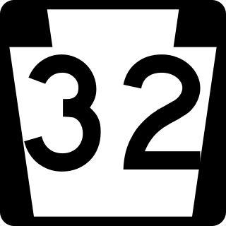
Pennsylvania Route 32 is a scenic two-lane highway that runs along the west side of the Delaware River in Bucks County, Pennsylvania. Signed north-south, it runs from U.S. Route 1 in Falls Township outside of Morrisville northwest to PA 611 in the village of Kintnersville in Nockamixon Township. PA 32 passes through Washington Crossing Historic Park, a Revolutionary War-themed historical park on the site of George Washington's crossing on the night of December 25–26, 1776. It also passes through the boroughs of Morrisville, Yardley, and New Hope.

The Morrisville–Trenton Railroad Bridge is a rail bridge across the Delaware River between Morrisville, Pennsylvania and Trenton, Mercer County, New Jersey, United States.
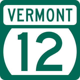
Vermont Route 12 (VT 12) is a 101.627-mile-long (163.553 km) north-south state highway in Vermont that runs from Weathersfield to Morrisville.
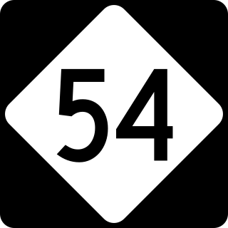
North Carolina Highway 54 (NC 54) is a 55.0-mile-long (88.5 km) primary state highway in the U.S. state of North Carolina. The highway serves the Research Triangle area, between Burlington and Raleigh, connecting the cities and towns of Chapel Hill, Durham, Morrisville and Cary. The highway also links the campuses of University of North Carolina at Chapel Hill and North Carolina State University.
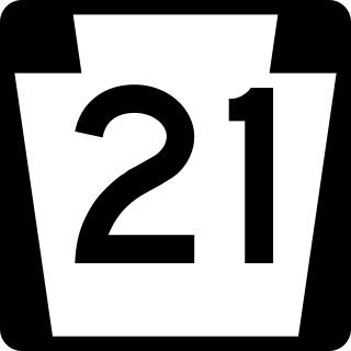
Pennsylvania Route 21 is a 50.75-mile (81.67 km) long east–west state highway in the US state of Pennsylvania. The western terminus of the route is at the West Virginia state line in Richhill Township, where PA 21 continues into West Virginia as West Virginia Route 891. The eastern terminus is at U.S. Route 40 Business in Uniontown. The route is known as the Roy E. Furman Highway for most of its length. PA 21 serves Waynesburg and Masontown along the way.

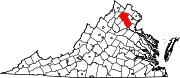
U.S. Route 17 (US 17) is a part of the United States Numbered Highway System that runs from Punta Gorda, Florida, to Winchester, Virginia. In Virginia, the U.S. Highway runs 255.83 miles (411.72 km) from the North Carolina state line in Chesapeake north to its northern terminus at US 11, US 50, and US 522 in Winchester. US 17 is a major highway in the eastern half of Virginia. The U.S. Highway connects the Albemarle Region of North Carolina with the Hampton Roads metropolitan area. Within the urban area, US 17 passes through the South Hampton Roads cities of Chesapeake, Portsmouth, and Suffolk and the Virginia Peninsula city of Newport News. Between Yorktown and Fredericksburg, the U.S. Highway serves as the primary highway of the Middle Peninsula. At Fredericksburg, US 17 leaves the Atlantic Plain; the highway passes through the Piedmont town of Warrenton and crosses the Blue Ridge Mountains on its way to Winchester in the Shenandoah Valley. The route from Tappahannock to Winchester roughly follows the Confederate march during the Civil War to Gettysburg.
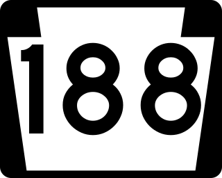
Pennsylvania Route 188 is a 9.7-mile (15.6 km) long east-west state highway in the U.S. state of Pennsylvania. The western terminus of the route is at U.S. Route 19 and PA 21 in Morrisville. The eastern terminus is at PA 88 in the Jefferson Township community of Dry Tavern.
U.S. Route 13 (US 13) is a United States Numbered Highway running from Fayetteville, North Carolina, north to Morrisville, Pennsylvania. The route runs for 49.359 miles (79.436 km) through the Delaware Valley in the U.S. state of Pennsylvania. The route enters the state from Delaware in Marcus Hook, Delaware County. It continues northeast through Delaware County, passing through the city of Chester before heading through suburban areas along Chester Pike to Darby. US 13 enters the city of Philadelphia on Baltimore Avenue and runs through West Philadelphia to University City, where it turns north along several city streets before heading east across the Schuylkill River along Girard Avenue. The route turns north and heads to North Philadelphia, where it runs northeast along Hunting Park Avenue. US 13 becomes concurrent with US 1 on Roosevelt Boulevard, continuing into Northeast Philadelphia. US 13 splits southeast on a one-way pair of streets before heading northeast out of the city on Frankford Avenue. The route continues into Bucks County as Bristol Pike, heading northeast to Bristol, where it turns into a divided highway. US 13 becomes a freeway in Tullytown and continues north to its terminus at US 1 in Falls Township, near Morrisville. US 13 roughly parallels Interstate 95 (I-95) through its course in Pennsylvania.
U.S. Route 13 (US 13) is a United States Numbered Highway running from Eastover, North Carolina to Morrisville, Pennsylvania. In North Carolina, it runs along a northeast–southwest alignment for 189.1 miles (304.3 km) connecting the cities of Fayetteville, Goldsboro, Greenville, Williamston, and Ahoskie. The southern terminus is located at Interstate 95 (I-95) and I-295 near Eastover. From the terminus, US 13 travels along a northeastern–southwestern alignment through Newton Grove to US 117 in Mar-Mac. US 13 runs concurrently along US 117 north to Goldsboro, where it also shares a brief concurrency with US 70. The highway continues northeastward to Greenville and then turns to the north until reaching US 64 near Bethel. US 13 and US 64 run concurrently to the east until Williamston where US 13 diverges to the north, concurrent with US 17. In Windsor, US 13 diverges from US 17 and runs northward through Ahoskie. US 13 turns to the northeast near Winton and continues in that direction until reaching the Virginia state line near Gates.
Hardwick is the primary village and a census-designated place (CDP) in the town of Hardwick, Caledonia County, Vermont, United States. As of the 2020 census, the CDP had a population of 1,269, out of 2,920 in the entire town of Hardwick.