New Orleans Public Library

Last updated

The New Orleans Public Library (NOPL) is the public library of the city of New Orleans, Louisiana, United States. Succeeding earlier libraries in the city, it opened in 1897. Three branches were added by 1908. Carnegie library branches were added in 1911 and 1915. By 2005 a dozen branches were open. The main library is listed on the National Register of Historic Places.

Contents

Main Branch, New Orleans Public Library, on Loyola Avenue NOPublicLibraryLoyolaMainBranch8Aug07.jpg
Main Branch, New Orleans Public Library, on Loyola Avenue

History

The Lee Circle Main Library around the time of its opening in 1908 Public Library NOLA Detroit Pub.jpg
The Lee Circle Main Library around the time of its opening in 1908

The system began in 1895 in the Fisk Free and Public Library in a building on Lafayette Square. [1] Abijah Fisk was a merchant who, over fifty years earlier, had left his houseat the corner of Iberville and Bourbon Streetsto the city for use as a library. Subsequent donations had resulted in libraries and collections not completely free and open to the citizenry. An 1896 city ordinance proposed by Mayor John Fitzpatrick combined the Fisk collection with a newer municipal library. It eventually became known as the New Orleans Public Library.

On January 18, 1897, the library opened its doors to the public. At that time the collection comprised over 35,000 volumes. A significant portion of the collection was obtained from the Fisk Free and Public Library and the Public School Lyceum and Library. The first librarian was William Beer who concurrently worked as a librarian at another library in New Orleans: the Howard Memorial Library. [1] Beer resigned from NOPL to focus on his work at the Howard Memorial Library in 1906. His successor was Henry Gill. [1]

A turn-of-the-20th-century donation of $50,000 from businessman Simon Hernsheim allowed the library to begin building a significant collection. In 1902 the city received $250,000 from Andrew Carnegie to build a new main library and five branches. By 1908, the new main library was open at Lee Circle and branches were open at Royal Street & Frenchmen in the Faubourg Marigny neighborhood, on Pelican Avenue in Algiers, and on Napoleon Avenue near Magazine Street uptown. [2] In 1911 and 1915, further Carnegie branches opened at 2940 Canal St and Dryades & Philip respectively.

By 2005, NOPL had a dozen branches in addition to a newer (1960) main library on Loyola Avenue. The branches included Algiers and Napoleon, mentioned above, although renamed. [3]

The main library is listed on the National Register of Historic Places as a contributing building in the New Orleans Lower Central Business District, as part of the district's 2006 expansion.

Effects of Hurricane Katrina

Flood-damaged interior of M.L. King Branch before it was gutted MLKLibraryNOLAPopularReading.jpg
Flood-damaged interior of M.L. King Branch before it was gutted

NOPL was severely impacted by Hurricane Katrina on August 29, 2005. Damage to branch locations ran from two windows broken at the Cita Dennis Hubbell Branch in Algiers to complete destruction of the Martin Luther King Branch in the heavily damaged northern section of the Lower 9th Ward. Photographs of branch building damage are available on the library's website. [3]

With the devastation of the city and the crippling of city government, NOPL was forced to lay off 90 percent of its employees. [4] All libraries were closed for over two months. The 19 remaining staff members, when they were able to re-enter the city, began surveying damage and salvaging assets.

Two branchesHubbell and Nix (on Carrollton Avenue uptown)reopened with limited services (no circulation) on 31 October 2005. Part of the Main Library also reopened. Damage to the NOPL system is estimated at $26–30 million. [5] Library administrators began looking for outside sources of funds to begin hiring additional staff.

Branches

From the four libraries in 1908, the New Orleans Public Library system continued to expand. In 2005, the system included three regional, three major and six neighborhood branches; as of 11 June 2008 the system had ten branches, including temporary branches. [3] By early 2017, there were fourteen branches open, with one additional branch scheduled to re-open in 2018. [6] [7]

Former branches in the 20th century

From 1908 to 1959, the main branch was on Lee Circle; it was demolished after the opening of the current main branch. The Marigny Branch on Frenchmen & Royal at Washington Square, one of the original Carnegie Branch libraries, was severely damaged during Hurricane Betsy in 1965 and demolished. From 1915 to 1965 there was a Central City branch at Dryades & Philip Street, originally the main "Colored" library during the era of racial segregation. A former Mid-City branch was on Canal Street at Gayoso.

The Latter Memorial Branch, in an old St. Charles Avenue mansion LatterLibraryStoneSignHouse.jpg
The Latter Memorial Branch, in an old St. Charles Avenue mansion

Summary of branch changes since 2005

City Archives of New Orleans

The City Archives of New Orleans date to 1769 and the Spanish established official archives in 1773. The archives have been held by the New Orleans Public Library since 1947. The archives include court documents, maps, newspapers, and photographs. [24] [25] The archives are part of the "City Archives & Special Collections". [26] The city's archivists have written about the city's mayors and newspapers. A blog and Facebook page provide updates on the archives. [27] [28] It also has a YouTube channel. [29] The City Archives have hosted exhibitions performances, and speakers. In the 1980s city records were transferred to microfilm. [25]

In 1871 City Ordinance 1035 AS established a keeper of the City Archives whose duties included allowing "no book, paper or archives of any kind to be taken thence, except upon the order of the Mayor, with due receipt being taken therefor showing description of the article so temporarily withdrawn." In 1904 documents were loaned for the Louisiana Purchase Exposition. In 1946 documents were transferred from City Hall to the Howard Annex of the New Orleans Public Library.In 1961 they were moved to the newly built main library. [25]

In 1976 the City Archives published a Property Guide to assist residents with information on property histories. In 1989 a Genealogy Guide was published by the archives staff. [25] The Guide to the Early Records (1760-1861) in the New Orleans City Archives Collection was published in 1992. [30]

Mrs. E. D. Friedrichs was Custodian of the Archives in 1938. [31] She was assisted by Marie Clark. [32] E. D. Friedrichs A.M. M.D. E.D. was a physiologist and hygienist. [33] She wrote and helped compile "Administrations of the Mayors of New Orleans, 1803-1936" with biographical sketches of the Mayors of New Orleans, a W.P.A. project. [34] E. D. Friedrichs was the son of dentist George J. Friedrichs who was killed when he was hit by trolley in New Orleans and trapped under it. [35] [36]

Charles F. Youngman was an archivist in the City of New Orleans Archives [31] who wrote about the city's historical newspapers. His "sketches" of newspapers are held in the New Orleans City Archives.

Archive holdings

The archives include:

Charles F. Youngman's "sketches" of the city's newspapers

See also

Related Research Articles

<span class="mw-page-title-main">Pass Christian, Mississippi</span> City in Mississippi, United States

Pass Christian, nicknamed The Pass, is a city in Harrison County, Mississippi, United States. It is part of the Gulfport–Biloxi Metropolitan Statistical Area. The population was 6,307 at the 2019 census.

<span class="mw-page-title-main">Carrollton, New Orleans</span> United States historic place

Carrollton is a historic neighborhood of Uptown New Orleans, Louisiana, USA, which includes the Carrollton Historic District, recognized by the Historic District Landmark Commission. It is the part of Uptown New Orleans farthest upriver while still being easily accessible to the French Quarter. It was historically a separate town, laid out in 1833 and incorporated on March 10, 1845. Carrollton was annexed by New Orleans in 1874, but it has long retained some elements of distinct identity.

<span class="mw-page-title-main">Canal Street, New Orleans</span> Street in New Orleans, Louisiana

Canal Street is a major thoroughfare in the city of New Orleans. Forming the upriver boundary of the city's oldest neighborhood, the French Quarter or Vieux Carré, it served historically as the dividing line between the colonial-era (18th-century) city and the newer American Sector, today's Central Business District.

<span class="mw-page-title-main">San Francisco Public Library</span> Public library system in California, US

The San Francisco Public Library is the public library system of the city and county of San Francisco. The Main Library is located at Civic Center, at 100 Larkin Street. The library system has won several awards, such as Library Journal's Library of the Year award in 2018. The library is well-funded due to the city's dedicated Library Preservation Fund that was established by a 1994 ballot measure. The Preservation Fund was renewed twice, by ballot measures in 2007 and 2022.

<span class="mw-page-title-main">9th Ward of New Orleans</span>

The Ninth Ward or 9th Ward is a distinctive region of New Orleans, Louisiana, which is located in the easternmost downriver portion of the city. It is geographically the largest of the 17 Wards of New Orleans. On the south, the Ninth Ward is bounded by the Mississippi River. On the western or "upriver" side, the Ninth Ward is bounded by Franklin Avenue, then Almonaster Avenue, then People's Avenue. From the north end of People's Avenue the boundary continues on a straight line north to Lake Pontchartrain; this line is the boundary between the Ninth and the city's Eighth Ward. The Lake forms the north and northeastern end of the ward. St. Bernard Parish is the boundary to the southeast, Lake Borgne farther southeast and east, and the end of Orleans Parish to the east at the Rigolets.

<span class="mw-page-title-main">Civil engineering and infrastructure repair in New Orleans after Hurricane Katrina</span> Overview of civil engineering and infrastructure repair post Hurricane Katerina

Though Hurricane Katrina did not deal the city of New Orleans a direct hit on August 29, 2005, the associated storm surge precipitated catastrophic failures of the levees and flood walls. The Mississippi River Gulf Outlet ("MR-GO") breached its levees in approximately 15 places. The major levee breaches in the city include the 17th Street Canal levee, the London Avenue Canal, and the wide, navigable Industrial Canal, which left approximately 80% of the city flooded.

<span class="mw-page-title-main">Lower Ninth Ward</span> Neighborhood in New Orleans, Louisiana, US

The Lower Ninth Ward is a neighborhood in the city of New Orleans, Louisiana. As the name implies, it is part of the 9th Ward of New Orleans. The Lower Ninth Ward is often thought of as the entire area within New Orleans downriver of the Industrial Canal; however, the City Planning Commission divides this area into the Lower Ninth Ward and Holy Cross neighborhoods.

<span class="mw-page-title-main">Algiers Point</span> Historic place in Louisiana, US

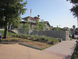
Algiers Point is a location on the Lower Mississippi River in New Orleans, Louisiana. In river pilotage, Algiers Point is one of the many points of land around which the river flows—albeit a significant one. Since the 1970s, the name Algiers Point has also referred to the neighborhood in the immediate vicinity of that point. People from Algiers Point are known as Algierines, or Algerines.

<span class="mw-page-title-main">Broadmoor, New Orleans</span> New Orleans Neighborhood in Louisiana, United States

Broadmoor is a neighborhood of the city of New Orleans. A subdistrict of the Uptown/Carrollton Area, its boundaries as defined by the New Orleans City Planning Commission are: Eve Street to the north, Washington Avenue and Toledano Street to the east, South Claiborne Avenue to the south, and Jefferson Avenue, South Rocheblave Street, Nashville Avenue, and Octavia Street to the west. It includes the Broadmoor Historic District which was listed on the National Register of Historic Places in 2003 and increased in its boundaries in 2007.

<span class="mw-page-title-main">City Park (New Orleans)</span> Public park in New Orleans, Louisiana, US

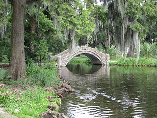
City Park, a 1,300-acre (5.3 km2) public park in New Orleans, Louisiana, is the 87th largest and 20th-most-visited urban public park in the United States. City Park is approximately 50% larger than Central Park in New York City, the municipal park recognized by Americans nationwide as the archetypal urban greenspace. Although it is an urban park whose land is owned by the City of New Orleans, it is administered by the City Park Improvement Association, an arm of state government, not by the New Orleans Parks and Parkways Department. City Park is unusual in that it is a largely self-supporting public park, with most of its annual budget derived from self-generated revenue through user fees and donations. In the wake of the enormous damage inflicted upon the park due to Hurricane Katrina, the Louisiana Department of Culture, Recreation and Tourism began to partially subsidize the park's operations.

<span class="mw-page-title-main">7th Ward of New Orleans</span> New Orleans neighborhood in Louisiana, United States

The 7th Ward is a legally defined voting ward and a neighborhood of the city of New Orleans. A sub-district of the Mid-City District Area, its boundaries as defined by the New Orleans City Planning Commission are: A.P. Tureaud Avenue, Agriculture, Allen, Industry, St. Anthony, Duels, Frenchmen and Hope Streets to the north, Elysian Fields Avenue to the east, St. Claude and St. Bernard Avenues, North Rampart Street and Esplanade Avenue to the south, and North Broad Street to the west.

<span class="mw-page-title-main">Gentilly, New Orleans</span> New Orleans neighborhood in Louisiana, United States

Gentilly is a broad, predominantly middle-class and racially diverse section of New Orleans, Louisiana. The Gentilly neighborhood is bounded by Lake Pontchartrain to the north, France Road to the east, Bayou St. John to the west, and CSX Transportation railroad tracks to the south.

<span class="mw-page-title-main">Place St. Charles</span> Skyscraper in New Orleans, Louisiana, US

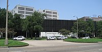
Place St. Charles, located at 201 St. Charles Avenue in the Central Business District of New Orleans, Louisiana, is a 53-story, 645-foot (197 m) skyscraper designed in the post-modern style by Moriyama & Teshima Architects with The Mathes Group, now Mathes Brierre Architects, as local architect. It is the second-tallest building in both the city of New Orleans and the state of Louisiana, and it is taller than Louisiana's tallest peak, Driskill Mountain.

<span class="mw-page-title-main">Lakeview, New Orleans</span> New Orleans Neighborhood in Louisiana, United States

Lakeview is a neighborhood of the city of New Orleans. A subdistrict of the Lakeview District Area, its boundaries as defined by the City Planning Commission are: Allen Toussaint Boulevard to the north, Orleans Avenue to the east, Florida Boulevard, Canal Boulevard and I-610 to the south and Pontchartrain Boulevard to the west. Lakeview is sometimes used to describe the entire area bounded by Lake Pontchartrain to the north, the Orleans Avenue Canal to the east, City Park Avenue to the south and the 17th Street Canal to the west. This larger definition includes the West End, Lakewood and Navarre neighborhoods, as well as the Lakefront neighborhoods of Lakeshore and Lake Vista.

<span class="mw-page-title-main">New Orleans East</span> Eastern section of New Orleans

New Orleans East is the eastern section of New Orleans, Louisiana, the newest section of the city. This collection neighborhood sub divisions represents 65% of the city's total land area, but it is geographically isolated from the rest of the city by the Inner Harbor Navigational Canal. It is surrounded by water on all sides, bounded by the Industrial Canal, Gulf Intracoastal Waterway, Lake Pontchartrain, Lake Borgne, and the Rigolets, a long deep-water strait connecting the two lakes. Interstate 10 (I-10) splits the area nearly in half, and Chef Menteur Hwy, Downman Rd, Crowder Blvd, Dwyer Rd, Lake Forest Blvd, Read Blvd, Bullard Ave, Michoud Blvd, Hayne Blvd, Morrison Rd, Bundy Rd, and Almonaster Ave serve as major streets and corridors.

<span class="mw-page-title-main">Touro Infirmary</span> Non-profit hospital in New Orleans, Louisiana

Touro Infirmary is a non-profit hospital located in New Orleans, Louisiana. Founded by Judah Touro in 1852, it is a part of the LCMC Health System.

<span class="mw-page-title-main">Charity Hospital (New Orleans)</span> Hospital in New Orleans, Louisiana

Charity Hospital was one of two teaching hospitals which were part of the Medical Center of Louisiana at New Orleans (MCLNO), the other being University Hospital. Three weeks after the events of Hurricane Katrina, then-Governor Kathleen Blanco said that Charity Hospital would not reopen as a functioning hospital. The Louisiana State University System, which owns the building, stated that it had no plans to reopen the hospital in its original location. It chose to incorporate Charity Hospital into the city's new medical center in the lower Mid-City neighborhood. The new hospital completed in August 2015 was named University Medical Center New Orleans.

<span class="mw-page-title-main">Davenport Public Library</span>

The Davenport Public Library is a public library located in Davenport, Iowa. With a history dating back to 1839, the Davenport Public Library's Main Library is currently housed in a 1960s building designed by Kennedy Center architect Edward Durell Stone. The Davenport Public Library system is made up of three libraries—the Main Library at 321 Main Street; the Fairmount Branch Library at 3000 N. Fairmount Street (41°33′06″N90°37′54″W); and the Eastern Avenue Branch Library at 6000 Eastern Avenue (41°34′59″N90°33′12″W).

<span class="mw-page-title-main">Rosa F. Keller Library and Community Center</span>

The Rosa F. Keller Library and Community Center is located in the Broadmoor neighborhood of New Orleans, Louisiana. It stands on the corner of Napoleon Avenue and South Broad Street which serve as the north/south, and east/west markers in the neighborhood. The library is a branch of the greater New Orleans Public Library System. The Broadmoor branch serves as one of the only centers for community engagement in the neighborhood and hosts adult education classes, art workshops, after-school activities for children, and community events throughout the year. It opened its doors on March 17, 2012.

The Faubourg Livaudais is a name of a neighborhood in central New Orleans that some people have re-adopted based upon the name of a former plantation that was in the area. The neighborhood is largely residential and contains mostly modest sized homes.

References

  1. 1 2 3 Kraus, Joe Walker (1952). William Beer and the New Orleans Libraries, 1891-1927. Publications Committee of the Association of College and Reference Libraries. Retrieved 28 February 2015.
  2. "NOPL Centennial Exhibit". New Orleans Public Library. Archived from the original on 2009-01-27. Retrieved 2006-07-27.
  3. 1 2 3 "Branch libraries". New Orleans Public Library. Archived from the original on 2009-01-27. Retrieved 2008-06-11.
  4. "Hubbell Library history". Hubbell Library. Archived from the original on 2006-07-14. Retrieved 2006-03-05.
  5. Clareson, Tom; Long, Jane (2006). "Libraries in the Eye of the Storm: Lessons Learned from Hurricane Katrina". American Libraries. 37 (7): 38–41 via EBSCOhost.
  6. "New Orleans Public Library Locations" . Retrieved 6 March 2017.
  7. "Library Renovations and Temporary Closures Information-Nora Navra Library Renovation" . Retrieved 6 March 2017.
  8. "Alvar Branch Renewed, Reopened". American Libraries. 37 (7): 51. 2006.
  9. 1 2 3 4 5 "Opening (and Closing) Dates of NOPL Buildings". City Archives New Orleans Public Library. 29 April 2014. Retrieved 6 March 2017.
  10. Krupa, Michelle (5 September 2010). "Mahalia Jackson learning center offers something for everyone in community". The Times-Picayune. Retrieved 6 March 2017.
  11. "Algiers library to close Saturday". New Orleans Times-Picayune. 2008-05-22. Retrieved 2008-06-11.
  12. 1 2 Williams, Jessica (13 December 2016). "Orphan no more: New Orleans Public Library's Mid-City branch opens doors in new space". The New Orleans Advocate. Retrieved 6 March 2017.
  13. "The History of Milton H. Latter Library" (PDF). www.nolalibrary.org. Retrieved 6 March 2017.
  14. "Latter library to close amid renovations | News | the Advocate — Baton Rouge, LA". theadvocate.com. Archived from the original on 2014-02-02.
  15. "Library Renovations and Temporary Closures Information-Nix Library Renovation" . Retrieved 6 March 2017.
  16. Rainey, Richard (2 May 2015). "New Orleans voters approve library tax". The Times Picayune. Retrieved 6 March 2017.
  17. Thompson, Richard (13 April 2016). "Plans for new 7th Ward public library win planners' approval". The New Orleans Advocate. Retrieved 6 March 2017.
  18. "Capital Projects Administration / PDU Project Status Worksheet (90 day look ahead)". 17 January 2017. Retrieved 7 March 2017.
  19. "Mayor Mitch Landrieu to Announce Nora Navra Library Ground Breaking". 6 March 2017. Retrieved 7 March 2017.
  20. 1 2 Warburton, Bob (2012). "Katrina-Damaged Libraries Reopen". Library Journal.
  21. "an exhibition celebrating the dedication of the Rosa Keller Branch". 13 July 2016. Retrieved 7 March 2017.
  22. "Rosa Keller Library". Village Green at the New Orleans Public Library. Archived from the original on 2011-07-28. Retrieved January 9, 2023.
  23. "Community Identifies Rosa F Keller Library as Priority Project". Belfer Center for Science and International Affairs. June 19, 2007. Archived from the original on January 17, 2010. Retrieved January 9, 2023.
  24. "» Resources for Research in New Orleans Louisiana Historical Society".
  25. 1 2 3 4 "About Us". City Archives & Special Collections.
  26. "Home". City Archives & Special Collections. January 22, 2024.
  27. "Blog". City Archives & Special Collections.
  28. "Facebook". www.facebook.com.
  29. "Archives NOLAlibrary - YouTube". www.youtube.com.
  30. Division, New Orleans Public Library Louisiana (January 24, 1992). "Guide to the Early Records (1760-1861) in the New Orleans City Archives Collection". The Division via Google Books.
  31. 1 2 Erskine, John (January 24, 1938). "The Start of the Road" via Google Books.
  32. L, Dorsey, Florence (January 24, 1947). Road to the Sea: The Story of James B. Eads and the Mississippi River. Pelican Publishing. ISBN   978-1-4556-1132-4 via Google Books.{{cite book}}: CS1 maint: multiple names: authors list (link)
  33. "Dental Items of Interest: A Monthly Journal of Dental Science, Art and Literature". Dental Items of Interest Publishing Company, Incorporated. January 24, 1907 via Google Books.
  34. Fertel, Rien (November 17, 2014). Imagining the Creole City: The Rise of Literary Culture in Nineteenth-Century New Orleans. LSU Press. ISBN   978-0-8071-5825-8 via Google Books.
  35. "Dr. George J Friedrichs killed by trolley car". The Times-Democrat. June 1, 1912. p. 4 via newspapers.com.
  36. "Dr. George J Friedrichs death notice". The Times-Democrat. June 1, 1912. p. 2 via newspapers.com.