Oak Grove, Dodge County, Wisconsin

Last updated

Oak Grove, Wisconsin
WIMap-doton-Oak Grove b.png
Location of Oak Grove, Wisconsin
Coordinates: 43°26′7″N88°41′59″W / 43.43528°N 88.69972°W / 43.43528; -88.69972
Country Flag of the United States.svg  United States
State Flag of Wisconsin.svg  Wisconsin
County Dodge
Area
  Total34.2 sq mi (88.6 km2)
  Land34.1 sq mi (88.3 km2)
  Water0.1 sq mi (0.3 km2)
Elevation
[1]
935 ft (285 m)
Population
 (2000)
  Total1,126
  Density33.0/sq mi (12.8/km2)
Time zone UTC-6 (Central (CST))
  Summer (DST) UTC-5 (CDT)
Area code 920
FIPS code 55-59000 [2]
GNIS feature ID1583841 [1]

Oak Grove (originally called Fairfield) is a town in Dodge County, Wisconsin, United States. The population was 1,126 at the 2000 census. The unincorporated community of Minnesota Junction is located in the town. The unincorporated community of Rolling Prairie is also located partially in the town.

Contents

Geography

According to the United States Census Bureau, the town has a total area of 34.2 square miles (88.6 km2), of which, 34.1 square miles (88.3 km2) of it is land and 0.1 square miles (0.3 km2) of it (0.32%) is water.

Demographics

As of the census [2] of 2000, there were 1,126 people, 428 households, and 335 families living in the town. The population density was 33.0 people per square mile (12.8/km2). There were 448 housing units at an average density of 13.1 per square mile (5.1/km2). The racial makeup of the town was 98.13% White, 0.36% African American, 0.44% Asian, 0.53% from other races, and 0.53% from two or more races. Hispanic or Latino of any race were 1.60% of the population.

There were 428 households, out of which 31.5% had children under the age of 18 living with them, 69.6% were married couples living together, 4.2% had a female householder with no husband present, and 21.7% were non-families. 18.0% of all households were made up of individuals, and 7.2% had someone living alone who was 65 years of age or older. The average household size was 2.63 and the average family size was 2.98.

In the town, the population was spread out, with 24.8% under the age of 18, 6.8% from 18 to 24, 29.3% from 25 to 44, 26.3% from 45 to 64, and 12.8% who were 65 years of age or older. The median age was 39 years. For every 100 females, there were 107.7 males. For every 100 females age 18 and over, there were 110.2 males.

The median income for a household in the town was $53,068, and the median income for a family was $58,333. Males had a median income of $36,793 versus $23,654 for females. The per capita income for the town was $20,277. About 5.4% of families and 7.4% of the population were below the poverty line, including 11.3% of those under age 18 and 13.5% of those age 65 or over.

43°23′10″N88°44′44″W / 43.38611°N 88.74556°W / 43.38611; -88.74556

Related Research Articles

<span class="mw-page-title-main">Steuben, Maine</span> Town in the state of Maine, United States

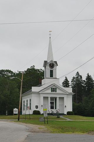
Steuben is a town in Washington County, Maine, United States. Incorporated in 1795, it was named after Baron Friedrich Wilhelm von Steuben, the Inspector General of the U.S. Army during the Revolutionary War. The population was 1,129 at the 2020 census.

<span class="mw-page-title-main">Midland, Maryland</span> Town in Maryland, United States

Midland is a town in Allegany County, Maryland, United States, along the Georges Creek Valley. It is part of the Cumberland, MD-WV Metropolitan Statistical Area. The population was 446 at the 2010 census. Midland was founded in 1850 as a coal-mining community, though today only some strip mining remains.

<span class="mw-page-title-main">Reeds Spring, Missouri</span> City in Missouri, United States

Reeds Spring is a city in Stone County, Missouri, United States. The population was 1,136 at the 2020 census.

<span class="mw-page-title-main">Frontier, North Dakota</span> City in North Dakota, United States

Frontier is a city in Cass County, North Dakota, United States. The population was 195 at the 2020 census. Frontier is located south of the city of Fargo and is located roughly six miles southwest of that city's downtown. Frontier was founded in 1976. Since Frontier's founding, the adjacent city of Fargo has grown to the point where it almost completely encompasses Frontier's city limits. Only a small gap on the city's southwest corner keeps Frontier from being a complete enclave community within Fargo's border.

<span class="mw-page-title-main">Ruby, South Carolina</span> Town in South Carolina, United States

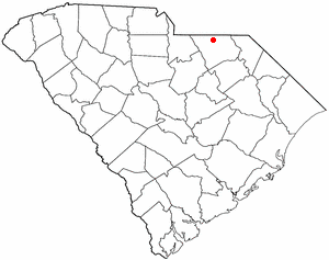
Ruby is a town in Chesterfield County, South Carolina, United States. The population was 360 at the 2010 census.

<span class="mw-page-title-main">Mabscott, West Virginia</span> Town in West Virginia, United States

Mabscott is a town in Raleigh County, West Virginia, United States. The population was 1,333 at the 2020 census. The town's name is a contraction of the name Mabel Scott, wife of local coal operator Cyrus H. Scott.

<span class="mw-page-title-main">Rhodell, West Virginia</span> Unincorporated community in West Virginia, United States

Rhodell is an unincorporated community in Raleigh County, West Virginia, United States. The population was 173 at the 2010 census.

<span class="mw-page-title-main">Washburn, Clark County, Wisconsin</span> Town in Wisconsin, United States

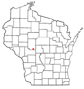
Washburn is a town in Clark County in the U.S. state of Wisconsin. The population was 304 at the 2000 census. The unincorporated community of Shortville is located in the town.

Friendship is a town in Fond du Lac County, Wisconsin, United States. The population was 2,406 at the 2000 census. The unincorporated communities of Dexter and Van Dyne are located within the town.

<span class="mw-page-title-main">Curran, Wisconsin</span> Town in Wisconsin, United States

Curran is a town in Jackson County, Wisconsin, United States. The population was 343 at the 2010 census.

<span class="mw-page-title-main">Newton, Manitowoc County, Wisconsin</span> Town in Wisconsin, United States

Newton is a town in Manitowoc County, Wisconsin, United States. The population was 2,241 at the 2000 census.

<span class="mw-page-title-main">Spruce, Wisconsin</span> Town in Wisconsin, United States

Spruce is a town in Oconto County, Wisconsin, United States. The population was 835 at the 2010 census.

<span class="mw-page-title-main">Underhill, Wisconsin</span> Town in Wisconsin, United States

Underhill is a town in Oconto County, Wisconsin, United States. The population was 846 at the 2000 census.

<span class="mw-page-title-main">Okauchee Lake, Wisconsin</span> CDP in Wisconsin, United States

Okauchee Lake is a census-designated place (CDP) in Waukesha County, Wisconsin, United States. The population was 5,094 at the 2020 census. Okauchee Lake is located in the town of Oconomowoc.

<span class="mw-page-title-main">Black Wolf, Wisconsin</span> Town in Wisconsin, United States

Black Wolf is a town in Winnebago County, Wisconsin, United States. The population was 2,429 at the 2020 census. The unincorporated communities of Black Wolf, Black Wolf Point, Little Point, Paukotuk, and Point Comfort are located in the town.

Watertown is a town in Jefferson County, Wisconsin, United States. The population was 1,975 at the 2010 census. The unincorporated community of Ebenezer is located in the town.

Lomira is a town in Dodge County, Wisconsin, United States. The population was 1,228 at the 2000 census. The Village of Lomira is located within the town. The unincorporated communities of Knowles and Nasbro are located in the town.

Lowell is a town in Dodge County, Wisconsin, United States. The population was 1,169 at the 2000 census. The Village of Lowell and the unincorporated community of North Lowell are located in the town.

Rosendale is a town in Fond du Lac County, Wisconsin, United States. The population was 783 at the 2000 census. The village of Rosendale is located partially within the town. The unincorporated communities of Rosendale Center and West Rosendale are also located in the town.

The Town of Prairie du Sac is located in southwestern Sauk County, Wisconsin, United States. The population was 1,138 at the 2000 census. The Village of Prairie du Sac is located within the town. The unincorporated community of Loddes Mill is also located in the town.

References

  1. 1 2 "US Board on Geographic Names". United States Geological Survey. October 25, 2007. Retrieved January 31, 2008.
  2. 1 2 "U.S. Census website". United States Census Bureau . Retrieved January 31, 2008.