The coat of arms of South Africa is the main heraldic insignia of South Africa. The present coat of arms was introduced on Freedom Day, 27 April 2000, and was designed by Iaan Bekker. It replaced the earlier national arms, which had been in use since 1910. The motto is written in the extinct |Xam, member of the Khoisan languages, and translates literally to "diverse people unite". The previous motto, in Latin, was Ex Unitate Vires, translated as "From unity, strength".

Bophuthatswana, officially the Republic of Bophuthatswana, was a Bantustan that was declared (nominally) independent by the apartheid regime of South Africa in 1977. However, its independence, like the other Bantustans of Ciskei, Transkei and Venda was not recognized by any country other than South Africa.

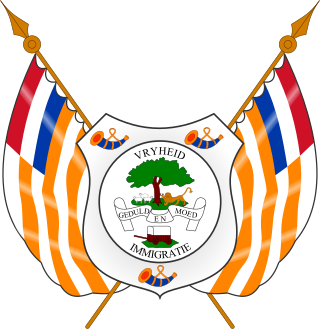
The Orange Free State was an independent Boer sovereign republic under British suzerainty in Southern Africa during the second half of the 19th century, which ceased to exist after it was defeated and surrendered to the British Empire at the end of the Second Boer War in 1902. It is one of the three historical precursors to the present-day Free State province.
QwaQwa was a bantustan ("homeland") in the central eastern part of South Africa. It encompassed a very small region of 655 square kilometres (253 sq mi) in the east of the former South African province of Orange Free State, bordering Lesotho. Its capital was Witsieshoek. It was the designated homeland of more than 180,000 Sesotho-speaking Basotho people.

Phuthaditjhaba, is a town in the Free State province of South Africa. It is located in a section of the Drakensberg mountains. It borders the province of KwaZulu-Natal to the south east and the independent country of Lesotho to the south west. The town was capital of the bantustan, or homeland, of QwaQwa. When apartheid ended, the town became part of the Free State province.

The Province of the Transvaal, commonly referred to as the Transvaal, was a province of South Africa from 1910 until 1994, when a new constitution subdivided it following the end of apartheid. The name "Transvaal" refers to the province's geographical location to the north of the Vaal River. Its capital was Pretoria, which was also the country's executive capital.

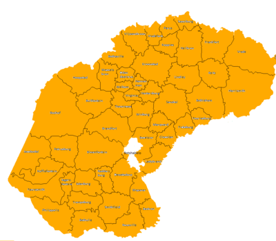
The Free State, formerly known as the Orange Free State, is a province of South Africa. Its capital is Bloemfontein, which is also South Africa's judicial capital. Its historical origins lie in the Boer republic called the Orange Free State and later the Orange Free State Province.
Oranjeville is a small town situated on the banks of the Wilge River in the Free State province of South Africa.

The University of the Free State is a multi-campus public university in Bloemfontein, the capital of the Free State and the judicial capital of South Africa. It was first established as an institution of higher learning in 1904 as a tertiary section of Grey College. It was declared an independent Afrikaans-language university in 1950 and the name was changed to the University of the Orange Free State. The university has two satellite campuses. Initially a whites-only precinct, the university was fully de-segregated in 1996. The first black university vice-chancellor was appointed in 2010.
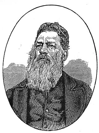
Josias Philip Hoffman was a South African Boer statesman, and was the chairman of the Provisional Government and later the first State President of the Orange Free State, in office from 1854 to 1855.
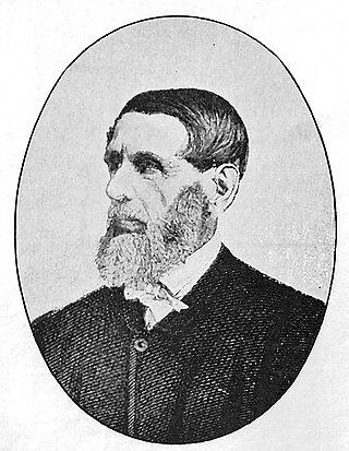
Jacobus Nicolaas Boshof was a South African (Boer) statesman, a late-arriving member of the Voortrekker movement, and the second state president of the Orange Free State, in office from 1855 to 1859.
Jacobus Groenendaal was a South African statesman of Dutch origin, member of the Volksraad of the Orange Free State and the republic's first Treasurer General and Government Secretary in office from 1854 to 1855 and 1856 respectively.

Just Friedrich Rudolph Kaufmann Höhne, commonly known as Friedrich Kaufmann Höhne, South African (Boer) politician, Government Secretary and in 1872 Acting State President of the Orange Free State, during the absence of State President Brand.
Cornelis Hiddingh, RNL was a South African born Dutch lawyer and civil servant, who acted as special envoy to the Orange Free State and South African Republic in 1855–1856 and was consul general of the Orange Free State in the Netherlands between 1861 and 1871.

The Volksblad is an Afrikaans-language daily newspaper published in Bloemfontein, South Africa, and distributed in the Free State and Northern Cape provinces, where it is the largest Afrikaans daily. It is South Africa's oldest Afrikaans The paper is owned by Media24.
Hoërskool Sand du Plessis is a secondary school in Bloemfontein, Free State, South Africa. This public high school was founded in 1970, when it split off from the lower school. Both boys and girls are taught here.

Regiment Louw Wepener was an infantry battalion of the South African Army. As a reserve force unit, it had a status roughly equivalent to that of a British Army Reserve or United States Army National Guard unit.
The Volksraad of the Orange Free State was the unicameral parliament of the Orange Free State. It was the supreme authority of Orange Free State.