Otway, Ohio

Last updated

Otway, Ohio
Otway Covered Bridge.jpg
OHMap-doton-Otway.png
Location of Otway, Ohio
Map of Scioto County Ohio Highlighting Otway Village.png
Location of Otway in Scioto County
Coordinates: 38°51′54″N83°11′17″W / 38.86500°N 83.18806°W / 38.86500; -83.18806
Country United States
State Ohio
County Scioto
Area
[1]
  Total0.18 sq mi (0.46 km2)
  Land0.17 sq mi (0.45 km2)
  Water0.00 sq mi (0.01 km2)
Elevation
[2]
591 ft (180 m)
Population
 (2020)
  Total92
  Density525.71/sq mi (203.03/km2)
Time zone UTC-5 (Eastern (EST))
  Summer (DST) UTC-4 (EDT)
ZIP code
45657
Area code 740
FIPS code 39-59066 [3]
GNIS feature ID2399599 [2]

Otway is a village in Scioto County, Ohio, United States. The population was 92 at the 2020 census.

Contents

History

A post office called Otway has been in operation since 1861. [4] The town site was platted on March 29, 1884. [5] The village was named after Thomas Otway, an English dramatist. [6] Otway was incorporated in 1890. [7]

Trains traveling from Portsmouth to Cincinnati would stop at the Norfolk & Western train depot located in Otway. In 1956, the depot was moved across the tracks and converted into a convenience store as roads were used more and more for travel instead of trains. [8]

On March 2, 2012, a tornado with winds upwards of 75 mph, swept through southern Ohio. Otway's fire department building, along with two houses, were damaged. [9] Also damaged was one of Otway's emergency response vehicles, but through a donation from the Uniopolis Fire Department, the vehicle was quickly replaced with a 1983 pumper tanker truck. [10]

Geography

According to the United States Census Bureau, the village has a total area of 0.20 square miles (0.52 km2), all land. [11]

Demographics

Historical population
CensusPop.Note
1900 274
1910 234−14.6%
1920 28923.5%
1930 265−8.3%
1940 235−11.3%
1950 229−2.6%
1960 2352.6%
1970 177−24.7%
1980 161−9.0%
1990 105−34.8%
2000 86−18.1%
2010 871.2%
2020 925.7%
U.S. Decennial Census [12]

2010 census

As of the census [13] of 2010, there were 87 people, 39 households, and 26 families living in the village. The population density was 435.0 inhabitants per square mile (168.0/km2). There were 52 housing units at an average density of 260.0 per square mile (100.4/km2). The racial makeup of the village was 94.3% White, 3.4% Native American, and 2.3% from two or more races.

There were 39 households, of which 28.2% had children under the age of 18 living with them, 48.7% were married couples living together, 12.8% had a female householder with no husband present, 5.1% had a male householder with no wife present, and 33.3% were non-families. 28.2% of all households were made up of individuals, and 15.4% had someone living alone who was 65 years of age or older. The average household size was 2.23 and the average family size was 2.69.

The median age in the village was 40.5 years. 18.4% of residents were under the age of 18; 8% were between the ages of 18 and 24; 25.2% were from 25 to 44; 28.6% were from 45 to 64; and 19.5% were 65 years of age or older. The gender makeup of the village was 40.2% male and 59.8% female.

2000 census

As of the census [3] of 2000, there were 86 people, 40 households, and 26 families living in the village. The population density was 388.1 inhabitants per square mile (149.8/km2). There were 59 housing units at an average density of 266.2 per square mile (102.8/km2). The racial makeup of the village was 96.51% White, 1.16% Native American, 2.33% from other races. Hispanic or Latino of any race were 2.33% of the population.

There were 40 households, out of which 17.5% had children under the age of 18 living with them, 47.5% were married couples living together, 12.5% had a female householder with no husband present, and 35.0% were non-families. 35.0% of all households were made up of individuals, and 20.0% had someone living alone who was 65 years of age or older. The average household size was 2.15 and the average family size was 2.77.

In the village, the population was spread out, with 16.3% under the age of 18, 14.0% from 18 to 24, 23.3% from 25 to 44, 20.9% from 45 to 64, and 25.6% who were 65 years of age or older. The median age was 44 years. For every 100 females there were 79.2 males. For every 100 females age 18 and over, there were 75.6 males.

The median income for a household in the village was $27,500, and the median income for a family was $35,000. Males had a median income of $32,500 versus $25,625 for females. The per capita income for the village was $12,966. There were 11.5% of families and 14.1% of the population living below the poverty line, including 21.1% of under eighteens and 15.8% of those over 64.

Related Research Articles

<span class="mw-page-title-main">Uniopolis, Ohio</span> Unincorporated community and Census-designated place in Ohio, United States

Uniopolis is an unincorporated community and former village in Auglaize County, Ohio, United States. The population was 188 at the 2020 census. It is included in the Wapakoneta, Ohio Micropolitan Statistical Area.

<span class="mw-page-title-main">Mechanicsburg, Ohio</span> Village in Ohio, United States

Mechanicsburg is a village in Champaign County, Ohio, United States. The population was 1,681 at the 2020 census.

<span class="mw-page-title-main">Moscow, Ohio</span> Village in Ohio, United States

Moscow is a village in Clermont County, Ohio. The population was 155 at the time of the 2020 census. The William H. Zimmer Power Station, a coal-fired power plant that was converted from a planned nuclear power plant during construction, is partially located within village limits. It is located near the Ulysses S. Grant Birthplace.

<span class="mw-page-title-main">North Robinson, Ohio</span> Village in Ohio, United States

North Robinson is a village in Crawford County, Ohio, United States. The population was 219 at the 2020 census.

<span class="mw-page-title-main">Ostrander, Ohio</span> Village in Ohio, United States

Ostrander is a village in Delaware County, Ohio, United States. The population was 1,094 at the 2020 census.

<span class="mw-page-title-main">Alger, Ohio</span> Village in Ohio, United States

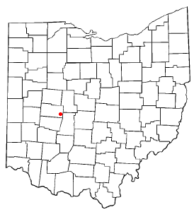
Alger is a village in Hardin County, Ohio, United States. The population was 837 at the 2020 census.

<span class="mw-page-title-main">Russells Point, Ohio</span> Village in Ohio, United States

Russells Point is a village located in northwest Logan County, Ohio, United States. The population was 1,320 at the 2020 census. It is situated on Indian Lake, which had long been a popular summer resort destination.

<span class="mw-page-title-main">Green Camp, Ohio</span> Village in Ohio, United States

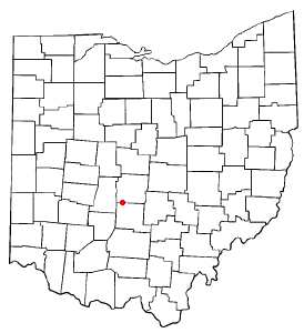
Green Camp is a village in Marion County, Ohio, United States, standing at the confluence of the Scioto and Little Scioto Rivers. The population was 310 at the 2020 census. Green Camp is served by Elgin Local School District.

<span class="mw-page-title-main">Cardington, Ohio</span> Village in Ohio, United States

Cardington is a village in Morrow County, Ohio, United States. The population was 2,051 at the 2020 census. Mount Gilead, Ohio, the county seat, is located northeast of Cardington on U.S. Route 42.

<span class="mw-page-title-main">Commercial Point, Ohio</span> Village in Ohio, United States

Commercial Point is a village in Pickaway County, Ohio, United States. The population was 3,078 at the 2020 census. It is the fastest-growing affluent community in Pickaway County and one of the fastest-growing villages in central Ohio. It is a suburb of Columbus, OH

<span class="mw-page-title-main">Orient, Ohio</span> Census-designated place in Ohio, United States

Orient is a census-designated place and former village in Pickaway County, Ohio, United States. The population was 246 at the 2020 census.

<span class="mw-page-title-main">Piketon, Ohio</span> Village in Ohio, United States

Piketon is a village in Pike County in the U.S. state of Ohio, along the Scioto River. The village is best known for the uranium enrichment plant located there, which is one of only three such plants in the United States. The population was 2,111 at the 2020 U.S. census.

<span class="mw-page-title-main">Franklin Furnace, Ohio</span> Census-designated place in Ohio, United States

Franklin Furnace is a census-designated place (CDP) in Scioto County, Ohio, United States, along the Ohio River. The population was 1,525 at the 2020 census.

<span class="mw-page-title-main">Lucasville, Ohio</span> Census-designated place in Ohio, United States

Lucasville is a census-designated place (CDP) in Scioto County, Ohio, United States. The population was 1,655 at the 2020 census. It is part of the Portsmouth micropolitan area.

<span class="mw-page-title-main">New Boston, Ohio</span> Village in Ohio, United States

New Boston is a village in Scioto County, Ohio, United States, along the Ohio River. The population was 2,298 at the 2020 census. Apart from its southern boundary on the Ohio River, New Boston is entirely surrounded by the city of Portsmouth.

<span class="mw-page-title-main">Rarden, Ohio</span> Village in Ohio, United States

Rarden is a village in Scioto County, Ohio, United States. The population was 146 at the 2020 census.

<span class="mw-page-title-main">Rosemount, Ohio</span> Census-designated place in Ohio, United States

Rosemount is a census-designated place (CDP) in Clay Township, Scioto County, Ohio, United States. The population was 2,117 at the 2020 census.

<span class="mw-page-title-main">South Webster, Ohio</span> Village in Ohio, United States

South Webster is a village in northeast Scioto County, Ohio, United States. It lies along State Route 140. The population was 670 at the 2020 census.

<span class="mw-page-title-main">Wheelersburg, Ohio</span> Census-designated place in Ohio, United States

Wheelersburg is a census-designated place (CDP) in Scioto County, Ohio, United States. It lies along the northern banks of the Ohio River in southern Ohio. Wheelersburg is approximately 7 miles (11 km) east of Portsmouth and 14 miles (23 km) west of Ironton. It is in Porter Township. The population was 6,531 at the 2020 census.

<span class="mw-page-title-main">Harveysburg, Ohio</span> Village in Ohio, United States

Harveysburg is a village in Massie Township, Warren County, Ohio, United States. The population was 554 at the 2020 census. It is best known as the home of the Ohio Renaissance Festival.

References

  1. "ArcGIS REST Services Directory". United States Census Bureau. Retrieved September 20, 2022.
  2. 1 2 U.S. Geological Survey Geographic Names Information System: Otway, Ohio
  3. 1 2 "U.S. Census website". United States Census Bureau . Retrieved January 31, 2008.
  4. "Post offices". Jim Forte Postal History. Retrieved June 19, 2016.
  5. "Portsmouth Area Resource Guide, 2007-2008". The Community Common. July 29, 2007. p. 7.[ need quotation to verify ]
  6. Bannon, Henry Towne (1927). Stories Old and Often Told, Being Chronicles of Scioto County, Ohio. Baltimore: Waverly Press. p. 274.
  7. Overman, William Daniel (1958). Ohio Town Names. Akron, OH: Atlantic Press. p. 106.
  8. Detty, Jim (2017). Scioto County. Arcadia Publishing. p. 95. ISBN   9781439659915.
  9. "March 2, 2012 -- Tornado near Otway". National Weather Service. Retrieved October 18, 2021.
  10. Lewis, Frank (March 13, 2012). "Uniopolis FD fills void Donates truck to tornado-torn Otway department". Lima News. NewspaperArchive. Retrieved October 17, 2021.
  11. "US Gazetteer files 2010". United States Census Bureau. Archived from the original on January 25, 2012. Retrieved January 6, 2013.
  12. "Census of Population and Housing". Census.gov. Retrieved June 4, 2015.
  13. "U.S. Census website". United States Census Bureau . Retrieved January 6, 2013.