Related Research Articles
Northwood is an area in northwest London, England. It is located within the London Borough of Hillingdon on the border with Hertfordshire and 14.5 miles (23.3 km) from Charing Cross. Northwood was part of the ancient parish of Ruislip, Middlesex and has formed part of Greater London since 1965.

Stanmore is part of the London Borough of Harrow in London. It is centred 11 miles (18 km) northwest of Charing Cross, lies on the outskirts of the London urban area and includes Stanmore Hill, one of the highest points of London, at 152 metres (499 ft) high. The district, which developed from the ancient Middlesex parishes of Great and Little Stanmore, lies immediately west of Roman Watling Street and forms the eastern part of the modern London Borough of Harrow.

The London Borough of Harrow is a London borough in north-west London, England, and forms part of Outer London. It borders four other London boroughs – Barnet to the east of ancient Watling Street, Brent to the south-east, Ealing to the south and Hillingdon to the west – plus the Hertfordshire districts of Three Rivers and Hertsmere to the north. The local authority is Harrow London Borough Council. The London borough was formed in 1965, based on boundaries that had been established in 1934. The borough is made up of three towns: Harrow proper, Pinner, and Stanmore, but also includes western parts of Edgware; it is of suburban character and includes some countryside in the northern outskirts.

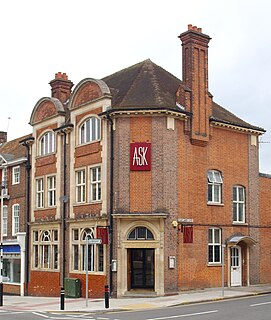
Harrow is a large town in Greater London, England, and serves as the principal settlement of the London Borough of Harrow. Lying about 9.5 miles (15.3 km) north-west of Charing Cross and 5.4 miles (8.7 km) south of Watford, the entire town including its localities had a population of 149,246 as of the 2011 census, whereas the wider borough had a population of 250,149.

North Harrow is a suburban area of North West London, situated north-west of central Harrow within the London Borough of Harrow. Its residential roads have expanded from North Harrow tube station, a station on the Metropolitan line of the London Underground which is one stop away from Harrow-on-the-Hill station in Harrow town centre. Before North Harrow tube station was opened and the suburb developed, the area was known as Hooking Green.

Harrow Weald is a suburban district in Greater London, England. Located about 2 miles north of Harrow, Harrow Weald is formed from a leafy 1930s suburban development along with ancient woodland of Harrow Weald Common. It forms part of the London Borough of Harrow.
The London Borough of Bexley owns and maintains over 100 parks and open spaces within its boundaries, with a total of 638 hectares. They include small gardens, river and woodland areas, and large parks with many sporting and other facilities.

The London Borough of Croydon has over 120 parks and open spaces within its boundaries, ranging from the 200 acre (80ha) Selsdon Wood Nature Reserve to many recreation grounds and sports fields scattered throughout the Borough. Croydon covers an area of 86.52 km², the 256th largest district in England. Croydon's physical features consist of many hills and rivers that are spread out across the borough and into the North Downs, Surrey and the rest of South London. Some of the open spaces in Croydon form part of the well-known London LOOP walks where the first section was opened on 3 May 1996 with a ceremony on Farthing Downs in Coulsdon. As a borough in Outer London it also contains some open countryside in the form of country parks. Croydon Council is associated with several other boroughs who are taking part in the Downlands Countryside Management Project. These boroughs are Sutton; and by Surrey County Council; the City of London Corporation; the Surrey districts of Reigate and Banstead and Tandridge; and the Countryside Agency. An additional partner is Natural Britain.
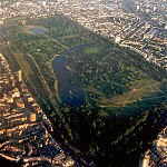
The London Borough of Barnet, located on the northern periphery of London and having much of the area within its boundaries in the Metropolitan Green Belt, has many parks and open spaces. In addition there are large areas taken over by cemeteries and golf courses, and part of Hampstead Heath.

Grim's Ditch or Grim's Dyke or Grimes Dike is a great earthwork in the London Borough of Harrow, in the historic county of Middlesex, and lends its name to the gentle escarpment it crowns, marking Hertfordshire's border. It extended east-west about 6 miles (9.7 km) from the edge of Stanmore where an elevated neighbourhood of London, Stanmore Hill, adjoins Bushey Heath to the far north of Pinner Green – Cuckoo Hill. Today the remaining earthworks start mid-way at Harrow Weald Common. It takes its name from the likely Roman Britain-era earthwork which became called one of seven Grim's Ditches, a few of which have two or three rows, in central-to-southern England.

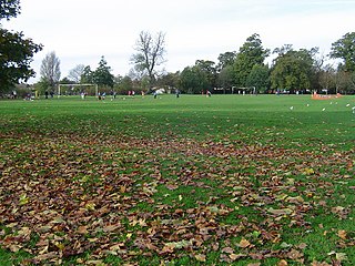
There are many parks and open spaces in Greater London, England. Green space in central London consists of five of the capital's eight Royal Parks, supplemented by a number of small garden squares scattered throughout the city centre. Open space in the rest of the region is dominated by the remaining three Royal Parks and many other parks and open spaces of a range of sizes, run mainly by the local London boroughs, although other owners include the National Trust and the City of London Corporation.
Headstone is a residential area north-west of Harrow, London, and immediately north of North Harrow. A green buffer exists between Headstone and North Harrow that consists of a moated manor site and football and rugby pitches, making the area mostly separate from North Harrow. However, there are some points of flux and overlap. To the west the area abuts the large and predominantly agricultural pasture of Pinner Park.

Headstone Manor is a 14th-century Grade I listed moated manor house in Headstone, England, and today a part of the Headstone Manor and Museum. Headstone Manor & Museum is a museum of the site itself as well as Harrow more generally. It also hosts a programme of talks, tours, events and family activities for visitors. Headstone Manor & Museum is open Tuesday to Sunday, all year round. Entry to the site and the museum is free.

Bentley Priory is an eighteenth to nineteenth century stately home and deer park in Stanmore on the northern edge of the Greater London area in the London Borough of Harrow.

Yeading Brook is the dominant source of the River Crane, in outer North West then West London. It flows 25.8 km (16.0 mi) south. It rises in the far south of suburban Pinner and drains all of the western suburbs of Harrow, insofar as they have not been by historical practice connected into sewers.

Stanmore Country Park is a 30.7 hectare public park, Local Nature Reserve and Site of Metropolitan Importance for Nature Conservation in Stanmore in the London Borough of Harrow. It is owned and managed by Harrow London Borough Council.

Stanmore Common is a 49.2-hectare public park, Local Nature Reserve and Site of Metropolitan Importance for Nature Conservation in Stanmore in the London Borough of Harrow in England. It is owned by Harrow Council and managed by the council with a local group. It was a biological Site of Special Scientific Interest, but was de-notified in the early 1990s.

Harrow Weald Common is an 18-hectare area of woodland, heath and pasture in Harrow Weald in the London Borough of Harrow. It is considered of considerable importance for wildlife, and it was formerly part of the Stanmore and Harrow Weald Commons and Bentley Priory Site of Special Scientific Interest, but in 1987 the boundaries of the SSSI were revised to exclude the Common. It has been designated by the Mayor of London as a Site of Metropolitan Importance for Nature Conservation.
References
| Districts |
|  | ||
|---|---|---|---|---|
| Attractions | ||||
| Parks and open spaces | ||||
| Constituencies | ||||
| Tube and rail stations | ||||
| Other topics | ||||
| | This London location article is a stub. You can help Wikipedia by expanding it. |