Piazza del Popolo is a large urban square in Rome. The name in modern Italian literally means "People's Square", but historically it derives from the poplars (populus in Latin, pioppo in Italian) after which the church of Santa Maria del Popolo, in the northeast corner of the piazza, takes its name.
The piazza lies inside the northern gate in the Aurelian Walls, once the Porta Flaminia of ancient Rome, and now called the Porta del Popolo. This was the starting point of the Via Flaminia, the road to Ariminum (modern-day Rimini) and the most important route to the north. At the same time, before the age of railroads, it was the traveller's first view of Rome upon arrival. For centuries, the Piazza del Popolo was a place for public executions, the last of which took place in 1826.
The layout of the piazza today was designed in neoclassical style between 1811 and 1822 by the architect Giuseppe Valadier,[1] He removed a modest fountain by Giacomo Della Porta, erected in 1572,[2] and demolished some insignificant buildings and haphazard high screening walls to form two semicircles, reminiscent of Bernini's plan for St. Peter's Square, replacing the original cramped trapezoidal square centred on the Via Flaminia.
Valadier's Piazza del Popolo, however, incorporated the verdure of trees as an essential element; he conceived his space in a third dimension, expressed in the building of the viale that leads up to the balustraded overlook from the Pincio (above, right).
An Egyptianobelisk of Sety I (later erected by Rameses II) from Heliopolis stands in the centre of the Piazza. Three sides of the obelisk were carved during the reign of Sety I and the fourth side, under Rameses II. The obelisk, known as the Flaminio Obelisk or the Popolo Obelisk, is the second-oldest and one of the tallest obelisks in Rome (some 24m high, or 36m including its plinth). The obelisk was brought to Rome in 10 BC by order of Augustus and originally set up in the Circus Maximus. It was re-erected here in the piazza by the architect-engineer Domenico Fontana in 1589 as part of the urban plan of Sixtus V. The piazza also formerly contained a central fountain, which was moved to the Piazza Nicosia in 1818, when fountains, in the form of Egyptian-style lions, were added around the base of the obelisk.[3]
Looking from the north (illustration, right), three streets branch out from the piazza into the city, forming the so-called "trident" (il Tridente): the Via del Corso in the centre; the Via del Babuino to the left (opened in 1525 as the Via Paolina) and the Via di Ripetta (opened by Leo X in 1518 as the Via Leonina) to the right. The twin churches (the chiese gemelle) of Santa Maria dei Miracoli (1681) and Santa Maria in Montesanto (1679), begun by Carlo Rainaldi and completed by Bernini and Carlo Fontana, define the junctions of the roads. Close scrutiny of the twin churches reveals that they are not mere copies of one another, as they would have been in a Neoclassical project, but vary in their details, offering variety within their symmetrical balance in Baroque fashion.
The central street, now known as the Via del Corso, was the ancient Via Lata, and to the north it links with the ancient Roman road, the Via Flaminia, beyond the city gate and southwards, to the Piazza Venezia (formerly the Piazza San Marco), the Capitol and the forum. The Via di Ripetta leads past the Mausoleum of Augustus to the River Tiber, where the Baroque riverside landing called the Porto di Ripetta was located until it was destroyed in the late 19th century. The Via del Babuino ("Baboon"), linking to Piazza di Spagna, takes its name from a grotesque sculpture of Silenus that gained the popular name of "the Baboon".
In his urbanistic project, Valadier constructed the matching palazzi that provide a frame for the scenography of the twin churches and hold down two corners of his composition. He positioned a third palazzo to face these and matched a low structure screening the flank of Santa Maria del Popolo, with its fine Early Renaissance façade, together holding down the two northern corners. Valadier outlined this newly defined oval forecourt to the city of Rome with identical sweeps of wall, forming curving exedra-like spaces. Behind the western one, a screen of trees masks the unassorted fronts of buildings beyond.
Fountains
One side of the Fontana dell'Obelisco
The aqueduct carrying the Acqua Vergine Nuovo was completed in the 1820s, and its water provided the opportunity for fountains and their basins that offered the usual public water supply for the rione or urban district. Ever since the Renaissance such terminal fountains also provided an occasion for the grand terminal water show called in Rome a mostra or a show. "What makes a fountain a mostra is not essentially its size or splendor, but its specific designation as the fountain that is a public memorial to the whole achievement of the aqueduct."[5] Valadier had planned fountains in the upper tier of the Pincio slope, but these were not carried out, in part for lack of water.[6]
Fountains by Giovanni Ceccarini (1822–23), with matching compositions of a central figure flanked by two attendant figures, stand on each side of the piazza to the east and west, flanked by neoclassical statues of The Seasons (1828).[7] The Fontana del Nettuno (Fountain of Neptune) [8] stands on the west side, Neptune with his trident is accompanied by two tritons. Rome between the Tiber and the Aniene on the east side, against the steep slope of the Pincio, represents the terminal mostra of the aqueduct. Dea Roma armed with lance and helmet, and in front is the she-wolf feeding Romulus and Remus.[6]
At the center of the piazza is the Fontana dell' Obelisco: a group of four mini fountains, each comprising a lion on a stepped plinth, surround the obelisk.
Urbanisation in three dimensions
From Piazza del Popolo, the steps lead to the Pincio, to the east.
Valadier's masterstroke was in linking the piazza with the heights of the Pincio, the Pincian Hill of ancient Rome, which overlooked the space from the east. He swept away informally terraced gardens that belonged to the Augustinian monastery connected with Santa Maria del Popolo. In its place he created a carriage drive that doubled back upon itself and pedestrian steps leading up beside a waterfall to the Pincio park, where a balustraded lookout, supported by a triple-arched nymphaeum is backed by a wide gravelled opening set on axis with the piazza below; formally planted bosquets of trees flank the open space. The planted Pincio in turn provides a link to the Villa Borghese gardens.
Before its restoration and conversion into a pedestrian zone in 1997–1998, the Piazza del Popolo was often choked with traffic and parked cars.[9]
↑ Valadier published his first proposal for the Piazza del Popolo in 1794; the final proposal as built appeared in 1816, when the works were already in progress.
↑ This obelisk was originally a set of two but the 'mate' has not been found with a degree of certainty.
↑ Whereas such festive structures elsewhere were built of weather-resistant plaster, this structure was more permanently executed in stone. See the festive tradition of the royal entry.
↑ Peter J. Aicher, "Terminal Display Fountains ("Mostre") and the Aqueducts of Ancient Rome" Phoenix47.4 (Winter 1993:339–352), p. 339. Aicher makes a case for the terminal fountains as features of modern Rome, but not of ancient Rome, as commonly assumed in the standard works listed in his bibliography p. 339.
1 2 M.G. Tolomeo, "Le fontane del piazza del Popolo e la mostra del nuovo aquedotto Vergine elevato", Il Trionfo dell'acqua (Rome, 1986:240–243).
↑ Touring Club Italiano, Roma e dintorni 1965:181, gives the names of the four sculptors responsible: Filippo Guaccarini (Spring), Francesco Massimiliano Laboureur (Summer), Achille Stocchi (Autumn), and Felice Raini (Winter).
↑ This fountain should not be confused with the Fountain of Neptune in the Piazza Navona.
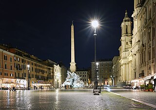
Piazza Navona is a public open space in Rome, Italy. It is built on the site of the 1st century AD Stadium of Domitian and follows the form of the open space of the stadium in an elongated oval. The ancient Romans went there to watch the agones ("games"), and hence it was known as "Circus Agonalis". It is believed that over time the name changed to in avone to navone and eventually to navona.
Campo Marzio is the 4th rione of Rome, Italy, identified by the initials R. IV. It belongs to the Municipio I and covers a smaller section of the area of the ancient Campus Martius. The logo of this rione is a silver crescent on a blue background.
The Aqua Virgo was one of the eleven Roman aqueducts that supplied the city of ancient Rome. It was completed in 19 BC by Marcus Agrippa, during the reign of the emperor Augustus and was built mainly to supply the contemporaneous Baths of Agrippa in the Campus Martius.
Acqua Vergine is one of several Roman aqueducts that deliver pure drinking water to Rome. Its name derives from its predecessor Aqua Virgo, which was constructed by Marcus Vipsanius Agrippa in 19 BC. Its terminal castellum is located at the Baths of Agrippa, and it served the vicinity of Campus Martius through its various conduits. In an effort to restore fresh water to Rome during the Renaissance, Pope Nicholas V, in 1453, renovated the main channels of the Aqua Virgo and added numerous secondary conduits under Campo Marzio. The original terminus, called a mostra, which means showpiece, was the stately, dignified wall fountain designed by Leon Battista Alberti in Piazza dei Crociferi. Due to several additions and modifications to the end-most points of the conduits during the years that followed, during the Renaissance and Baroque periods, the Acqua Vergine culminated in several magnificent mostre - the Trevi Fountain and the fountains of Piazza del Popolo.
Giuseppe Valadier was an Italian architect and designer, urban planner and archaeologist and a chief exponent of Neoclassicism in Italy.
Via Margutta is a narrow street in the centre of Rome, near Piazza del Popolo, accessible from Via del Babuino in the ancient Campo Marzio neighborhood also known as "the foreigner's quarter". Mount Pincio is nearby. Via Margutta originally was home to modest craftsmen, workshops and stables, but now hosts many art galleries and fashionable restaurants.
The Pincian Hill is a hill in the northeast quadrant of the historical centre of Rome. The hill lies to the north of the Quirinal, overlooking the Campus Martius. It was outside the original boundaries of the ancient city of Rome, and was not one of the Seven hills of Rome, but it lies within the wall built by Roman Emperor Aurelian between 270 and 273.
Santa Maria dei Miracoli and Santa Maria di Montesanto are two churches in Rome.
The Porta del Popolo, or Porta Flaminia, is a city gate of the Aurelian Walls of Rome that marks the border between Piazza del Popolo and Piazzale Flaminio.
The Via del Corso is a main street in the historical centre of Rome. It is straight in an area otherwise characterized by narrow meandering alleys and small piazzas. Considered a wide street in ancient times, the Corso is approximately 10 metres wide, and it only has room for two lanes of traffic and two narrow sidewalks. The northern portion of the street is a pedestrian area. The length of the street is roughly 1.5 kilometres.
The Acqua Felice is one of the aqueducts of Rome, completed in 1586 by Pope Sixtus V, whose birth name, which he never fully abandoned, was Felice Peretti. The first new aqueduct of early modern Rome, its source is at the springs at Pantano Borghese, off Via Casilina. Its length is fifteen miles (24 km), running underground for eight miles (13 km) from its source, first in the channel of Aqua Alexandrina, then alternating on the arches of the Aqua Claudia and the Aqua Marcia for seven miles (11 km) to its terminus at the Fontana dell'Acqua Felice on the Quirinal Hill, standing to one side of the Strada Pia, so as to form a piazza in this still new part of Rome. The engineer was Giovanni Fontana, brother of Sixtus' engineer-architect Domenico Fontana, who recorded that the very day the new pope entered the Lateran, he decided that he would bring water once again to the hills of Rome, which had remained waterless and sparsely inhabited, largely by monasteries, since the original ancient aqueducts had been destroyed in the sixth century. From the source, which Sixtus purchased, there was only a very small fall, and the work required an underground conduit as well as an aqueduct carried on arches.
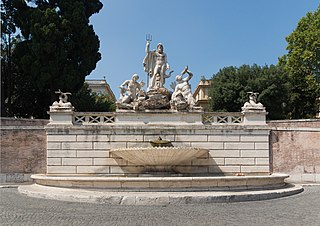
The Fontana di Piazza Nicosia is a fountain in Rome, Italy, is the first of the modern fountains of Rome. It is located in the square with the same name.
Flaminio–Piazza del Popolo is an underground station on Line A of the Rome Metro, inaugurated in 1980. The station is situated on the large Piazzale Flaminio, in the Flaminio quarter outside the Aurelian Walls, next to Piazza del Popolo, and is near the Campus Martius.
Via del Babuino is a street in the historic centre of Rome (Italy), located in the rione Campo Marzio. It connects Piazza del Popolo to Piazza di Spagna and is part of the complex of streets known as Tridente.
The Fontana del Nettuno is a monumental fountain located in the Piazza del Popolo in Rome.
The Piazza della Rotonda is a piazza in Rome, Italy, on the south side of which is located the Pantheon. The square gets its name from the Pantheon's informal title as the church of Santa Maria Rotonda.
The Fountain in Piazza Santa Maria in Trastevere is a fountain located in the square in front of the church of Santa Maria in Trastevere, Rome, Italy. It is believed to be the oldest fountain in Rome, dating back, according to some sources, to the 8th century. The present fountain is the work of Donato Bramante, with later additions by Gian Lorenzo Bernini and Carlo Fontana.
The Tridente is the complex of roads formed by three straight streets of Rome (Italy), departing from Piazza del Popolo and diverging southward, taking the shape of a trident.
References
Giedion, Siegfried, Space, Time and Architecture pp.151–54
This page is based on this Wikipedia article Text is available under the CC BY-SA 4.0 license; additional terms may apply. Images, videos and audio are available under their respective licenses.