
Wichita County is a county located in the U.S. state of Texas. As of the 2020 census, its population was 129,350. The county seat is Wichita Falls. The county was created in 1858 and organized in 1882. Wichita County is part of the Wichita Falls, Texas, TX Metropolitan Statistical Area.

Walker County is a county located in the east central section of the U.S. state of Texas. As of the 2020 census, its population was 76,400. Its county seat is Huntsville. Initially, Walker County was named for Robert J. Walker, a legislator from Mississippi who introduced into the United States Congress the resolution to annex Texas. Walker later supported the U.S. during its Civil War and earned some enmity for it. In order to keep the county's name, the state renamed it for Samuel H. Walker, a Texas Ranger and soldier in the United States Army.

Scurry County is a county located in the U.S. state of Texas. As of the 2020 census, its population was 16,932. Its county seat is Snyder, which is the home for Western Texas College. The county was created in 1876 and organized in 1884. Scurry County was one of 46 prohibition, or entirely dry, counties in the state of Texas, until a 2006 election approved the sale of beer and wine in Snyder, and a 2008 election approved the sale of liquor by the drink throughout the county.

Potter County is a county located in the U.S. state of Texas. As of the 2020 census, the population was 118,525. Its county seat is Amarillo. The county was created in 1876 and organized in 1887. It is named for Robert Potter, a politician, signer of the Texas Declaration of Independence and the Texas Secretary of the Navy.

Polk County is a county located in the U.S. state of Texas. As of the 2020 census, its population was 50,123. Its county seat is Livingston. The county is named after James K. Polk.
Madison County is a county located in the U.S. state of Texas. As of the 2020 census, its population was 13,455. Its seat is Madisonville. The county was created in 1853 and organized the next year. It is named for James Madison, the fourth President of the United States.

Liberty County is a county in the U.S. state of Texas. As of the 2020 census, its population was 91,628. The county seat is Liberty. The county was created in 1831 as a municipality in Mexico and organized as a county in 1837. It is named for the popular American ideal of liberty.
Jones County is a county located in the U.S. state of Texas. As of the 2020 census, its population was 19,663. Its county seat is Anson. The county was created in 1858 and organized in 1881. Both the county and its county seat are named for Anson Jones, the fourth and final president of the Republic of Texas.

Hartley County is a county located in the U.S. state of Texas. As of the 2020 census, its population was 5,382. The county seat is Channing. The county was created in 1876 and later organized in 1891. It is named for Oliver C. Hartley and his brother, Rufus K. Hartley, two early Texas legislators and lawyers.

Coryell County is a county located on the Edwards Plateau in the U.S. state of Texas. As of the 2020 census, its population was 83,093. The county seat is Gatesville. The county is named for James Coryell, a frontiersman and Texas Ranger who was killed by Caddo Indians.

Bee County is a county located in the U.S. state of Texas. It is in South Texas and its county seat is Beeville.

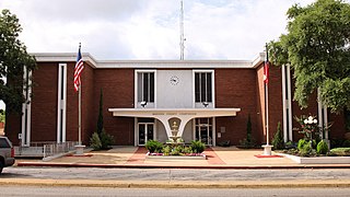
Gatesville is a city in and the county seat of Coryell County, Texas, United States. Its population was 16,135 at the 2020 census. The city has five of the nine prisons and state jails for women operated by the Texas Department of Criminal Justice. One of the facilities, the Mountain View Unit, has the state's death row for women.

Mount Pleasant is the county seat of and largest city in Titus County, in the U.S. state of Texas. As of the 2020 census, Mount Pleasant's population was 16,047; it is situated in Northeast Texas.

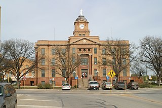
Huntsville is a city in and the county seat of Walker County, Texas. The population was 45,941 as of the 2020 census. It is the center of the Huntsville micropolitan area. Huntsville is in the East Texas Piney Woods on Interstate 45 and home to the infamous Texas State Prison. It is home to Sam Houston State University, the Texas Department of Criminal Justice, Huntsville State Park, and HEARTS Veterans Museum of Texas. The city served as the residence of Sam Houston, who is recognized in Huntsville by the Sam Houston Memorial Museum and a statue on Interstate 45.
Mark W. Stiles Unit is a Texas Department of Criminal Justice men's prison located in an unincorporated area of Jefferson County, Texas, near Beaumont. The unit, located along Farm to Market Road 3514, is 4 miles (6.4 km) southeast of downtown Beaumont. The approximately 776 acres (314 ha) unit is co-located with the Gist Unit and the LeBlanc Unit.

The Joe F. Gurney Transfer Facility or Joe F. Gurney Unit (ND) is a Texas Department of Criminal Justice men's Transfer Unit located in unincorporated Anderson County, Texas. The unit is along Farm to Market Road 2054, 4 miles (6.4 km) south of Tennessee Colony. The unit, on 20,518 acres (8,303 ha) of land, is co-located with the Beto, Coffield, Michael and Powledge prison.
The H. H. Coffield Unit (CO) is a Texas Department of Criminal Justice prison for men in unincorporated Anderson County, Texas. The prison, near Tennessee Colony, is along Farm to Market Road 2054. The unit, on a 20,518 acres (8,303 ha) plot of land, is co-located with Beto, Gurney, Michael, and Powledge units. With a capacity of 4,139 inmates, Coffield is the TDCJ's largest prison. Coffield opened in June 1965.
The Hutchins State Jail (HJ) is a state prison for men located in Hutchins, a city in Dallas County, Texas, with a Dallas postal address. The state jail serves mixed security levels, with an official capacity of 2276.
The Nathaniel J. Neal Unit is a state prison for men located in unincorporated Potter County, Texas, near Amarillo. It is owned and operated by the Texas Department of Criminal Justice. This facility was opened in December 1994, and a maximum capacity of 1732 male inmates held at various security levels. Sergio Perez, Senior Warden - Charles Bristow, Assistant Warden.
The Daniel Webster Wallace Unit is a state prison for men located in Colorado City, Mitchell County, Texas, owned and operated by the Texas Department of Criminal Justice. This facility was opened in May 1994, and holds a maximum of 1428 male prisoners, held at security levels G1, G2 and G4.
