Frederick County is located in the Commonwealth of Virginia. As of the 2010 census, the population was 78,305. Its county seat is Winchester. The county was formed in 1743 by the splitting of Orange County. It is Virginia's northernmost county.

Addison, commonly known as Webster Springs, is a town in Webster County, West Virginia, United States. Although it was incorporated as Addison in 1892, it is more frequently referred to as Webster Springs, the name of the town's post office. It was named Addison McLaughlin, upon whose land the town was originally laid out. The population was 776 at the 2010 census.

The Allegheny Mountain Range, informally the Alleghenies and also spelled Alleghany and Allegany, is part of the vast Appalachian Mountain Range of the Eastern United States and Canada and posed a significant barrier to land travel in less technologically advanced eras. The barrier range has a northeast–southwest orientation and runs for about 400 miles (640 km) from north-central Pennsylvania, through western Maryland and eastern West Virginia, to southwestern Virginia.

The Monongahela National Forest is a national forest located in the Allegheny Mountains of eastern West Virginia, USA. It protects over 921,000 acres of federally owned land within a 1,700,000 acres proclamation boundary that includes much of the Potomac Highlands Region and portions of 10 counties.

The Dolly Sods Wilderness — originally simply Dolly Sods — is a U.S. Wilderness Area in the Allegheny Mountains of eastern West Virginia, USA, and is part of the Monongahela National Forest (MNF) of the U.S. Forest Service (USFS).

Capon Springs is an unincorporated community in Hampshire County, West Virginia, United States. According to the 2000 census, the Capon Springs community has a population of 95.
West Virginia Route 12 is a north–south route located in the southern portion of the U.S. state of West Virginia. The southern terminus of the route is at U.S. Route 219 in Peterstown, Monroe County, less than 300 yards (270 m) from the Virginia state line. It compromises a portion of the Farm Heritage Road byway between Peterstown and West Virginia Route 122. The northern terminus of the route is at U.S. Route 60 in Alta, Greenbrier County, near Interstate 64 exit 161.

Berkeley Springs State Park is situated in the center of Berkeley Springs, West Virginia, USA. The centerpiece of the Park is its historic mineral spa. These waters were celebrated for their medicinal or restorative powers and were generally taken internally for digestive disorders, or bathed in for stress relief. Native peoples visited these springs as did George Washington. Berkeley Springs is the only state-run spa in the United States and is operated by the West Virginia Division of Natural Resources.

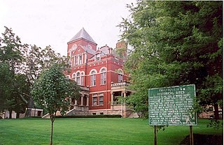
This is a list of properties and historic districts in West Virginia that are listed on the National Register of Historic Places. There are listings in every one of West Virginia's 55 counties.
Red Sulphur Springs is an unincorporated community in Monroe County, West Virginia, USA. It once boasted the Red Sulphur Springs Hotel. It is located on West Virginia Route 12, close to Indian Creek.

Mountain Lake Wilderness is a U.S. Wilderness Area in the George Washington and Jefferson National Forests. The wilderness area is located next to privately owned Mountain Lake, and consists of 8,314 acres (3,365 ha) in Virginia and 2,721 acres (1,101 ha) in West Virginia.
Sweet Chalybeate is an unincorporated community in Alleghany County, Virginia, United States. It is located directly across the state-line from Sweet Springs, West Virginia. It is serviced by Virginia State Route 311.
Climate change in West Virginia is of a concern due to the effects on the environment. Over the last century, the average temperature in Charleston, West Virginia, has increased 1.1 °F (0.61 °C), and precipitation has increased by up to 10% in many parts of the state.

Shannondale Springs Wildlife Management Area is located near Charles Town, West Virginia in Jefferson County. Shannondale Springs WMA is located on 1,361 acres (551 ha) of hills covered with oak-hickory woodlands, brushy areas, and open fields.

Sleepy Creek Wildlife Management Area is located in Morgan and Berkeley Counties in West Virginia's Eastern Panhandle. It encompasses 22,928 acres (92.79 km2), mostly covered with mixed oak and pine forest, although about 3,500 acres (14 km2) are covered with mixed hardwoods. The 205-acre (83 ha) Sleepy Creek Lake is located entirely within the WMA.

The West Virginia State Wildlife Center is a zoological park in French Creek, West Virginia. Operated by the West Virginia Division of Natural Resources, the Wildlife Center displays many of West Virginia's wildlife, including both native and introduced species. A few of the animals at the Wildlife Center were once found naturally in West Virginia, but were extirpated by the early 1900s (decade).

The Laurel Fork is a 15.7-mile-long (25.3 km) stream in Virginia and West Virginia, United States. The stream flows north from Highland County, Virginia, where its source and the majority of its length is located, to its mouth in Pendleton County, West Virginia. Laurel Fork is a tributary to the North Fork South Branch Potomac River, making it a part of the Potomac River watershed. The area surrounding Laurel Fork is home to several plant and animal species found nowhere else in Virginia, and is a prime example of a northern boreal forest in the state.